Quill Hill Scenic Summit & Picnic Area Photos


More like Quill Hill Scenic Summit & Picnic Area
Recommended Reviews - Quill Hill Scenic Summit & Picnic Area
Start your review...


Reviews With Photos
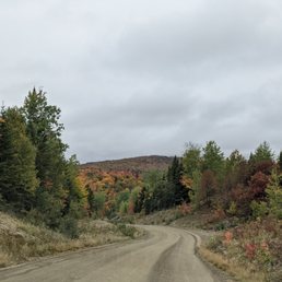

I've never actually seen Quill Hill, but I'm gonna give it five stars anyway because it's probably as exceptional as I think it is. Let me explain... The first time we came here it was pea soup weather. Couldn't see more than twenty feet ahead of us, and despite knowing that, we drove up here anyway. The foliage (...of the trees we passed in our vehicle) in October was beautiful! And, on a non-foggy day, we should have been able to see a 360° panoramic view of the impressive Western Maine Mountains. The website says this is "Maine's best and most accessible view... A well maintained four mile dirt road leads you to the 2848' summit where you will find ample parking and easy maneuvering for even the largest vehicles. Yes, that includes rv's!" All of that is true. There's even picnic tables at the top and stargazing is welcomed! For sure a must visit when in the area (no matter what the weather!). (Reminder: carry in, carry out and please remember to make a donation in one of the two boxes to keep this incredible space incredible for years to come.)


An absolute must stop for anyone that is in the area. An easy drive up a well maintained dirt road that rewards you with beautiful and breathtaking views of the surrounding area. I believe it would offer amazing views in different ways for each season. They have picnic tables so you can bring in your own food and eat while taking in the views and nature. Just make sure to bring out any trash to keep it looking beautiful. Would be the perfect spot to watch a sunset or sunrise or even stargaze. Like I said at the beginning this is a must stop if you are visiting the area or live nearby. Great views of nature and easily accessible. Also make sure to donate to help maintain this spot for generations to come.


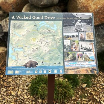
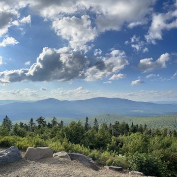
This place is just so amazing. Talk about a 360° view ! Just off of Route 16 traveling northeast toward Stratton, you'll see the quill hill sign and access road. The road itself, is usually well maintained, but it is gravel. It's free to drive up, but does have donation boxes, if you wanted to help maintain the park. It takes about 10-12 minutes to drive to the top. 3/4s the way up, there a stove built right into the side of the mountain. You can barbecue and cook just about anything. The top is a one way road, so make sure to read the signs and go the right way. Especially when you come down the mountain, read and follow signage. There are several parking areas at the top of the mountain. There are picnic tables and educational signs scattered about the summit. The view is a complete 360° and in every direction, you see nothing but beauty. You can see most if not all of the white mountains, both in NH and in ME. You can see the Bigelow Mountains and flagstaff lake. The signs are pretty cool too and describe what it was like when Adrain first thought to put his private lands up for this project. He was generous and kind, and wanted the general public to see what he saw. Boy do we, it's so beautiful, any time of day, but especially at Dawn and Dusk. It's also pretty cool that his family continues his work. So if you enjoy this place regularly, please consider a donation at one of the sites. It's also pretty damn cool that driving there and back on route 16, almost always means seeing a moose! We live a bit far from this beautiful place, but come once or twice a year, it's just so wonderful there. The world isn't as chaotic or fast paced, not here, it lives a bit slower. That's ok with me, it's part of this areas charm. If you've never checked it out, do so! It's the only place on the east coast, you can drive up and get the kind of 360° this place has. 5 stats read more


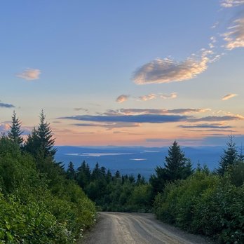

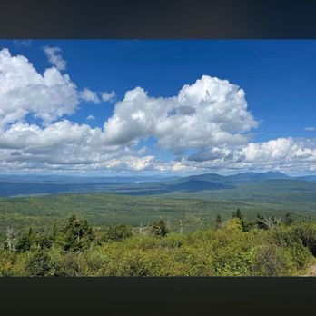


The Quill of Rights Mountain top located not too far from Rangeley Lake that features epic 360° views of the surrounding area. It should be considered a "must stop" spot if you're visiting this neck of the woods, as it's a low effort, high reward kinda deal that should satisfy even the laziest of nature lovers. We were unaware of this place, but luckily one of the store clerks at one of the stores in DT Rangeley put us on to it, and now I'm doing the same for you. You're welcome. The Good: *Part of the Appalachian Trail! You can literally hike from here to Georgia, if one was so inclined. *You don't have to hike to Georgia but you can def schlep across the AT to your hearts desire and then turnaround. :) *Windy four-mile drive up to the top that gets a little hairy, but not terrible. You can also hike up it from the bottom but beware of the vehicles and dust. *Free to visit but they have a suggested donation of $5 that you can pay with cash or via Venmo. *The views are truly epic and this is a great place to stop if you're leaf-peeping. *Picnic tables at the top *ADA Compliant Trails The Meh: *It's a *lot* longer to the Lower Scenic View than those signs lead you to believe. If my Fitbit is correct, it was ±1.5-miles round-trip--which isn't terribly long, but just be aware if you're in a rush that you'll need *at least* 30min total. *And speaking of hiking, in the winter months when the snow is deep here, you'll only be about to reach the peak by hiking or snowmobile. The Ugly: *Cheapskates who don't donate and just fly thru the exit with dropping a buck or stopping to get the Venmo code. *Don't come here with a freshly cleaned vehicle--esp on a dry day--as the amount of dust these trails kick up is obscene. *If you plan to hike to the top, be aware the trail is fully exposed with zero to little shade. So, probably not a great idea on a warm day. Conclusion: Epic views with almost zero effort. What are you waiting for??? read more


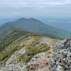
Quill Hill is a 2848 foot summit in the heart of the Rangeley Lakes region of Maine, right near the town of Rangeley. A four mile dirt road carries you up to the top for amazing views of fall colors, mountains, and Flagstaff Lake in the distance! The dirt road is very well maintained and wide enough for two cars comfortably. It's a tad bumpy in places but nothing an everyday car can't handle. The dirt road is only open from May to October but foot traffic and snowmobiles are allowed all year. At the top you'll find a nice picnic area with tables and info signs and sweeping views. There's also a little trail at the top that takes you to a "lower scenic viewpoint" and I highly recommend it!! Foot traffic only and it's a little less than 3/4 mile long with just under 200 feet elevation gain. A portion of the Appalachian Trail runs along here too! The views are spectacular and the fall foliage is dazzling!! And there are a few picnic tables at the viewpoint at the end of the trail as well. Quill Hill was a dream and the labor of love of a very generous local man that the community adored - Adrian Brochu - who lived an adventurous and interesting life that is well worth a read - highly recommend you google him. He moved here from Canada, spoke only French, fought in Vietnam, established successful logging businesses here, loved his wife and family and motorcycle, was an avid traveler - and he built this hill to give people "the best view in the state" lol! The hill is privately owned and cared for but they accept donations via several donation boxes or Venmo (link on their website). There are several parking areas around the top and everything is clean and well maintained. They've even put a wood fired grill just below the summit that they keep stocked with wood if you want to grill! Truly a lovely local treasure with amazing views and a precious little trail - definitely a must when visiting the Rangeley Lakes region. read more




I've never actually seen Quill Hill, but I'm gonna give it five stars anyway because it's probably as exceptional as I think it is. Let me explain... The first time we came here it was pea soup weather. Couldn't see more than twenty feet ahead of us, and despite knowing that, we drove up here anyway. The foliage (...of the trees we passed in our vehicle) in October was beautiful! And, on a non-foggy day, we should have been able to see a 360° panoramic view of the impressive Western Maine Mountains. The website says this is "Maine's best and most accessible view... A well maintained four mile dirt road leads you to the 2848' summit where you will find ample parking and easy maneuvering for even the largest vehicles. Yes, that includes rv's!" All of that is true. There's even picnic tables at the top and stargazing is welcomed! For sure a must visit when in the area (no matter what the weather!). (Reminder: carry in, carry out and please remember to make a donation in one of the two boxes to keep this incredible space incredible for years to come.) read more
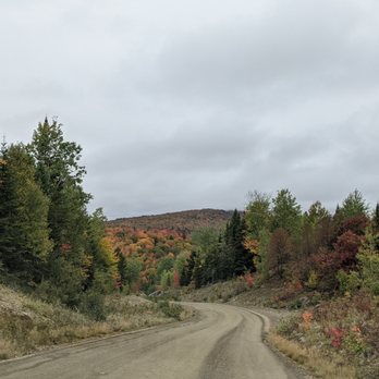

An absolute must stop for anyone that is in the area. An easy drive up a well maintained dirt road that rewards you with beautiful and breathtaking views of the surrounding area. I believe it would offer amazing views in different ways for each season. They have picnic tables so you can bring in your own food and eat while taking in the views and nature. Just make sure to bring out any trash to keep it looking beautiful. Would be the perfect spot to watch a sunset or sunrise or even stargaze. Like I said at the beginning this is a must stop if you are visiting the area or live nearby. Great views of nature and easily accessible. Also make sure to donate to help maintain this spot for generations to come. read more



2 years ago
3 years ago
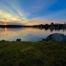
Beautiful, beautiful sunsets :) the place is so cool! Picnic tables provided, ample parking and beautiful views! They even have an outdoor pizza oven! We didn't try it, but our son has and he says they had great pizzas that night! read more