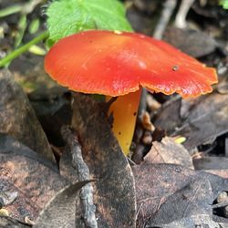
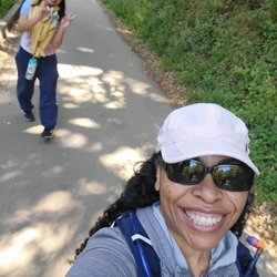
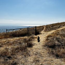
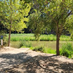
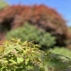
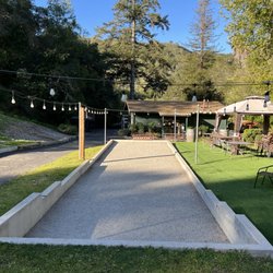
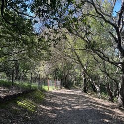
Ramage Peak Trail Photos


You might also consider
More like Ramage Peak Trail
Recommended Reviews - Ramage Peak Trail
Start your review...

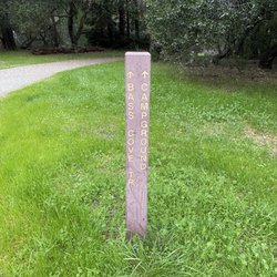
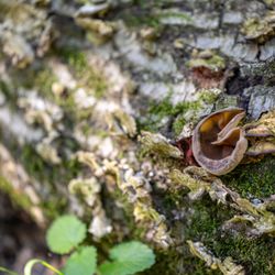
This trail is pretty advanced, so don't try it for your first hike. Also, please note it is on EBMUD land, so you need to purchase an inexpensive permit. The rangers will come around and check, so be sure to get the permit. You can buy it online for about $10. There is a large staging area called Chabot Staging, right off Redwood Road. It's a large parking lot with one outhouse. I don't recall seeing any drinking faucets there however. The trailhead is very close by. You will be required to sign in with your permit number at a little kiosk there. There is also a road nearby going into the area, but that is actually a private road, so stay off that. It leads right to the dam. I have mixed feelings about the trail. Some sections of it are really rutted and difficult to hike, whereas others are really beautiful. On the day that I visited, I measured six miles from the gate at Chabot to the gate at Rocky Ridge. None of the sections were super steep, but I didn't like hiking through the rutted areas, which are often near cattle drinking troughs. However, if you like really oozy mud sticking to your hiking boots, you will love those sections. I took three liters of water which proved to be a good amount. Many of the hikers on this Trail are geocachers, discovering the little hidden containers spread out along the trail. read more


More info about Ramage Peak Trail
Castro Valley, CA 94552
Directions
Visit Website
http://RamagePeak.com
Hours
Outdoor Amenities
You might also consider


Ramage Peak Trail - hiking - Updated June 2026
Best of Castro Valley
People found Ramage Peak Trail by searching for…
Parks in Castro Valley, California
Hiking Trails in Castro Valley, California
Off Road Trails in Castro Valley, California
Redwood Trees in Castro Valley, California
Secret Spots in Castro Valley, California
Walking Groups in Castro Valley, California
Fall Foliage in Castro Valley, California
Trail in Castro Valley, California
Things to Do in Castro Valley, California
Running Trails in Castro Valley, California
Shaded Hike in Castro Valley, California
Walking Trails in Castro Valley, California
Redwood Forest in Castro Valley, California
Secluded Spots in Castro Valley, California
Stroller Friendly Hikes in Castro Valley, California
Hiking Groups in Castro Valley, California
Trending Searches in Castro Valley, CA
Amusement Parks near Ramage Peak Trail
Beaches near Ramage Peak Trail
Black Owned Nail Salons near Ramage Peak Trail
Boat Rental near Ramage Peak Trail
Cliff Jumping near Ramage Peak Trail
Dog Friendly Things To Do near Ramage Peak Trail
Free Kids Activities near Ramage Peak Trail
Jet Ski Rental near Ramage Peak Trail
Outdoor Activities near Ramage Peak Trail
Picnic Areas near Ramage Peak Trail
Public Pools near Ramage Peak Trail
Public Shower near Ramage Peak Trail
River Swimming near Ramage Peak Trail
Rock Quarry near Ramage Peak Trail
Running Trails near Ramage Peak Trail
Scenic Drive near Ramage Peak Trail
Secluded Spots near Ramage Peak Trail
Splash Pad near Ramage Peak Trail
State Parks near Ramage Peak Trail
Strawberry Picking near Ramage Peak Trail
Summer Camps near Ramage Peak Trail
Sunrise View near Ramage Peak Trail
Swimming Holes near Ramage Peak Trail
Swimming Lakes near Ramage Peak Trail
Swimming Pools near Ramage Peak Trail
Watch Sunset near Ramage Peak Trail
Browse Articles
Browse Nearby
BEST of Castro Valley, California Coffee near Ramage Peak Trail
BEST of Castro Valley, California Restaurants near Ramage Peak Trail
BEST of Castro Valley, California Things to Do near Ramage Peak Trail
BEST of Castro Valley, California Walking Trails near Ramage Peak Trail
BEST of Castro Valley, California Breakfast near Ramage Peak Trail
BEST of Castro Valley, California Parks near Ramage Peak Trail
BEST of Castro Valley, California Campgrounds near Ramage Peak Trail
BEST of Castro Valley, California Hot Springs near Ramage Peak Trail
BEST of Castro Valley, California Lodging near Ramage Peak Trail
Browse Brands
Related Searches in Castro Valley, CA
Affordable Kayak Rental Services in Castro Valley, California
Best Fishing Locations and Guides in Castro Valley, California
Best Nature Trails for Hiking in Castro Valley, California
Best Places for Horseback Riding in Castro Valley, California
Best Waterfalls and Swimming Holes in Castro Valley, California
Check Out Off Road Trails in Castro Valley, California
Discover Dog Friendly Trails to Explore in Castro Valley, California
Discover Kid Friendly Hiking Trails in Castro Valley, California
Discover Scenic Hiking Trails in Castro Valley, California
Discover Scenic Mountain Bike Trails Near Castro Valley, California
Discover Scenic Waterfall Spots in Castro Valley, California
Discover Walking Parks in Castro Valley, California Near You
Discover a Hiking Trail in Castro Valley, California
Discover the Best Night Hike Trails in Castro Valley, California
Discover the Best Running Track in Castro Valley, California
Dog-Friendly Hikes With Dogs in Castro Valley, California
Enjoy Camping Adventures Around Castro Valley, California
Enjoy Kayaking Adventures in Castro Valley, California
Enjoy Tent Camping Spots Around Castro Valley, California
Enjoy a Beautiful Waterfall Hike in Castro Valley, California
Enjoy a Peaceful Nature Walk in Castro Valley, California
Enjoy the Best Walking Path in Castro Valley, California
Enjoy the Best Walking Trails in Castro Valley, California
Explore Beautiful Parks and Green Spaces in Castro Valley, California
Explore Easy Hikes Perfect for All in Castro Valley, California
Explore Fun Activities to Do in Castro Valley, California
Explore Popular Campgrounds Near Castro Valley, California
Explore the Best Beach Spots in Castro Valley, California
Explore the Best Swimming Holes Around Castro Valley, California
Explore the Best Trail Options in Castro Valley, California
Family Friendly Hiking With Kids in Castro Valley, California
Find Beautiful Views in Castro Valley, California
Find the Best Parks for Picnics in Castro Valley, California
Find the Best Scenic View Locations in Castro Valley, California
Great Places to Walk in Castro Valley, California
Hike the Popular Waterfall Trail in Castro Valley, California
Hiking Trails With Waterfalls in Castro Valley, California
Off Leash Dog Hiking Trails in Castro Valley, California
Plan Nature Center Visits in Castro Valley, California
Plan a Scenic Drive Route Near Castro Valley, California
Popular Outdoor Activities to Try in Castro Valley, California
Popular Picnic Spots to Visit in Castro Valley, California
Safe River Swimming Areas in Castro Valley, California
Safe and Fun Parks for Kids in Castro Valley, California
Top Climbing Spots and Gyms in Castro Valley, California
Top Running Trails to Explore in Castro Valley, California
Top Swimming Lakes to Enjoy in Castro Valley, California
Top Swimming Spots and Pools in Castro Valley, California
Walk Dog Friendly Hiking Trails in Castro Valley, California
Walk the Best Paved Walking Trails in Castro Valley, California