Ramsey Canyon Photos


More like Ramsey Canyon
Recommended Reviews - Ramsey Canyon
Start your review...


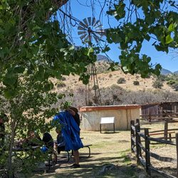
Very lovely place to hike. The visitor center was closed, so we didn't get to go inside the building, but the hike was beautiful and had a nice amount of shade. It's been a pretty dry year, so not much water in the stream, but still lots of birds, deer, and squirrels. We didn't see any frogs, but apparently they are there too. We hiked up the hill. It's a pretty challenging walk up to the top. We only made it to a nice viewpoint along the path. There's benches along the way to take breaks at. Overall, it's a pretty place to visit. read more


7 years ago
A beautiful place to drive to and see Mother nature's wonders. There are trails that you can hike and get away to one of the quietest places you will ever find and be surrounded by amazing beauty. It does not matter what time of year you visit there is always something to see. Birds, animals, plants and cactus no matter where you look. If you visit Sierra Vista do not miss this Canyon. It is just a short drive out of town. read more


7 years ago
Very nice trail, very sweet staff. First half mile is a pretty easy walk but if you want to go to the overlook it is quite a hike. You see deers, and lots of birds on your walk. Very well maintained. read more


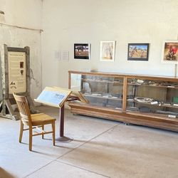
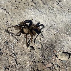
I know what you're thinking. (See my caustic review of RadioShack) Yes, it is strange for me to leave a review that isn't for a dive bar...but I feel like that's all I was becoming known for, typecast like Charlie Sheen...or Leonard Nimoy. So I thought, "What would Charlie or Leonard do to shake this rut?" (I mean besides goddess worship and texting Walter Koenig) Friends, they would go for a hike, and Ramsey Canyon is a beautiful place to start. I like Ramsey Canyon, even if it doesn't serve alcohol or have scantily clad waitstaff. Or a single Chiricahua Leopard frog. (More about that shortly) It does have over 15 species of hummingbirds. Wow, who knew? The Nature Conservancy and their sweet old docents, that's who. If you ask 'em they'll probably tell you that Ramsey Canyon is one of those sky island places, a place with unique flora and fauna due to a serendipitous confluence of geologic and geographic factors. It's here that the Rockies meet the Sierra Madres and the Sonoran desert butts up to the Chihuahuan desert. The high canyon walls, the San Pedro river and the Chiricahua mountains all create the ideal environment for little creatures and the little old people that watch little creatures. So $6 for adults ($3 for Conservancy members) and kids for free (sweet!) all goes to a super noble organization that really does some great work. And it's a cool easy hike for about a mile in a very pristine canyon. There are a couple of old ghostly houses along the creek, remnants of miners and their families that did or didn't make their fortunes in Ramsey Canyon. The adventurous and physically fit can hit the Hamburg Trail at the top of the loop, 2.5 miles of thigh burning switchbacks with a 2000 foot climb in elevation. Yeah. I did it once. It was worth the burn for sure. Okay. My gripe. The Chiricahua Leopard frog, lithobates chiricahuensis*, no longer exists in Ramsey. Chytridiomycosis, a fungal disease, wiped em out. So if you're going there to see is this rare frog, well skip it. Frog. Fraud. Frog protection. Yeah, my daughter got tired of me saying it too. RIP little endangered frog. I'll still take 5 at your pond. So, if you find yourself in Sierra Vista or thereabouts, and you want to do something healthy- before going to "Dusk Till Dawn" (yeah, as if I'm going to a strip club with that name...Puh-leez)[review forthcoming], then Ramsey Canyon is a great daytime activity that is good for your soul and the environment. Update: the Leopard frog isn't the only creature dying in the Chiricahua's. The strip club "Dusk Till Dawn" is also, RIP, gone. Mayhaps too from some fungus. *My new catch phrase. I'm going to try to work it into daily conversations. Maybe like a blessing. Lithobates chiricahuensis! Mazel tov! read more


6 years ago
More info about Ramsey Canyon
Ask the Community - Ramsey Canyon


Ramsey Canyon - landmarks - Updated July 2026
Best of Sierra Vista
People found Ramsey Canyon by searching for…
Things to Do in Sierra Vista, Arizona
Hiking Trails in Sierra Vista, Arizona
Scenic Drive in Sierra Vista, Arizona
Parking in Sierra Vista, Arizona
Places to Take Pictures in Sierra Vista, Arizona
Walking Trails in Sierra Vista, Arizona
Photo Spots in Sierra Vista, Arizona
Alligator in Sierra Vista, Arizona
Attractions in Sierra Vista, Arizona
Things to See in Sierra Vista, Arizona
Sunrise View in Sierra Vista, Arizona
Public Services & Government in Sierra Vista, Arizona
Beautiful Views in Sierra Vista, Arizona
Hiking in Sierra Vista, Arizona
Waterfalls in Sierra Vista, Arizona
Trail in Sierra Vista, Arizona
Scenic Overlook in Sierra Vista, Arizona
Natural Hot Springs in Sierra Vista, Arizona
What to Do in Sierra Vista, Arizona
Reviews in Sierra Vista, Arizona
Castles in Sierra Vista, Arizona
Landmarks in Sierra Vista, Arizona
Trending Searches in Sierra Vista, AZ
Fruit Picking near Ramsey Canyon
Landmarks & Historical Buildings near Ramsey Canyon
Picnic Areas near Ramsey Canyon
Public Pools near Ramsey Canyon
Scenic Restaurants near Ramsey Canyon
Swimming Holes near Ramsey Canyon
Swimming Lakes near Ramsey Canyon
Swimming Pools near Ramsey Canyon
Browse Articles
Browse Nearby
Browse Brands
Related Searches in Sierra Vista, AZ
Best Fishing Locations and Guides in Sierra Vista, Arizona
Best Fun Things to Do in Sierra Vista, Arizona
Best Places for Stunning Views in Sierra Vista, Arizona
Best Spots for Star Gazing in Sierra Vista, Arizona
Book Engaging Historical Tours in Sierra Vista, Arizona
Discover Famous Monuments in Sierra Vista, Arizona
Discover Historic Sites and Places in Sierra Vista, Arizona
Discover Popular Photo Spots in Sierra Vista, Arizona
Discover the Best Beaches in Sierra Vista, Arizona
Discover the Best Caves to Explore in Sierra Vista, Arizona
Enjoy Arts & Entertainment in Sierra Vista, Arizona
Enjoy Hiking Adventures in Sierra Vista, Arizona
Enjoy Scenic Night View Experiences in Sierra Vista, Arizona
Enjoy the Best Family Activities in Sierra Vista, Arizona
Enjoy the Best Night View Spots in Sierra Vista, Arizona
Enjoy the Best Walking Trails in Sierra Vista, Arizona
Experience Stunning Sunset Views in Sierra Vista, Arizona
Explore Beautiful Castles and Landmarks in Sierra Vista, Arizona
Explore Beautiful Parks and Green Spaces in Sierra Vista, Arizona
Explore Children's Museums Near Sierra Vista, Arizona
Explore Easy Hikes Perfect for All in Sierra Vista, Arizona
Explore Family-Friendly Zoos and Wildlife in Sierra Vista, Arizona
Explore Popular Scenic Drives Around Sierra Vista, Arizona
Explore Popular Scenic Overlook Points in Sierra Vista, Arizona
Explore Popular Scenic Views Near Sierra Vista, Arizona
Explore Scenic Lakes to Visit in Sierra Vista, Arizona
Explore Secret Spots Worth Visiting in Sierra Vista, Arizona
Explore Top Art Galleries Located in Sierra Vista, Arizona
Explore Venues & Event Spaces in Sierra Vista, Arizona
Find Beautiful Views in Sierra Vista, Arizona
Find Exciting Tours to Take in Sierra Vista, Arizona
Find Fun Things to Do With Kids in Sierra Vista, Arizona
Find Top-Rated Waterfalls in Sierra Vista, Arizona Now
Find the Best Bridge Spots in Sierra Vista, Arizona
Find the Best Playgrounds to Visit in Sierra Vista, Arizona
Fun Things for Kids in Sierra Vista, Arizona
Hiking Trails With Waterfalls in Sierra Vista, Arizona
Must-See Tourist Attractions Around Sierra Vista, Arizona
Perfect Spots to Watch Sunset in Sierra Vista, Arizona
Popular Kids Activities in Sierra Vista, Arizona
Popular Places to Take Pictures in Sierra Vista, Arizona
Popular Things to Do in Sierra Vista, Arizona
Relax at Natural Hot Springs Near Sierra Vista, Arizona
Secure Convenient Parking Options in Sierra Vista, Arizona
Top Hiking Trails to Explore in Sierra Vista, Arizona
Top Things to Do With Kids in Sierra Vista, Arizona
Visit Popular Museums in Sierra Vista, Arizona Now
Visit a Charming Gift Shop in Sierra Vista, Arizona
Visit the Train Museum in Sierra Vista, Arizona
Where to Catch the Best Sunrise View in Sierra Vista, Arizona
People who viewed Ramsey Canyon also viewed
The Wyatt Earp House
6 reviews
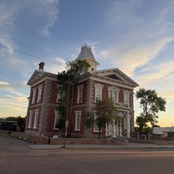
Tombstone Courthouse State Historic Park
47 reviews
Brown Canyon Ranch
7 reviews
San Pedro House
3 reviews
Sierra Vista City Government
1 review
Motor Vehicle Division
16 reviews
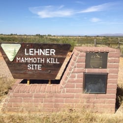
Lehner Mammoth Kill Site
2 reviews
US Post Office
3 reviews
Schiefflin Monument Annex
1 review
Copper Queen Library
7 reviews