
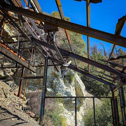
San Antonio Ski Hut Photos


You might also consider
More like San Antonio Ski Hut
Recommended Reviews - San Antonio Ski Hut
Start your review...

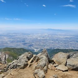
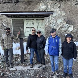
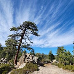
**Review for the trail not the hut Such a fun hike! About a mile in you'll start to see some snow and you'll want to put on your spikes and use trekking poles. It's a popular trail so even if you feel a little lost, you will eventually run into someone or see someone you can follow. My spikes weren't the best, but they got me up and down. Dogs are allowed, highly recommend they wear their shoes. Overall it is challenging but a doable solo hike. Always check the weather conditions before going, there were rescues going on the whole time I was there. Take your time and one step at a time. Once you get to the top, you'll be rewarded with awesome views. read more
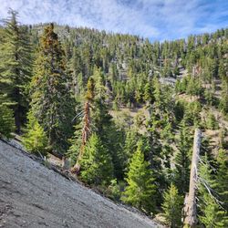
Accessible parking and restrooms are available near the trailhead. As of 01/30/22, the ski hut is locked but the hiking trail is still accessible. A small portion of the trail leading up to the Ski Hut is covered in ice/snow, so I would recommend using hiking poles if you have any. Once you pass the Ski Hut, then micro-spikes are highly recommended (almost a must) because the trail is full of snow. More than half of the trail is not shaded and it's filled with loose rocks & gravels. And so, make sure to bring a hat and/or sunglasses, a good pair of hiking shoes as well as enough water and/or snacks. According to AllTrails, this a "difficult" trail so be prepared for 2-2.5 miles of incline (2000ft) heading up to the hut. There isn't a lot of signs along the trail so make sure you have some kind of offline map or navigation tool accessible. read more
 - Hiking Near Me - Mount Baldy, California")
 - Hiking Near Me - Mount Baldy, California")

3 years ago
6 years ago
The ski hut is halfway up the trail to Mt Baldy. Although this is a difficult trail the Ski Hut offers a little bit of a rest, it is also fun for families. During the winter the ski hut has activities such as tubing and skiing! Instead of hiking up you can always take the ski lift up and enjoy the view. I come here for a beer on the hike down. After a few beers I cheat and take the Ski lift down to my car lol. This is also a cute date idea! You can catch the ski lift up, enjoy a few beers and a light lunch at the ski hut and enjoy the ski lift back down. Definitely a hidden SoCal gem read more

More info about San Antonio Ski Hut
Baldy Bowl Trl
Mount Baldy, CA 91759
Directions
Visit Website
http://angeles.sierraclub.org/san_antonio_ski_hut
Hours
Outdoor Amenities
Other Amenities
You might also consider


Why does Yelp recommend reviews?
1 review that is not currently recommended
The reviews below are not factored into the business's overall star rating.
8 years ago
San Antonio Ski Hut - hiking - Updated July 2026
Best of Mount Baldy
People found San Antonio Ski Hut by searching for…
Snow Tubing in Mount Baldy, CA
Tent Camping in Mount Baldy, CA
Snow Sledding in Mount Baldy, CA
Ski Lessons in Mount Baldy, CA
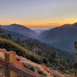
Sunrise View in Mount Baldy, CA
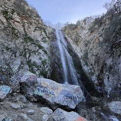
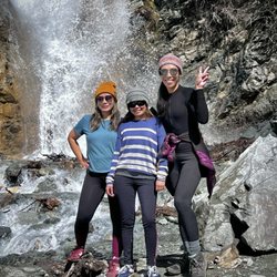
Waterfall Hike in Mount Baldy, CA
Secret Spots in Mount Baldy, CA
Redwood Trees in Mount Baldy, CA
Picnic Areas in Mount Baldy, CA
Cross Country Skiing in Mount Baldy, CA
Free Things to Do in Mount Baldy, CA
Natural Hot Springs in Mount Baldy, CA
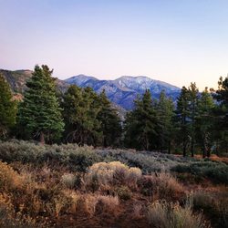
Hiking Trails in Mount Baldy, CA
Scenic Overlook in Mount Baldy, CA
Off Road Trails in Mount Baldy, CA
Redwood Forest in Mount Baldy, CA


