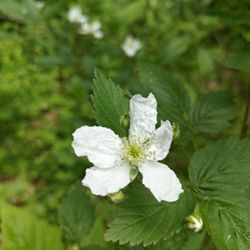
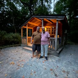
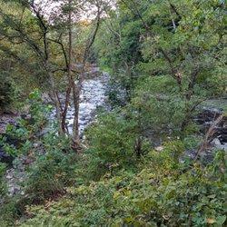
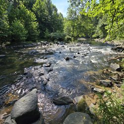
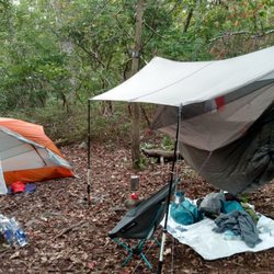
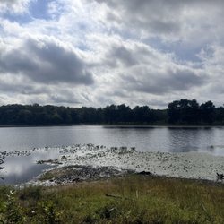
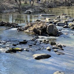
Severn Run Natural Environmental Area Photos


You might also consider
More like Severn Run Natural Environmental Area
Recommended Reviews - Severn Run Natural Environmental Area
Start your review...

8 years ago
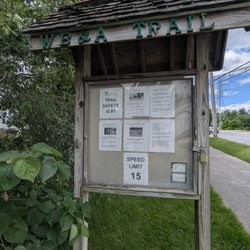
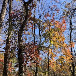
Severn Run Natural Environment Area is protected lands located off a somewhat isolated, one-lane, each way road. There is no designated parking area, just pull off on the side of the road. There is no hard top. This area is true wooded, wetland along Severn Run. You are allowed to fish and hike only. If you are going to fish right at the pull off feel free. However, if you are not a true, informed outdoorsman and dressed (boots & backpack) for the terrain, I would not advise you to go out solo nor far from the road. With that said, I may revisit. Note: There is mention of an established trail on-line but I did not see one from the directions I received. read more


More info about Severn Run Natural Environmental Area
You might also consider


Severn Run Natural Environmental Area - hiking - Updated July 2026
Best of Severn
People found Severn Run Natural Environmental Area by searching for…
Attractions in Severn, Maryland
Running Trails in Severn, Maryland
Hiking Trails in Severn, Maryland
Walking Trails in Severn, Maryland
Playgrounds in Severn, Maryland
Fishing Spots in Severn, Maryland
Things to Do in Severn, Maryland
Lakes & Ponds in Severn, Maryland
Secret Spots in Severn, Maryland
Live Bait Shop in Severn, Maryland
Off Road Trails in Severn, Maryland
Sunrise View in Severn, Maryland
Bait and Tackle Shop in Severn, Maryland
Fly Fishing Shop in Severn, Maryland
Things to Do on a Rainy Day in Severn, Maryland
Scenic Views in Severn, Maryland
Things to Do at Night in Severn, Maryland
Swimming Lakes in Severn, Maryland
Hunting & Fishing Supplies in Severn, Maryland
Crabbing Location in Severn, Maryland
Trending Searches in Severn, MD
4th Of July Fireworks near Severn Run Natural Environmental Area
Black Owned Nail Salons near Severn Run Natural Environmental Area
Boat Launch near Severn Run Natural Environmental Area
Boat Rental near Severn Run Natural Environmental Area
Cliff Jumping near Severn Run Natural Environmental Area
Day Trips near Severn Run Natural Environmental Area
Fireworks near Severn Run Natural Environmental Area
Fishing Charter near Severn Run Natural Environmental Area
Jet Ski Rental near Severn Run Natural Environmental Area
Kayak Rental near Severn Run Natural Environmental Area
Lakes near Severn Run Natural Environmental Area
Lakes & Ponds near Severn Run Natural Environmental Area
Off Road Trails near Severn Run Natural Environmental Area
Outdoor Activities near Severn Run Natural Environmental Area
Picnic Spots near Severn Run Natural Environmental Area
Places To Walk Around near Severn Run Natural Environmental Area
Pontoon Boat Rentals near Severn Run Natural Environmental Area
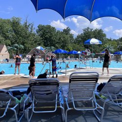
Public Pools near Severn Run Natural Environmental Area
Public Shower near Severn Run Natural Environmental Area
River Swimming near Severn Run Natural Environmental Area
Rock Quarry near Severn Run Natural Environmental Area
Running Trails near Severn Run Natural Environmental Area
Scenic Drive near Severn Run Natural Environmental Area
Scenic Night View near Severn Run Natural Environmental Area
Scenic Overlook near Severn Run Natural Environmental Area
Secluded Spots near Severn Run Natural Environmental Area
Soccer Store near Severn Run Natural Environmental Area
Splash Pad near Severn Run Natural Environmental Area
Strawberry Picking near Severn Run Natural Environmental Area
Sunrise View near Severn Run Natural Environmental Area
Sunset Cruise near Severn Run Natural Environmental Area
Swimming Holes near Severn Run Natural Environmental Area
Swimming Lakes near Severn Run Natural Environmental Area
Watch Sunset near Severn Run Natural Environmental Area
Browse Nearby
BEST of Severn, Maryland Coffee near Severn Run Natural Environmental Area
BEST of Severn, Maryland Things to Do near Severn Run Natural Environmental Area
BEST of Severn, Maryland Restaurants near Severn Run Natural Environmental Area
BEST of Severn, Maryland Walking Trails near Severn Run Natural Environmental Area
BEST of Severn, Maryland Breakfast near Severn Run Natural Environmental Area
BEST of Severn, Maryland Parks near Severn Run Natural Environmental Area
BEST of Severn, Maryland Campgrounds near Severn Run Natural Environmental Area
Browse Brands
Related Searches in Severn, MD
Affordable Fishing Rental Services in Severn, Maryland
Affordable Kayak Rental Services in Severn, Maryland
Best Crabbing Locations to Visit in Severn, Maryland
Best Fishing Locations and Guides in Severn, Maryland
Best Places for Horseback Riding in Severn, Maryland
Best Waterfalls and Swimming Holes in Severn, Maryland
Boat Services and Rentals Available in Severn, Maryland
Book Top Fishing Trips in Severn, Maryland Today
Check Out Off Road Trails in Severn, Maryland
Discover Dog Friendly Trails to Explore in Severn, Maryland
Discover Kid Friendly Hiking Trails in Severn, Maryland
Discover Lakes & Ponds to Explore in Severn, Maryland
Discover Scenic Bike Paths in Severn, Maryland
Discover Scenic Waterfall Spots in Severn, Maryland
Discover Top Boat Tours in Severn, Maryland for All Ages
Discover Top State Parks to Visit in Severn, Maryland
Discover Walking Parks in Severn, Maryland Near You
Discover a Hiking Trail in Severn, Maryland
Discover the Best Night Hike Trails in Severn, Maryland
Discover the Best Sunset Cruise Tours in Severn, Maryland
Dog-Friendly Hikes With Dogs in Severn, Maryland
Enjoy Camping Adventures Around Severn, Maryland
Enjoy Fishing Pier Spots in Severn, Maryland With Scenic Views
Enjoy Fishing With Kids in Severn, Maryland Safely
Enjoy Hiking Adventures in Severn, Maryland
Enjoy Kayaking Adventures in Severn, Maryland
Enjoy River Tubing Adventures in Severn, Maryland
Enjoy Sailing Adventures in Severn, Maryland
Enjoy Tent Camping Spots Around Severn, Maryland
Enjoy Water Activities and Fun in Severn, Maryland
Enjoy a Beautiful Waterfall Hike in Severn, Maryland
Enjoy a Peaceful Nature Walk in Severn, Maryland
Enjoy a Scenic Boat Ride in Severn, Maryland
Enjoy the Best Tubing Experiences in Severn, Maryland
Enjoy the Best Walking Trails in Severn, Maryland
Exciting Cliff Jumping Spots in Severn, Maryland
Experience Deep Sea Fishing Adventures in Severn, Maryland
Experienced Fishing Guides Available in Severn, Maryland
Explore Beautiful Parks and Green Spaces in Severn, Maryland
Explore Easy Hikes Perfect for All in Severn, Maryland
Explore Fun Activities to Do in Severn, Maryland
Explore Popular Boat Charters Near Severn, Maryland
Explore Popular Campgrounds Near Severn, Maryland
Explore Scenic Lakes to Visit in Severn, Maryland
Explore Top Marinas Near Severn, Maryland
Explore the Best Bait Shops Around Severn, Maryland
Explore the Best Beach Spots in Severn, Maryland
Explore the Best Boating Spots in Severn, Maryland