1. Skeggs Point

    1. Skeggs Point

    0

    Woodside, CA

    Cancel

    Open app

    Search

    Skeggs Point

    4.7 (24 reviews)

    Skeggs Point Photos

    You might also consider

    Recommended Reviews - Skeggs Point

    Your trust is our priority, so businesses can't pay to alter or remove their reviews. Learn more about reviews.
    Yelp app icon
    Browse more easily on the app
    Review Feed Illustration

    Reviews With Photos

    Don't forget to pick up a map!
    Earlene C.

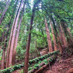
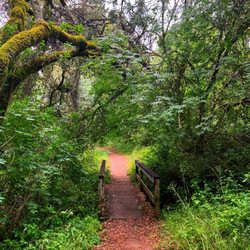
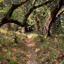
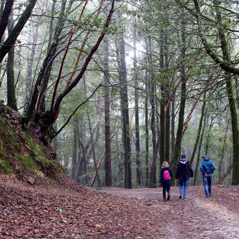
    There are several trails to explore here at Skeggs Point. Even the shortest hike will be 6 miles. Its all pretty steady and easy with beautiful Redwood Trees and just calming nature. The paths are mostly shaded which is a super plus for me. Who wants to hike in heat?! The Sandstone Formation is a must! Its a unique site to see. Quicktip: Don't forget to grab a map offered at the entrance!
    Fir Trail
    Lee A.

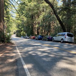
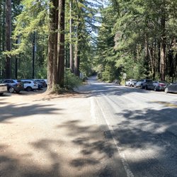
    Skeggs Point parking lot is clean, free, and has picnic tables in case you want to sit for a snack before you get your butt to hikin'. El Corte de Madera Creek Preserve is one of the most beautiful places on the Peninsula to hike. I went here a week ago in search of the infamous plane wreckage (which I believe has been swept away by the rain :(). I love the Sandstone features off the Tafoni trail! Incredible. I had a great workout and my joy was not at all dampened by the rain.

    Vinay M.

    Nice Tafoni trail with shades for summer trail. Do complete the tafoni trail and for trail loop for a 6.5 mile moderate hike. Not much vista views but definitely cold breeze and mountain bikers awaits your hiking trip.

    See all

    8 months ago

    Helpful 2
    Thanks 2
    Love this 2
    Oh no 0

    3 years ago

    Helpful 1
    Thanks 0
    Love this 0
    Oh no 0
    Photo of Doctor G.
    1
    2405
    2

    2 years ago

    Helpful 2
    Thanks 0
    Love this 0
    Oh no 0
    Photo of Liv K.
    665
    551
    2599

    7 years ago

    Helpful 5
    Thanks 0
    Love this 4
    Oh no 0

    15 years ago

    Helpful 2
    Thanks 1
    Love this 0
    Oh no 0

    11 years ago

    Helpful 16
    Thanks 1
    Love this 13
    Oh no 0

    8 years ago

    Helpful 2
    Thanks 2
    Love this 0
    Oh no 0

    17 years ago

    Helpful 13
    Thanks 0
    Love this 13
    Oh no 0

    10 years ago

    Helpful 4
    Thanks 0
    Love this 1
    Oh no 0

    13 years ago

    Helpful 8
    Thanks 0
    Love this 4
    Oh no 0
    Photo of Sam M.
    191
    829
    1069

    14 years ago

    Helpful 3
    Thanks 1
    Love this 2
    Oh no 0
    Photo of Tae K.
    57
    38
    0

    17 years ago

    Helpful 2
    Thanks 0
    Love this 0
    Oh no 0
    Photo of John N.
    62
    29
    0

    16 years ago

    Helpful 2
    Thanks 0
    Love this 0
    Oh no 0

    13 years ago

    Definitely my favorite place to hit the trails with solid descents and challenging climbs. A must-go!

    Helpful 1
    Thanks 0
    Love this 1
    Oh no 0

    12 years ago

    Helpful 1
    Thanks 0
    Love this 0
    Oh no 0
    Photo of David H.
    205
    66
    169

    13 years ago

    Helpful 0
    Thanks 0
    Love this 0
    Oh no 0
    Photo of John S.
    34
    71
    20

    19 years ago

    Helpful 5
    Thanks 0
    Love this 2
    Oh no 0

    15 years ago

    Helpful 1
    Thanks 0
    Love this 0
    Oh no 0

    11 years ago

    Helpful 1
    Thanks 1
    Love this 0
    Oh no 0
    Photo of Joey F.
    40
    81
    0

    18 years ago

    Helpful 1
    Thanks 0
    Love this 0
    Oh no 0

    10 years ago

    Helpful 0
    Thanks 1
    Love this 0
    Oh no 0
    Photo of Jason R.
    34
    61
    24

    19 years ago

    Helpful 0
    Thanks 0
    Love this 0
    Oh no 0
    Photo of H K.
    54
    1298
    186

    14 years ago

    Helpful 0
    Thanks 0
    Love this 0
    Oh no 0
    Photo of B P.
    8
    22
    5

    12 years ago

    Helpful 0
    Thanks 0
    Love this 0
    Oh no 0

    Ask the Community - Skeggs Point

    Review Highlights - Skeggs Point

    Pit toilets available at the new lot (the one with the El Corte de Madera Open Space Preserve sign).

    Mentioned in 5 reviews

    Read more highlights

    You might also consider

    Verify this business for free

    People searched for Hiking 4,835 times last month within 15 miles of this business.

    Verify this business

    Wunderlich Park - Museum

    Wunderlich Park

    4.2(131 reviews)
    1.7 mi

    Small Wunder A…read more940-acre park nestled in the eastern Redwoods and madrone-laden slopes of King Mountain. The name of the park is derived from contractor Martin Wunderlich, who donated the land to San Mateo County. The Good: * Free to visit * Parking lot * Picnic tables available * Restroom in parking lot * Seventeen miles of trails, including several loops. * If you like horses, then this is the place for you! There's a really cool old historic stable and lots of equine action to be found. * Camping available (https://www.smcgov.org/parks/make-reservation) The Meh: * Currently, no recreational horse activities like trail rides and lessons are available. * Crazy elevation gains, as trail elevations run from ±350' to over 4,300'. Be sure to check the trail guides to make sure you don't get in over your head. * No dogs allowed The Ugly: * The restroom has no running water, just hand sanitizer. * I'll admit, I'm not a fan of horses, and having to share trails with horses isn't my idea of a good time. Conclusion: Not the biggest park in this area that's full of fantastic OSPs, but it's certainly worth a visit--especially if you're a hippophile.
    Hiked at Wunderlich Park on a sunny Saturday in March! We used AllTrails for directions and we…read morereached around 9am - to our surprise, the parking lot was full by then so definitely recommend coming earlier. There were multiple cars circling around looking for a spot as well. We ended up waiting about 30 minutes before parking. We did the Bear Gulch and Alambique trail clockwise. There are some brief steep sections, but for the most part, the trail was moderate in terms of difficulty. We didn't encounter too many people despite all the cars in the lot. We spotted a small snake on the trail and there was a lot of horse manure on the Alambique portions, so we had to watch our step closely. The trail was mostly shaded which was nice, but there wasn't much of a view. Overall, the trail was well marked and maintained (minus the manure on Alambique). Good hike for a sunny day, but the parking lot situation could be improved.

    Photos
    Wunderlich Park - Horse stables

    Horse stables

    Wunderlich Park
    Wunderlich Park

    See all

    Purisima Creek Redwoods Preserve

    Purisima Creek Redwoods Preserve

    4.6(247 reviews)
    5.4 mi

    We really enjoyed this hike at Purisima Creek Redwoods. We started at the North Ridge parking area…read moreand followed North Ridge Trail Whittemore Gulch Trail Harkins Ridge Trail, returning to the same parking area. The entire loop ended up being around 6.5-7 miles. About 75% of the hike was shaded, much of it through beautiful redwood forest, with a small creek alongside portions of the trail. There are also some more exposed sections with great views. Be prepared for the elevation changes! The extended downhill sections are harder on the legs and knees than you might expect, and the return on Harkins Ridge is a long, sustained and quite strenuous uphill climb. It was probably one of the more strenuous hikes I've done in California in many years. That said, it was absolutely worth it. Beautiful scenery, lots of shade, peaceful forest, and a great workout. I'd definitely do this loop again -- I'd just be mentally prepared for that climb back to the parking lot!

    I think my mainest girl is trying to eliminate me. I don't know why, but she thinks I love taking…read morelong arduous hikes through the woods and huffing and puffing through beautiful scenery. Levity aside, this is a stunningly beautiful park to commune with nature. But be warned, if you're a novice (me), don't have broken in hiking shoes (me) or could be in better shape (also me), it will be challenging. Steep inclines and declines are the order of the day. Also plenty of banana slugs. The park is beautiful, the silence is eerily beautiful, and you will enjoy all of it.

    Photos
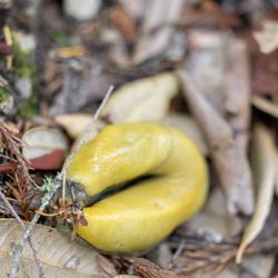
    Purisima Creek Redwoods Preserve - Banana slug

    Banana slug

    Purisima Creek Redwoods Preserve
    Purisima Creek Redwoods Preserve - A few wildflowers

    See all

    A few wildflowers

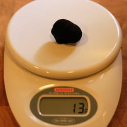
    Phleger Estate - My black truffle (13g) found near Phleger Estate, Woodside, CA

    Phleger Estate

    4.4(5 reviews)
    3.5 mi

    Beautiful and quiet park that is currently run by the Golden Gate National Recreation Area, Phleger…read moreEstate can be accessed via Huddart County park or by a roadside lot off Skyline Blvd. The benefit of parking at Huddart (albeit with a $6 parking fee) are clean restrooms and the fact you are doing most of the uphill at the start of your hike. Hiking in from Huddart, the crowds thinned and I only saw 3 other hiking groups the whole time-unusual for a beautiful Saturday in August. The park is well signed and I took the Miramontes trail which meanders along what is now a dry creek, gently uphill to a fork (again well signed) that points you to the Raymundo or Mt Redundo trails. I veered right to the Raymundo trail which is a steady but not too steep climb through mixed redwood forest and what is now a dry creek. Would love to do this trail again in rainier years to see the creek flowing and find newts and banana slugs. Still, despite a dry year, the trails were pretty green and lush. The Raymundo trail ends and another fork to the right can take you up to Skyline via the Lonely Trail or stay straight on the Mt Redundo trail which takes you back to the start of the loop and the Miramontes trail (which is out and back to Huddart County park). I headed back on Mt Redundo and it was a bit steep downhill with some roots and rocks making for uneven footing. It also has some steep ravines so mind your step. This part of the trail was eerily quiet and not as bright, so I was happy to get back to the Miramontes trail that led me back to the more well traveled Huddart County park. Really lovely park with some of the nicest redwood trails on the peninsula. Review #49 of 100 review goal in 2021

    Fantastic hike next to the more well-known Purisma Creek. We took Lonely Trail, then Raymundo…read moreTrail, then Mt. Redondo trail and back up the Lonely Trail. It was about 6 miles. There's parking on Skyline Boulevard past Kings Mountain Fire Brigade -- just a handful of spots by the side of the road. It's downhill until you get to the juncture of Raymundo and Mt. Redondo, then straight back up again. My thighs were burning up and I had to stop and rest a bunch of times. Overall, the hike too about 3 hours and 15 minutes. My favorite part was the Raymundo Trail because you hike right next to a stream. There was plenty of water in the stream, probably because it has rained recently. Actually, most of the hike was next to a stream of some sort. You could hear water the whole time which was cool. Another great thing about this hike is that it's shady the whole way. Lots of pretty redwoods to look at. There were lots of very muddy parts on this trail. Also, the Miramontes trail, which connects Mt Redondo trail to Huddart County Park, was closed, due to the rain. We ran into three other couples on the trail during our hike. Very quiet trail! Really quite a hidden gem.

    Photos
    Phleger Estate
    Phleger Estate - Once you reach the top of the Raymundo trail it gets flat for a bit

    Once you reach the top of the Raymundo trail it gets flat for a bit

    Phleger Estate

    See all

    El Corte de Madera Creek Preserve - El Corte de Madera Creek Open Space Preserve

    El Corte de Madera Creek Preserve

    4.5(78 reviews)
    2.2 mi

    Creek Squad…read more +2,900-acre preserve managed by Mid-Pen that features over 34 miles of trails across a variety of terrains. The Good: * Free to visit. * Restroom in the main parking lot * Horses OK * Mountain biking OK on designated trails (check signage and maps) * Main parking lot as well as several roadside parking lots available off Skyline Blvd (aka Hwy 35). * Trails are in pretty good shape for the most part, and they're mostly shaded from what we can tell. There are several loops of varying difficulties, so check AllTrails for suggestions. * Several points of interest to check out, including the Tafoni skulls and the Methuselah Tree. * Some of the largest banana slugs we've ever seen! The Meh: * Roadside parking fills up quickly on weekends. Lots of cars waiting when we left around 11:30-ish. * No dogs * No camping The Ugly: * Beware of the mountain bikers who come ripping through the trails like they own them. You'll usually hear them before you see them, so keep the music down. * Driving here is no picnic on very windy roads, so please take your time and slow down, especially on weekends where you'll see hordes of bicyclists on the Hwy. Conclusion: Fantastic park with some great trails, beautiful forests, and huge banana slugs!

    This place is stunning ! There are so many trails to choose from, and a number of parking spots so…read moreeven during late morning my husband and I were able to find parking in one of the lots. We decided to just go see the giant sandstone, which did not disappoint ! I really appreciated how well the trails were marked so that you knew clearly where you were going. On the way to the sandstone, it was also coo lto see some ocean views as well as random open fields in the dense woods here and there. Definitely a worthy hike to try ! This place is stunning ! There are so many trails to choose from, and a number of parking spots so even during late morning my husband and I were able to find parking in one of the lots. We decided to just go see the giant sandstone, which did not disappoint ! I really appreciated how well the trails were marked so that you knew clearly where you were going. On the way to the sandstone, it was also coo lto see some ocean views as well as random open fields in the dense woods here and there. Definitely a worthy hike to try !

    Photos
    El Corte de Madera Creek Preserve - El Corte de Madera Creek Preserve

    El Corte de Madera Creek Preserve

    El Corte de Madera Creek Preserve - El Corte de Madera Creek Preserve

    El Corte de Madera Creek Preserve

    El Corte de Madera Creek Preserve - El Corte de Madera Creek Preserve

    See all

    El Corte de Madera Creek Preserve

    Pulgas Ridge Open Space Preserve

    Pulgas Ridge Open Space Preserve

    4.2(147 reviews)
    6.2 mi

    It's Chris' first time here and he loved it, it was a late nite walk/hike and wasn't too bad. The…read moredoggies loved it, so many friendly people and dogs alike and different routes are plenty. Weather was perfect & parking wasn't too bad. FYI, there's areas that "No-Leash" required for Dogs, it has signs as a warning, which is cool for those dogs who are well trained and don't run away lol. I tried it w/ Sadie and gave me the look are you for real, Mom? Lol Overall it was a great 3 miles workout for us rookies as it's been awhile since we took our dogs out for a hike!

    Dog friendly park! Super sad because the Cordilleras Trail was closed for construction and will be…read morethrough the end of July :( I came with two friends to have a cute mommy date with their babies in strollers and had to drive to a new park. We will definitely come back again once it's open! 4/5 stars for the closure and only one restroom made available at the parking lot (I also did not see a water bottle/fountain filling station) Parking: There's a free parking lot (fits ~20 cars) and ample street parking if it's filled. I recommend coming on a week day to secure a parking spot Easy Trail: the cordilleras trail is wheelchair and stroller friendly! It's a 0.3 mile flat trail that breaks off into other trails leading to the dog park or towards the creek. This trail is paved, so no worries about bumpy roads or muddy patches Moderate Trail: the blue oak trail has a steep incline immediately at the start of the hike. It zig zags and is a ~200 ft elevation increase for 0.4 miles. It gets dusty but is doable due to the many trees for shade. It leads directly to the off leash dog area

    Photos
    Pulgas Ridge Open Space Preserve
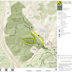
    Pulgas Ridge Open Space Preserve - Pulgas Ridge Preserve trail map https://www.openspace.org/preserves/pulgas-ridge

    Pulgas Ridge Preserve trail map https://www.openspace.org/preserves/pulgas-ridge

    Pulgas Ridge Open Space Preserve

    See all

    Skeggs Point - hiking - Updated September 2026

    Loading...
    Loading...
    Loading...