Windy Hill Open Space Preserve Photos


You might also consider


More like Windy Hill Open Space Preserve
Recommended Reviews - Windy Hill Open Space Preserve
Start your review...


Reviews With Photos
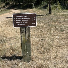

Fun and easy trail, not steep inclines and lot of tree shades. We hiked via Hamms Gulch trail and go all the way up to 3 miles trail and decided to turned back the same way. It will take total 5 miles to reach the top. The weather was too hot 80+ at 4pm ish.


Very pretty! I was passing down Portola Rd and stopped here to use the bike parking and public restroom off of the parking lot. I saw a bunch of people getting ready to hike with their dogs. The parking lot is gravel, but there are plenty of spaces. The restroom is clean-ish, it's an enclosed building but there's no running water - they have toilets that are more like porter potty style (dumps into holes in the ground) and hand sanitizer instead of a sink. But for convenience this was great.
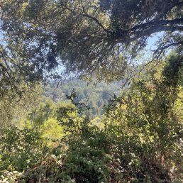

This is a loop that you can do clockwise or counterclockwise. It's pretty intuitive but it's not well marked for this specific loop and you end up on a lot of different trail names so make sure you look at your map so you don't get lost. I wasn't super impressed with the views- pretty barren and the hills are so small. The woodsy area is nice though. When I did the hike I saw several rattlesnakes in the sunny sections which was terrifying! Be careful.


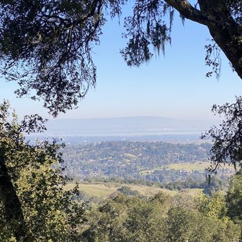
Amazing place to hike with flat grounds and overall beautiful views of the bay. Also it's not crowded. If you want less exposure and less wind, head south toward Lost Trail (longer trail, 2 hours long). If it's not too windy, head left toward Anniversary Trail (can be done as loop, less than an hour)
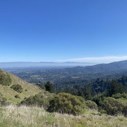

As with most of the preserves on the Mid Pen Open Space Preserve list, this place has views for days! Spectacular take your breath away views...and it's not just because you hiked over 3 miles up hill to see them! There's a bottom parking lot accessible through Portola Valley and one up top that's accessible from Skyline Rd. If you're in the mood to see some good views and don't want to do a hard hike to find them, enter through skyline! From here you can do a little exploring without having to get a full hike in. If you do want to get the whole hike in, start from the bottom that way you start with the uphill battle and end with the down hill. We hiked Windy Hill Loop clockwise from the bottom parking lot on a beautiful *clear and not too hot* day. According to All Trails this loop is about 6.2 miles, if you read into it and look at the starting point on their map it seems that is is actually closer to 7. Unfortunately my friend was unable to find parking so I hopped in her car and parked about 3/4 miles down the road. What was supposed to be a just over 6 mile hike turned into what was closer to an 8 mile hike for us. In doing the trail clockwise from the bottom, the first half was lovely! This part of the trail took you through trees, over a creek, and on a lot of switch backs to get you up there. There were still some fairly steep climbs here and there, but the majority of the trail was shaded switch backs. The views on this side were nice, but only once you got closer to the top did they start to really get amazing. Going down the trail on the other side was a different story, it was steep and sunny. So steep that it really wasn't fun and ended up being kind of painful on my knees (I hav bad knees) and quads. The views on this side however were great. No trees to block out the view...but also no trees to block out the sun. I probably won't do this loop trail again because I didn't find the 2nd half enjoyable. I would love to come back and do a smaller portion of the trail from the top (and not end up down hill) just to see those views again.

Two months ago on a trip to Hayes Valley for dumpling treats on a weekday I parked on a slight incline near the dumpling establishment. Not like a Pac Heights hill or the Castro, a gentle slope. Upon parking I busied myself stashing or packing every single item even remotely visible as you all know what happens if you don't do that in this shining example of an amazing American city. Then off to the delicious dumplings we went. Returned within the two hours to find a gift from SF's finest under my wiper blade. 59 clams for not curbing my wheels. I've lived in SF and parked in SF for three decades and have gotten a variety of tickets for a variety of reasons but never one for this. The steep hills have signs instructing the wheel curbing behavior. The gentle ones do not. The ticket referenced the SF muni code as its justification. What complete jerks. Upon exiting our maiden voyage to Windy Hill yesterday we returned to the vehicle parked carefully off the driving surface on the proper side of the white line in an area where there are no signs saying don't do this and so many folks did because the Windy Hill parking lot is pretty small and as we neared the windshield wiper there was a little white paper flapping and my smile turned upside down and the sheriff was two cars ahead leaving more flapping papers and I grabbed it and looked then looked again and ... it was a $0 warning. I looked again. A message saying don't do this again here's how to do it properly. Take note, SF, of a much better way to get your message across. If you were perfect, SF, maybe you'd have a reason to be mean, but you aren't. We thanked the officer as we drove away, still amazed. With respect to Windy Hill itself, pretty perfect conserved space, excellent loop trail up to Skyline w awesome views, birds and flowers. In the summer you'll want to ascend via the southern trail (Hamm's Gulch) and descend on the one to the north (Spring Hill) as the latter has no shade while the former is shaded and cool and much better for the up part of the adventure. There are also a few small lots on Skyline and you could park and go down then up but who really wants to finish a walk with the up part. Thank you again, officer, for your kindness. We will definitely situate our ride properly next time. And thank you Windy Hill for a perfect 9-mile ish workout in a beautiful setting on a beautiful day.


I had an amazing hike here earlier this week! It was an overcast day and when we made it to the top, the cloud layer was below us and we saw the sunrise over the East Bay Hills. Memorable moment! My friend said that on a clear day, you can see SF as well. I plan to come back for that. Note that getting directions to the park from Apple Maps takes you to a neighborhood. Look for Windy Hill Preserve parking lot on Google and that will take you to the right spot.
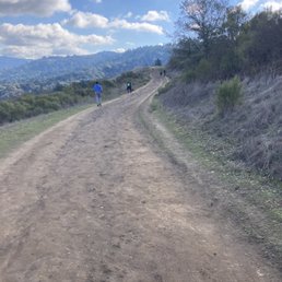

We did it! 10 miles! Spring Ridge Trail to Anniversary Trail to Lost Trail to Razorback Ridge Trail to Hamms Gulch Trail. Took about 4 hours and we stopped twice. Spring Ridge is slow, steady, climb up. Very wide but a bit crowded with lots of dogs on leashes. Very hot. Top of Anniversary Trail there were two people getting ready to paraglide off the mountain. Gorgeous 360 degree views and you can see San Francisco in the distance. Lost trail was very muddy since it had rained the day before - I loved it. Felt like a kid again stomping in the mud. Razorback Ridge Trail is a very slow decline with lots of switchbacks. It did get cold since the sun was setting. Parking is a little tough (Saturday at noon) but I only had to wait 5 minutes for someone to come and leave.


Beautiful rolling hills on the top of the Santa Cruz mountains to catch the sunset or overlook the Bay from the other side.


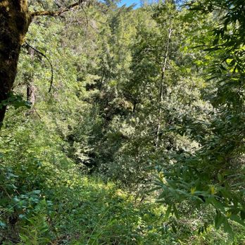
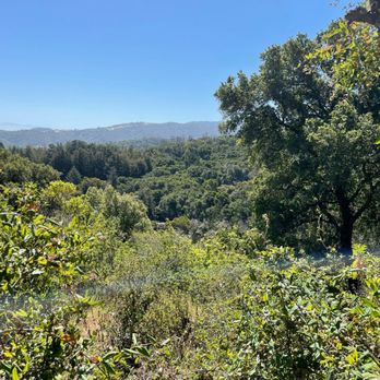
Great on-leash dog trail. I walked the entire trail that was dog-accessible, and recorded 8.4 miles in 3.5 hours. I'm a slow hiker, and my dog needed plenty of breaks. Even at 9AM, there was available parking across the street on Portola Trail. My path: Betsy Crowder Trail (very cool and shaded) Sequoias Trail Hamms Gulch Trail (shaded and lots of uphill) Lost Trail (no shade, hotter, flowers!) Anniversary Trail (surprisingly muddy for the altitude) Windy Hill Summit (hardest part bc of the mud) Spring Ridge Trail (hotter, no shade, but all downhill and small rocky terrain) Betsy Crowder Trail (back to the shade) There is internet access for almost the entire trail so it's easier to find your way if you feel you wandered off the wrong path for 2 miles. Compared to Mission Peak, there's more to see, and the difficulty level is the same because it's moderately difficult, and the time to complete is longer. I definitely will be back because there's more to see here, but my dog probably won't want to come back.


There is so many great places to hike in the Bay and like most of the Preserves in the area you won't be disappointed. This 1,335-acre preserve is filled with grassland ridges and forests covered with redwoods, fir and oaks. The hikes at Windy Hill are indeed on the breezy side but it's a great place in the summer when you need a little cooling off from the warm sun. One of my favorite hikes is taking Lost Trail to the end and back making a nice 5 mile hike. Doggies are allowed, on leash, on most trails except Lost and Razorback Trail.


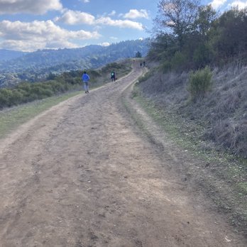
Came here for the Spring Ridge Trail hike on 8/1, which is 2 miles one-way. There is a public parking lot right where the trail head is, it does get full but there is street parking right outside the lot as well. There is a bathroom outhouse right in front of the trail. This trail isn't too steep, mostly slow incline all the way up except for a few short steeper parts. The path is mostly dirt and lots of small rocks especially on the hilly parts. On the way, we saw some insects like flies, dragonflies, and a warning sign for rattlesnakes. Also saw 1 lizard. read more


Had my first hike of the year, and it was a beauty! The weather worked in my favor, and hitting golden hour was a bonus. I should have stayed longer to hit sunset, but that can be for another time. It was definitely windy, so be mindful of that if you decide to trek here. The views were so worth it! read more


Stunning views! I've been wanting to go to Windy Hill for a while and finally got to hike the Windy Hill loop today (Saturday). I got to the park around 7:45am and there was a decent amount of street parking near the trailhead then. I went clockwise (up Spring Ridge and down Hamms Gulch) - steep initially but the hike got easier as I went along. The trail was well-maintained, with benches throughout. The scenery was amazing, especially with all the green hills! Felt like a Studio Ghibli film. Weather was great as well - perfect hike for spring time. The trail got more crowded as time went on so I recommend going before 9am. Very safe for solo hikers. Highly recommend! read more

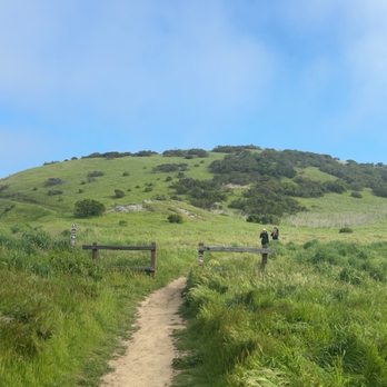


Fun and easy trail, not steep inclines and lot of tree shades. We hiked via Hamms Gulch trail and go all the way up to 3 miles trail and decided to turned back the same way. It will take total 5 miles to reach the top. The weather was too hot 80+ at 4pm ish. read more


1 year ago
Very pretty! I was passing down Portola Rd and stopped here to use the bike parking and public restroom off of the parking lot. I saw a bunch of people getting ready to hike with their dogs. The parking lot is gravel, but there are plenty of spaces. The restroom is clean-ish, it's an enclosed building but there's no running water - they have toilets that are more like porter potty style (dumps into holes in the ground) and hand sanitizer instead of a sink. But for convenience this was great. read more


2 years ago
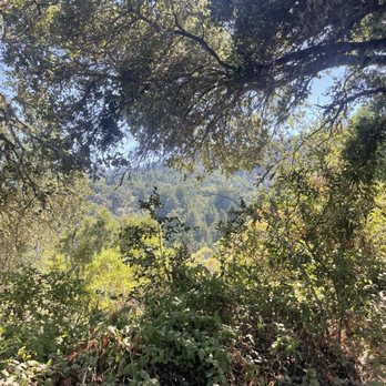
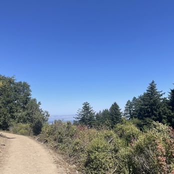
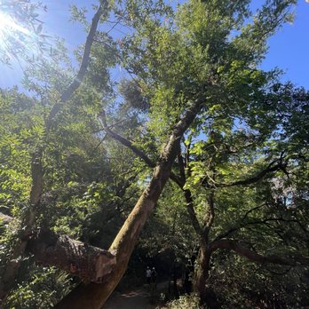
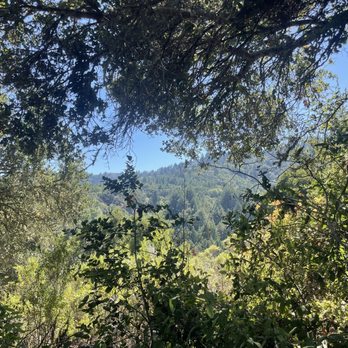
This is a loop that you can do clockwise or counterclockwise. It's pretty intuitive but it's not well marked for this specific loop and you end up on a lot of different trail names so make sure you look at your map so you don't get lost. I wasn't super impressed with the views- pretty barren and the hills are so small. The woodsy area is nice though. When I did the hike I saw several rattlesnakes in the sunny sections which was terrifying! Be careful. read more



4 years ago
Amazing place to hike with flat grounds and overall beautiful views of the bay. Also it's not crowded. If you want less exposure and less wind, head south toward Lost Trail (longer trail, 2 hours long). If it's not too windy, head left toward Anniversary Trail (can be done as loop, less than an hour) read more


As with most of the preserves on the Mid Pen Open Space Preserve list, this place has views for days! Spectacular take your breath away views...and it's not just because you hiked over 3 miles up hill to see them! There's a bottom parking lot accessible through Portola Valley and one up top that's accessible from Skyline Rd. If you're in the mood to see some good views and don't want to do a hard hike to find them, enter through skyline! From here you can do a little exploring without having to get a full hike in. If you do want to get the whole hike in, start from the bottom that way you start with the uphill battle and end with the down hill. We hiked Windy Hill Loop clockwise from the bottom parking lot on a beautiful *clear and not too hot* day. According to All Trails this loop is about 6.2 miles, if you read into it and look at the starting point on their map it seems that is is actually closer to 7. Unfortunately my friend was unable to find parking so I hopped in her car and parked about 3/4 miles down the road. What was supposed to be a just over 6 mile hike turned into what was closer to an 8 mile hike for us. In doing the trail clockwise from the bottom, the first half was lovely! This part of the trail took you through trees, over a creek, and on a lot of switch backs to get you up there. There were still some fairly steep climbs here and there, but the majority of the trail was shaded switch backs. The views on this side were nice, but only once you got closer to the top did they start to really get amazing. Going down the trail on the other side was a different story, it was steep and sunny. So steep that it really wasn't fun and ended up being kind of painful on my knees (I hav bad knees) and quads. The views on this side however were great. No trees to block out the view...but also no trees to block out the sun. I probably won't do this loop trail again because I didn't find the 2nd half enjoyable. I would love to come back and do a smaller portion of the trail from the top (and not end up down hill) just to see those views again. read more
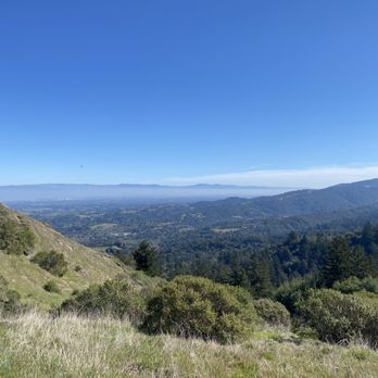

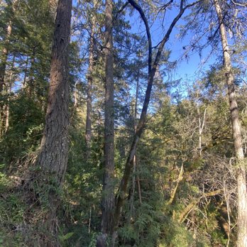
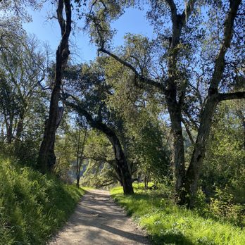


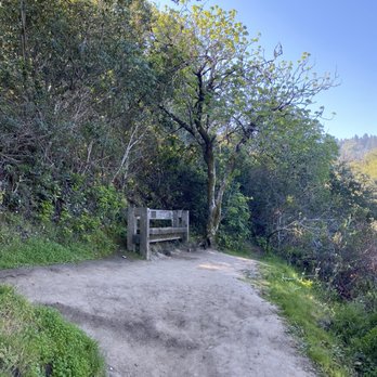



Two months ago on a trip to Hayes Valley for dumpling treats on a weekday I parked on a slight incline near the dumpling establishment. Not like a Pac Heights hill or the Castro, a gentle slope. Upon parking I busied myself stashing or packing every single item even remotely visible as you all know what happens if you don't do that in this shining example of an amazing American city. Then off to the delicious dumplings we went. Returned within the two hours to find a gift from SF's finest under my wiper blade. 59 clams for not curbing my wheels. I've lived in SF and parked in SF for three decades and have gotten a variety of tickets for a variety of reasons but never one for this. The steep hills have signs instructing the wheel curbing behavior. The gentle ones do not. The ticket referenced the SF muni code as its justification. What complete jerks. Upon exiting our maiden voyage to Windy Hill yesterday we returned to the vehicle parked carefully off the driving surface on the proper side of the white line in an area where there are no signs saying don't do this and so many folks did because the Windy Hill parking lot is pretty small and as we neared the windshield wiper there was a little white paper flapping and my smile turned upside down and the sheriff was two cars ahead leaving more flapping papers and I grabbed it and looked then looked again and ... it was a $0 warning. I looked again. A message saying don't do this again here's how to do it properly. Take note, SF, of a much better way to get your message across. If you were perfect, SF, maybe you'd have a reason to be mean, but you aren't. We thanked the officer as we drove away, still amazed. With respect to Windy Hill itself, pretty perfect conserved space, excellent loop trail up to Skyline w awesome views, birds and flowers. In the summer you'll want to ascend via the southern trail (Hamm's Gulch) and descend on the one to the north (Spring Hill) as the latter has no shade while the former is shaded and cool and much better for the up part of the adventure. There are also a few small lots on Skyline and you could park and go down then up but who really wants to finish a walk with the up part. Thank you again, officer, for your kindness. We will definitely situate our ride properly next time. And thank you Windy Hill for a perfect 9-mile ish workout in a beautiful setting on a beautiful day. read more


1 year ago
If you like hiking and watching sunrise this is the place. One of the Best place to hike, watch sunrise and watch the cloud drift! read more


I had an amazing hike here earlier this week! It was an overcast day and when we made it to the top, the cloud layer was below us and we saw the sunrise over the East Bay Hills. Memorable moment! My friend said that on a clear day, you can see SF as well. I plan to come back for that. Note that getting directions to the park from Apple Maps takes you to a neighborhood. Look for Windy Hill Preserve parking lot on Google and that will take you to the right spot. read more


We did it! 10 miles! Spring Ridge Trail to Anniversary Trail to Lost Trail to Razorback Ridge Trail to Hamms Gulch Trail. Took about 4 hours and we stopped twice. Spring Ridge is slow, steady, climb up. Very wide but a bit crowded with lots of dogs on leashes. Very hot. Top of Anniversary Trail there were two people getting ready to paraglide off the mountain. Gorgeous 360 degree views and you can see San Francisco in the distance. Lost trail was very muddy since it had rained the day before - I loved it. Felt like a kid again stomping in the mud. Razorback Ridge Trail is a very slow decline with lots of switchbacks. It did get cold since the sun was setting. Parking is a little tough (Saturday at noon) but I only had to wait 5 minutes for someone to come and leave. read more




1 year ago

2 years ago

5 years ago

3 years ago
Beautiful rolling hills on the top of the Santa Cruz mountains to catch the sunset or overlook the Bay from the other side. read more


5 years ago
Great on-leash dog trail. I walked the entire trail that was dog-accessible, and recorded 8.4 miles in 3.5 hours. I'm a slow hiker, and my dog needed plenty of breaks. Even at 9AM, there was available parking across the street on Portola Trail. My path: Betsy Crowder Trail (very cool and shaded) Sequoias Trail Hamms Gulch Trail (shaded and lots of uphill) Lost Trail (no shade, hotter, flowers!) Anniversary Trail (surprisingly muddy for the altitude) Windy Hill Summit (hardest part bc of the mud) Spring Ridge Trail (hotter, no shade, but all downhill and small rocky terrain) Betsy Crowder Trail (back to the shade) There is internet access for almost the entire trail so it's easier to find your way if you feel you wandered off the wrong path for 2 miles. Compared to Mission Peak, there's more to see, and the difficulty level is the same because it's moderately difficult, and the time to complete is longer. I definitely will be back because there's more to see here, but my dog probably won't want to come back. read more



5 years ago

There is so many great places to hike in the Bay and like most of the Preserves in the area you won't be disappointed. This 1,335-acre preserve is filled with grassland ridges and forests covered with redwoods, fir and oaks. The hikes at Windy Hill are indeed on the breezy side but it's a great place in the summer when you need a little cooling off from the warm sun. One of my favorite hikes is taking Lost Trail to the end and back making a nice 5 mile hike. Doggies are allowed, on leash, on most trails except Lost and Razorback Trail. read more


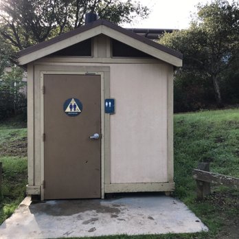
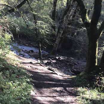
For oldies trying to be in shape, we spontaneously choice this trail for a step up on our hike! Thanks to fellow Yelpers for the recommendation of what to expect, it has made this hike bearable!! Once we start, forget going back! Haha We started at the Portola parking area by apartments. Our main goal here was the 7 mile hike route: 1) you will start at Spring Ridge Trail. This is about half a mile. 2) follow the Hamms Gulch Trail which once you see the sign at a V (take the left). This goes steadily uphill on crooked roads. This trail is about 2.5 miles. Make sure to take pics at the end of this trail where it has the view of the Silicon Valley. Bring that selfie stick! 3) once you hit Lost Trail, take a right. This part is less than a mile, you will hit a parking lot by Skyline road where there is parking and a bathroom. 4) take the Anniversary trail for a short distance. If you are not scared of heights, this is a beautiful trail looking at the valley. It starts the trail at the edge of the mountain. This is about 3/4 of a mile long. 5) take the Spring Ridge Road. This part is the killer going down the hill. This is about 2 miles. I am so glad we came from the Hamms Gutch trail as going up Spring Valley first would have killed my caves and would not make it back on Hamms Gutch trail to the car. I would rather go down the hill on Spring Ridge Trail. This part made my knees sore! I recommend to take a few snacks and water. Bring lunch and picnic at the end of Lost trail. Make sure to bring extra clothes to change after this trail especially, if it had rained as it can be muddy. Hamms Gutch trail is good on summer days to cover from the sun. I would have walked this and gone back instead of a loop if I came for another hike. There is no trail cans here so bring your trail with you. This is a beautiful trail to take for nice views. This is considered a moderate trail. My ass! It was difficult for us first timers. Make sure to stretch before the hike as it will help you not be so sore. I would try this again...one day. ;-p. [28/100] read more



3 years ago

Taking off a star only because it does not offer as much shade as other hikes in the area- but getting 4 stars because it's ridiculously close to stanford's campus for busy students to get away without actually putting in the miles. The "windy" area of the hike is certainly very exposed and the gusts can make you feel breathless- especially because there are 2 large hills with steep elevation gain you'll want to save your glutes for. The nice thing about the hike is the incredible variety you'll get in the types of climate settings- the fogginess of the almost rainforest-like shaded area versus the dry barren exposed patch of the grassy hills. A beautiful respite! read more


6 years ago
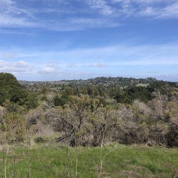
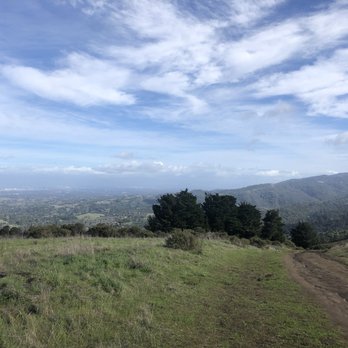
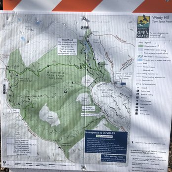
Came around noon on a Saturday and there was still parking spots. The parking lot is quite large and you can park on the side of the main street. (Search for Windy Hill Preserve Parking). From here, the main trail is the Spring Ridge Trail that takes you up to the Windy Hill Summit, which is about 3 miles one-way and takes about 1.5 hours depending on your pace. The journey west is more challenging and is essentially a steady incline all the way to the top. There's not many interconnecting trails so unless you plan on spending the entire day doing a loop, you'll likely come down the way you went, which is more leisurely as it's downhill all the way. Even if you don't make it all the way, you get great views of the Bay along the entire path. It's a popular trail for dog owners and also horseback riders (beware of horse poop!). It can get a bit windy at times and trails can get muddy, so would recommend hiking shoes and packing a jacket. Would highly recommend for a decent workout, while also having a hike that you don't need to wait until the end for the views. read more




5 years ago
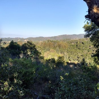
Sweet life! I loved this summit hike! Four miles up and four miles down. It was a sunset hike and a moonrise hike as well. It's been a while since I've done a summit hike and it's so great that this hike is just 25 minutes from my home. Far better than driving a couple of hours to find mountains in the Atlanta and D.C. areas. It's so nice that I can just make this a part of my evening routine after work from 6 p.m. to 9 p.m. thrice a week. The terrain keeps changing as you go up. Lion documentary in Africa terrain at the bottom, then redwood forests and ferns further up, and alpine forest with pines everywhere on top. This hike lives up to its name and is super windy and cold at the summit. However, that's almost every summit hike I've done and I've done some summit hikes in precariously dangerous weather, against all odds. Day 4 of being nice to myself yesterday! read more


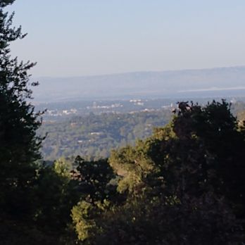


8 years ago

Wonderful wonderful! I am glad that this open space preserve honors its name and is somewhat windy, as last Sunday was super hot and would have been too much in the open air trails, such as the Anniversary trail. Just a note: the parking might be not easy to spot, we almost pass it as the wood sign with the maps etc was further in than usual and the parking was reduced to a few cars (I haven't check how many entrances this park has, maybe I went through the non very visible one). Mine had a big tree and 3 picnic tables, and from there you could either choose to take the under the sun trails on your left or the forest like on the your right. The vistas were amazing from the top but my favorite part was wandering through the 'jungle' of magnificent redwood trees, ferns, tons of ferns, so tropical looking, refreshing and beautiful. This first time there was just an appetizer and we needed too leave soon, otherwise I will continue until reaching the meadows on the bottom. Great place for a nice workout. read more


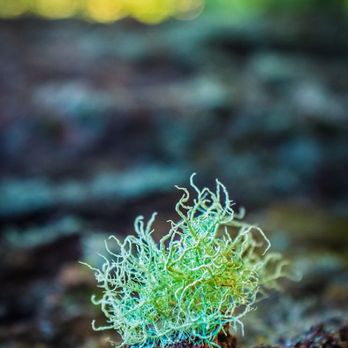


3 years ago

8 years ago
The view from the anniversary trail was amazing! You can see the entire South Bay Area and even paraglide like the man in the picture! There is free parking and a portable bathroom near the anniversary trail/lost trail area. No trash can or water fountain though! Parts of the lost trail was very muddy even though it hasn't rained in awhile, so prepare to get your shoes a bit dirty! The anniversary trail takes about 20 minutes and has benches along the way. Dogs are allowed in some areas too. This would be a great place for photography to capture the fog/clouds rolling below in the morning. read more
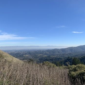
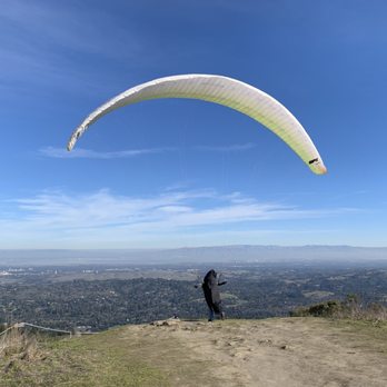


The service here was terrible. Despite it being November, the inconsiderate sun beat down on us while we were making our grueling ascent to the summit, causing us to sweat uncomfortably. Due to the name of the place, we were expecting some wind to cool us off, but the wind was AWOL. Only after we reached the summit did it get windy. Talk about too much too late. Restroom facilities at the summit were notoriously absent, and nobody came and refilled our waters. Needless to say, we didn't leave a tip. Other than that, Windy Hill is awesome. This scenic park offers a 1000 foot ascent over a 2-mile stretch, perfect for getting in shape to do Mission Peak (http://www.yelp.com/biz/mission-peak-regional-park-fremont) in Fremont. At the northeast corner of the park is a parking lot that accommodates roughly 40 cars. Additional parking is located outside along the side of Portola Road. There's also an outhouse at the parking lot, but I didn't see a drinking fountain anywhere. The Spring Ridge Trail will take you all the way from Portola Road to the park's western edge at Skyline Road. This trail is wide and is open to cyclists and horses. Going westward, prepare for a 2-mile trek uphill with almost no shade. It's not difficult but does take effort. When you reach Skyline Road, you'll find a small parking area and the start of the Anniversary Trail (http://www.yelp.com/biz_photos/windy-hill-open-space-preserve-portola-valley?select=Sncpa7wJdEEZYhkbfXttNg#Bv4Ojd68ALK_nycTRQSpTQ). At 0.2 miles into the Anniversary Trail is the summit of Windy Hill. Shoot, you could park along Skyline and walk to the summit in 5 minutes. But that just feels like cheating. At the summit is a small concrete marker (http://www.yelp.com/biz_photos/windy-hill-open-space-preserve-portola-valley?select=Sncpa7wJdEEZYhkbfXttNg#Sncpa7wJdEEZYhkbfXttNg) and a nice view of other parks (http://www.yelp.com/biz_photos/windy-hill-open-space-preserve-portola-valley?select=Sncpa7wJdEEZYhkbfXttNg#Zv0tsO1rFgHzIo517v2-sg) and Palo Alto and Stanford (http://www.yelp.com/biz_photos/windy-hill-open-space-preserve-portola-valley?select=Sncpa7wJdEEZYhkbfXttNg#YymPYIdfUZGGMnMi8fmVBA). Following the Anniversary Trail south will take you to a slightly larger parking area along Skyline. Another outhouse is located here. This is where the Lost Trail begins. This trail is not open to cyclists or horses. Follow the Lost Trail, turn left onto Hamms Gulch Trail, then left onto the Spring Ridge Trail, and that will take you back to the parking lot on Portola Road. Hamms Gulch Trail is completely shaded, and going eastward it's all downhill. The total distance covered by the Spring Ridge - Anniversary - Lost - Hamms Gulch loop from the parking lot and back is 7.2 miles. The nice thing about this place is that you take the uphill route to the summit, then for the way back you just let gravity do all the hard work! read more
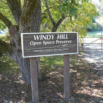


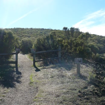


I love this place, mostly because I didn't get bit by a rattlesnake. It's easy to enjoy a place if you just judge it by wether you get bit by a rattlesnake. I'm starting to appreciate the DMV so much more, I haven't seen a snake there once. I can't say the same about Windy Hill. I didn't see this rattlesnake until I was about to step on it. Luckily I was able to avoid it just in time. After that experience I was just happy to not be going to the hospital. The one critique I have for this place is their signs. They had a sign that explained what to do if attacked by a mountain lion. It said "if attacked, fight back". To me that seemed a bit self explanatory. That would be like if a pool had a sign that said, "if drowning, start swimming". That wasn't even the worst part about the sign. It also had a picture of what parents should do if they encounter a mountain lion with their kids. Parents are suppose to pick them up and hold them in front of them, kind of like a cute little shield. It's almost like the sign wants parents to sacrifice their kids to the mountain lion. Another sign I didn't agree with was the "Not Potable" sign. The sign was placed right next to a tub of water. I'd imagine this sign would be extremely frustrating for those that brought pots on their hike and don't have the best vocabulary. They might want to put that water in their pots, I mean it's already in a tub, why on Earth can't it go in a pot. I don't have the best vocabulary and typically I would be confused by a word like "potable", but for some reason I remember that day in school where they talked about "potable". I know it means "drinkable", but why couldn't they just say that. Don't speak in code! Besides the signs, this hike was awesome! read more


3 years ago

5 years ago

Some would say to start with the easy part first and then do the harder things last. However, that should not be applied to hiking (especially when you have options available) and I'll explain why later on! This is an absolutely beautiful place to do hiking and get spectacular views of the Peninsula and parts of the South Bay. I was at first intimidated by a 1.6 mile stretch from the bottom (the Portola side) to the top (Skyline Blvd.) but realized that there was a lot to see at the top so I motivated myself to check it out. Besides, I enjoy going places, running, hiking and doing personal photography of especially scenic places. Yes, the uphill part may be overwhelming but it is well worth it in the end! Of course, you'll find out why they named this place Windy Hill and that is because you can feel the gusts about half-way up the mountain. Perfect photo opportunity! Bottom line is, some people make the mistake of starting on the Skyline side of Windy Hill and going downhill before having to go back uphill to their vehicle. You don't want to do that. It's always best to start at the bottom when possible, work your way up to the top, relax, and then go back downhill! read more




6 years ago
PLEASE DO NOT BRING YOUR DOG ON THIS HIKE. I'm an avid hiker of these trails and every time I bring my dogs on the hike with me, we leave with multiple ticks--a lot more ticks than any other hikes. It's a "preserve" after all. The thing is, I love this hike so much I still bring my dogs even though I know I'm risking it with the ticks, but I thought they'd be okay if I kept them away from the tall grass and foliage. But the last time I took my dog on a hike with me I kept on the trail & kept the leash short so she wouldn't wander into the grass. 30 minutes into the hike I noticed what I thought was just black dirt or plant debris/ pollen on her leg fur & I go to pick it off and noticed it was actually a swarm of ticks already in her fur! What really scared me was it wasn't just the one or four ticks you usually find on your dog when you take them out on hikes....upon further inspection I must've individually picked out 30 ticks from her fur......I immediately turned around and headed straight to my car to drive home. When I got back to my house I inspected her fur for more ticks and individually picked out 20 more ticks at home. I was so astonished with how many ticks I was able to find. I've never picked out that many ticks from my baby's fur in my life. I was immediately so scared for all the other dogs I saw hiking on that same trail that day. We passed by so many other dogs & even dogs off leash that the owners let wander around--so I can't even imagine how many ticks those fur babies got :( I picked out so many ticks that I ended up needing to get a jar out so I could safely discard of the plethora of ticks I found, faster. It was a literal nightmare. AMAZING hike for us humans with great views and a great workout. But please, PLEASE do not bring your dogs. And if you insist on bringing your dogs please be aware of ticks. Please have them on leash so you can look out for their health and minimize the risk of them getting ticks. To this day I still have no idea how my baby was able to get so many ticks in her fur while she was kept on a pretty short leash. Just really be wary dog parents!!! read more





13 years ago
Great views, dog friendly (on-leash only I believe) and lots of sunny trails to choose from. Gorgeous views, and a great workout since there were tons of hills to trek on our way to the summit. - Wildlife: saw a few deer and a lizard, but nothing too crazy. - Parking: neighborhood parking, pretty easy to find but looks pretty small. We were lucky I guess! - Bathrooms: didn't see any, so go beforehand! read more


Page 1 of 5
More info about Windy Hill Open Space Preserve
Portola Valley, CA 94028
Directions
(650) 691-1200
Call Now
Visit Website
http://www.openspace.org/preserves/windy-hill
Hours
Indoor Amenities
Outdoor Amenities
Ask the Community - Windy Hill Open Space Preserve
Review Highlights - Windy Hill Open Space Preserve
You might also consider


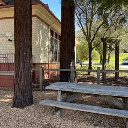
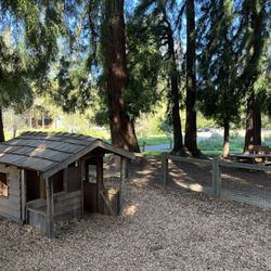


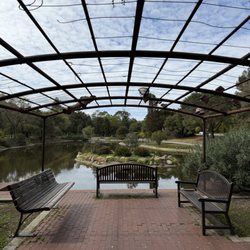
















Why does Yelp recommend reviews?


Windy Hill Open Space Preserve - parks - Updated August 2026
Best of Portola Valley
People found Windy Hill Open Space Preserve by searching for…
Things to Do in Portola Valley, CA
Hiking Trails in Portola Valley, CA
Star Gazing in Portola Valley, CA
Scenic Views in Portola Valley, CA
Attractions in Portola Valley, CA
Snow Park in Portola Valley, CA
Watch Sunset in Portola Valley, CA
Dog Friendly Hiking Trails in Portola Valley, CA
Scenic Drive in Portola Valley, CA
Natural Hot Springs in Portola Valley, CA
Waterfall Hike in Portola Valley, CA
Photo Spots in Portola Valley, CA
Walking Trails in Portola Valley, CA
Scenic Places to Walk in Portola Valley, CA
Picnic Areas in Portola Valley, CA
Redwood Forest in Portola Valley, CA
Beautiful Views in Portola Valley, CA
Dog Friendly Parks in Portola Valley, CA
Kite Flying in Portola Valley, CA
Fall Foliage in Portola Valley, CA
Running Trails in Portola Valley, CA
Public Shower in Portola Valley, CA
Trending Searches in Portola Valley, CA
Antiques near Windy Hill Open Space Preserve
Barbershop For Men near Windy Hill Open Space Preserve
Bike Shop near Windy Hill Open Space Preserve
Bird Sanctuary near Windy Hill Open Space Preserve
Cliff Jumping near Windy Hill Open Space Preserve
Consignment Shops near Windy Hill Open Space Preserve
Cruising Spots near Windy Hill Open Space Preserve
Dog Friendly Beaches near Windy Hill Open Space Preserve
Dog Friendly Things To Do near Windy Hill Open Space Preserve
Ear Piercing near Windy Hill Open Space Preserve
Eyebrow Threading near Windy Hill Open Space Preserve
Fishing Spots near Windy Hill Open Space Preserve
Flower Fields near Windy Hill Open Space Preserve
Kids Haircut near Windy Hill Open Space Preserve
Lakes near Windy Hill Open Space Preserve
Mini Golf near Windy Hill Open Space Preserve
Parks near Windy Hill Open Space Preserve
Pedicure near Windy Hill Open Space Preserve
Permanent Makeup near Windy Hill Open Space Preserve
Picnic Areas near Windy Hill Open Space Preserve
Playgrounds near Windy Hill Open Space Preserve
Preschools near Windy Hill Open Space Preserve
Public Golf Courses near Windy Hill Open Space Preserve
Public Pools near Windy Hill Open Space Preserve
Public Running Track near Windy Hill Open Space Preserve
Rock Quarry near Windy Hill Open Space Preserve
Scenic Night View near Windy Hill Open Space Preserve
Scenic Overlook near Windy Hill Open Space Preserve
Sunrise View near Windy Hill Open Space Preserve
Swimming Holes near Windy Hill Open Space Preserve
Tennis Courts near Windy Hill Open Space Preserve
Things To Do With Kids near Windy Hill Open Space Preserve
Trading Card Shops near Windy Hill Open Space Preserve
Used Furniture Stores near Windy Hill Open Space Preserve
Browse Nearby
BEST of Portola Valley, California Coffee near Windy Hill Open Space Preserve
BEST of Portola Valley, California Restaurants near Windy Hill Open Space Preserve
BEST of Portola Valley, California Things to Do near Windy Hill Open Space Preserve
BEST of Portola Valley, California Playgrounds near Windy Hill Open Space Preserve
BEST of Portola Valley, California Picnic Areas near Windy Hill Open Space Preserve
BEST of Portola Valley, California Breakfast near Windy Hill Open Space Preserve
BEST of Portola Valley, California Star Gazing near Windy Hill Open Space Preserve
BEST of Portola Valley, California Campgrounds near Windy Hill Open Space Preserve
BEST of Portola Valley, California Natural Hot Springs near Windy Hill Open Space Preserve
Browse Brands
Related Searches in Portola Valley, CA
Best Dog Hiking Trails Around Portola Valley, California
Best Fishing Locations and Guides in Portola Valley, California
Best Nature Trails for Hiking in Portola Valley, California
Best Off Leash Dog Parks in Portola Valley, California
Best Parks for Parties and Events in Portola Valley, California
Best Places for Horseback Riding in Portola Valley, California
Best Sightseeing Experiences Available in Portola Valley, California
Best Water Parks for Kids in Portola Valley, California
Check Out Great Playgrounds in Portola Valley, California
Check Out Off Road Trails in Portola Valley, California
Discover Baseball Fields Around Portola Valley, California
Discover Dog Friendly Trails to Explore in Portola Valley, California
Discover Easy Hiking Trails Near Portola Valley, California
Discover Fun Toddler Parks in Portola Valley, California for Your Little One
Discover Kid Friendly Hiking Trails in Portola Valley, California
Discover Popular Bike Trails in Portola Valley, California
Discover Popular Photo Spots in Portola Valley, California
Discover Soccer Fields in Portola Valley, California Near You
Discover Top Nature Parks to Visit in Portola Valley, California
Discover Top State Parks to Visit in Portola Valley, California
Discover Walking Parks in Portola Valley, California Near You
Discover a Hiking Trail in Portola Valley, California
Discover the Best Beaches in Portola Valley, California
Discover the Best Kids Park Spots in Portola Valley, California
Discover the Best Night Hike Trails in Portola Valley, California
Dog-Friendly Hikes With Dogs in Portola Valley, California
Enjoy Camping Adventures Around Portola Valley, California
Enjoy Kayaking Adventures in Portola Valley, California
Enjoy Off Leash Dog Hikes in Portola Valley, California
Enjoy Scenic Places to Walk in Portola Valley, California
Enjoy a Beautiful Waterfall Hike in Portola Valley, California
Enjoy the Best Picnic Spots and Ideas in Portola Valley, California
Enjoy the Best Walking Path in Portola Valley, California
Enjoy the Best Walking Trails in Portola Valley, California
Explore Beautiful Parks and Green Spaces in Portola Valley, California
Explore Easy Hikes Perfect for All in Portola Valley, California
Explore Free Picnic Areas Around Portola Valley, California
Explore Fun Activities to Do in Portola Valley, California
Explore Parks With Pull Up Bars in Portola Valley, California
Explore Picnic Parks Near Portola Valley, California
Explore Popular Campgrounds Near Portola Valley, California
Explore Popular Dog Walking Trails in Portola Valley, California
Explore Popular Kids Parks Throughout Portola Valley, California
Explore Popular Picnic Areas Around Portola Valley, California
Explore Popular RV Parks Around Portola Valley, California
Explore Scenic Lakes to Visit in Portola Valley, California
Explore Top Dog Parks in Portola Valley, California Near You
Explore Top Water Parks in Portola Valley, California Today
Explore the Best Beach Spots in Portola Valley, California
Family Friendly Hiking With Kids in Portola Valley, California


