Sope Creek Photos


You might also consider


More like Sope Creek
Recommended Reviews - Sope Creek
Start your review...


Reviews With Photos


Parking lot is bit further than expected, parking fee is not required. From parking lot, there are different paths that can reach the historical ruins which is popular photo spots. during the day, there are always some photo sessions in progress. The trails are networks, if you missed one branch , you can always find next branch.


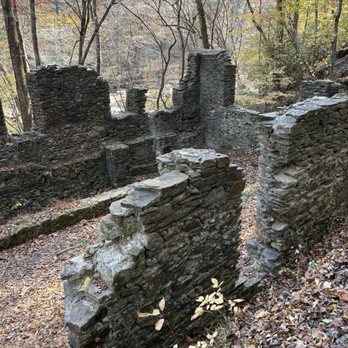
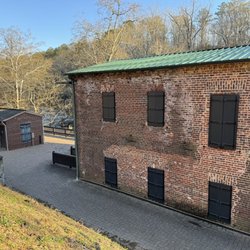
This is a part of the extensive national park land that surrounds the waterways in Atlanta's suburbs. This spot had a smallish parking area and requires payment (or display of a national park pass). The trails and verdant and mildly hilly. The most notable feature is a set of ruins of various industrial buildings, which make for an interesting visual experience. There's plenty of other places to spend an hour or two hiking around.


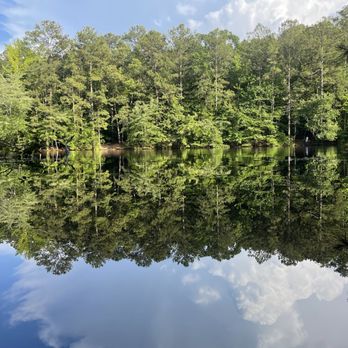
I've been coming here since I was a little kid and it's always great! Whether you're looking for a casual stroll around the pond, walking down to the creek or looking for a longer hike, Sope Creek trails are great for it all. There is a little platform by the pond where people will fish. The ruins by the creek are so much fun when you're a kid to explore. As a kid I spent a lot of time playing on the rocks of the creek in the summers. As a adult, I've hiked short trips on the trails and longer trips from Sope Creek to the Cochran Shoals trails. There's a lot of area here to explore. We love it so much we even took our engagement photos here


Sope Creek is a real neat park. It is part of the Chattahoochee River National Recreation Area (CRNRA) federal parks along the Chattahoochee River. Sope Creek is used primarily for hiking and biking. Today a group of 10 friends hiked 6 miles around the park. Trails are marked with maps at junctions. Highlights included mill ruins along the creek and an old graveyard in the middle of park. See pics. Medium size parking lot which gets busy on weekends and holidays. Parking fee is required here (currently $5). Three CRNRA units connect together: Sope Creek, Cochran Shoals, and Powers Island. One of my friends said you can do a 17 mile hike if you combine all of them. Nice! Great area and worth a stop. My favorite CRNRA unit is "Island Ford", see my review .... but all of them are worth a stop at least once if you are in the area.


As of October 2024, parking is free at the Sope Creek Trailhead in case you see anything contradictory. Easy trail with lots of bikes. The ruins themselves are off the main bike path.


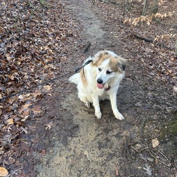
Sope Creek Trails had abundant parking on a Thursday. Perhaps 6 cars when we arrived and 20-ish spots. Bring your dog, your bike, your sneaks and maybe a light spray of mosquito repellent. On a Sunday lucked out getting a spot as someone was leaving. This loop allows you to explore the park's highlights; the trails are abundant on both sides of Sope's rocky creek bed before looping to the placid waters of Sibley Pond (if your hubby doesn't mess about and slide on a rock and fall in-yup, he did that on the weekday, so we went back on Sunday). If you want to get to the Ruins quickly, download from All trails or another trail application because the trail signs/markers don't indicate where to go. Sope Creek Trails are covered quite nicely so you won't burn up. Feels 10 degrees cooler here! Plus, so much quieter. The hike departs at the Sope Creek trailhead and there are maps at every turn guiding your way, they do tell you no bikes or bike path. Do be careful on weekends...if you walk where bikes go and have small kids...the bike guys come pretty fast (some not all) you may want to stick to the paths that have no bikes). If you can go weekdays vs weekend so quiet and more enjoyable. But go, enjoy and just kick around the many trails :)


I went for a hike on a 9:00 am on a Friday in July. It wasn't crowded at all and there was plenty of parking. They have dog waste bins and other secure trash cans at the trailhead. There was also a water fountain. The signage was really good and the trails were well-marked. There were signs at every fork we passed. The creek, pond, and paper mill are all nice to see. You can hear the traffic at certain parts on the trail, but it's separated enough. Minimal elevation change. Shaded with trees. Great place for a leisurely walk.


Here's to one of the many trail opportunities offered up by Chattahoochee River Parks. Sope Creek Parking can be found off Paper Mill Rd, right off Johnson Ferry Rd before you hit the VERY steep hill going down to the river and Columns Drive. It's about 2.5 miles from Johnson Ferry Rd. One thing to be cautious of is how curvy the road gets before you get to the parking lot. Most of the parks in this area require a pay-to-park, which is typically $3. Or, you can get an annual pass for $35. If you're planning to visit more trails in the area, I would recommend just opting for the annual pass. Seeing that I'm running on these trails 4-5 days per week, it doesn't take a mathematician to figure out how much value is in the annual pass. This parking lot is fairly small and might offer up around 30 spots. However, if you can find a spot, it's certainly a trail worth checking out. I took my son up here this past weekend, and thought it would be fun to hike to the creek. I've run these particular trails hundreds of times, but have never hiked them. To be honest, I never even realized they had maps on the trail telling you of your exact location either. I've just run them and tried to memorize where I was going. They have some beginner parts, intermediate parts and then some very rugged terrain. You'll need to keep an eye out for bikers, as some trails allow bikers (who fly down them) and some don't. Part of the trails can get pretty rocky, so depending on the route you want to go, you might want to wear some thick shoes (as the little rocks can really hurt). There are NO restrooms at this part, which is why i bumped it down one star. However, there is a water fountain (multi-level for adults, kids and pets) and park benches. There is easily about 7-9 miles of trails back in here, maybe more. It's hard to get lost if you follow the maps, so that should be comforting for beginners. The sites along the walk are great, and two particular areas are worth the trip: a very calm pond and the old Marietta Paper Mill Company ruins. If you take the trail to your immediate left, you'll hit the ruins. If you go straight from the parking lot, you'll hit the pond at the bottom of the hill (less than a quarter mile). My son and I explored the pond first. They have little brim in there swimming near the dock, and it was almost twilight zone like when we threw a small leaf in the water and ALL the fish literally turned around and were STARING at us. It was freaky. I assume they've been well trained to be fed from here. Him and I hiked about 2-3 miles, and decided to check out the old ruins. This is certainly worth the trip, as it sits right by the river, with tons of rocks and shallow spots to wade in. It's also great for pictures. The story behind the mill is a good one to read, as it was built in the 1850s, burned down, built again in the 1870s, burned down again, and then built again until it's final use in the very early 1900s. All that remains are the stone walls, but you can pull up pictures of it on the internet, and see what it looked like in the early 1900s, as well as the once covered bridge right near it. Truly fascinating to see. There were tons of families and couples hiking, so good for all ages. I would highly recommend this as a spot to check-out!


My son lives about a mile west of here as the crow flies and a couple times a week, he will take my two Grandsons here. It's one of their favorite spots. Last week when we were down for Thanksgiving, I went with them. We did not walk all the way down to the Chattahoochee but did walk down from the main parking lot to the Lake and then circumnavigated the Lake and back. An interesting walk with a three year old who did keep up nicely. The one year old was safely strapped into a carrier on his fathers back. It's surprising to me to find this much space conserved in the Atlanta area. This was an old Paper Mill and you can still visit the ruins. Park is well maintained and the Park Service takes good care of it. Dylan the three year old was not happy we did not bring along anything to feed the turtles. Apparently that is something the local kids like to do. That and catch and release the small snappers. It's a pleasant walk and while there is an incline to the lake, it's not difficult. We were there during a drought where it had not rained in 45 days plus so the lake level was down. Still it was a nice walk and the kids enjoyed it. Word of caution. This is maintained by the National Park Service and requires a permit. One day is $3 and annual is $35. (recently up from $25). My son did not place his pass in a prominent position on this dash and got a ticket. Options were to buy the $3 pass, get an annual one for $35. Not sure what he did since his current annual permit is good till February 2017


Photos on IG of the ruins is what lead me to Sope Creek. I've heard about it from ex-coworkers (they no longer work with me at my current job). Because I don't live in the area but just work in the area, never do I want to come after work to hike nor on weekends. However, because I was itching to go hiking cause it is going to be sunny all weekend, I dragged my hubby to go hiking with me. We have the annual Chattahoochee pass since hubby likes to fish at the Hooch. Since it's been raining, we haven't used much of it. I had no idea where the ruins is. We just kept walking and walking. The only thing I remember reading online is that it's half a mile to get to the ruins. We just kept walking and walking and found the pond. Afterwards, we took a chance and just went left and kept walking, and walking, and walking. Never did we find the ruins, we didn't hit every marker but hubby was hangry so we left after me hitting 8,000 steps on my Fitbit. Thinking to myself is if this place is like East Palasides where no one wants to tell you where the bamboo is. I had to keep going and finally found it on my own. The map is not hard to follow and much better than East Palasides. Wide Nature trails. Very well shaded also. I will come back to find the ruins!! 82/2019


Great place for a day hike. My wife and I went out on a beautiful mid week afternoon, hiked down to the ruins of the old mill, packed a lunch and just had a really nice time. Excellent hiking, lots to see and do.


I came here to do a photoshoot. I came a day early to scope out locations to shoot. We got lost because most of the maps on the markers were chipped or broken in half. It took us a long time to find the ruins as it was not labeled on the map. But after the frustrations of being lost, we finally found the Paper Mill Ruins and the creek. It was absolutely beautiful and totally worth getting lost. We didn't get to see the pond. We definitely plan to come here again and exploring the entire park. Tip #1: Parking is $5. Bring exact cash! Tip #2: The ruins and the creek are on Marker SC27. It's a little over a half mile walk. Follow the sound of the cars on Paper Mill Road. Tip #3: Wear comfortable shoes with good traction.


2 months ago
Plenty of trails to explore; walking, running, or biking. There is a free parking lot at 3726 Paper Mill Rd SE, Marietta, GA 30067. The trails are pretty narrow so you have no choice but to say hello when crossing paths. But there are PLENTY of trails to avoid people all together. I may have gotten lost and tripped over a tree root or two but I enjoyed this park. If you are parking at the above address, it doesn't really show on the map so don't mistake that parking lot for the Powers Ferry parking lot like I did, when you are trying to find your way back to your vehicle. Definitely a great place to get a good walk in. read more




Parking lot is bit further than expected, parking fee is not required. From parking lot, there are different paths that can reach the historical ruins which is popular photo spots. during the day, there are always some photo sessions in progress. The trails are networks, if you missed one branch , you can always find next branch. read more

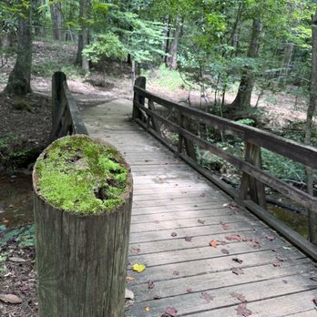


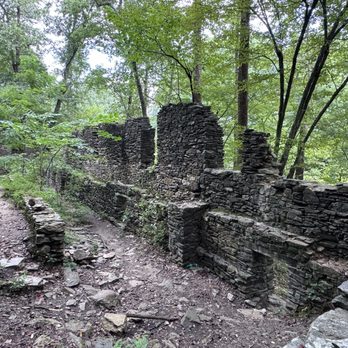
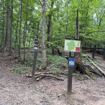
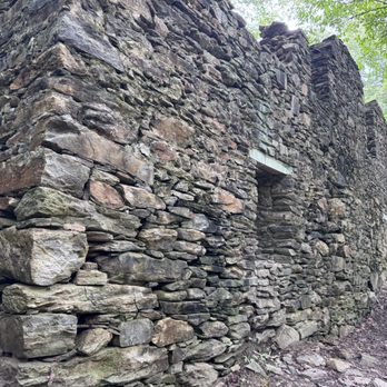


This is a part of the extensive national park land that surrounds the waterways in Atlanta's suburbs. This spot had a smallish parking area and requires payment (or display of a national park pass). The trails and verdant and mildly hilly. The most notable feature is a set of ruins of various industrial buildings, which make for an interesting visual experience. There's plenty of other places to spend an hour or two hiking around. read more


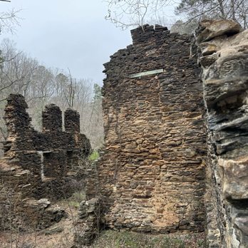


I've been coming here since I was a little kid and it's always great! Whether you're looking for a casual stroll around the pond, walking down to the creek or looking for a longer hike, Sope Creek trails are great for it all. There is a little platform by the pond where people will fish. The ruins by the creek are so much fun when you're a kid to explore. As a kid I spent a lot of time playing on the rocks of the creek in the summers. As a adult, I've hiked short trips on the trails and longer trips from Sope Creek to the Cochran Shoals trails. There's a lot of area here to explore. We love it so much we even took our engagement photos here read more


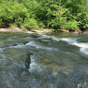

Sope Creek is a real neat park. It is part of the Chattahoochee River National Recreation Area (CRNRA) federal parks along the Chattahoochee River. Sope Creek is used primarily for hiking and biking. Today a group of 10 friends hiked 6 miles around the park. Trails are marked with maps at junctions. Highlights included mill ruins along the creek and an old graveyard in the middle of park. See pics. Medium size parking lot which gets busy on weekends and holidays. Parking fee is required here (currently $5). Three CRNRA units connect together: Sope Creek, Cochran Shoals, and Powers Island. One of my friends said you can do a 17 mile hike if you combine all of them. Nice! Great area and worth a stop. My favorite CRNRA unit is "Island Ford", see my review .... but all of them are worth a stop at least once if you are in the area. read more


2 years ago
As of October 2024, parking is free at the Sope Creek Trailhead in case you see anything contradictory. Easy trail with lots of bikes. The ruins themselves are off the main bike path. read more


Sope Creek Trails had abundant parking on a Thursday. Perhaps 6 cars when we arrived and 20-ish spots. Bring your dog, your bike, your sneaks and maybe a light spray of mosquito repellent. On a Sunday lucked out getting a spot as someone was leaving. This loop allows you to explore the park's highlights; the trails are abundant on both sides of Sope's rocky creek bed before looping to the placid waters of Sibley Pond (if your hubby doesn't mess about and slide on a rock and fall in-yup, he did that on the weekday, so we went back on Sunday). If you want to get to the Ruins quickly, download from All trails or another trail application because the trail signs/markers don't indicate where to go. Sope Creek Trails are covered quite nicely so you won't burn up. Feels 10 degrees cooler here! Plus, so much quieter. The hike departs at the Sope Creek trailhead and there are maps at every turn guiding your way, they do tell you no bikes or bike path. Do be careful on weekends...if you walk where bikes go and have small kids...the bike guys come pretty fast (some not all) you may want to stick to the paths that have no bikes). If you can go weekdays vs weekend so quiet and more enjoyable. But go, enjoy and just kick around the many trails :) read more


I went for a hike on a 9:00 am on a Friday in July. It wasn't crowded at all and there was plenty of parking. They have dog waste bins and other secure trash cans at the trailhead. There was also a water fountain. The signage was really good and the trails were well-marked. There were signs at every fork we passed. The creek, pond, and paper mill are all nice to see. You can hear the traffic at certain parts on the trail, but it's separated enough. Minimal elevation change. Shaded with trees. Great place for a leisurely walk. read more


2 years ago
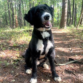


Here's to one of the many trail opportunities offered up by Chattahoochee River Parks. Sope Creek Parking can be found off Paper Mill Rd, right off Johnson Ferry Rd before you hit the VERY steep hill going down to the river and Columns Drive. It's about 2.5 miles from Johnson Ferry Rd. One thing to be cautious of is how curvy the road gets before you get to the parking lot. Most of the parks in this area require a pay-to-park, which is typically $3. Or, you can get an annual pass for $35. If you're planning to visit more trails in the area, I would recommend just opting for the annual pass. Seeing that I'm running on these trails 4-5 days per week, it doesn't take a mathematician to figure out how much value is in the annual pass. This parking lot is fairly small and might offer up around 30 spots. However, if you can find a spot, it's certainly a trail worth checking out. I took my son up here this past weekend, and thought it would be fun to hike to the creek. I've run these particular trails hundreds of times, but have never hiked them. To be honest, I never even realized they had maps on the trail telling you of your exact location either. I've just run them and tried to memorize where I was going. They have some beginner parts, intermediate parts and then some very rugged terrain. You'll need to keep an eye out for bikers, as some trails allow bikers (who fly down them) and some don't. Part of the trails can get pretty rocky, so depending on the route you want to go, you might want to wear some thick shoes (as the little rocks can really hurt). There are NO restrooms at this part, which is why i bumped it down one star. However, there is a water fountain (multi-level for adults, kids and pets) and park benches. There is easily about 7-9 miles of trails back in here, maybe more. It's hard to get lost if you follow the maps, so that should be comforting for beginners. The sites along the walk are great, and two particular areas are worth the trip: a very calm pond and the old Marietta Paper Mill Company ruins. If you take the trail to your immediate left, you'll hit the ruins. If you go straight from the parking lot, you'll hit the pond at the bottom of the hill (less than a quarter mile). My son and I explored the pond first. They have little brim in there swimming near the dock, and it was almost twilight zone like when we threw a small leaf in the water and ALL the fish literally turned around and were STARING at us. It was freaky. I assume they've been well trained to be fed from here. Him and I hiked about 2-3 miles, and decided to check out the old ruins. This is certainly worth the trip, as it sits right by the river, with tons of rocks and shallow spots to wade in. It's also great for pictures. The story behind the mill is a good one to read, as it was built in the 1850s, burned down, built again in the 1870s, burned down again, and then built again until it's final use in the very early 1900s. All that remains are the stone walls, but you can pull up pictures of it on the internet, and see what it looked like in the early 1900s, as well as the once covered bridge right near it. Truly fascinating to see. There were tons of families and couples hiking, so good for all ages. I would highly recommend this as a spot to check-out! read more


My son lives about a mile west of here as the crow flies and a couple times a week, he will take my two Grandsons here. It's one of their favorite spots. Last week when we were down for Thanksgiving, I went with them. We did not walk all the way down to the Chattahoochee but did walk down from the main parking lot to the Lake and then circumnavigated the Lake and back. An interesting walk with a three year old who did keep up nicely. The one year old was safely strapped into a carrier on his fathers back. It's surprising to me to find this much space conserved in the Atlanta area. This was an old Paper Mill and you can still visit the ruins. Park is well maintained and the Park Service takes good care of it. Dylan the three year old was not happy we did not bring along anything to feed the turtles. Apparently that is something the local kids like to do. That and catch and release the small snappers. It's a pleasant walk and while there is an incline to the lake, it's not difficult. We were there during a drought where it had not rained in 45 days plus so the lake level was down. Still it was a nice walk and the kids enjoyed it. Word of caution. This is maintained by the National Park Service and requires a permit. One day is $3 and annual is $35. (recently up from $25). My son did not place his pass in a prominent position on this dash and got a ticket. Options were to buy the $3 pass, get an annual one for $35. Not sure what he did since his current annual permit is good till February 2017 read more


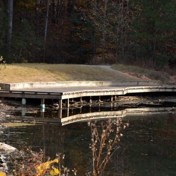
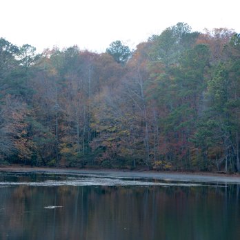


Photos on IG of the ruins is what lead me to Sope Creek. I've heard about it from ex-coworkers (they no longer work with me at my current job). Because I don't live in the area but just work in the area, never do I want to come after work to hike nor on weekends. However, because I was itching to go hiking cause it is going to be sunny all weekend, I dragged my hubby to go hiking with me. We have the annual Chattahoochee pass since hubby likes to fish at the Hooch. Since it's been raining, we haven't used much of it. I had no idea where the ruins is. We just kept walking and walking. The only thing I remember reading online is that it's half a mile to get to the ruins. We just kept walking and walking and found the pond. Afterwards, we took a chance and just went left and kept walking, and walking, and walking. Never did we find the ruins, we didn't hit every marker but hubby was hangry so we left after me hitting 8,000 steps on my Fitbit. Thinking to myself is if this place is like East Palasides where no one wants to tell you where the bamboo is. I had to keep going and finally found it on my own. The map is not hard to follow and much better than East Palasides. Wide Nature trails. Very well shaded also. I will come back to find the ruins!! 82/2019 read more



8 years ago

5 years ago
Great place for a day hike. My wife and I went out on a beautiful mid week afternoon, hiked down to the ruins of the old mill, packed a lunch and just had a really nice time. Excellent hiking, lots to see and do. read more


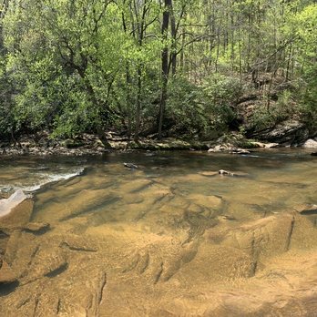

I came here to do a photoshoot. I came a day early to scope out locations to shoot. We got lost because most of the maps on the markers were chipped or broken in half. It took us a long time to find the ruins as it was not labeled on the map. But after the frustrations of being lost, we finally found the Paper Mill Ruins and the creek. It was absolutely beautiful and totally worth getting lost. We didn't get to see the pond. We definitely plan to come here again and exploring the entire park. Tip #1: Parking is $5. Bring exact cash! Tip #2: The ruins and the creek are on Marker SC27. It's a little over a half mile walk. Follow the sound of the cars on Paper Mill Road. Tip #3: Wear comfortable shoes with good traction. read more


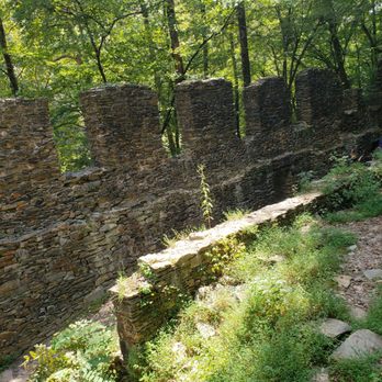


The entire Chattahoochee National Recreation Area system rocks, which is not a surprise because everything the National Park Service is associated with rocks. That said, the Sope Creek unit is exceptionally cool. Along with the usual awesome trails and forests and creeks and rivers, you have a pretty neat set of ruins: the Paper Mill ruins. You'll find them just past SC-27 on the map (where Paper Mill Road crosses the crick). You can climb in and all around them; the stones used to build them make great steps. But you need to go to the other side of the creek to see the rest of the ruins, between SC-28 & 29 on the map. It's a dead-end trail but not real long and totally worth the trip. Although you can see the bulk of the ruins from the trail, which is a bit elevated from the creek, do also go down to the creek at one of several places along the trail and at the ruins. This unit has good elevation changes, so you can get a workout if you want one. Or you can take it easy. The trails are well marked and easy to walk- as with all the Chattahoochee NRA units - but some have a lot of tree roots. Watch your step. Also typical of the Chatt NRA - there are good trail intersection maps, making it easy to track your hike. Except for between SC-18 &16, on the west side. There you will find many unmarked trails and intersections. One of the paths leads off to Paper Mill Road - a trail you won't find on the map - and even has a blue-marked tree, normally the marker for the 'official' path. Very misleading. In the end, I decided to follow the topography, knowing that the mapped trail should end up at the lake, which is at a lower elevation. But it's not like you're gonna get lost in the woods, never to be seen or heard from again. This is, after all, a city park. Sope Creek has a mix of hiking-only trails and hiking/biking trails. The hiking trails are a bit less developed and offer a better chance to get away from people. Not that that was a problem when I was here - my hike started out at a temperature of 26 degrees on a Friday - not many people at all. And I saw no bikers. read more


9 years ago
Really, really pretty trails but they are a little confusing. *Most* cross-sections are marked which is confusing for the one or two that aren't. I also looked up Google Maps before and planned my trails based on that which was WRONG. So use the one from NPS https://www.nps.gov/chat/planyourvisit/upload/TrailMapSopeCreek.pdf Parking wasn't a problem for me on a Saturday afternoon, but there was some rain so that may have kept the crowds away. read more


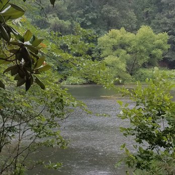


5 years ago


10 years ago
Off the beaten path kind of a park. Light crowd and the $3/day parking has about 30 stalls. This park is best for outdoorsy types not Sunday strollers. Half the people we encountered were mountain bikers moving full steam ahead. We did a 5 mile hike covering all the outer perimeters and criss crossing the paths. You could pick easier and much shorter hikes or runs or bike rides. The elevation is moderate to lightly difficult if you climb up from the creek. The canopied trails are well maintained and best marked out of most Metro Atlanta parks. Some of the trails are tree root heavy so wear proper shoes and take precaution. This park has everything - historic ruins to explorer, water, forest, rolling elevation, wildlife, flexible hikes and duration options. But there is no restroom. There are a couple of trash bins at the parking lot. The hiking trail head is to the left of the parking deposit box. Enjoy! read more


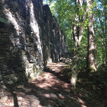

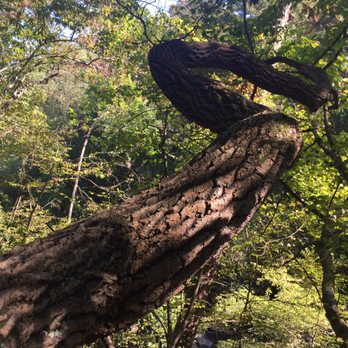


9 years ago
-Great place for an outdoor trail hike/walk/run/ride -Noticed a fair amount of trail runners and bikers -Small lake with a trail around it upon entering the park -Extremely limited parking on weekend. A constant line waiting for someone to leave in order to park, so highly recommend carpooling. -Parking is $3, unless you have an annual pass. You'll need exact change. Grab an envelope, insert the $3 cash, tear off perforated tag and hang from rearview mirror in car, deposit the envelope is designated box. Park rangers do monitor this. -Of course, dog friendly. -Recommend to bring/download a detailed map how to get to the ruins & creek as the maps throughout the park do not have that area marked. We had to ask someone. It was a little tricky, but thankfully found it. read more


9 years ago
We took a quick hike at Sope Creek on Saturday and were pleasantly surprised at what a gem this place was! We were visiting from Nashville and our hotel happened to be about 5 miles away from here. We need a little time to kill in between our planned activities and this place did the trick! How amazing that this NATIONAL PARK exists in an urban area of Mariettta, GA, has nice trails, and RUINS along the beautiful Chattahoochee River. My only complaint was that the map wasn't clear about which way to go to get to the ruins, but we got to loop by the pond in our first attempt to get there, which was also a nice little area. I highly recommend you check this place out for a really nice hike. Spend an hour or a few more! Either way you'll really be glad you did! read more


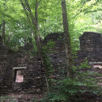


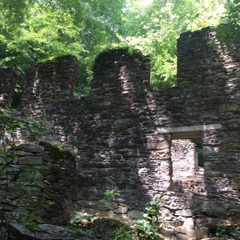

5 years ago


8 years ago

9 years ago

9 years ago


12 years ago


11 years ago
Great place to hike. It's not as busy as most trails so it's peaceful and relaxing. Plus the creek offers a great place for your dog to swim. read more
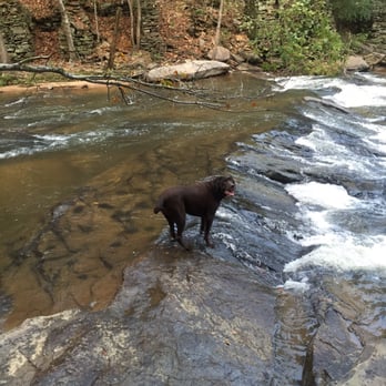


5 years ago

11 years ago
My favorite place to go to hike. Absolutely beautiful. My dog loves it. Careful of snakes in the summer. Maps are posted so you don't get lost. Parking can be tricky on weekends. read more


Out of all my recent hikes, this is one that I love returning to. The Sope Creek hikes have a decent amount of moderate trails, but it is the combination of the ruins with the backdrop of the creek that make this place awesome. Most recent visit was in Autumn when the leaves were mid-way through their color changes. Started at the lot off of Paper Mill and made our way down to the creek-side initially before backtracking to the ruins. What I did not know is that the other side of the creek has ruins of its own. The ruins were burnt down over the years, but it is easy to imagine the history that has occurred in these locations. It is also an added bonus for the architecture fan to see the magnificent homes of Paper Mill Road on the drive in to the hike itself. Sidenote: the address linked from Yelp took me somewhere completely different, so I would double check and make sure you are on Paper Mill Rd. read more
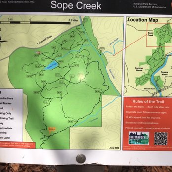


11 years ago

8 years ago

10 years ago
Page 1 of 2
More info about Sope Creek
Ask the Community - Sope Creek
Is there a good place to watch the sunset on the trail or an overlook?
There used to be a bench to site and look but last week it was missing.. There is some road construction going on.. I hope they get back the bench soon
Review Highlights - Sope Creek
You might also consider


































Why does Yelp recommend reviews?
2 reviews that are not currently recommended
The reviews below are not factored into the business's overall star rating.

4 years ago
9 years ago
Sope Creek - parks - Updated August 2026
Best of Marietta
People found Sope Creek by searching for…
Trending Searches in Marietta, GA
Barbershop For Men near Sope Creek
Consignment Shops near Sope Creek
Cruising Spots near Sope Creek
Dog Friendly Beaches near Sope Creek
Dog Friendly Things To Do near Sope Creek
Eyebrow Threading near Sope Creek
Permanent Makeup near Sope Creek
Public Golf Courses near Sope Creek
Public Running Track near Sope Creek
Running Trails near Sope Creek
Scenic Night View near Sope Creek
Scenic Overlook near Sope Creek
Swimming Holes near Sope Creek
Things To Do With Kids near Sope Creek
Trading Card Shops near Sope Creek
Used Furniture Stores near Sope Creek
Browse Nearby
Browse Brands
Related Searches in Marietta, GA
Affordable Kayak Rental Services in Marietta, Georgia
Best Dog Hiking Trails Around Marietta, Georgia
Best Fishing Locations and Guides in Marietta, Georgia
Best Nature Trails for Hiking in Marietta, Georgia
Best Off Leash Dog Parks in Marietta, Georgia
Best Parks for Parties and Events in Marietta, Georgia
Best Places for Horseback Riding in Marietta, Georgia
Best Sightseeing Experiences Available in Marietta, Georgia
Best Water Parks for Kids in Marietta, Georgia
Best Waterfalls and Swimming Holes in Marietta, Georgia
Check Out Great Playgrounds in Marietta, Georgia
Discover Baseball Fields Around Marietta, Georgia
Discover Dog Friendly Trails to Explore in Marietta, Georgia
Discover Fun Toddler Parks in Marietta, Georgia for Your Little One
Discover Kid Friendly Hiking Trails in Marietta, Georgia
Discover Lakes & Ponds to Explore in Marietta, Georgia
Discover Popular Bike Trails in Marietta, Georgia
Discover Scenic Mountain Bike Trails Near Marietta, Georgia
Discover Soccer Fields in Marietta, Georgia Near You
Discover Top Nature Parks to Visit in Marietta, Georgia
Discover Top State Parks to Visit in Marietta, Georgia
Discover a Hiking Trail in Marietta, Georgia
Discover the Best Beaches in Marietta, Georgia
Discover the Best Kids Park Spots in Marietta, Georgia
Discover the Best Night Hike Trails in Marietta, Georgia
Dog-Friendly Hikes With Dogs in Marietta, Georgia
Enjoy Camping Adventures Around Marietta, Georgia
Enjoy Kayaking Adventures in Marietta, Georgia
Enjoy Off Leash Dog Hikes in Marietta, Georgia
Enjoy Tent Camping Spots Around Marietta, Georgia
Enjoy a Beautiful Waterfall Hike in Marietta, Georgia
Enjoy the Best Picnic Spots and Ideas in Marietta, Georgia
Enjoy the Best Walking Path in Marietta, Georgia
Enjoy the Best Walking Trails in Marietta, Georgia
Explore Beautiful Parks and Green Spaces in Marietta, Georgia
Explore Easy Hikes Perfect for All in Marietta, Georgia
Explore Free Picnic Areas Around Marietta, Georgia
Explore Fun Activities to Do in Marietta, Georgia
Explore Parks With Pull Up Bars in Marietta, Georgia
Explore Picnic Parks Near Marietta, Georgia
Explore Popular Campgrounds Near Marietta, Georgia
Explore Popular Kids Parks Throughout Marietta, Georgia
Explore Popular Picnic Areas Around Marietta, Georgia
Explore Popular RV Parks Around Marietta, Georgia
Explore Scenic Lakes to Visit in Marietta, Georgia
Explore Top Dog Parks in Marietta, Georgia Near You
Explore Top Water Parks in Marietta, Georgia Today
Explore the Best Beach Spots in Marietta, Georgia


