Stonewall Peak Trail Photos


You might also consider


More like Stonewall Peak Trail
Recommended Reviews - Stonewall Peak Trail
Start your review...


Reviews With Photos


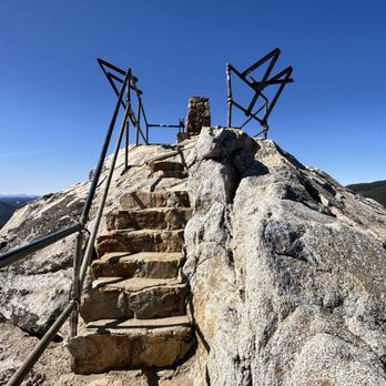
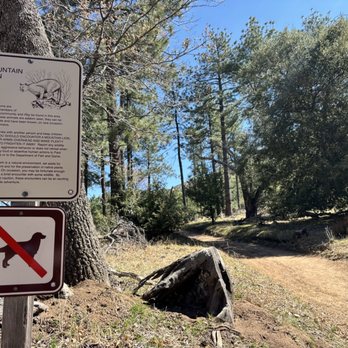
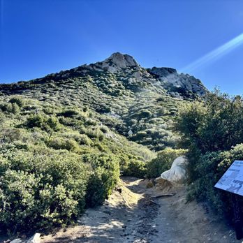
This was an awesome hike. You'll start by pulling into Paso Picacho Campground, where there's a $10 fee for a day-use parking pass. From there, just cross the street to begin the trail. The trail starts with a bit of an incline, but quickly levels out and feels mostly flat for a good portion of the hike. It's not very well marked, so we did stray off the path a couple of times, though never for more than 15 seconds before realizing it. Having AllTrails open was a big help. The incline section is about 2 miles and takes roughly 50 minutes. The full hike is around 4 miles total and took us under two hours. At the summit, you'll find large boulders and a cool metal railing with steps to help you reach the top. The view is absolutely worth it. We started at 8:30 AM and didn't see anyone else on the trail until the way down, when we passed a few groups. There's a sign at the entrance warning about mountain lions, so it's a good idea to hike with a buddy. Cell service is spotty, so be sure to load your AllTrails map ahead of time.


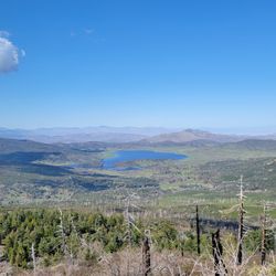
It was such beautiful hike. The view was amazing with 360° on the top of the maintain, where the stairs lead us. It was a beautiful 360 Viewpoint for sure. I could spot our parking site in the campground from the top as well (attached photo). It was such a worth it hike despite all the challenge with snow and elevations. I assumed it was just a normal, moderate level of height, but obviously the snow was still melting. When we get halfway up, lucky our hiking boots was waterproof, what I've been ended up with walking in, so it sounds like many other hikers we met. Highly recommend going early as it took us 2 hours to get to the top and 1.5 hours to get back down, too do need to rest and snack to refuel as well as take photos of the views. So I suggest time yourself right, especially if you're a big group, to avoid coming down after sunset, as it's still very cold on the mountain. NOTE- parking is inside the campground on the opposite of the trailhead. We also picnicked at the campsite picnic are as we already paid for the parking. It was a very peaceful picnic!
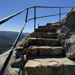

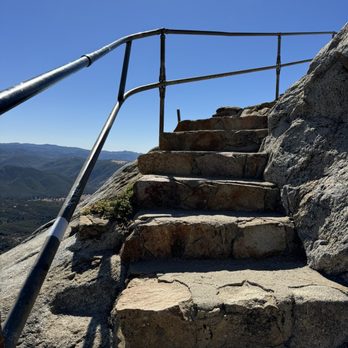
If you aren't parking on the side of the road I would say pay the ten dollars and park in the campsite across the way, the hike is worth it. Wear comfortable shoes with ankle support and bring water and sunblock, but there are lots of trees for shade along the way. There is a steep start but after that just a gradual climb and views all the way up. The stairs along the rocks towards the end are a nice touch to help folks scramble up a bit for a better view. Cool hike definitely on anyone's level !


Beautiful. Got there early- nobody on the trail until 12 (Monday). Easy hike, safe and wide trail. A great alternative to Cowells for SD peeps. I could see the Salton Sea 53 miles away. I was thinking I may be able to see the pacific but there was cloud cover in that direction.


HIGHLY RECOMMEND! 1. Easy/moderate hike with moderate incline. 2. 90% shaded hiking trail. 3. Tennis shoes OK, but hiking shoes or shoes with great grip preferred because there are loose gravel during the last 5 minutes incline before reaching the peak. 4. 2 miles in & 2 miles out (roughly 2 hours total (round trip)). 5. Safe for kids 5 years + and elderly, in my opinion. 6. $10 parking at camp grounds across the street (start of trail head). 7. Temperature: mid 40 degrees fahrenheit (Nov 25th, 2023) with minimal wind. Moderate winds at the peak only. Long pants and long sleeves/jacket recommended if hiking at this time during the year.
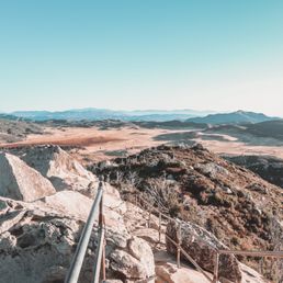

This hike has a rewarding 360 degree view at the end! Parking across the street (Paso Picacho Campground) in the lot is $10, which you pay at the booth when you enter. There's a slip that you take that you write down your info and a slot to put part of it with the $10. There's plenty of parking, picnic tables, and 2 restrooms available for your use. From the parking lot you immediately cross the street to the beginning of the trail. It's a very easy trail to navigate, and it's not steep at all. It's narrow but wide enough so that traffic going both ways can go past each other. I went last Sunday during the morning hours (we started around 7:30AM) and there was quite a bit of foot traffic on our descent. Heading up the trail, closer to the top, you'll reach a large area with huge rocks. Just follow the trail to the left and you'll reach the stairs to ascend to the peak. At the very top you'll get a nice, 360 degree view of the area. The space is small up there (on the peak) so make good use of the time you got up there before the crowds start flocking in. This was our second time doing this hike, and it was just as fun as the first. Since it's near winter it was extremely windy and cold at the top, but it was manageable. We took out the Jetboil and made Cup Noodles and hung out on one of the rocks below the peak. I highly recommend this hike!


PSA!!! You have to park at Paso Picacho Campground which is right across from the start of the hike, it does cost $10 and there is no parking allowed on the side of the road. The trail is moderate, hike is pretty well marked for the most part there is some areas where your like "where the heck do I go?" lol. There was a few younger children that made it to the top so if you plan on bringing any younger children it is doable. Definitely my favorite hike to do while in the area. I would definitely recommend if it's your first time doing it the views at the top are worth the hike up!!


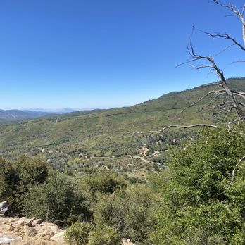
This was such a nice, short hike with pretty breathtaking views from the top! I can't believe how close this was to home. The hike is worth it and a definite must do! It is a short hike so if you're looking for a challenge there is a loop trail across the street you can add on to get some extra mileage. You do have to pay for parking in the day use portion of the campground ($10 I believe). There are restrooms and picnic tables but I regret not taking my lunch with me on the hike and enjoying it from the top.


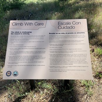
This trail is Literally across the street from the Paso Picacho Campgrounds. It's listed as a moderate 2 mile hike, likely because of the elevation gains and rocky terrain, especially at the end to reach the peak. I usually start my hikes at or near sunrise to avoid the sun and heat. For some reason me and my friends started much later after having full breakfast at our campsite...around 10am. It was warm when we started out and it got progressively hotter as we made our assent. Overall, this hike isn't that difficult. Normally The quick elevation gains as you wind your way through the switchbacks would pose the biggest challenge, but because we started so late in the morning on a warm day we didn't do ourselves any favors in trying to make things easier. There's also limited shade on this trail so take breaks when you find some. The last 100 feet or so of this trail has you scaling the side of a rocky cliff, with a simple metal pipe railing to serve as your last line of protection from an almost certain fatal drop. The view from atop is spectacular and can feel precarious if it's windy. You can see the entire Paso Picacho Campgrounds from the peak as well as nearby Lake Cuyamaca. We even identified Poway and parts of the coast in Del Mar into the horizon using Google Maps. On a clearer day I'm sure there's more that can be seems. This was a nice short hike that I wouldn't mind attempting again...just as long as I start out much earlier in the morning.


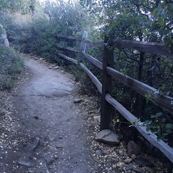
Heavily trafficked, yet beautiful trail along the 79 Hwy. A moderate hike that is ~4 miles round trip with elevation gains and rocky inclines. Lots of shade, but bright/sunny at parts. Wear sturdy hiking boots and layers if needed. Be prepared to share the trail and viewpoint! - Parking is directly across the street at Paso Picacho Campground for $10. You can pay through your phone using the signs posted in the lot or pay cash at the booth. - Trail is clean and pretty straightforward. - The last 100ft is a scramble up some big rocks and a precarious incline on rock guided only by a metal safety railing. There was a line to wait for the metal scaffolding-type lookout, but the 360 views were unbeatable. Solid hike with spectacular views! Just wished it wasn't so popular :)


This is an excellently maintained trail that would be great for catching a sunset. 2 miles (one way) of easy incline. It would be very difficult to get lost here as the trail is so well marked. - Parking is located at the campground across the street from the trail. It cost $10. - There are restrooms located in the parking lot/camp ground. - I would recommend bringing a flashlight if you plan to stay after sunset. - Bring at least a bottle of water, especially if it's hot. - Pack a lunch or food to grill after the hike, you've paid $10 already you might as well use some of the amenities.


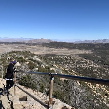
Excellent hike. Only about 45 minutes or so from San Diego. Parking cost like $10. Views are excellent up on the top. You get 360 views from around. Excellent, short hike around SD. Pretty trees and pretty views. You can see some snow up there during the winter season.
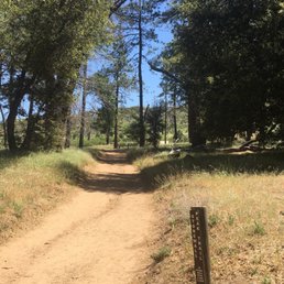

Last year from the campground, I was swinging in my hammock looking at Stonewall Peak thinking how gorgeous the wall looked and that the views must be spectacular at the peak. Time wise, a hike didn't work with my schedule. This year I hiked to Stonewall Peak and enjoyed every step to the top. Driving out here it was overcast so I thought it will be a comfortable hike, but because of the elevation the closer I got I could see the sun peeking through the clouds. It was a warm hike, but the wind helped keep it cool at times. I parked at the campgrounds for a $10 fee, well worth it for me. The ranger gave me a map and information on the area. There are other levels of hiking in the area so be sure to check out what works for you. I found Stonewall Peak trail to be easy, but I could see it to be moderate or even difficult for some. There are crevasses, sandy ground, rocks of all sizes and obstacles such as high stepping areas and lifting yourself on a couple of large rocks. Don't let my description frighten you! If you have trekking poles or a hiking partner this trek could easily be accomplished. You will be glad you did it. It took me awhile to reach the peak because I made sure to stop and enjoy the views as well as taking many photos. It took me over an 11/2 hours. There are some shade areas along the hike. To my surprise I didn't see much wild life as I thought I would being out in the open. I couldn't capture a shot of the healthy lizards that hurried along as I approached their space. I had a chance to see a couple of beautiful butterflies, hear a lot of chirping birds and buzzing bees. As you are just about to reach the area to climb the peak, I somehow couldn''t figure out where or which trail led to the top. Some hikers sunning on the boulders were kind enough to point out the direction. I'm sure I would have figured it out if there was no one to ask. The steps leading to the peak are railed. Be sure to stop, turn and soak in the views as you make your way up. When you reach the peak you will see that it is a not a very big space so I'm sure it could get quite crowded on a busy day. They have a few kiosks with information. Oh, I saw a few turkey vultures while at the top. They were taking advantage of the winds that blew that day. They soared in the beauty of nature, I was jealous... but I did enjoy the beauty nonetheless. A must do hike! If you do park at the campgrounds for $10 they have a picnic area you could enjoy a bite before or after. So pack a picnic and plan for a beautiful hike.


This is my ideal type of hike. Can be completed in under 4 hours (only took us 1.5 hours including lingering at the top), mostly shaded, lots of uphill, beautiful view up top. Aim to hike in the morning for the most shade. Start at the parking lot across the street and pay $10 to park. There are restrooms on site that are relatively clean. The first quarter mile is a little steep and not shaded, so it seems like you're in for a strenuous hike, but it quickly turns to shade and very gradual incline switchbacks. It's not until you get to the last quarter mile that it gets steep and sunny again. The trail is 2 miles one-way. read more


Stonewall Peak is one of the more underrated inland hikes of San Diego County located halfway between Julian and Descanso at Cuyamaca Rancho State Park. It's a little over an hour from the I-5/I-8 intersection to reach this trail. We visited during the cooler season when the afternoon temperature was in the low 70s without any clouds to obscure the sun. There was a parking lot across the road from the trailhead for campers and day hikers. The charge for the latter was $10 per vehicle. The trek to the summit was roughly two miles, and we managed to reach it in about 50 minutes. The trail itself had a lot of gentle switchbacks which made the ascent easier and allowed us to keep a good pace. There was also a lot of shade throughout the hike which made it even more pleasant. We saw many parents with young kids along the way. That indicated the difficulty level wasn't too strenuous. Having said that, the final climb did involve scaling across boulders before you reached a set of rock steps with metal handrails on one side leading up to the peak. The views at the top were gorgeous with the backdrop of a clear blue sky and other mountains in the distance. A few signs were mounted facing different directions. They described some of the landmarks that you could see from the respective perch. The only feature missing from this trail was the presence of a nearby body of water (e.g. creek, pond, lake). That would have elevated Stonewall Peak Trail to a full five-star experience. read more


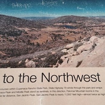


This review is for Stonewall Peak via Cold Stream and Stonewall Creek Loop which was a ~5.1 miles round trip that took ~2.5 hours to complete. Personally, I prefer this one over Cuyamaca Peak but it could get very crowded near the peak. Starting the loop counterclockwise; majority of the trail was a dirt path with some rocky areas. Furthermore, it was a steady incline towards the top. The latter half of the loop was less traveled because most people reach the peak and go down the same way. Stunning views at higher elevation of the surrounding areas including Lake Cuyamaca! There was a $10 day use fee at the Paso Pichaco Campground. Then walk across State Hwy 79 to get to the trailhead. Restrooms are available at the parking lot. Short video of the hike for those interested! https://youtu.be/36p5hN3UgzQ read more


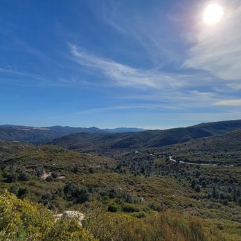
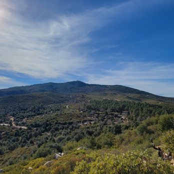

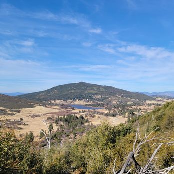


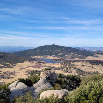


1 year ago
This was an awesome hike. You'll start by pulling into Paso Picacho Campground, where there's a $10 fee for a day-use parking pass. From there, just cross the street to begin the trail. The trail starts with a bit of an incline, but quickly levels out and feels mostly flat for a good portion of the hike. It's not very well marked, so we did stray off the path a couple of times, though never for more than 15 seconds before realizing it. Having AllTrails open was a big help. The incline section is about 2 miles and takes roughly 50 minutes. The full hike is around 4 miles total and took us under two hours. At the summit, you'll find large boulders and a cool metal railing with steps to help you reach the top. The view is absolutely worth it. We started at 8:30 AM and didn't see anyone else on the trail until the way down, when we passed a few groups. There's a sign at the entrance warning about mountain lions, so it's a good idea to hike with a buddy. Cell service is spotty, so be sure to load your AllTrails map ahead of time. read more





3 years ago
It was such beautiful hike. The view was amazing with 360° on the top of the maintain, where the stairs lead us. It was a beautiful 360 Viewpoint for sure. I could spot our parking site in the campground from the top as well (attached photo). It was such a worth it hike despite all the challenge with snow and elevations. I assumed it was just a normal, moderate level of height, but obviously the snow was still melting. When we get halfway up, lucky our hiking boots was waterproof, what I've been ended up with walking in, so it sounds like many other hikers we met. Highly recommend going early as it took us 2 hours to get to the top and 1.5 hours to get back down, too do need to rest and snack to refuel as well as take photos of the views. So I suggest time yourself right, especially if you're a big group, to avoid coming down after sunset, as it's still very cold on the mountain. NOTE- parking is inside the campground on the opposite of the trailhead. We also picnicked at the campsite picnic are as we already paid for the parking. It was a very peaceful picnic! read more


2 years ago
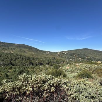
If you aren't parking on the side of the road I would say pay the ten dollars and park in the campsite across the way, the hike is worth it. Wear comfortable shoes with ankle support and bring water and sunblock, but there are lots of trees for shade along the way. There is a steep start but after that just a gradual climb and views all the way up. The stairs along the rocks towards the end are a nice touch to help folks scramble up a bit for a better view. Cool hike definitely on anyone's level ! read more


1 year ago
Beautiful. Got there early- nobody on the trail until 12 (Monday). Easy hike, safe and wide trail. A great alternative to Cowells for SD peeps. I could see the Salton Sea 53 miles away. I was thinking I may be able to see the pacific but there was cloud cover in that direction. read more


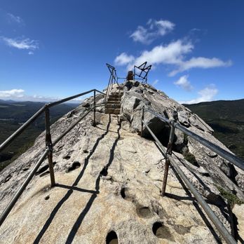

HIGHLY RECOMMEND! 1. Easy/moderate hike with moderate incline. 2. 90% shaded hiking trail. 3. Tennis shoes OK, but hiking shoes or shoes with great grip preferred because there are loose gravel during the last 5 minutes incline before reaching the peak. 4. 2 miles in & 2 miles out (roughly 2 hours total (round trip)). 5. Safe for kids 5 years + and elderly, in my opinion. 6. $10 parking at camp grounds across the street (start of trail head). 7. Temperature: mid 40 degrees fahrenheit (Nov 25th, 2023) with minimal wind. Moderate winds at the peak only. Long pants and long sleeves/jacket recommended if hiking at this time during the year. read more


6 years ago
This hike has a rewarding 360 degree view at the end! Parking across the street (Paso Picacho Campground) in the lot is $10, which you pay at the booth when you enter. There's a slip that you take that you write down your info and a slot to put part of it with the $10. There's plenty of parking, picnic tables, and 2 restrooms available for your use. From the parking lot you immediately cross the street to the beginning of the trail. It's a very easy trail to navigate, and it's not steep at all. It's narrow but wide enough so that traffic going both ways can go past each other. I went last Sunday during the morning hours (we started around 7:30AM) and there was quite a bit of foot traffic on our descent. Heading up the trail, closer to the top, you'll reach a large area with huge rocks. Just follow the trail to the left and you'll reach the stairs to ascend to the peak. At the very top you'll get a nice, 360 degree view of the area. The space is small up there (on the peak) so make good use of the time you got up there before the crowds start flocking in. This was our second time doing this hike, and it was just as fun as the first. Since it's near winter it was extremely windy and cold at the top, but it was manageable. We took out the Jetboil and made Cup Noodles and hung out on one of the rocks below the peak. I highly recommend this hike! read more
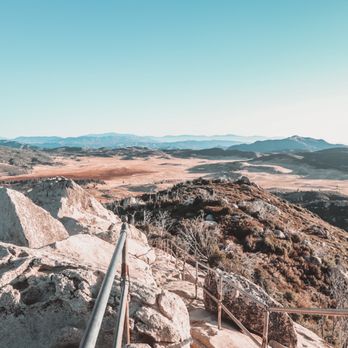

PSA!!! You have to park at Paso Picacho Campground which is right across from the start of the hike, it does cost $10 and there is no parking allowed on the side of the road. The trail is moderate, hike is pretty well marked for the most part there is some areas where your like "where the heck do I go?" lol. There was a few younger children that made it to the top so if you plan on bringing any younger children it is doable. Definitely my favorite hike to do while in the area. I would definitely recommend if it's your first time doing it the views at the top are worth the hike up!! read more


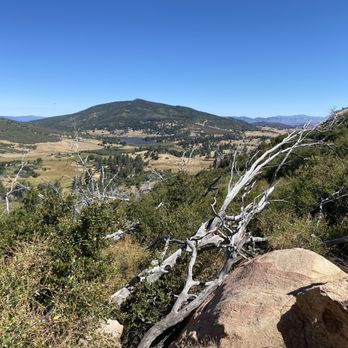
This was such a nice, short hike with pretty breathtaking views from the top! I can't believe how close this was to home. The hike is worth it and a definite must do! It is a short hike so if you're looking for a challenge there is a loop trail across the street you can add on to get some extra mileage. You do have to pay for parking in the day use portion of the campground ($10 I believe). There are restrooms and picnic tables but I regret not taking my lunch with me on the hike and enjoying it from the top. read more






2 years ago

This trail is Literally across the street from the Paso Picacho Campgrounds. It's listed as a moderate 2 mile hike, likely because of the elevation gains and rocky terrain, especially at the end to reach the peak. I usually start my hikes at or near sunrise to avoid the sun and heat. For some reason me and my friends started much later after having full breakfast at our campsite...around 10am. It was warm when we started out and it got progressively hotter as we made our assent. Overall, this hike isn't that difficult. Normally The quick elevation gains as you wind your way through the switchbacks would pose the biggest challenge, but because we started so late in the morning on a warm day we didn't do ourselves any favors in trying to make things easier. There's also limited shade on this trail so take breaks when you find some. The last 100 feet or so of this trail has you scaling the side of a rocky cliff, with a simple metal pipe railing to serve as your last line of protection from an almost certain fatal drop. The view from atop is spectacular and can feel precarious if it's windy. You can see the entire Paso Picacho Campgrounds from the peak as well as nearby Lake Cuyamaca. We even identified Poway and parts of the coast in Del Mar into the horizon using Google Maps. On a clearer day I'm sure there's more that can be seems. This was a nice short hike that I wouldn't mind attempting again...just as long as I start out much earlier in the morning. read more




5 years ago
Heavily trafficked, yet beautiful trail along the 79 Hwy. A moderate hike that is ~4 miles round trip with elevation gains and rocky inclines. Lots of shade, but bright/sunny at parts. Wear sturdy hiking boots and layers if needed. Be prepared to share the trail and viewpoint! - Parking is directly across the street at Paso Picacho Campground for $10. You can pay through your phone using the signs posted in the lot or pay cash at the booth. - Trail is clean and pretty straightforward. - The last 100ft is a scramble up some big rocks and a precarious incline on rock guided only by a metal safety railing. There was a line to wait for the metal scaffolding-type lookout, but the 360 views were unbeatable. Solid hike with spectacular views! Just wished it wasn't so popular :) read more



5 years ago
This is an excellently maintained trail that would be great for catching a sunset. 2 miles (one way) of easy incline. It would be very difficult to get lost here as the trail is so well marked. - Parking is located at the campground across the street from the trail. It cost $10. - There are restrooms located in the parking lot/camp ground. - I would recommend bringing a flashlight if you plan to stay after sunset. - Bring at least a bottle of water, especially if it's hot. - Pack a lunch or food to grill after the hike, you've paid $10 already you might as well use some of the amenities. read more


7 years ago
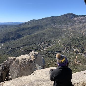
Excellent hike. Only about 45 minutes or so from San Diego. Parking cost like $10. Views are excellent up on the top. You get 360 views from around. Excellent, short hike around SD. Pretty trees and pretty views. You can see some snow up there during the winter season. read more





8 years ago
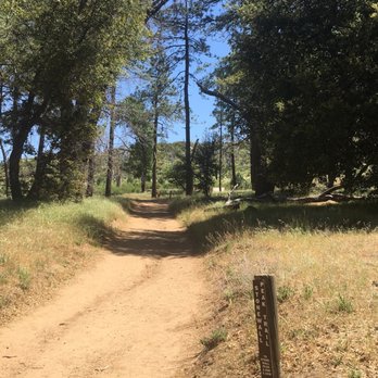
Last year from the campground, I was swinging in my hammock looking at Stonewall Peak thinking how gorgeous the wall looked and that the views must be spectacular at the peak. Time wise, a hike didn't work with my schedule. This year I hiked to Stonewall Peak and enjoyed every step to the top. Driving out here it was overcast so I thought it will be a comfortable hike, but because of the elevation the closer I got I could see the sun peeking through the clouds. It was a warm hike, but the wind helped keep it cool at times. I parked at the campgrounds for a $10 fee, well worth it for me. The ranger gave me a map and information on the area. There are other levels of hiking in the area so be sure to check out what works for you. I found Stonewall Peak trail to be easy, but I could see it to be moderate or even difficult for some. There are crevasses, sandy ground, rocks of all sizes and obstacles such as high stepping areas and lifting yourself on a couple of large rocks. Don't let my description frighten you! If you have trekking poles or a hiking partner this trek could easily be accomplished. You will be glad you did it. It took me awhile to reach the peak because I made sure to stop and enjoy the views as well as taking many photos. It took me over an 11/2 hours. There are some shade areas along the hike. To my surprise I didn't see much wild life as I thought I would being out in the open. I couldn't capture a shot of the healthy lizards that hurried along as I approached their space. I had a chance to see a couple of beautiful butterflies, hear a lot of chirping birds and buzzing bees. As you are just about to reach the area to climb the peak, I somehow couldn''t figure out where or which trail led to the top. Some hikers sunning on the boulders were kind enough to point out the direction. I'm sure I would have figured it out if there was no one to ask. The steps leading to the peak are railed. Be sure to stop, turn and soak in the views as you make your way up. When you reach the peak you will see that it is a not a very big space so I'm sure it could get quite crowded on a busy day. They have a few kiosks with information. Oh, I saw a few turkey vultures while at the top. They were taking advantage of the winds that blew that day. They soared in the beauty of nature, I was jealous... but I did enjoy the beauty nonetheless. A must do hike! If you do park at the campgrounds for $10 they have a picnic area you could enjoy a bite before or after. So pack a picnic and plan for a beautiful hike. read more


4 years ago
I'm not a hiker or outdoorsy girl to say the least but I did really enjoy this hike! I have a hard time with incline and as soon as you start there is a slight incline to the right then to the left that had me worried. Honestly, it was the hardest part. Everything else was smooth sailing. There's a lot of trees the whole way so your not straight up in the sun the whole time which was a huge plus. The view at the top is truly unreal and very worth it! read more


This is a short, easy hike that many different ages and fitness levels can complete and be rewarded with great 360 degree views from the top. Parking- $10; don't need an adventure pass (the trailhead is to the east across Hwy 79 from the parking lot) My app recorded it as 4 miles RT with about 800 ft of elevation gain and the path is easy to follow. There is not much room at the top, but I luckily started early and had it to myself. However, on my way down I did see quite a few people on their way up. It took me 1 1/2 hrs to finish and i jogged most of the way down. Should take about 2 hrs or so if you don't run. It was a beautiful drive on Hwy 79 so even though this is kinds out of the way the drive is somewhat enjoyable. read more


A fun hike with a great viewpoint at the windy top. A popular hike for campers and church groups, Stonewall Peak Trail is a challenging hike for those not experienced in hiking. The distance isn't too bad, but being under the sun, the switchbacks, and the elevation can take it's toll on some. Take breaks and bring water because there is none on this mountain. No dogs. Despite the challenge, this is a kid friendly trail. Note that it's pretty scary at the top especially when its windy...Lots of perilous cliffs. - Parking is $10 in the Paso Picacho camp. Or, you can park along the road at a turn off 2 miles down the road. - Distance round tip from parking lot to the top and back came out about 4.5 miles - There is one Geocache on the mountain. Found it! read more


6 years ago
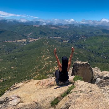
Blood sucking flies, the trail gets narrow so people coming from the other side have to either wait or vice versa. Regardless of the negatives, me and my husband would do it again. Great hike, great exercise but the best part, the beautiful view when you get to the peak. read more




5 years ago

One of the prettiest hikes I've been so far in San Diego! About 5,730 feet and a 4 miles RT. so about 2 hours to hike at a steady pace and time to chill at the top! If you are staying at the campgrounds across the street, chose this over Cuyamaca peak. Cuyamaca peak has the ugliest and dirtiest mt peak. Avoid and do stonewall instead. Unless you want to ascend to a worn out cell tower, dirty used diapers, trash and lots of flies... So avoid Cuyamaca and Stonewall is the way to go! Start early. And I mean it. Because if you don't, be prepared for an ant hill. The hike is pretty easy, we saw many kids hiking. Mostly gradual switchbacks. When you get to the top, they have beautiful craved stone stairways to the highest point and even display boards to know what you are looking at. The view is so high up you can see Cuyamaca Peak, San Jacinto, Anzo Borrego, Salton Sea and even Mexico! It was such a beautiful hike, I would definitely come back...parking sucks though because you have to park at the campsite across the street and they charge $8. Other than that, this is a must see and do hike in SD! read more


I love hiking, but I'm super slow when the terrain is steep, and I found the very beginning of the hike to be pretty steep, and then it is a gradual ascent that switchbacks back and forth. We parked at the campground and paid the $10 fee---the only spot where you'll see restrooms are at the campground. The hike up was pretty warm with the sun beating down on us, and when you get to the peak, it's very windy---I recommend bringing a jacket if you're hanging out at the peak for a while. And I wish that I had brought my trekking poles, because that would have helped a lot. The views are breathtaking, and I can't wait to come back. read more


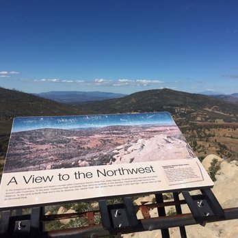


Start early! We got to the camp ground at about 7:45. There was only one other couple there at the time. The restroom across from the camp ground were actually real bathrooms, which was nice. The trail itself is only steep at the beginning. Once you get past the first .3 miles, it's pretty easy. The path is pretty rocky, so pay attention to your step. Lots of nice views, lots of shade. It can get windy at the top, so if you are hiking in winter I would say wear layers. The summit is not very big either, hence the "start early" portion of the review in the very beginning. So many people were on their way up by the time we were coming down...I can't even imagine them all being up at the summit. It's kid friendly, but only up to a certain point. I wouldn't take any nobody under 5 on this hike, if only because of the climb at the end.. read more


11 years ago
If I am able to experience the outdoors and fresh air, it gets an easy five-stars! Stonewall Peak was such a treat and happy get away from the hustle and bustle of other popular hikes in SD. It's also an EASY 4-mile hike round trip which would take you around 2 hours at a happy stroll. I already know why many aren't keen to make a trek out to this BEAUTIFUL location because, as many have mentioned, you must pay to park at the Paso Picacho campground (it's $8 for an all day pass). A friend of mine has told me that there is a way to avoid this, but I haven't tried it out for myself yet (so excuse me if my directions are vague!). Apparently, taking this route does make the hike longer (5-6 miles or so roundtrip), but Stonewall is already easy to begin with so I see no problem with this. This is what my friend advised: -Park on Milk Ranch Rd. at the first turnout you see -Walk back up the road and proceed into the horse camp -Somewhere in the horse camp, there should be trails leading up to the mountain and the peak I can vouch for a trail leading up to the peak from the direction of the horse camp because before you make your way up along the usual route, there is another trail to the left leading off in that direction. I hear the views are much more beautiful coming up from this side, so someone please let me know how it's like if you're able to try it out before me! That being said, if you are taking the main route from the campground, make sure you head off to the trail on the right when you reach the top. When you find the staircase with railing (you know you're in the right area when you start walking on rock), make your way to the top to experience a BREATH-TAKING 360 degree view of East county. You will be blown away and will not regret having made the drive out here even if you do park and fork out $8. You're obviously going to go for some pie and beer later so it's worth it in the end! read more



11 years ago
What a great hike! I would much rather do his than Cuyamaca Peak, which starts on the other side of the road at Paso Picacho Campground. CP is dirty and full of graffiti at the top so the reward is marginal. Stonewall is not as hard as the sign at the trailhead implies (strenuous), but do bring water because it can get super hot. There were quite a few families hiking with there kids so it's not that hard. It's a gorgeous hike all the way up. *Views at the top include: Cuyamaca Peak, Middle Peak, Palomar Mountain, San Jacinto, Anzo Borrego, parts of the dessert. 4 miles round trip 2 hour hike Pay and park at Paso Picacho Campground across the street read more


Did this hike yesterday on a Sunday in February. I've seen pictures with snow on this trail, but yesterday it was definitely in the 70's with no snow in sight. Hiked up in shorts and a tank top. Short and fun hike in the Julian/Descanso area near Cuyamaca Peak. The reason this hike doesn't get 5 stars is because parking is $8.00 across the street at Paso Picacho Campground. Campground has nice facilities though, with clean restrooms. Paso Picacho Campground pulls up on Google maps. We drove out from PB and it took us around an hour to get there. Hike itself is pretty self explanatory. Trail head is directly across the street from the campgrounds. Roughly 4 miles round trip. Good signage along the way. Trail is well maintained. If you're scared of heights, the last part might be scary for you, climbing up the giant boulder to the top. It's 5700 ft in elevation. Great view of Julian with Cuyamaca Peak, Cuyamaca Lake, and San Jacinto Peak all in sight. As of yesterday there is a giant American flag at the top. If you're daring enough, climb beyond the railing onto the giant boulders for a good photo op. read more


8 years ago
It was our first time coming to this trail and so we did got lost. There were no phone signal as well on the road. We stopped at a school and they're so nice to help us out. So some things that might help newcomers would be: * Look for Paso Picacho campground. * $10 all day parking there. * There are restrooms * There are two trails and the ranger can tell you about each one. I really like this hiking trail. My mom and I actually went today, there weren't a lot of people. It was also windy but it was fine there's already a trail made for people to follow. I also like how there are spots where someone can take pictures even though they are not that high up yet. When we got to the top, my knee weakens because I'm afraid of heights and I can feel the strong wind about to carry me. I kind of regret not making it all the way to the top though, I had three more steps and I would be on the very top read more




8 years ago
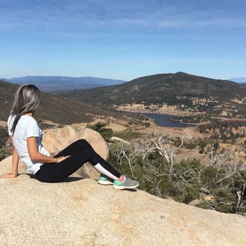
I enjoyed this hike, I recommend getting up there early because by 11 o'clock there was lots of people hiking up! The view at the top was great, small area on top so again less people the better! Also, you have to pay 10$ to park at the campgrounds across the street which is kinda a lot just to hike for 2 hours. read more


7 years ago
Did this in the snow , it was really beautiful I felt like I was walking in a real life Christmas card ! Was able to do without crampons just went very carefully and held onto railings at the peak bc it was icy . It was beautiful , many points of great views. Good exercise with some steady incline , took about 3 hours going very slowly because of snow. The day I went, got there about 1pm and was given one of the last parking spaces at the campground and then I saw they weren't letting anymore people in after that read more


Easy hike even for the kids, about 4 m round trip, hike up the hill and at the the top the views are amazing, all around. Worth it! It gets windy some days Trail is well maintain, I have found all the trails in this area to be like this. Use the Picacho parking area, day use is $10. Is for day use with picnic tables. read more


We have camped in Cuyamaca but never really got to hike, so we didnt know what to expect on this trail over the weekend. We started at about 3.30pm and we were back in the car at about 5.45pm. We got to do some night hiking on our way down. This hike is definitely very easy. It is about 2.5 miles up . i only had a sip of water once. However it was a chilly day, i can imagine you would sweat alot more on a warm/hot day. So go prepared. There is no parking at the trail. Parking can be found across the road at Paso Picacho Campground for $10. There is no way of getting around this. No dogs allowed on trail. The views are amazing and the summit is incredible. Like i said it is a easy hike so im sure you can make it with no problem. Be prepared. You can see more photos in IG. read more


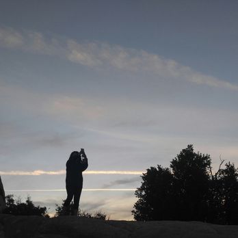

After the holidays the carbs were catching up with me. No matter how fast I ran, there were cookies around every corner, plus cheezy things - oh man, all the fooooooods! Needless to say, some activity was needed before I turned into a couch potato so official that I got a Idaho drivers license. Some pals suggested a drive out East to do this hike and it was really lovely. For a weekend it wasn't too busy early in the morning - although it got busier as the day went on. We started early and cold, some snow still on the ground. The first few minutes are a steep incline, then it settles into slow gains on pleasant switchbacks. the views get better and better as you climb higher and higher, and it takes about an hour to reach the top at a nice pace, about 2 miles up. Once at the top the views are spectacular. There is not a lot of room up the stone steps to the view point, so switching out with other hikers is a polite must. Going down was SUPER muddy because the sun had started to melt the frozen ground and the little bit of snow. Its okay because Nature!! Parking is across the street, for 8$, at the park. You know what this hike put me in the mood for? Pie. read more
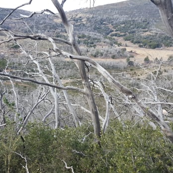


9 years ago
Perfect hike for the entire family from the little ones to grandma' & grandpa' . Parking will be at the Paso Picacho Campground which charges $10 fee for the day. I recommend to bring exact cash. Hike to the stonewall peak is right across the street. In my opinion, it is an easy to moderate 40-50 minute walk up to the top of the mountain for some outstanding views of Cuyamaca lake and surroundings. Be ready to take amazing, awesome pictures upthere as your hair will be messed up by the heavy winds . Once, down back at the Paso Picacho enjoy the green scenario and set the mood for a pic nic gathering, have fun! read more


Google maps took us way out of our way to some mining historic site. The parking lot for this trailhead is actually at the campground. You have to walk across the 79 to get to the trailhead. $10 cash to park. Restrooms near the parking lot. The trail itself is lovely, and takes longer than expected for some reason. I would definitely recommend hiking shoes or trail runners--it's pretty rocky and there's some boulder-climbing at the end that's definitely aided by grippy shoes--especially coming down. View at the top is great! read more


8 years ago
Contemplated writing a review based on the fact that I haven't done c**p in about two months, but here goes! Start early or you'll be forced to hear a few conversations along the way. Christmas eve hike began at 10, far from my norm and it sucked-all sorts of people, kids and dogs (trail isn't wide). Oh yeah, trail also says no dogs. Glad I didn't bring my pittie because it would have been too rocky for her paws. Anywhoo, round trip was about 1.5....could be shorter! There are some shaded parts with plenty switchbacks. The only difficult part is the first 5 min of incline, but only if you haven't done a darn thing in months. The views up top are pretty dope and pic spots along the way. Again, go early because it does get crammed up top; viewing area is not that big. This is the perfect hike to get you back into the swing of things. *parked at Paso Picacho $10 but next time will park down the road for the extra walk. *had pie 10 minutes down the road *haven't been out this way in a while and was stoked about the new roads...yay, no more potholes! read more


Page 1 of 3
More info about Stonewall Peak Trail
Cuyamaca Rancho State Park
12551 Hwy 79
Descanso, CA 91916
Directions
(760) 765-3056
Call Now
Hours
Indoor Amenities
Outdoor Amenities
Ask the Community - Stonewall Peak Trail
Review Highlights - Stonewall Peak Trail
You might also consider


















Why does Yelp recommend reviews?
4 reviews that are not currently recommended
The reviews below are not factored into the business's overall star rating.

12 years ago

11 years ago

8 years ago

8 years ago
Stonewall Peak Trail - parks - Updated September 2026
Best of Descanso
People found Stonewall Peak Trail by searching for…
Trending Searches in Descanso, CA
Archery near Stonewall Peak Trail
Barbershop For Men near Stonewall Peak Trail
Bike Shop near Stonewall Peak Trail
Bird Sanctuary near Stonewall Peak Trail
Boardwalk near Stonewall Peak Trail
Casinos near Stonewall Peak Trail
Cliff Jumping near Stonewall Peak Trail
Consignment Shops near Stonewall Peak Trail
Cruising Spots near Stonewall Peak Trail
Dog Friendly Beaches near Stonewall Peak Trail
Dog Friendly Things To Do near Stonewall Peak Trail
Ear Piercing near Stonewall Peak Trail
Elementary Schools near Stonewall Peak Trail
Eyebrow Threading near Stonewall Peak Trail
Fishing Spots near Stonewall Peak Trail
Flower Fields near Stonewall Peak Trail
Fun Things To Do With Kids near Stonewall Peak Trail
Hair Braiding near Stonewall Peak Trail
Kids Haircut near Stonewall Peak Trail
Lakes near Stonewall Peak Trail
Lookout Points near Stonewall Peak Trail
Parks near Stonewall Peak Trail
Pedicure near Stonewall Peak Trail
Picnic Areas near Stonewall Peak Trail
Playgrounds near Stonewall Peak Trail
Public Golf Courses near Stonewall Peak Trail
Public Running Track near Stonewall Peak Trail
Public Tennis Courts near Stonewall Peak Trail
Rock Quarry near Stonewall Peak Trail
Scenic Night View near Stonewall Peak Trail
Scenic Overlook near Stonewall Peak Trail
Sunrise View near Stonewall Peak Trail
Swimming Holes near Stonewall Peak Trail
Trading Card Shops near Stonewall Peak Trail
Uniforms near Stonewall Peak Trail
Used Furniture Stores near Stonewall Peak Trail
Browse Nearby
BEST of Descanso, California Things to Do near Stonewall Peak Trail
BEST of Descanso, California Coffee near Stonewall Peak Trail
BEST of Descanso, California Restaurants near Stonewall Peak Trail
BEST of Descanso, California Hiking near Stonewall Peak Trail
BEST of Descanso, California Lakes near Stonewall Peak Trail
BEST of Descanso, California Cabins near Stonewall Peak Trail
BEST of Descanso, California Breakfast near Stonewall Peak Trail
BEST of Descanso, California Campgrounds near Stonewall Peak Trail
Browse Brands
Related Searches in Descanso, CA
Best Dog Hiking Trails Around Descanso, California
Best Fishing Locations and Guides in Descanso, California
Best Off Leash Dog Parks in Descanso, California
Best Parks for Parties and Events in Descanso, California
Best Places for Horseback Riding in Descanso, California
Best Sightseeing Experiences Available in Descanso, California
Best Water Parks for Kids in Descanso, California
Best Waterfalls and Swimming Holes in Descanso, California
Check Out Great Playgrounds in Descanso, California
Check Out Off Road Trails in Descanso, California
Discover Baseball Fields Around Descanso, California
Discover Dog Friendly Trails to Explore in Descanso, California
Discover Easy Hiking Trails Near Descanso, California
Discover Fun Toddler Parks in Descanso, California for Your Little One
Discover Kid Friendly Hiking Trails in Descanso, California
Discover Lakes & Ponds to Explore in Descanso, California
Discover Popular Bike Trails in Descanso, California
Discover Soccer Fields in Descanso, California Near You
Discover Top Nature Parks to Visit in Descanso, California
Discover Top State Parks to Visit in Descanso, California
Discover Walking Parks in Descanso, California Near You
Discover a Hiking Trail in Descanso, California
Discover the Best Kids Park Spots in Descanso, California
Discover the Best Night Hike Trails in Descanso, California
Dog-Friendly Hikes With Dogs in Descanso, California
Enjoy Camping Adventures Around Descanso, California
Enjoy Kayaking Adventures in Descanso, California
Enjoy Off Leash Dog Hikes in Descanso, California
Enjoy Scenic Places to Walk in Descanso, California
Enjoy Tent Camping Spots Around Descanso, California
Enjoy a Beautiful Waterfall Hike in Descanso, California
Enjoy the Best Picnic Spots and Ideas in Descanso, California
Enjoy the Best Walking Path in Descanso, California
Enjoy the Best Walking Trails in Descanso, California
Explore Easy Hikes Perfect for All in Descanso, California
Explore Free Picnic Areas Around Descanso, California
Explore Fun Activities to Do in Descanso, California
Explore Parks With Pull Up Bars in Descanso, California
Explore Picnic Parks Near Descanso, California
Explore Popular Campgrounds Near Descanso, California
Explore Popular Kids Parks Throughout Descanso, California
Explore Popular Picnic Areas Around Descanso, California
Explore Popular RV Parks Around Descanso, California
Explore Scenic Lakes to Visit in Descanso, California
Explore Top Dog Parks in Descanso, California Near You
Explore Top Water Parks in Descanso, California Today
Explore the Best Beach Spots in Descanso, California


