Cancel

    Open app

    Search

    Point Abbaye Natural Area

    4.7 (3 reviews)

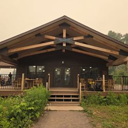
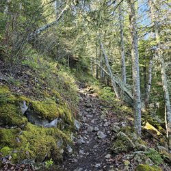
    Point Abbaye Natural Area Photos

    More like Point Abbaye Natural Area

    Recommended Reviews - Point Abbaye Natural Area

    Your trust is our priority, so businesses can't pay to alter or remove their reviews. Learn more about reviews.
    Yelp app icon
    Browse more easily on the app
    Review Feed Illustration

    3 years ago

    Beautiful drive to a very quiet, well maintained park. Had the place all to myself. I will definitely visit again

    Helpful 0
    Thanks 0
    Love this 0
    Oh no 0

    11 years ago

    Helpful 1
    Thanks 0
    Love this 2
    Oh no 0
    Photo of Lil D.
    0
    10
    0

    9 years ago

    Helpful 1
    Thanks 1
    Love this 1
    Oh no 0

    Verify this business for free

    Get access to customer & competitor insights.

    Verify this business

    Isle Royale National Park - Exhibit of furs and video

    Isle Royale National Park

    4.6(15 reviews)
    21.1 mi

    Such a quiet island. Bugnets in July were the best thing we brought. We hiked the Huginnin Trail…read moreand camped on Huginnin Cove for 2 nights and then in Washington campground for 1 night. The trails were well marked and for the most part we could identify the trail. It seemed overgrown in parts, but I get it, they want to maintain the nature. The cove campground we stayed at was on the beach (#2). It was nice. We didn't encounter any moose or wolves...July 13-July 15 2026. We got lucky and got a shelter in Washington campground during our final night. The shelter was clean and pest free. The ranger came by twice to check on us which felt reassuring. We definitely want to return in the future to hike the other side of the island.

    This is one of the least visited national parks, and it's not because it isn't worth visiting…read more Rather, it's so isolated that it needs a 3-6 hr ferry ride or a 45-60 min sea plane ride. Even then, there's only one hotel to stay in which is usually booked out pretty far in advance, unless you want to camp with potable water sources not the most reliable. Of course, this is by design in order to preserve the beautiful natural wilderness. I visited in the shoulder season in the first week of June, and there weren't that many people, emphasizing the wild solitude. It seems like all the visitors here are respectful of nature since there was not any litter nor any defacing at all. The trails here are primitive and not paved or lined with gravel. You can see so much wildlife here, from tiny amphibians the size of my fingernail to huge moose. The night sky is amazing with so many stars, and I saw the Milky Way due to the high quality of the night sky. It is very humbling. As a note, limited amounts of foraging is allowed. I didn't take anything, but I saw edible mushrooms and fiddleheads, and later in the season there's wild blueberries, strawberries, and thimbleberries. Even though it is early before the first hatch, the mosquitoes here are ferocious!

    Photos
    Isle Royale National Park - Example of trail quality

    Example of trail quality

    Isle Royale National Park - Great presenter

    Great presenter

    Isle Royale National Park - Hugginin Cove

    See all

    Hugginin Cove

    Baraga State Park - Spirit of Superior

    Baraga State Park

    3.2(13 reviews)
    18.8 mi

    Baraga State Park is a small State Park situated in a perfect area across from Lake Superior that…read moreis between somewhere and nowhere. This isn't a State Park made to stay at for any extended period of time but rather a great stopping point for us on our Circle tour of the biggest lake of all the great lakes. We rolled in on a Friday mid-afternoon and couldn't be more pleased with our one night stay. Yes, the highway is nearby and you do hear the traffic but for our visit, it couldn't have been more perfect. We saw the sunset and the moon on full tilt out on Superior. It was truly a welcoming rest on our journey through the North. From Milwaukee, expect about a 5 or so hour drive. From there you have just about reached as far as you can go before you run out of road. Next stop, Copper Harbor. Our favorite amenity about Baraga was the bathrooms. They were absolutely the cleanest facilities we had use of during our 9-day jaunt. The showers were solid and the water was hot. Baraga was a great start for our camping adventures to come! We would stop through this place anytime!

    My wife is not happy tonight as this park sits right alongside the main highway US-41 that runs up…read morethrough Baraga and north toward Copper Harbor. This was a mistake coming here as the road noise is terrible, it sounds like the Indy 500 and it is not conducive for an enjoyable camping experience. We won't camp here again and we will be sure to look into the next camping area we pick as an unhappy wife creates an unhappy life.

    Photos
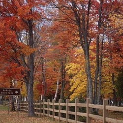
    Baraga State Park
    Baraga State Park
    Baraga State Park

    See all

    Ontonagon Township Park - Beautiful sunsets

    Ontonagon Township Park

    4.7(3 reviews)
    52.7 mi

    Camping here was so amazing, site 4 on the end may be farthest from the bathhouse but along the…read morewater was magical! We stayed two nights midweek and didn't want to leave. Deb in the office was a rockstar employee, so friendly and welcoming! We enjoyed visiting with her and will return in the future!

    Township parks offering camping are off the radar and difficult to discover. This is the second one…read moreI've found and it is a gem. (First one on Madeline Island in the Apostle Islands, Wisconsin). I tripped over Ontonagon Township Park while reading a separate review of a Porcupine Mountain State Park. So, only downside, day-of-arrival reservation only. Call (no email) by 7AM and make your claim (906 884 2930). I did. It was a weekday in late June. A site was set aside for me. I wasn't thrilled with the site assigned. Together with the site operator we hopped in his golf cart and I got a complete tour of available sites. By the way, $15/night for the site I chose. On the matter of the day of arrival reservation, you might call in advance and get a sense of the level of campsite fill. It's not a guarantee but it might provide some guidance. I was tent camping generally looking for a modest amount of solitude and not hanging with the party-lights and generator RV crowd. Pleased to note that even with that constraint I had some choice. Without question, the sites directly on Lake Superior are great locations. Many are RV sites but there are a few tent-only or tent-likely sites. But strong north winds and temps down to 45 at night told me this was not the place for me. I chose a location (site 74) across the road from the lake and slightly up an incline. The strong winds diminished to a gentle breeze and the moderate temps made bugs a non-issue. I had power, which I really didn't need, but nevertheless. And water spigots were at some sites. Not mine but nearby. The vault toilet nearby was spotless. The modern restroom with coin-op showers was a short walk away. The mercury vapor street lamp lighting the access road was a little annoying and I think they could have provided a similar amount of safety without the lumens. But now I'm just picking nits. OTP was just a one night stand. Next day I back tracked 12 miles west along a lake-hugging road to the Porkies for some trail hiking and then back again through Ontonagon and up the Peninsula. By the way, for the highway freaks, Ontonagon is the head end of US Route 45 that continues south to the Gulf of Mexico. Road trip for another time.

    Photos
    Ontonagon Township Park - View of Lake Superior from across the road. Trees helped block fierce north winds.

    View of Lake Superior from across the road. Trees helped block fierce north winds.

    Ontonagon Township Park - Campsite 74. power, no water. Good for a tent

    Campsite 74. power, no water. Good for a tent

    Ontonagon Township Park - The "perfect" tent site directly on Lake Superior if the wind and weather cooperate

    See all

    The "perfect" tent site directly on Lake Superior if the wind and weather cooperate

    Houghton Waterfront Park

    Houghton Waterfront Park

    5.0(6 reviews)
    21.0 mi

    This Waterfront Park really embodies what the town of Houghton, Michigan is all about…read more Houghton, Michigan (in my opinion) is a pretty cozy/old fashioned/industrial city with this terrific Waterfront Park situated along the edge of Portage Lake within the Keweenaw Waterway. The main highlight is a pedestrian walking pathway, where all you have to do is stroll about and breathe in the fresh air of the UP - Upper Peninsula. Plus, another scenic aspect of the park is having the Portage Lake Lift Bridge as the centerpiece focal point, making for quality photo opportunities (especially when the sun is out, lol) for those visitors exploring around town. And...the Portage Lake Lift Bridge connects the cities of Houghton and Hancock, which the road eventually leads towards Copper Harbor, MI - "The Gateway to Isle Royale National Park". For me coming to Houghton on my eventual journey out to Isle Royale...I very much enjoyed becoming acquainted with the city. Btw, there is an Isle Royale Visitor Center right nearby here for those interested in purchasing souvenirs, watching a park film and having your NP Passport stamped. Overall, this Waterfront Park gave me a fresh perspective for appreciating what makes Houghton quite the charming town. I used about 1 hour just casually hanging out here, taking some time to sit down on one of the many benches to relax and people watch.

    Parked by the water and went to dinner. After walked i bit around town and by the water. Peaceful…read moreand seems very safe. nice to be on vacation and not have to feel you need to be on alter and didn't see any homeless on the Upper P trip. Houghton is a college town ... several bar and restaurants. Water sports, fishing, hiking. This was our last stop on our Upper P trip. We actually went home a day early .. missed the dog. hope to return in the fall or spring ... especially the fall.

    Photos
    Houghton Waterfront Park
    Houghton Waterfront Park
    Houghton Waterfront Park

    See all

    Thomas Rock Scenic Outlook - Driving up to Thomas Rock

    Thomas Rock Scenic Outlook

    4.8(4 reviews)
    24.9 mi

    This was a beautiful stop, something I did not expect when Smokin'Hubster suggested it. The hike…read morewas vigorous without becoming strenuous. The vistas are totally worth the climb (I even paid for the telescopic view). We didn't use the amenities (picnic tables, toilets), it's nice to have them available. We definitely caught a one-of-a-kind view of the U.P.; rugged and beautiful. Parking is easy; bring the family, get outside and play!

    Not even a half mile loop (0.4 mi to be exact), this outlook is extremely friendly to all skill…read morelevels and a perfect place to stretch your legs, get a grant vantage point overlooking the Big Bay/Marquette, and a must-visit for when the fall foliage is at its peak in this area! Follow the signs and begin the loop on the left. The trail winds through forest and there will be a slight incline for a bit, but will soon even out, and you're basically at the peak at that point. The overlook area is well maintained, but basically fully exposed to the elements as you emerge from the trees, with railing and additional steps up to the top of the literal rock where you will be above most trees and you get a great view overlooking the bay. There are picnic tables at the top, so it's also a great place to have a little lunch or snack on a good day. Once you're ready to head down, continue to follow the path you took and the trail will soon begin its decline and before you know it, you're back in the parking lot where you started. There are cute little informational posts placed throughout the trail for you to read up on the wildlife and flora/fauna located on the trail. Total elevation gain on this trail is 50 feet, which I believe includes the steps up to the top of the rock, which is optional, but highly encouraged for the views.

    Photos
    Thomas Rock Scenic Outlook - View from thomas Rock Scenic Overlook

    View from thomas Rock Scenic Overlook

    Thomas Rock Scenic Outlook - Thomas Rock Scenic Overlook

    Thomas Rock Scenic Overlook

    Thomas Rock Scenic Outlook - Thomas Rock Scenic Overlook

    See all

    Thomas Rock Scenic Overlook

    Point Abbaye Natural Area - parks - Updated July 2026

    Loading...
    Loading...
    Loading...