Tassajara Creek Regional Park Photos



You might also consider


More like Tassajara Creek Regional Park
Recommended Reviews - Tassajara Creek Regional Park
Start your review...


Reviews With Photos

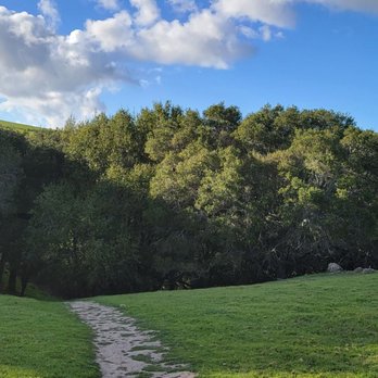
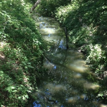
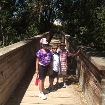
I loved the fact that there was a park near my home and the park had a hiking trail in it. However, from the get go you could tell that this park wasn't really super duper well maintained. But I enjoyed the wooden bridge it had there with a creek right below it. It could be a good place for Instagram posts or selfies. When we were there, we say lots and lots of bunnies and squirrels. They were super cute and adorable. I think the fact that there weren't just lot of visitors in this park made them more comfortable to go out in this area. This park is perfect for an early morning stroll during the weekend.


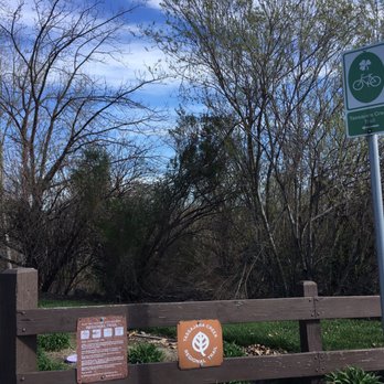
****************** 1638 ****************** The Tassajara Creek Trail is located in the southeast portion of Mount Diablo State Park. Remote and exciting for people just want a quick walk after a food coma or to add on your regular jog routine if you live in the neighborhood. This trail is short than most, only 1.28 mile and it's not a real hike, fairly easy for beginner. However, if you jog or run, after your weight training. This trail works good for that and it's nice to be connect with nature. I saw rainbow here after the rain yesterday. Nice and green now in the fall of 2016, hope the rains keep coming to keep it pretty this way.


4 years ago
We visit this trail for the first time last weekend. It was a nice walk with the kiddos. There was lots of shade on the trail which was really nice given how hot it gets at Dublin. On cooler days it gets a little windy here so carry a light jacket. At the end of one way we saw Emerald Glen Park so we crossed the road and had the kids play at the park. Such a nice way to energize the kids before heading back to complete the trail. All in all a quiet and kid friendly trail. We'll definately be coming here often! read more




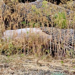
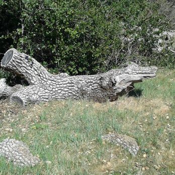
"Scary Alligator (or was it a Crocodile?)" This open space and trail is part of the East Bay Park system. It is definitely NOT the crown jewel of their park system. For a long time, it was just a dirty old parking lot and a poorly maintained trail. The big old parking lot is still there, but there are some nice additions behind that area. There's a good-sized parking lot off Tassajara. From this point, the park really doesn't look like much. Well, you're about half right. There is a trail that leads out of the park, and if you go left you join up with another paved trail, sort of like the Iron Horse Trail. This trail is well maintained and looks quite new. If you take the trail out of the rear parking lot and go right, a trail continues next to the US government property for about a half mile or so, then just sort of peters out. There seems to be a homeless person living near this area, next to the creek, close to the US government fencing. I started to go underneath a big oak tree, then spotted some strange looking pieces of trash. I did not go any further. There is a new, well-designed bridge crossing over the creek. Believe it or not, the bridge is actually a site worth seeing--beautiful woodwork along the top edges of the bridge. You can see the giant concrete pieces from an old bridge. If anyone has a photo of the old bridge, please post. The only photo I have shows it in big pieces. There aren't many facilities in this park. There is a big outhouse in the dirt parking lot. That's about it. Oh yes, here's the rest of the story: Near the old parking lot, there are some wood piles. One big log looks like an alligator snout. I admit I jumped when I first saw it. Then, I realized that this area probably doesn't have many alligators. A friend of mine explains that seeing animals in nature is a sign of spiritual wisdom. I'm sure he's right. Check out the alligator photo I posted. Scary, huh? read more




4 years ago
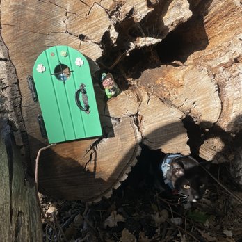
Wanted a place to take my cat on a walk and this seemed like a very good spot since it seemed very quiet. It was a good first outdoor trip if you are looking to introduce your cat to walking. There were slightly isolated bits with areas for exploration (a bunch of logs piled for a kitty to hop around on). Only downside is that most of the trail is paved with a low fence on either side, and houses really close to the trail. This kept my cat from getting to grass and wanting to go into peoples yards. As well there are a few areas where you have to cross roads, which is spooky for a cat. My cat spent most of the trail in his backpack/carrier looking around. Great desensitization-work in an outdoor space, though. Overall, a pretty decent hike. read more

3 years ago

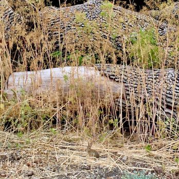
I loved the fact that there was a park near my home and the park had a hiking trail in it. However, from the get go you could tell that this park wasn't really super duper well maintained. But I enjoyed the wooden bridge it had there with a creek right below it. It could be a good place for Instagram posts or selfies. When we were there, we say lots and lots of bunnies and squirrels. They were super cute and adorable. I think the fact that there weren't just lot of visitors in this park made them more comfortable to go out in this area. This park is perfect for an early morning stroll during the weekend. read more


10 years ago
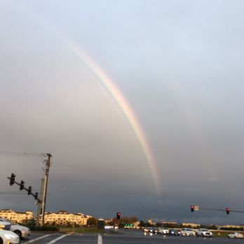
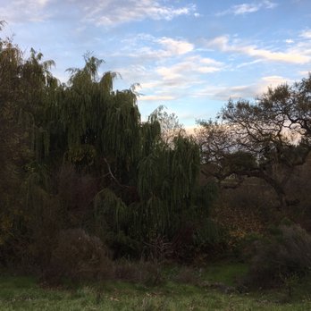
****************** 1638 ****************** The Tassajara Creek Trail is located in the southeast portion of Mount Diablo State Park. Remote and exciting for people just want a quick walk after a food coma or to add on your regular jog routine if you live in the neighborhood. This trail is short than most, only 1.28 mile and it's not a real hike, fairly easy for beginner. However, if you jog or run, after your weight training. This trail works good for that and it's nice to be connect with nature. I saw rainbow here after the rain yesterday. Nice and green now in the fall of 2016, hope the rains keep coming to keep it pretty this way. read more







10 years ago

8 years ago
Don't be fooled because park is undeveloped and the trail is really short. Not much signage around the area to help you find your way. read more


15 years ago
I haven't yet explored this trail, but I'm excited to explore it with our 15 month english lab. It's just a short walk or run from our place. read more


14 years ago
I'm excited to do a review for this trail! I went with my kids and it was a really cute and friendly trail but I think for tiny kids like if you have kids under five this'll be the perfect trail for them it's no ups and downs great for a stroller it was very quick it only took us about thirty minutes! But if you're looking for hiking this is not the trail for you, this is more like a Sunday afternoon stroll read more



10 years ago

11 years ago

10 years ago

12 years ago
More info about Tassajara Creek Regional Park
6100 Tassajara Rd
Dublin, CA 94568
Directions
Hours
Outdoor Amenities
Ask the Community - Tassajara Creek Regional Park
Review Highlights - Tassajara Creek Regional Park
You might also consider


















Why does Yelp recommend reviews?
2 reviews that are not currently recommended
The reviews below are not factored into the business's overall star rating.

10 years ago

11 years ago
Tassajara Creek Regional Park - hiking - Updated August 2026
Best of Dublin
People found Tassajara Creek Regional Park by searching for…
Trending Searches in Dublin, CA
Blueberry Picking near Tassajara Creek Regional Park
Boating near Tassajara Creek Regional Park
Cinema near Tassajara Creek Regional Park
Cliff Jumping near Tassajara Creek Regional Park
Creeks near Tassajara Creek Regional Park
Cruising Spots near Tassajara Creek Regional Park
Day Trips near Tassajara Creek Regional Park
Dog Friendly Things To Do near Tassajara Creek Regional Park
Flower Fields near Tassajara Creek Regional Park
Jet Ski Rental near Tassajara Creek Regional Park
Kayak Rental near Tassajara Creek Regional Park
Kids Activities Indoor near Tassajara Creek Regional Park
Lakes near Tassajara Creek Regional Park
Outdoor Activities near Tassajara Creek Regional Park
Parks near Tassajara Creek Regional Park
Peach Picking near Tassajara Creek Regional Park
Picnic Areas near Tassajara Creek Regional Park
Places To Walk At Night near Tassajara Creek Regional Park
Rainy Day Activities near Tassajara Creek Regional Park
River Swimming near Tassajara Creek Regional Park
Scenic Overlook near Tassajara Creek Regional Park
Shopping Malls near Tassajara Creek Regional Park
Sports Card Shops near Tassajara Creek Regional Park
Sunrise View near Tassajara Creek Regional Park
Things To Do On A Rainy Day near Tassajara Creek Regional Park
Watch Sunset near Tassajara Creek Regional Park
Waterfalls And Swimming Holes near Tassajara Creek Regional Park
Browse Articles
Browse Nearby
BEST of Dublin, California Restaurants near Tassajara Creek Regional Park
BEST of Dublin, California Coffee near Tassajara Creek Regional Park
BEST of Dublin, California Things to Do near Tassajara Creek Regional Park
BEST of Dublin, California Walking Trails near Tassajara Creek Regional Park
BEST of Dublin, California Parks near Tassajara Creek Regional Park
BEST of Dublin, California Breakfast near Tassajara Creek Regional Park
BEST of Dublin, California Campgrounds near Tassajara Creek Regional Park
BEST of Dublin, California Sightseeing near Tassajara Creek Regional Park
BEST of Dublin, California Day Trips near Tassajara Creek Regional Park
Browse Brands
Related Searches in Dublin, CA
Best Dog Hiking Trails Around Dublin, California
Best Fishing Locations and Guides in Dublin, California
Best Nature Trails for Hiking in Dublin, California
Best Places for Horseback Riding in Dublin, California
Best Sightseeing Experiences Available in Dublin, California
Check Out Off Road Trails in Dublin, California
Discover Dog Friendly Trails to Explore in Dublin, California
Discover Easy Hiking Trails Near Dublin, California
Discover Kid Friendly Hiking Trails in Dublin, California
Discover Popular Bike Trails in Dublin, California
Discover Scenic Mountain Bike Trails Near Dublin, California
Discover Walking Parks in Dublin, California Near You
Discover a Hiking Trail in Dublin, California
Discover the Best Night Hike Trails in Dublin, California
Dog-Friendly Hikes With Dogs in Dublin, California
Enjoy Camping Adventures Around Dublin, California
Enjoy Kayaking Adventures in Dublin, California
Enjoy Off Leash Dog Hikes in Dublin, California
Enjoy Scenic Places to Walk in Dublin, California
Enjoy a Beautiful Waterfall Hike in Dublin, California
Enjoy the Best Walking Path in Dublin, California
Enjoy the Best Walking Trails in Dublin, California
Explore Beautiful Parks and Green Spaces in Dublin, California
Explore Easy Hikes Perfect for All in Dublin, California
Explore Fun Activities to Do in Dublin, California
Explore Popular Campgrounds Near Dublin, California
Explore Popular Dog Walking Trails in Dublin, California
Explore Top Dog Parks in Dublin, California Near You
Explore the Best Beach Spots in Dublin, California
Family Friendly Hiking With Kids in Dublin, California
Find Cozy Camping Cabins in Dublin, California
Find Top Dog Friendly Parks to Visit in Dublin, California
Find Top-Rated Waterfalls in Dublin, California Now
Find the Best Parks for Picnics in Dublin, California
Hiking Trails With Waterfalls in Dublin, California
Off Leash Dog Hiking Trails in Dublin, California
Popular Outdoor Activities to Try in Dublin, California
Popular Picnic Spots to Visit in Dublin, California
Popular Waterfall Hiking Trails in Dublin, California
Safe River Swimming Areas in Dublin, California
Safe and Fun Parks for Kids in Dublin, California
Top Hiking Trails to Explore in Dublin, California
Top Playgrounds for Kids to Enjoy in Dublin, California
Top Running Trails to Explore in Dublin, California
Top Swimming Lakes to Enjoy in Dublin, California
Top Swimming Spots and Pools in Dublin, California
Top-Rated Camping Sites in Dublin, California


