
Turtle Bay Pillbox Photos


You might also consider
More like Turtle Bay Pillbox
Recommended Reviews - Turtle Bay Pillbox
Start your review...


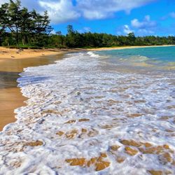
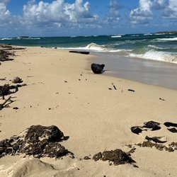
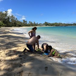
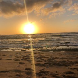
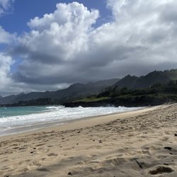
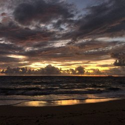
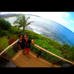
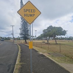
Wow, What a nice surprise, we didn't know there was a Pillbox hike here out at Turtle Bay, took a walk along one of trails and as we were looking at the map, my hubby asked if I wanted to hike to the Pillbox. I only made it up once to the Pillbox in Kailua so I am up for the challenge. We followed the trail, there is a short walk to get to bunker and we walked trough the trees and via the beach way. I came prepared and bought my walking shoes. *tips, I don't recommend slippers esp. walking in the sand/rocks from Turtle Bay. This a cool historical site, during the attack on Pearl Harbor ( 12.7.41) nearby Kahuku Gold Course served as an emergency landing field for one of twelve B-47's returning from the Philippines. In 1942, the US Army established Kahuku Air Base as an auxillary airfield including multiple runaways, ancillary bunkers and emplacements. In April 1946, following 7.8 magnitude earthquake, a tsunami destroyed most of the shoreline structures in the area and this machine gun pill box is one of the few remnants of the KAAB defensive infrastructure from that time. It was about a 45 min. hike to the bunkers and back, allow about 2 hour time frame, ( 2 miles -round trip) elevation about 500 feet, it was a moderate hike for me. Note, the next day ( after checking out of Turtle Bay) we wanted to check out the hike from the front of pillbox, the entrance is closed with the metal gates, this is why we so many cars are parked in front. I didn't trust parking our cars with our belongings, so we didn't do the hike again. Glad I got to hike it while we had parking staying at Turtle Bay, much safer. All in all, we got to see bunkers and learned about the history, also got to catch the breathtaking views of North Shore coastline. Grateful to be able to experience this moment, don't forget comfortable shoes, water, sun protection, and respect the land! T The secret bunker of North Shore, now you know. I had such a great wonderful experience, I really want to check it out again, during our next time staycation! read more


More info about Turtle Bay Pillbox
57-236 Kakipi Pl
Kahuku, HI 96731
Directions
Hours
Outdoor Amenities
You might also consider


Turtle Bay Pillbox - beaches - Updated July 2026
Best of Kahuku
People found Turtle Bay Pillbox by searching for…
Trending Searches in Kahuku, HI
Beach Chair Rentals near Turtle Bay Pillbox
Blueberry Picking near Turtle Bay Pillbox
Boardwalk near Turtle Bay Pillbox
Cliff Jumping near Turtle Bay Pillbox
Crabbing Location near Turtle Bay Pillbox
Day Trips near Turtle Bay Pillbox
Dog Friendly Beaches near Turtle Bay Pillbox
Jet Ski Rental near Turtle Bay Pillbox
Kayak Rental near Turtle Bay Pillbox
Lakes & Ponds near Turtle Bay Pillbox
Mudslide near Turtle Bay Pillbox
Off Road Trails near Turtle Bay Pillbox
Outdoor Activities near Turtle Bay Pillbox
Picnic Spots near Turtle Bay Pillbox
Places To Swim near Turtle Bay Pillbox
Places To Walk Around near Turtle Bay Pillbox
Pokemon Go near Turtle Bay Pillbox
Pool Day Pass near Turtle Bay Pillbox
Public Beaches near Turtle Bay Pillbox
Public Shower near Turtle Bay Pillbox
Public Swimming Pools near Turtle Bay Pillbox
River Swimming near Turtle Bay Pillbox
River Tubing near Turtle Bay Pillbox
Rock Quarry near Turtle Bay Pillbox
Salt Water Pool near Turtle Bay Pillbox
Scenic Night View near Turtle Bay Pillbox
Scenic Overlook near Turtle Bay Pillbox
Secluded Spots near Turtle Bay Pillbox
Snorkeling near Turtle Bay Pillbox
Soccer Store near Turtle Bay Pillbox
Sunrise View near Turtle Bay Pillbox
Swimming Holes near Turtle Bay Pillbox
Swimming Lakes near Turtle Bay Pillbox
Tide Pools near Turtle Bay Pillbox
U Pick Farms near Turtle Bay Pillbox
Volleyball Courts near Turtle Bay Pillbox
Browse Nearby
BEST of Kahuku, Hawaii Coffee near Turtle Bay Pillbox
BEST of Kahuku, Hawaii Restaurants near Turtle Bay Pillbox
BEST of Kahuku, Hawaii Things to Do near Turtle Bay Pillbox
BEST of Kahuku, Hawaii Tide Pools near Turtle Bay Pillbox
BEST of Kahuku, Hawaii Breakfast near Turtle Bay Pillbox
BEST of Kahuku, Hawaii Parks near Turtle Bay Pillbox
BEST of Kahuku, Hawaii Campgrounds near Turtle Bay Pillbox
BEST of Kahuku, Hawaii Vacation Rentals near Turtle Bay Pillbox
Browse Brands
Related Searches in Kahuku, HI
Affordable Kayak Rental Services in Kahuku, Hawaii
Affordable Paddle Board Rental in Kahuku, Hawaii
Affordable Snorkel Rental Services in Kahuku, Hawaii
Best Dog Hiking Trails Around Kahuku, Hawaii
Best Fishing Locations and Guides in Kahuku, Hawaii
Best Nature Trails for Hiking in Kahuku, Hawaii
Best Off Leash Dog Parks in Kahuku, Hawaii
Best Parks for Parties and Events in Kahuku, Hawaii
Best Places for Horseback Riding in Kahuku, Hawaii
Best Sightseeing Experiences Available in Kahuku, Hawaii
Best Waterfalls and Swimming Holes in Kahuku, Hawaii
Book a Snorkeling Tour in Kahuku, Hawaii
Discover Dog Friendly Beaches Near Kahuku, Hawaii
Discover Dog Friendly Trails to Explore in Kahuku, Hawaii
Discover Easy Hiking Trails Near Kahuku, Hawaii
Discover Kid Friendly Beaches to Visit in Kahuku, Hawaii
Discover Kid Friendly Hiking Trails in Kahuku, Hawaii
Discover Popular Bike Trails in Kahuku, Hawaii
Discover Public Beaches to Visit in Kahuku, Hawaii
Discover Scenic Beach Camping Sites in Kahuku, Hawaii
Discover Scenic Mountain Bike Trails Near Kahuku, Hawaii
Discover Sea Shell Beaches Near Kahuku, Hawaii
Discover Top Nature Parks to Visit in Kahuku, Hawaii
Discover a Hiking Trail in Kahuku, Hawaii
Discover the Best Night Hike Trails in Kahuku, Hawaii
Discover the Best Sunset Cruise Tours in Kahuku, Hawaii
Dog-Friendly Hikes With Dogs in Kahuku, Hawaii
Enjoy Camping Adventures Around Kahuku, Hawaii
Enjoy Kayaking Adventures in Kahuku, Hawaii
Enjoy Off Leash Dog Hikes in Kahuku, Hawaii
Enjoy Surfing Adventures in Kahuku, Hawaii
Enjoy Water Activities and Fun in Kahuku, Hawaii
Enjoy a Beautiful Waterfall Hike in Kahuku, Hawaii
Enjoy a Dog Beach Day in Kahuku, Hawaii
Enjoy the Best Walking Path in Kahuku, Hawaii
Enjoy the Best Walking Trails in Kahuku, Hawaii
Experience Stunning Sunset Views in Kahuku, Hawaii
Experience Thrilling Parasailing Adventures in Kahuku, Hawaii
Explore Beautiful Parks and Green Spaces in Kahuku, Hawaii
Explore Boat Rentals for Every Need in Kahuku, Hawaii
Explore Easy Hikes Perfect for All in Kahuku, Hawaii
Explore Fun Activities to Do in Kahuku, Hawaii
Explore Off Leash Dog Beaches in Kahuku, Hawaii
Explore Popular Campgrounds Near Kahuku, Hawaii
Explore Popular Picnic Areas Around Kahuku, Hawaii
Explore Popular State Park Destinations in Kahuku, Hawaii
Explore Secluded Beaches to Relax in Kahuku, Hawaii