Upper Table Rock Photos


More like Upper Table Rock
Recommended Reviews - Upper Table Rock
Start your review...


Reviews With Photos


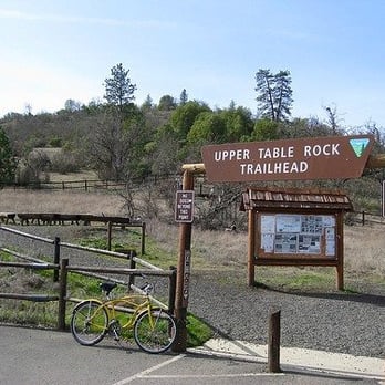
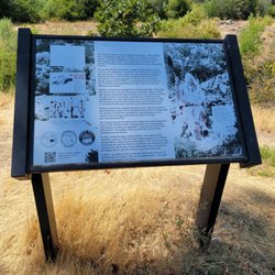
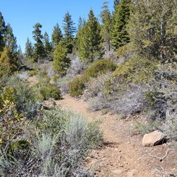
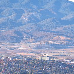
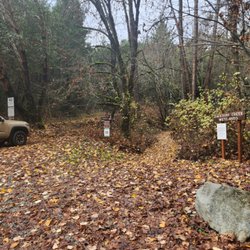
Free parking, restrooms and informational pictures about the wildlife are at the beginning of this trail. No water, so bring your own. Takes about 2-3 hours to complete. It's almost a 2 mile hike up, then you reach the flat top. It has good views of the mountain nearby and it's cool to look at the town from a distance. There isn't a trail when you reach the flat top, just a bunch of rocks scattered about. They're useful as stepping stones for it can get marshy if you hike to the center of the flat. Honestly, I won't return to this part of Table Top. I found it painful to walk straight down for almost 2 miles at the end of our hike. At the top, yeah the views are pretty, but it isn't anything spectacular. Nothing to call home about. If you can afford the gasoline, go hike a different part of Table Top or even a different park/trail system.


This was a beautiful place to view the fireworks from- we arrived just as the sun was setting, found a nice little outcrop of rocks to nestle down and watch the show below- it looked like we could see all of the shows throughout the valley at once, including multiple grand finales- it was fun making our way down in the dark as well- we'll definitely do this again :)


This is a really cool spot to hike, and the top views are spectacular. Take water if hiking during the summer. My friend and I made it to the top in about 50 mins, which might be a bit slow, but still a good work out.


We were here the end of July 2014. While we got an early start to beat the heat, it really wasn't that bad because the trail is shaded for the majority of the walk. The trail does get rocky at times and I tripped (luckily didn't fall) coming down. My 9 and 10 year olds were able to make the trek although we had to stop a few times to catch our breath. They do have a couple of benches along the way. Towards the end, there is a steep pitch before you reach the flat summit. Although the wildflowers were long gone, I loved the change in scenery from the woods, to the grassy summit with lava rocks.


7 years ago
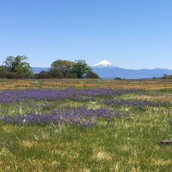
Beautiful hike close to town with an abundance of seasonal interest. The wildflowers are gorgeous and plentiful in Springtime. Beware of Poison Oak which is prolific year-round and ubiquitous and can be seen growing in abundance alongside the trail. Have your toddlers and teens stay well away from the edge once on top. Everything is Beautiful. read more



11 years ago
I was here the first week of october 2015 and it was great! Not that hard of a hike. The hike to Upper Table Rock is an easy 2.8-mile trip, gaining 720 feet. Easy to find. Beautiful trees. Wonderful views all around. Port-o-potty's near the parking lot. *almost stepped on a rattlesnake. Be aware of your surroundings. read more


13 years ago
Free parking, restrooms and informational pictures about the wildlife are at the beginning of this trail. No water, so bring your own. Takes about 2-3 hours to complete. It's almost a 2 mile hike up, then you reach the flat top. It has good views of the mountain nearby and it's cool to look at the town from a distance. There isn't a trail when you reach the flat top, just a bunch of rocks scattered about. They're useful as stepping stones for it can get marshy if you hike to the center of the flat. Honestly, I won't return to this part of Table Top. I found it painful to walk straight down for almost 2 miles at the end of our hike. At the top, yeah the views are pretty, but it isn't anything spectacular. Nothing to call home about. If you can afford the gasoline, go hike a different part of Table Top or even a different park/trail system. read more



10 years ago
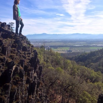
This was a beautiful place to view the fireworks from- we arrived just as the sun was setting, found a nice little outcrop of rocks to nestle down and watch the show below- it looked like we could see all of the shows throughout the valley at once, including multiple grand finales- it was fun making our way down in the dark as well- we'll definitely do this again :) read more


10 years ago
This is a really cool spot to hike, and the top views are spectacular. Take water if hiking during the summer. My friend and I made it to the top in about 50 mins, which might be a bit slow, but still a good work out. read more


11 years ago
We were here the end of July 2014. While we got an early start to beat the heat, it really wasn't that bad because the trail is shaded for the majority of the walk. The trail does get rocky at times and I tripped (luckily didn't fall) coming down. My 9 and 10 year olds were able to make the trek although we had to stop a few times to catch our breath. They do have a couple of benches along the way. Towards the end, there is a steep pitch before you reach the flat summit. Although the wildflowers were long gone, I loved the change in scenery from the woods, to the grassy summit with lava rocks. read more


8 years ago

9 years ago

10 years ago
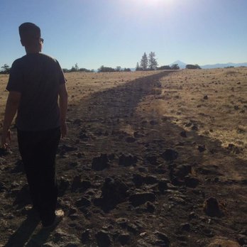
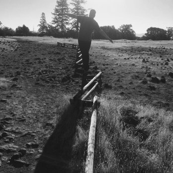
We were really excited about this trail. The two table rocks are the remains of a river of lava seven million years ago. After a nearby volcano erupted and filled the Rogue valley with a river of molten rocks, the Rogue River helped soften the molten rocks which eventually became Upper and Lower Table Rock. This area was also once a Native American reservation. Coming from an experienced hiker, it took me 30 minutes to get to the top. The view from the top is amazing. You can see Upper Table Rock once you get to the top of Lower Table Rock. Really like this trail and not as hard as Upper Table Rock. read more




8 years ago

9 years ago
7 years ago
More info about Upper Table Rock
Upper Table Rock Trl
White City, OR 97503
Directions
Hours
Outdoor Amenities
Ask the Community - Upper Table Rock
How long does it usually take one to reach to the top?
Depends. It's about two miles.
Review Highlights - Upper Table Rock















Why does Yelp recommend reviews?
1 review that is not currently recommended
The reviews below are not factored into the business's overall star rating.

1 year ago
Upper Table Rock - hiking - Updated August 2026
Best of White City
People found Upper Table Rock by searching for…
Things to Do in White City, OR
Beautiful Views in White City, OR
Places to Take Pictures in White City, OR
Hiking Trails in White City, OR
Walking Trails in White City, OR
Waterfall Hike in White City, OR
Parks for Kids in White City, OR
Things to Do on a Rainy Day in White City, OR
Free Parking in White City, OR
Dog Friendly Hiking Trails in White City, OR
Scenic Views in White City, OR
Scenic Overlook in White City, OR
Running Trails in White City, OR
Hiking With Kids in White City, OR
Scenic Spots in White City, OR
Trending Searches in White City, OR
Barbershop For Men near Upper Table Rock
Bike Shop near Upper Table Rock
Cliff Jumping near Upper Table Rock
Consignment Shops near Upper Table Rock
Dog Friendly Things To Do near Upper Table Rock
Ear Piercing near Upper Table Rock
Elementary Schools near Upper Table Rock
Eyebrow Threading near Upper Table Rock
Flower Fields near Upper Table Rock
Hair Braiding near Upper Table Rock
Kids Haircut near Upper Table Rock
Lookout Points near Upper Table Rock
Pedicure near Upper Table Rock
Picnic Areas near Upper Table Rock
Public Golf Courses near Upper Table Rock
Public Pools near Upper Table Rock
Running Trails near Upper Table Rock
Scenic Overlook near Upper Table Rock
Swimming Holes near Upper Table Rock
Trading Card Shops near Upper Table Rock
Browse Articles
Browse Nearby
Browse Brands
Related Searches in White City, OR
Affordable Kayak Rental Services in White City, Oregon
Best Dog Hiking Trails Around White City, Oregon
Best Fishing Locations and Guides in White City, Oregon
Best Places for Horseback Riding in White City, Oregon
Discover Dog Friendly Trails to Explore in White City, Oregon
Discover Easy Hiking Trails Near White City, Oregon
Discover a Hiking Trail in White City, Oregon
Discover the Best Night Hike Trails in White City, Oregon
Dog-Friendly Hikes With Dogs in White City, Oregon
Enjoy Camping Adventures Around White City, Oregon
Enjoy Kayaking Adventures in White City, Oregon
Enjoy Off Leash Dog Hikes in White City, Oregon
Enjoy Tent Camping Spots Around White City, Oregon
Enjoy a Beautiful Waterfall Hike in White City, Oregon
Enjoy the Best Walking Trails in White City, Oregon
Experience Thrilling White Water Rafting in White City, Oregon
Explore Beautiful Parks and Green Spaces in White City, Oregon
Explore Bike Rentals Throughout White City, Oregon
Explore Easy Hikes Perfect for All in White City, Oregon
Explore Fun Activities to Do in White City, Oregon
Explore Popular Campgrounds Near White City, Oregon
Explore Popular RV Parks Around White City, Oregon
Explore Popular Scenic Views Near White City, Oregon
Explore Scenic Lakes to Visit in White City, Oregon
Explore the Best Boating Spots in White City, Oregon
Explore the Best Swimming Holes Around White City, Oregon
Family Friendly Hiking With Kids in White City, Oregon
Find Beautiful Views in White City, Oregon
Find Parks and Recreation Activities in White City, Oregon
Find the Best Parks for Picnics in White City, Oregon
Find the Best Playgrounds to Visit in White City, Oregon
Hiking Trails With Waterfalls in White City, Oregon
Off Leash Dog Hiking Trails in White City, Oregon
Plan a Scenic Drive Route Near White City, Oregon
Popular Picnic Spots to Visit in White City, Oregon
Popular Places to Walk Around in White City, Oregon
Relax at Natural Hot Springs Near White City, Oregon
Safe River Swimming Areas in White City, Oregon
Safe and Fun Parks for Kids in White City, Oregon
Top Dog Friendly Things to Do in White City, Oregon
Top Hiking Trails to Explore in White City, Oregon
Top Playgrounds for Kids to Enjoy in White City, Oregon
Top Running Trails to Explore in White City, Oregon
Top Swimming Lakes to Enjoy in White City, Oregon
Top Swimming Spots and Pools in White City, Oregon
Top Things to Do With Kids in White City, Oregon





