West Glacier Trail - Mendenhall Glacier Photos


More like West Glacier Trail - Mendenhall Glacier
Recommended Reviews - West Glacier Trail - Mendenhall Glacier
Start your review...


Reviews With Photos


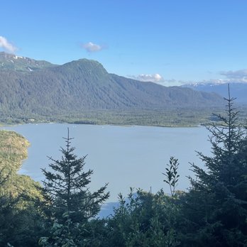
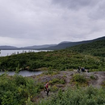
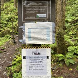
Ok so where do I start ? We decide to give this trail a go w out really realizing how far , a bit hard & confusing it really gets .. I mean the sign at the entrance says it all, u need to be prepared to go all the way to the glacier & if not at least we prepared to camp out! We had no intentions on camping out as we figured we have plenty of time to reach the glacier well that wasn't the case & found ourselves wondering .. how much longer , how much longer to the glacier ? We were probably 4 hours in & still not exactly sure so we abandoned the hike & turned back just in time before it got dark needless to say if the glacier is your goal come early & prepared. We were Half way though it probably we made it to the overlooking point & the hike itself really wasn't bad until it gets crazy , up, down .. under trees so much on the ground it's pretty wild can't say that I would take the hike again just simple because it's too much the route not 100% sure where u going unless u see the tree markers which lord can be a little hard to find I'd say this is something to do w people who have completed the hike & or professionals it's challenging trying to figure out specially also w phones not really working properly I mean we certainly did not want to become a statistic 12-14 I believe people need to be rescue from this trail yearly. Aside from not completing the hike what we did was lovely , great scenery as you make your way up , lovely views for sure would recommend half way at least to the looking point after that u are on your own.
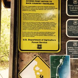

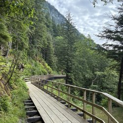
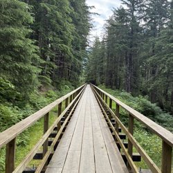
[50/100] *Half way through and what a better review than the hardest, most challenging but most rewarding hike I have ever put myself through, solo. !DISCLAIMER! - Hiking this trail is dangerous! Anyone that decides to hike this trail does it at their own risk. There will be a warning sign at the beginning of the trail. You have been warned! MY EXPERIENCE: The trail is pretty sporty and I would categorize it has intermediate level. The terrain changes as the trail gets closer to the glacier. The trail begins in the woods, there is a clear path with bridges over a few creeks. Majority of the trail is incline leading to the glacier. There are portions of the trail where the park was kind enough to set up handles because the trail is the edge of the mountain. There is a rope attached to a large boulder that helps hikers climb up a large rock that the trail is on. As the trees become less and less and rocks becoming more and more along the trail, there will be brightly colored tape as markers on branches. They are more frequent in the woody areas but they are more spaced out as it becomes more rocky. There is very steep decline before reaching the glacier and ice cave. This is the trickiest part of the hike because the rocks aren't stable. Its pretty much rubble that hikers climb down on. I slid most of the time going down because there is also ice that has formed underneath the rubble with made it very muddy and slippery. The glacier is a sight to see! The ice cave is a gorgeous blue! There is a smaller mountain in front of the glacier that is a perfect spot to each lunch and take photos. Heading back, I took longer. Climbing up the rubble was difficult because it was on ice and almost ever step I took I would slide down. I was very muddy when I was able to reach the top. Most importantly, the markers are very helpful! They will lead you back to the distinct trail. I made the wrong turn on one of them and I got lost. I decided to head back to the last marker I saw and was able to find my way back. I don't advocate doing anything dangerous or risk but people will do what they want. As long as they take accountability. For those that like living on the edge, here are some tips. 1. Wear really good climbing shoes. It makes a difference. 2. Wear layers because it does it warm, especially in the Spring and Summer. Winter and Fall may differ. 3. Bring lots of water. 4. Bring bright colored tape to use as markers, just in case the markers left by other hikers no longer are there. 5. PLEASE BE CAREFUL! There were plenty of other hikers as I was hiking back but I still made sure I knew where I was heading. Again, if you decide to hike this trail all the way to the glacier and ice cave, just be prepared and travel smart, not sorry!


If you can and/or are willing to hike this trail, do it. This was by far the best hike we took during our four day vacation in Juneau. The day we hiked this was in mid-May and the temperature was cooler and the rain was light. I recommend the following: Hiking pants: Two of us didn't have hiking pants and our jeans were wet and heavy which made it challenging in some areas of the trail, e.g. boulder staircases. Also, some parts have thick brush and long pants will prevent scratches or pokes to the legs. Hiking shoes/boots: You'll be hiking in muddy and slippery areas, through shallow creeks, thick trees and vegetation, and climbing up and over boulder staircases. Boots are going to help with traction and keep your feet dry. Tennis shoes will work but they don't provide as much traction which is needed many times here. Breathable shirt: A tech shirt would be best but wearing cotton will only hold in the heat and weigh you down if it's raining. Makes for an uncomfortable long hike. Light waterproof rain jacket: We wore ours the entire time and it kept us dry and warm as we got closer to the glacier. The wind up there can be frigid. Water: Between the four of us we had two CamelBak hydration packs and I also carried an 18oz Hydro Flask. By the time we made the round trip hike, we had drank it all. You'll need it and you'll want it. Is the hike dangerous? It can be if you're not careful and paying attention to your surroundings. Be mindful of others and take your time where it's needed. You'll know where. Can I hike this trail? Depending on your normal, daily activity level. All four of us are in our 30s and are very active. We hike and walk frequently and my husband and I are runners. We got through this in 5 hours with very few breaks, only to take photos. If you're not as active, or live a more sedentary lifestyle, or have bad knees, the hike will be more challenging for you but still doable. Follow the tips I listed above and bringing hiking poles won't be a bad idea either. This will be one of the most rewarding hikes you'll take. Along the way, it'll give you gorgeous views of Mendenhall Lake and Nugget Falls and a most spectacular up close and personal look at Mendenhall Glacier. Being inside the ice cave was the coolest thing and such a pretty blue. Sadly, it melted just 2-1/2 months after our visit but my friend, who lives there, assured me there is another ice cave close to where that one was that hikers can access.


Amazing fun hike. If you are planning to do one hike, this is the hike to do in Juneau. Actually, inside of going the west glacier trail, you should deviate and do the ice cave trail. The hike takes half a day and you can get there by bus. Take the 3 or 4 to mendenhall loop rd and Montana creek rd. Tell the bus driver drop you off closest to skater cabin or west glacier trailhead. Generally the stop after mendenhall visitor center. The hike is doable by everyone but takes a lot of time. There are a few section that are intimidating. I would consider this an intermediate due to the rocky terrain and one steep rock scramble section. Watch out if it rains, the rocky terrain. An be very slippery. The ice cave is a must go. The trail you will be hiking on would be marked by the year the glacier is retreating. To get on the trail, make a right once you see view point sign. Once you make the right, you will see "1940" sign that tells you when the glacier was at 1940. That is where the trail start. You will drop down which is marked with pink/green/white/orange ribbons on tree. Ice cave is a must see. Go there before it disappear.


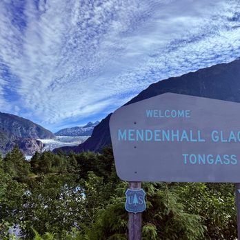
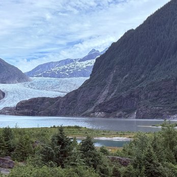
Alaska is one of the most heavily glaciated areas in the world outside of the polar regions. Approx. 23,000 square miles of the state are covered in glaciers--an area nearly the size of West Virginia. They tell stories of the Earth's history, shape the Earth's surface as they move and form valleys and mountains. A remnant of the last ice age cradled high in the Coast Mountains' lofty peaks, the Mendenhall Glacier, named after a noted scientist who served on the Alaska Boundary Commission, is one of many major glaciers that connect to the vast ice field in Juneau, where we arrived this morning as our second port of call. This was our first excursion given by the Norwegian cruise line. My partner and I took a tour bus to the Mendenhall Glacier from our cruise ship. It was about a 30-minute ride. The tour guide did a nice job in keeping us informed. Upon arrival, most visitors walk down to the shoreline by the lake to see this awesome spectacle at Photo Point. If one has never seen a glacier before, this is definitely worth your time. read more



11 months ago
Stunning trail. So many mushrooms, lots of lush green trees and moss, the glacier and views are breathtaking. Sad that the glacier is continuing to recede backwards. The hike is really not that difficult. Its a pretty short day hike of around 5 miles round trip and i believe to spot we went to with the group was around 800 feet of elevation gain. I found it to be a relatively easy trail but the people in my tour group were slow and many found it to be challenging. There are some chains to help you get up some of the uneven spots. Of course as with any hike be prepared, have water, snacks, good shoes. I would definitely come back here in the future but I would want to finish the hike all the way up to the top. Did not really see anyone else out on the trail other than our tour group. This was a weds morning. read more





4 years ago
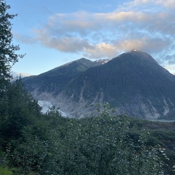
Ok so where do I start ? We decide to give this trail a go w out really realizing how far , a bit hard & confusing it really gets .. I mean the sign at the entrance says it all, u need to be prepared to go all the way to the glacier & if not at least we prepared to camp out! We had no intentions on camping out as we figured we have plenty of time to reach the glacier well that wasn't the case & found ourselves wondering .. how much longer , how much longer to the glacier ? We were probably 4 hours in & still not exactly sure so we abandoned the hike & turned back just in time before it got dark needless to say if the glacier is your goal come early & prepared. We were Half way though it probably we made it to the overlooking point & the hike itself really wasn't bad until it gets crazy , up, down .. under trees so much on the ground it's pretty wild can't say that I would take the hike again just simple because it's too much the route not 100% sure where u going unless u see the tree markers which lord can be a little hard to find I'd say this is something to do w people who have completed the hike & or professionals it's challenging trying to figure out specially also w phones not really working properly I mean we certainly did not want to become a statistic 12-14 I believe people need to be rescue from this trail yearly. Aside from not completing the hike what we did was lovely , great scenery as you make your way up , lovely views for sure would recommend half way at least to the looking point after that u are on your own. read more






9 years ago
[50/100] *Half way through and what a better review than the hardest, most challenging but most rewarding hike I have ever put myself through, solo. !DISCLAIMER! - Hiking this trail is dangerous! Anyone that decides to hike this trail does it at their own risk. There will be a warning sign at the beginning of the trail. You have been warned! MY EXPERIENCE: The trail is pretty sporty and I would categorize it has intermediate level. The terrain changes as the trail gets closer to the glacier. The trail begins in the woods, there is a clear path with bridges over a few creeks. Majority of the trail is incline leading to the glacier. There are portions of the trail where the park was kind enough to set up handles because the trail is the edge of the mountain. There is a rope attached to a large boulder that helps hikers climb up a large rock that the trail is on. As the trees become less and less and rocks becoming more and more along the trail, there will be brightly colored tape as markers on branches. They are more frequent in the woody areas but they are more spaced out as it becomes more rocky. There is very steep decline before reaching the glacier and ice cave. This is the trickiest part of the hike because the rocks aren't stable. Its pretty much rubble that hikers climb down on. I slid most of the time going down because there is also ice that has formed underneath the rubble with made it very muddy and slippery. The glacier is a sight to see! The ice cave is a gorgeous blue! There is a smaller mountain in front of the glacier that is a perfect spot to each lunch and take photos. Heading back, I took longer. Climbing up the rubble was difficult because it was on ice and almost ever step I took I would slide down. I was very muddy when I was able to reach the top. Most importantly, the markers are very helpful! They will lead you back to the distinct trail. I made the wrong turn on one of them and I got lost. I decided to head back to the last marker I saw and was able to find my way back. I don't advocate doing anything dangerous or risk but people will do what they want. As long as they take accountability. For those that like living on the edge, here are some tips. 1. Wear really good climbing shoes. It makes a difference. 2. Wear layers because it does it warm, especially in the Spring and Summer. Winter and Fall may differ. 3. Bring lots of water. 4. Bring bright colored tape to use as markers, just in case the markers left by other hikers no longer are there. 5. PLEASE BE CAREFUL! There were plenty of other hikers as I was hiking back but I still made sure I knew where I was heading. Again, if you decide to hike this trail all the way to the glacier and ice cave, just be prepared and travel smart, not sorry! read more
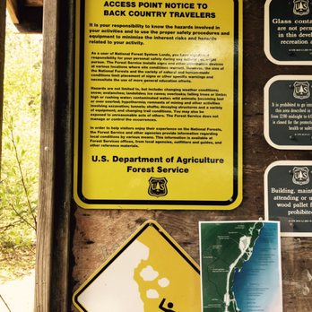
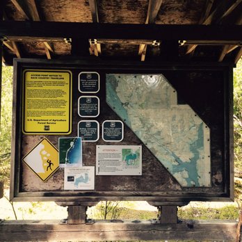


If you can and/or are willing to hike this trail, do it. This was by far the best hike we took during our four day vacation in Juneau. The day we hiked this was in mid-May and the temperature was cooler and the rain was light. I recommend the following: Hiking pants: Two of us didn't have hiking pants and our jeans were wet and heavy which made it challenging in some areas of the trail, e.g. boulder staircases. Also, some parts have thick brush and long pants will prevent scratches or pokes to the legs. Hiking shoes/boots: You'll be hiking in muddy and slippery areas, through shallow creeks, thick trees and vegetation, and climbing up and over boulder staircases. Boots are going to help with traction and keep your feet dry. Tennis shoes will work but they don't provide as much traction which is needed many times here. Breathable shirt: A tech shirt would be best but wearing cotton will only hold in the heat and weigh you down if it's raining. Makes for an uncomfortable long hike. Light waterproof rain jacket: We wore ours the entire time and it kept us dry and warm as we got closer to the glacier. The wind up there can be frigid. Water: Between the four of us we had two CamelBak hydration packs and I also carried an 18oz Hydro Flask. By the time we made the round trip hike, we had drank it all. You'll need it and you'll want it. Is the hike dangerous? It can be if you're not careful and paying attention to your surroundings. Be mindful of others and take your time where it's needed. You'll know where. Can I hike this trail? Depending on your normal, daily activity level. All four of us are in our 30s and are very active. We hike and walk frequently and my husband and I are runners. We got through this in 5 hours with very few breaks, only to take photos. If you're not as active, or live a more sedentary lifestyle, or have bad knees, the hike will be more challenging for you but still doable. Follow the tips I listed above and bringing hiking poles won't be a bad idea either. This will be one of the most rewarding hikes you'll take. Along the way, it'll give you gorgeous views of Mendenhall Lake and Nugget Falls and a most spectacular up close and personal look at Mendenhall Glacier. Being inside the ice cave was the coolest thing and such a pretty blue. Sadly, it melted just 2-1/2 months after our visit but my friend, who lives there, assured me there is another ice cave close to where that one was that hikers can access. read more




9 years ago
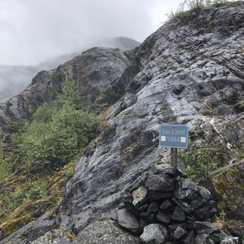
Amazing fun hike. If you are planning to do one hike, this is the hike to do in Juneau. Actually, inside of going the west glacier trail, you should deviate and do the ice cave trail. The hike takes half a day and you can get there by bus. Take the 3 or 4 to mendenhall loop rd and Montana creek rd. Tell the bus driver drop you off closest to skater cabin or west glacier trailhead. Generally the stop after mendenhall visitor center. The hike is doable by everyone but takes a lot of time. There are a few section that are intimidating. I would consider this an intermediate due to the rocky terrain and one steep rock scramble section. Watch out if it rains, the rocky terrain. An be very slippery. The ice cave is a must go. The trail you will be hiking on would be marked by the year the glacier is retreating. To get on the trail, make a right once you see view point sign. Once you make the right, you will see "1940" sign that tells you when the glacier was at 1940. That is where the trail start. You will drop down which is marked with pink/green/white/orange ribbons on tree. Ice cave is a must see. Go there before it disappear. read more


7 years ago
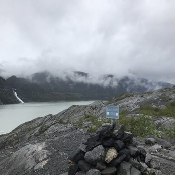
Great hike that ranges from easy to fairly challenging! We decided to do this on an afternoon in November so we were drenched with rain and struggled to complete this before sundown at 4pm. On the upside, the issue of bugs and cruise ship crowds are not a factor this late in the season. That being said be prepared for some decent scrambling up and down rocks the closer to the glacier you get. The trail becomes a bit more challenging to follow as well. There is a series of cairns that help you navigate the last bit before you reach the glacier. It is pretty rewarding to touch the toe of Mendenhall glacier but also depressing at how much it has receded as evident by the post markers that you pass which indicate where the glacier was at say 1984 and 2010. We just barely made it out as it became pitch black outside and we didnt have to fire up our one head lamp. We found out later that this trail is the most common trail that the local search and rescue team responds to rescue lost or injured hikers! Glad we made it out relatively unscathed! Plan accordingly before attempting! read more


More info about West Glacier Trail - Mendenhall Glacier
Ask the Community - West Glacier Trail - Mendenhall Glacier
Review Highlights - West Glacier Trail - Mendenhall Glacier














West Glacier Trail - Mendenhall Glacier - hiking - Updated August 2026
Best of Juneau
People found West Glacier Trail - Mendenhall Glacier by searching for…
Trending Searches in Juneau, AK
Browse Articles
Browse Nearby
Browse Brands
Related Searches in Juneau, AK
Affordable Kayak Rental Services in Juneau, Alaska
Best Fishing Locations and Guides in Juneau, Alaska
Best Fun Things to Do in Juneau, Alaska
Best Nature Trails for Hiking in Juneau, Alaska
Best Sightseeing Experiences Available in Juneau, Alaska
Best Things to Do on a Rainy Day in Juneau, Alaska
Best Waterfalls and Swimming Holes in Juneau, Alaska
Check Out Off Road Trails in Juneau, Alaska
Discover Popular Bike Trails in Juneau, Alaska
Discover Popular Photo Spots in Juneau, Alaska
Discover Top Boat Tours in Juneau, Alaska for All Ages
Discover a Hiking Trail in Juneau, Alaska
Discover the Best Beaches in Juneau, Alaska
Enjoy Camping Adventures Around Juneau, Alaska
Enjoy Fishing Pier Spots in Juneau, Alaska With Scenic Views
Enjoy Kayaking Adventures in Juneau, Alaska
Enjoy the Best Walking Trails in Juneau, Alaska
Exciting Things to Do in Juneau, Alaska Today
Explore Beautiful Parks and Green Spaces in Juneau, Alaska
Explore Easy Hikes Perfect for All in Juneau, Alaska
Explore Free Things to Do Around Juneau, Alaska
Explore Fun Activities to Do in Juneau, Alaska
Explore Landmarks & Historical Buildings in Juneau, Alaska
Explore Popular Boat Charters Near Juneau, Alaska
Explore Popular Campgrounds Near Juneau, Alaska
Explore Popular Scenic Views Near Juneau, Alaska
Explore Scenic Lakes to Visit in Juneau, Alaska
Explore Whale Watching Tours in Juneau, Alaska
Explore the Best Boating Spots in Juneau, Alaska
Family Friendly Hiking With Kids in Juneau, Alaska
Find Beautiful Views in Juneau, Alaska
Find Exciting Tours to Take in Juneau, Alaska
Find Popular Ziplining Spots Around Juneau, Alaska
Find Top-Rated Waterfalls in Juneau, Alaska Now
Find the Best Playgrounds to Visit in Juneau, Alaska
Fun Things for Kids in Juneau, Alaska
Hiking Trails With Waterfalls in Juneau, Alaska
Must-See Tourist Attractions Around Juneau, Alaska
Popular Places to Take Pictures in Juneau, Alaska
Popular Things to Do in Juneau, Alaska
Popular Things to See in Juneau, Alaska
Top Fishing Charter Experiences in Juneau, Alaska
Top Hiking Trails to Explore in Juneau, Alaska
Top Playgrounds for Kids to Enjoy in Juneau, Alaska
Top Swimming Spots and Pools in Juneau, Alaska
Top Things to Do With Kids in Juneau, Alaska


