Andrew Molera State Park Photos


You might also consider


More like Andrew Molera State Park
Recommended Reviews - Andrew Molera State Park
Start your review...


Reviews With Photos


What a nice park. I would recommend the one mile trail walk to the beach. The beach is quite empty during the week. Also, while the trail is quite wide, it is lined on both sides with poison oak almost the entire walk which is fine as long as you don't touch it. The trail floor starts out as dirt and small rocks and eventually turns to sand and rock. There's also a small section of a two planks wide stable bridge over a river. It's maybe 30 feet long and the water below is about 6 inches to a foot deep. It would be fine for most children to cross with an adult. The views once you arrive at the ocean are truly stunning . The sand is quite hot and there are many small rocks and lots of seaweed, so I'm glad I wore flip flops. Sneakers would have been better I think.


We visited Andrew Molera State Park on a Saturday in late July, 2024 with the intention of doing an easy "hike" to the ocean. In reviewing a map before arriving, we had decided upon a trail (the Beach Trail) that would take us from the parking lot to Molera Point. However, upon arriving, we learned that it was closed due to damage and the ranger recommended the Creamery Meadow Trail instead. State Park Admission. The entrance is down a steep but short paved road off CA-1. It's a sharp left if coming from the south (Big Sur side). Signage is good. At the bottom, there was a manned ranger station where you pay for parking ($10, or $9 for seniors). Note that California State Parks allow you to visit multiple state parks on the same day with only one admission fee. Also, if you've paid for camping in a state park, this entitles you to state park admissions until 5 pm the following day. Molera's parking lot has designated spots for campers who stay in the walk-in campground, as well as for day users. We were able to secure parking at 10:30 am, but demand exceeds supply on a typical Saturday in July. By the time we returned after our hike, the park had posted a sign at the top that parking was full, so users parked along CA-1 and walked down. The Creamery Meadows Trail, one mile in length (one-way), was wide, smooth, easy to follow, and mostly hard-packed until it turned to sand near the beach. A highlight was crossing the shallow Big Sur River on a double plank board. It would be hard to get lost as there were dense shrubs on both sides of the trail and few intersections with other trails. There was one, with the Bluff Trail, that was well marked as such. The beach itself was scenic, with a lot of driftwood and kelp, and a dozen or so people were relaxing on or walking along the beach, some watching the few surfers trying to catch a wave. A couple of young women waded in the water towards the surfers, and we were surprised how shallow it was in that area. What could've been better? * We had asked for a brochure about the park and a map with trails, both at the state park itself, as well as at the Big Sur Station, and we told that they were out. In both cases, we were told that we could take a photograph of a posted map. The map from Big Sur Station was more detailed and better for planning purposes than that at the actual park. * We had taken a few snacks for our hike, but wanted to have a quick picnic lunch upon our return to the parking area. There were no picnic tables, but the ranger pointed us to a grassy patch under a tree OR to Pfeiffer Big Sur State Park five miles down CA-1. * The parking area and trail that we took were generally clean and well maintained. However, the only restrooms were at the parking area, and some trail users used the edge of the trail to do their business, leaving behind their organic materials and wipes. In the most obvious case, it was next to a large natural log where I stopped to tighten my shoelaces. Park staff were friendly. Restrooms were clean. Signage (park map) could've been more detailed.
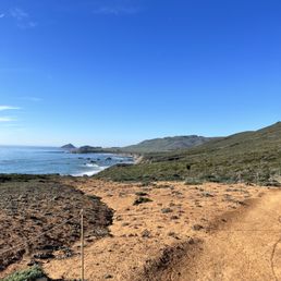

Wow! Completed the 8 mile Bluff trail and am in love with this park! Extremely clean and taken care of. The best part was being able to see redwoods, the beach, red dirt, and a flowery trail. Lots of different terrains!


We stayed one night at the Trail Camp in late August. It was a bit of a schlep to the camp (about a quarter mile with a section of stairs) so pack light. Also the campsites are pretty close together. This probably isn't the most gorgeous, private, or convenient campsite in Big Sur. The upside of the trek to the campground is that, other than being surrounded by people, you feel a bit of distance from the road and more in nature. The bathrooms were clean and well maintained. There were bear boxes at every site, and water, trash cans and bathrooms conveniently spread throughout the site. Almost every other national forest and state park in the state wasn't allowing campfires, even in developed campgrounds, but this campsite was!


This is our second visit here. Our first time was last year when I decided to check out Big Sur on a whim and we've been going back ever since. If you park inside the park, there is a fee. If you want to be cheap, you can park on Highway 1 with the other cars and walk in. We've been on the trail along the river, more on the hot and dry side and watch out for poison oak. On this visit, we decided to take the beach trail. At the entrance of the trail, you walk over a two plank wood bridge over a creek. This is my favorite part because the water is so clear and if you look down, it's really pretty. Overall, the beach trail is an easy walk to the beach. You will know you're there because you will hear the waves roaring before you see the ocean. The river connects to the each, so one side is calm, the other is waves. Unfortunately, there really is a drought because the water was low that I was walking on wet sand. I was observing families and the kids were walking in the middle of the river because it was so shallow. When the sun is out, the light hits the sand which has a purple tint (i.e., the same purple sand is at Pfeiffer Beach). We weren't well prepared on this visit, but definitely bring some water shoes, swimsuit, blanket, towel and snacks. We saw one family haul in their boogie boards and jump right in. There are no trash cans, so haul your trash and dump it in the garbage cans near the restrooms/entrance. Next time, we're taking the Bluff Trail!


One of my favorite hikes ever - and this is coming from the least active person lol. You have to cross a river from the parking lot ($10) but they recently took out the bridge (as of 10/24/20). The water goes up your knees, but the worst part is stepping on all those rocks. I usually go on the Bluff trail (I think that's what it's called) - it's extremely challenging but definitely doable when it's not too hot. GO CLOCKWISE ON THIS TRAIL. 2-3 miles of just steep uphill. Once you get to the top, you're surrounded by trees. Then eventually you will get to the top at 1,220 feet of elevation! The way down is my favorite because you're walking along side the mountain with the view & sounds of the ocean. It's so surreal. There's a trail that will lead you straight to the beach to end your hike as well. If you don't feel like doing an intense hike, there's a beach if you just go straight down from the bridge area for 2-3 miles. The beach is ok at best.


This is such a beautiful park! We decided to come here on Saturday during the heatwave to check out the trails. It was a bad & good idea at the same time. We arrived around 8:30 AM and was able to find parking in the shade. It's $10 to park here! We wanted to do the Beach, Bluffs, Panorama, Ridge & Creamery Meadow trail, which is about 8.2 miles. We the other way around where we started on Creamery Meadow to Ridge Trail. Big mistake. The inline on the Ridge Trail was such a workout and with the heat, we were profusely sweating. Once we got to the top, it was really gorgeous! Making our way down, we decided to go check out the beach by going through the drift woods. We ended up resting here for awhile. It was nice and secluded. Throughout the trail, everyone was mindful of social distancing and/or wearing masks. There's lots of poison oak on the trail, so be careful. If you can, wear long pants! If not, just stick to the trail and stay away from the poison oak. Overall, it was a very rewarding hike. Definitely spent most of our day there. Remember to bring lots of water, snacks, and sunscreen!
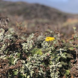

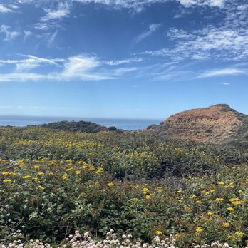
I am unable to check in at this park as the internet service for me is non existent here. But, thankfully I can write a review and post pics!! This is rugged, gorgeous park! I say rugged because once you are at the beach there is no bathroom and you do have to walk at least a mile to get there. It is so worth it for the beauty and solitude. I recently hiked the ridge trail to the bluff trail. In total it is 8 miles. I like to go up the ridge trail first, because ending a hike on a down hill. The top of the mountain is a gorgeous rugged area that is a small redwood forest. If you do this hike I recommend starting early. I was on the trail by 8:45 am. I was finished by 12:00. The trail is very narrow in parts heading down towards the beach. I wore long pants and a hat and had plenty of water. It is so gorgeous here I cannot believe it. Super natural all the way through the trail. The trail markers are minimal and signage is very little too. I saw loads of animal scat and kept thinking I would come across an animal of some sort. The only animals visible were birds, turkey vultures and seagulls of course. Watch out for poison oak and wear appropriate shoes! Cheers and Happy Hiking.


Andrew Molera State Park is one of those "to get to the beach you need to earn it" parks. Located several miles south of the Bixby Bridge, it's a park that can be visited easily enough when you start from Monterey. I've even done it from the East Bay as part of a day trip along the coast. The parking lot is relatively small for such a popular area but on weekdays there are few visitors. It's a $10 day use fee but they do accept the CA Parks Golden Poppy pass. They've recently opened back up following COVID-19 related closures, but with limitations. Picnic areas are closed and there was not a ranger at the entry kiosk, so bring exact change to self register/pay for parking. The main attraction is the beach-one or the more unique stretches of coast I've visited with driftwood, purple sand and tons of interesting pebbles along the shore. To get there there is a relatively flat trail from the parking area on the Creamery Meadow Trail. You'll have to cross the river and during certain months, a footbridge is installed. The dirt path winds through oaks, seasonal wildflowers and small meadows. Eventually it puts you out on the beach where you will see the river flowing in to ocean. The rock formations, driftwood and dramatic cliffs make this a scenic beach hike. Along the way you'll come across purple sand, which is caused by what I believe are minerals mixed in. Truly a lovely spot that's not too crowded during weekdays. To me, it's a must stop if you're spending a day in Big Sur. Give yourself about 20-30 minutes each way to get to the beach depending on how quickly you walk and take your time enjoying this amazing stretch of coast


Great for hikes! Went on the trail towards the beach. very scenic and easy hike. The beach is beautiful too. We came here on fourth of July weekend. There was lots of trash on the beach and it was super windy. A completely different feel from the hike itself. I would definitely go back and do some of the other trails.


Andrew Molera SP is named after the rancher who popularized the idea of commercially cultivating artichokes in California. His family were the original owners of the land as result of the Rancho El Sur land grant. After his death the land was transferred to his sister, who eventually sold it to the The Nature Conservancy with the intention of converting the land into a state park in memory of her brother. At 4,800 acres, this is the largest state park in Big Sur. LOCATION: Along CA-1, mile marker 51. Going south from Carmel (21 miles), the park is between the Bixby Bridge (mile marker 60) and Pfeiffer Big Sur SP (mile marker 47). PARKING: Dedicated parking for day use is $10. Otherwise just park along the highway. As of this writing, due to the recent fires and general COVID restrictions the campground remains closed, as is the Ranch House Museum. Hiking trails are open. The park is famous for its trails. The majority of the trails require an initial crossing of the Big Sur River. From spring to fall a footbridge is installed so people can easily cross the river. During the winter, the bridge is removed due to the steelhead trout migration. Crossing the river is still relatively easy, just be prepared to get your feet wet. The most popular trails consist of the following: 1. Creamery Meadow Trail (2 miles, easy). This is the main trail that leads to the beach. The views are lovely especially with the driftwood, but I prefer the view that you get when you take the Spring Trail spur. 2. "The Loop" - consisting of the Ridge, Panorama and Bluffs Trails (6.2 miles, moderate) with an optional spur (Spring Trail, .1 mile one way). The recommended route is Ridge/Panorama/Bluffs as you get the hardest part out of the way, 1,100 feet elevation gain within the first 2.8 miles of the trail. In addition by going in this direction the beach views will always be at your front. It can get a little tricky on the descent on the Panorama Trail but definitely doable for the average hiker. While research has noted the presence of poison oak on the trail, I mitigated my risk by wearing long pants. Considering that I have average fitness with a budding passion for hiking, I was able to do this with a friend in about ~4 hours. We started later in the day (~1pm) and was able to finish the hike right before sunset. - Favorite part of the hike is the Spring Trail spur. As I have mentioned earlier the views are a lot better than the beach area closer to the parking lot but you have to do some work to even get to this point. After reaching the Spring Trail trailhead you'll then have to walk down and cross a big section of driftwood to even get access to the beach. This would be my ideal place for a secluded lunch spot. - The section of redwood forest that marks the back half of Ridge trail make a good scenic diversion should you manage to get tired of beach scenery (*pfft*). - The border of Ridge and Panorama Trail is a great birds-eye viewpoint of the beach and is a great lunch spot. I did not see a bench, which is mentioned in many guidebooks and blog posts about this hike. - My friend and I saw a few deer grazing by the Creamery Meadow Trail. - Surprisingly there is decent cell reception, especially near the beach areas. Could it be due to the cell towers near Point Sur Lighthouse? Ever since I knew about Big Sur I've always wanted to hike a few of its trails. COVID gave me a reason to do so by way of a Central Coast roadtrip. This was my first ever hike inside Big Sur and I can definitely see why people consider it one of their most favorite spots in the entire world. I thoroughly enjoyed my workout and would recommend this hike to just about anyone with average fitness who want to experience the beauty that is Big Sur.
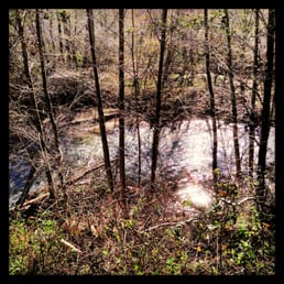

If you tire easily of the crowds at Point Lobos, then join the club since I haven't been back there for years despite what I know are striking views of the rugged coast. If you continue driving south on Highway 1 past Bixby Bridge, you should take a stop at Andrew Molera State Park, which is named after the man who popularized the artichoke in the 1920's. Now the trick is to avoid the steep $10 entrance fee that allows you the use of their unpaved parking area next to the trailheads. Thanks to the insights of fellow Yelpers, Jamie W. and I stopped at the quarter-mile sign and walked precariously on the shoulder of the high-speed highway. Once we made it to the ranger booth, we bought a park map for a dollar and asked her to point us to the Headlands Trail. We basically followed the leisurely Beach Trail that follows the Big Sur River (see photos). We passed by an expansive campground and into a wooded area that was still a bit muddy from the recent rains. We kept running into the surfers coming back from the beach. We detoured onto a short upward path that turned out to be the Headlands Trail. Sturdy, weather-worn wooden steps and benches dotted the trail that leads above the beach to Molera Point. Here is where you get the classic Big Sur views and watch the surfers as they attempt to catch the waves (see photos). It was only two miles round trip, and as we inspected Cooper Cabin, the oldest structure in Big Sur, we found an alternative path that led us directly to our car.


Wow what a hidden treasure ! I just got back from a weekend in Big Sur and am so glad I came across this gem. We were on our road trip back up the coast when we wanted to stop and check out the lighthouse. Well of course we didn't get up early enough to go on the lighthouse tour so we decided to check out this place next door. First of all the trip out to the ocean was quite an adventure. The bridge was out so we had to cross about calf deep ice cold water. Luckily we discovered this at the beginning of the trail so everyone went back to the car to get into their flip flops. The trail was nice and flat and beautiful ! You have all the elements of the beauty of California in this trail - river, grass fields, trees, mountains, ocean and nature. We also saw some hawks? along the trail. It was a mile trail and when we got out to the ocean it was like we had our one private beach. The sand was soft and warm with multi-colored cliffs to our right and bluffs to our left. I really would like to go up the bluff trail next trip, we saw some half nude mountain bikers coasting down while we were there. We spent about an hour on the beach which was surprisingly not too windy and then sadly headed back. One of the best hikes I have been on and will be back. What an adventure!


2 months ago

First time visiting Andrew Molera State park this last weekend 5/25/2024. We were feeling ambitious and decided to hike the whole 8 mile loop (creamery meadow, ridge, panorama, and bluffs trail) roughly 1450 ft elevation gain total. At the beginning of the hike and at the end of the hike you have to cross a river that is about knee deep for someone around my height of 5"4. The hike took us 5 hours to compete with ample breaks included. We hung out on two different beaches (not included in the time) throughout our day which was a ton of fun. It was my first time ever seeing or even hearing about purple sand and my mind was blown. The trails are VERY overgrown so I'd suggest wearing long sleeves and pants to avoid ticks, poison ivy, and stinging nettle. Parking is free if you are willing to park along hwy 1 and walk/run across the street. There is paid parking inside of the park and there seemed to be plenty of space if that's your preference. Lastly, I love that there are clean bathrooms at the beginning of the trail head. Overall, this loop offered absolutely amazing ocean views during the majority of hike. Bring lots of water, sunscreen, and your camera. read more


What a nice park. I would recommend the one mile trail walk to the beach. The beach is quite empty during the week. Also, while the trail is quite wide, it is lined on both sides with poison oak almost the entire walk which is fine as long as you don't touch it. The trail floor starts out as dirt and small rocks and eventually turns to sand and rock. There's also a small section of a two planks wide stable bridge over a river. It's maybe 30 feet long and the water below is about 6 inches to a foot deep. It would be fine for most children to cross with an adult. The views once you arrive at the ocean are truly stunning . The sand is quite hot and there are many small rocks and lots of seaweed, so I'm glad I wore flip flops. Sneakers would have been better I think. read more


2 years ago

We visited Andrew Molera State Park on a Saturday in late July, 2024 with the intention of doing an easy "hike" to the ocean. In reviewing a map before arriving, we had decided upon a trail (the Beach Trail) that would take us from the parking lot to Molera Point. However, upon arriving, we learned that it was closed due to damage and the ranger recommended the Creamery Meadow Trail instead. State Park Admission. The entrance is down a steep but short paved road off CA-1. It's a sharp left if coming from the south (Big Sur side). Signage is good. At the bottom, there was a manned ranger station where you pay for parking ($10, or $9 for seniors). Note that California State Parks allow you to visit multiple state parks on the same day with only one admission fee. Also, if you've paid for camping in a state park, this entitles you to state park admissions until 5 pm the following day. Molera's parking lot has designated spots for campers who stay in the walk-in campground, as well as for day users. We were able to secure parking at 10:30 am, but demand exceeds supply on a typical Saturday in July. By the time we returned after our hike, the park had posted a sign at the top that parking was full, so users parked along CA-1 and walked down. The Creamery Meadows Trail, one mile in length (one-way), was wide, smooth, easy to follow, and mostly hard-packed until it turned to sand near the beach. A highlight was crossing the shallow Big Sur River on a double plank board. It would be hard to get lost as there were dense shrubs on both sides of the trail and few intersections with other trails. There was one, with the Bluff Trail, that was well marked as such. The beach itself was scenic, with a lot of driftwood and kelp, and a dozen or so people were relaxing on or walking along the beach, some watching the few surfers trying to catch a wave. A couple of young women waded in the water towards the surfers, and we were surprised how shallow it was in that area. What could've been better? * We had asked for a brochure about the park and a map with trails, both at the state park itself, as well as at the Big Sur Station, and we told that they were out. In both cases, we were told that we could take a photograph of a posted map. The map from Big Sur Station was more detailed and better for planning purposes than that at the actual park. * We had taken a few snacks for our hike, but wanted to have a quick picnic lunch upon our return to the parking area. There were no picnic tables, but the ranger pointed us to a grassy patch under a tree OR to Pfeiffer Big Sur State Park five miles down CA-1. * The parking area and trail that we took were generally clean and well maintained. However, the only restrooms were at the parking area, and some trail users used the edge of the trail to do their business, leaving behind their organic materials and wipes. In the most obvious case, it was next to a large natural log where I stopped to tighten my shoelaces. Park staff were friendly. Restrooms were clean. Signage (park map) could've been more detailed. read more


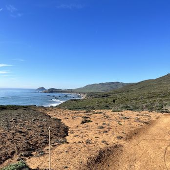


We stayed one night at the Trail Camp in late August. It was a bit of a schlep to the camp (about a quarter mile with a section of stairs) so pack light. Also the campsites are pretty close together. This probably isn't the most gorgeous, private, or convenient campsite in Big Sur. The upside of the trek to the campground is that, other than being surrounded by people, you feel a bit of distance from the road and more in nature. The bathrooms were clean and well maintained. There were bear boxes at every site, and water, trash cans and bathrooms conveniently spread throughout the site. Almost every other national forest and state park in the state wasn't allowing campfires, even in developed campgrounds, but this campsite was! read more


5 years ago
This is our second visit here. Our first time was last year when I decided to check out Big Sur on a whim and we've been going back ever since. If you park inside the park, there is a fee. If you want to be cheap, you can park on Highway 1 with the other cars and walk in. We've been on the trail along the river, more on the hot and dry side and watch out for poison oak. On this visit, we decided to take the beach trail. At the entrance of the trail, you walk over a two plank wood bridge over a creek. This is my favorite part because the water is so clear and if you look down, it's really pretty. Overall, the beach trail is an easy walk to the beach. You will know you're there because you will hear the waves roaring before you see the ocean. The river connects to the each, so one side is calm, the other is waves. Unfortunately, there really is a drought because the water was low that I was walking on wet sand. I was observing families and the kids were walking in the middle of the river because it was so shallow. When the sun is out, the light hits the sand which has a purple tint (i.e., the same purple sand is at Pfeiffer Beach). We weren't well prepared on this visit, but definitely bring some water shoes, swimsuit, blanket, towel and snacks. We saw one family haul in their boogie boards and jump right in. There are no trash cans, so haul your trash and dump it in the garbage cans near the restrooms/entrance. Next time, we're taking the Bluff Trail! read more


One of my favorite hikes ever - and this is coming from the least active person lol. You have to cross a river from the parking lot ($10) but they recently took out the bridge (as of 10/24/20). The water goes up your knees, but the worst part is stepping on all those rocks. I usually go on the Bluff trail (I think that's what it's called) - it's extremely challenging but definitely doable when it's not too hot. GO CLOCKWISE ON THIS TRAIL. 2-3 miles of just steep uphill. Once you get to the top, you're surrounded by trees. Then eventually you will get to the top at 1,220 feet of elevation! The way down is my favorite because you're walking along side the mountain with the view & sounds of the ocean. It's so surreal. There's a trail that will lead you straight to the beach to end your hike as well. If you don't feel like doing an intense hike, there's a beach if you just go straight down from the bridge area for 2-3 miles. The beach is ok at best. read more


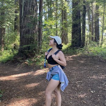


This is such a beautiful park! We decided to come here on Saturday during the heatwave to check out the trails. It was a bad & good idea at the same time. We arrived around 8:30 AM and was able to find parking in the shade. It's $10 to park here! We wanted to do the Beach, Bluffs, Panorama, Ridge & Creamery Meadow trail, which is about 8.2 miles. We the other way around where we started on Creamery Meadow to Ridge Trail. Big mistake. The inline on the Ridge Trail was such a workout and with the heat, we were profusely sweating. Once we got to the top, it was really gorgeous! Making our way down, we decided to go check out the beach by going through the drift woods. We ended up resting here for awhile. It was nice and secluded. Throughout the trail, everyone was mindful of social distancing and/or wearing masks. There's lots of poison oak on the trail, so be careful. If you can, wear long pants! If not, just stick to the trail and stay away from the poison oak. Overall, it was a very rewarding hike. Definitely spent most of our day there. Remember to bring lots of water, snacks, and sunscreen! read more



6 years ago
I am unable to check in at this park as the internet service for me is non existent here. But, thankfully I can write a review and post pics!! This is rugged, gorgeous park! I say rugged because once you are at the beach there is no bathroom and you do have to walk at least a mile to get there. It is so worth it for the beauty and solitude. I recently hiked the ridge trail to the bluff trail. In total it is 8 miles. I like to go up the ridge trail first, because ending a hike on a down hill. The top of the mountain is a gorgeous rugged area that is a small redwood forest. If you do this hike I recommend starting early. I was on the trail by 8:45 am. I was finished by 12:00. The trail is very narrow in parts heading down towards the beach. I wore long pants and a hat and had plenty of water. It is so gorgeous here I cannot believe it. Super natural all the way through the trail. The trail markers are minimal and signage is very little too. I saw loads of animal scat and kept thinking I would come across an animal of some sort. The only animals visible were birds, turkey vultures and seagulls of course. Watch out for poison oak and wear appropriate shoes! Cheers and Happy Hiking. read more




6 years ago
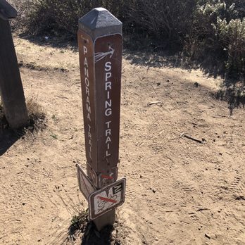
Andrew Molera State Park is one of those "to get to the beach you need to earn it" parks. Located several miles south of the Bixby Bridge, it's a park that can be visited easily enough when you start from Monterey. I've even done it from the East Bay as part of a day trip along the coast. The parking lot is relatively small for such a popular area but on weekdays there are few visitors. It's a $10 day use fee but they do accept the CA Parks Golden Poppy pass. They've recently opened back up following COVID-19 related closures, but with limitations. Picnic areas are closed and there was not a ranger at the entry kiosk, so bring exact change to self register/pay for parking. The main attraction is the beach-one or the more unique stretches of coast I've visited with driftwood, purple sand and tons of interesting pebbles along the shore. To get there there is a relatively flat trail from the parking area on the Creamery Meadow Trail. You'll have to cross the river and during certain months, a footbridge is installed. The dirt path winds through oaks, seasonal wildflowers and small meadows. Eventually it puts you out on the beach where you will see the river flowing in to ocean. The rock formations, driftwood and dramatic cliffs make this a scenic beach hike. Along the way you'll come across purple sand, which is caused by what I believe are minerals mixed in. Truly a lovely spot that's not too crowded during weekdays. To me, it's a must stop if you're spending a day in Big Sur. Give yourself about 20-30 minutes each way to get to the beach depending on how quickly you walk and take your time enjoying this amazing stretch of coast read more



6 years ago
Great for hikes! Went on the trail towards the beach. very scenic and easy hike. The beach is beautiful too. We came here on fourth of July weekend. There was lots of trash on the beach and it was super windy. A completely different feel from the hike itself. I would definitely go back and do some of the other trails. read more


6 years ago
Andrew Molera SP is named after the rancher who popularized the idea of commercially cultivating artichokes in California. His family were the original owners of the land as result of the Rancho El Sur land grant. After his death the land was transferred to his sister, who eventually sold it to the The Nature Conservancy with the intention of converting the land into a state park in memory of her brother. At 4,800 acres, this is the largest state park in Big Sur. LOCATION: Along CA-1, mile marker 51. Going south from Carmel (21 miles), the park is between the Bixby Bridge (mile marker 60) and Pfeiffer Big Sur SP (mile marker 47). PARKING: Dedicated parking for day use is $10. Otherwise just park along the highway. As of this writing, due to the recent fires and general COVID restrictions the campground remains closed, as is the Ranch House Museum. Hiking trails are open. The park is famous for its trails. The majority of the trails require an initial crossing of the Big Sur River. From spring to fall a footbridge is installed so people can easily cross the river. During the winter, the bridge is removed due to the steelhead trout migration. Crossing the river is still relatively easy, just be prepared to get your feet wet. The most popular trails consist of the following: 1. Creamery Meadow Trail (2 miles, easy). This is the main trail that leads to the beach. The views are lovely especially with the driftwood, but I prefer the view that you get when you take the Spring Trail spur. 2. "The Loop" - consisting of the Ridge, Panorama and Bluffs Trails (6.2 miles, moderate) with an optional spur (Spring Trail, .1 mile one way). The recommended route is Ridge/Panorama/Bluffs as you get the hardest part out of the way, 1,100 feet elevation gain within the first 2.8 miles of the trail. In addition by going in this direction the beach views will always be at your front. It can get a little tricky on the descent on the Panorama Trail but definitely doable for the average hiker. While research has noted the presence of poison oak on the trail, I mitigated my risk by wearing long pants. Considering that I have average fitness with a budding passion for hiking, I was able to do this with a friend in about ~4 hours. We started later in the day (~1pm) and was able to finish the hike right before sunset. - Favorite part of the hike is the Spring Trail spur. As I have mentioned earlier the views are a lot better than the beach area closer to the parking lot but you have to do some work to even get to this point. After reaching the Spring Trail trailhead you'll then have to walk down and cross a big section of driftwood to even get access to the beach. This would be my ideal place for a secluded lunch spot. - The section of redwood forest that marks the back half of Ridge trail make a good scenic diversion should you manage to get tired of beach scenery (*pfft*). - The border of Ridge and Panorama Trail is a great birds-eye viewpoint of the beach and is a great lunch spot. I did not see a bench, which is mentioned in many guidebooks and blog posts about this hike. - My friend and I saw a few deer grazing by the Creamery Meadow Trail. - Surprisingly there is decent cell reception, especially near the beach areas. Could it be due to the cell towers near Point Sur Lighthouse? Ever since I knew about Big Sur I've always wanted to hike a few of its trails. COVID gave me a reason to do so by way of a Central Coast roadtrip. This was my first ever hike inside Big Sur and I can definitely see why people consider it one of their most favorite spots in the entire world. I thoroughly enjoyed my workout and would recommend this hike to just about anyone with average fitness who want to experience the beauty that is Big Sur. read more


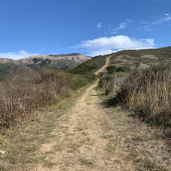


If you tire easily of the crowds at Point Lobos, then join the club since I haven't been back there for years despite what I know are striking views of the rugged coast. If you continue driving south on Highway 1 past Bixby Bridge, you should take a stop at Andrew Molera State Park, which is named after the man who popularized the artichoke in the 1920's. Now the trick is to avoid the steep $10 entrance fee that allows you the use of their unpaved parking area next to the trailheads. Thanks to the insights of fellow Yelpers, Jamie W. and I stopped at the quarter-mile sign and walked precariously on the shoulder of the high-speed highway. Once we made it to the ranger booth, we bought a park map for a dollar and asked her to point us to the Headlands Trail. We basically followed the leisurely Beach Trail that follows the Big Sur River (see photos). We passed by an expansive campground and into a wooded area that was still a bit muddy from the recent rains. We kept running into the surfers coming back from the beach. We detoured onto a short upward path that turned out to be the Headlands Trail. Sturdy, weather-worn wooden steps and benches dotted the trail that leads above the beach to Molera Point. Here is where you get the classic Big Sur views and watch the surfers as they attempt to catch the waves (see photos). It was only two miles round trip, and as we inspected Cooper Cabin, the oldest structure in Big Sur, we found an alternative path that led us directly to our car. read more
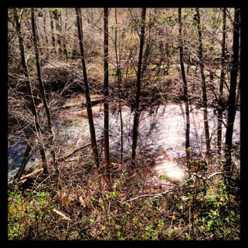


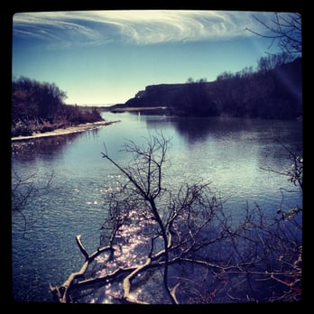


Wow what a hidden treasure ! I just got back from a weekend in Big Sur and am so glad I came across this gem. We were on our road trip back up the coast when we wanted to stop and check out the lighthouse. Well of course we didn't get up early enough to go on the lighthouse tour so we decided to check out this place next door. First of all the trip out to the ocean was quite an adventure. The bridge was out so we had to cross about calf deep ice cold water. Luckily we discovered this at the beginning of the trail so everyone went back to the car to get into their flip flops. The trail was nice and flat and beautiful ! You have all the elements of the beauty of California in this trail - river, grass fields, trees, mountains, ocean and nature. We also saw some hawks? along the trail. It was a mile trail and when we got out to the ocean it was like we had our one private beach. The sand was soft and warm with multi-colored cliffs to our right and bluffs to our left. I really would like to go up the bluff trail next trip, we saw some half nude mountain bikers coasting down while we were there. We spent about an hour on the beach which was surprisingly not too windy and then sadly headed back. One of the best hikes I have been on and will be back. What an adventure! read more


Very scenic park. This park has everything: ocean view, beach, river, hills, deer. Very pretty! People seem to park on the street to save $10. Also, the map costs $2. The restroom is at the parking lot. Also water is available at the parking lot (picnic area). The biggest loop is 9 miles, around +1000 feet elevation gain. read more


Nice spot near Big Sur for a hike and ocean views! THE COST: $10 for parking. The rangers at the entrance will help you figure out a trail to hike; they're very nice and knowledgeable. The restroom at the parking lot is nice for a park - it has running water and flushing toilets! The main beach at Molera Point (~15-20 min from the parking lot) is pretty dirty with lots of seaweed, wash up, & tons of flies on the sand, and it was crowded. We went further to the smaller beach off of the Spring Trail (an additional ~45 minutes away) and that was much nicer and more secluded (though to be fair it was much later in the day at that point). It's a bit smaller too. It also has purple sand! Though I wouldn't have noticed if the park rangers hadn't told us about it beforehand. You have to scrape a little under the top layer of sand to see it. It was about 5pm when we got there, and it was pretty chilly by then. Views from the further beach: http://www.yelp.com/biz_photos/andrew-molera-state-park-big-sur?select=6P0Bka4Lxvuj_d7BvzVWGg#6P0Bka4Lxvuj_d7BvzVWGg http://www.yelp.com/biz_photos/andrew-molera-state-park-big-sur?select=6P0Bka4Lxvuj_d7BvzVWGg#0ZA4RpW4mISkOX39X_ulbw The Beach Trail to get to that further beach hugs the coast and has almost no elevation change - it's really nice, but also really exposed! Make sure to have your sunblock and a hat. It offers amazing views of the coast. The Spring Trail is very jungle-y, with lots of overgrowth on the sides, and it ends at this big area of washed up sea wood, and you really have to pick your way across it, balancing on smoothed over tree trunks and branches: http://www.yelp.com/biz_photos/andrew-molera-state-park-big-sur?select=6P0Bka4Lxvuj_d7BvzVWGg#zgmw3iV88RQRYNRCUt2Xkw Trail map: http://www.yelp.com/biz_photos/andrew-molera-state-park-big-sur?select=Dj1HYHWGTC2c-xBOTJ_ZnQ#Dj1HYHWGTC2c-xBOTJ_ZnQ read more


3 years ago

19 years ago

4 years ago

6 years ago


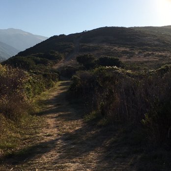
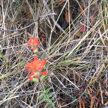
Always enjoyable to hike in Big Sur. Get there early, just like Point Lobos it get crazy by mid morning. Or maybe a late afternoon hike? First time I did this, it was to help someone special to workout some stress, the climb up the ridge will definitely do that, than getting into the oak and redwoods on top of the ridge, looking towards the ocean or East towards the coastal mountains, definitely peaceful and stress relieving . So many beautiful views and a great workout. Going clockwise, you get the big climb out of the way, then you can enjoy the oak and redwood forests, before you descend towards the ocean views and lots of scrub brush and flowers. Awesome views of the ocean throughout. You can hear the waves almost through the whole hike. Pretty cool to see the dwarf redwood groves, easy to miss if you don't know what you're looking for. Pretty sunny all the way. Sunscreen and a big hat helps. Covid protocol was pretty mixed. I can't point at just one type of group. Probably the worse I've seen it, at any park. People!! It's simple, wear a mask for others, it's not about you!! I know if it was in Monterey or a ranger around, fines would have been given. Looking forward to coming back after some rain and cooler weather. Stay positive and keep hiking read more





3 years ago

For a quick and scenic adventure, I highly recommend visiting Molera Beach. We parked directly in the Andrew Molera parking lot ($10), which is just a one mile walk to the beach. The park rangers are very helpful and friendly. There are a few restrooms in the parking lot which I always appreciate after a long car ride. Parking can fill up quickly on busy weekends. We got there at 11am on a Saturday so there were still spots available. We hiked the Creamery Meadow Trail to the beach; it's flat and easy to walk though a bit dusty (come prepared with an old pair of sneakers). There's a plank bridge near the entrance of the hike so you can cross the Big Sur River. We saw some families wading in the water there and it looked very relaxing. Once we got to the beach, we saw plenty of people doing beach things (sunbathing, surfing, camping, picnicking, etc.). Although we didn't come prepared for any beach activities, it was still very enjoyable just taking in everything. We also saw quite a few nifty driftwood shelters across the beach. Definitely glad we stopped here during our trip. Next time we'll come prepared with more sunscreen and a few towels. read more


10 years ago

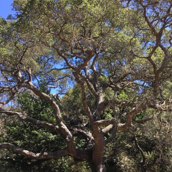
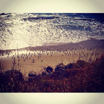
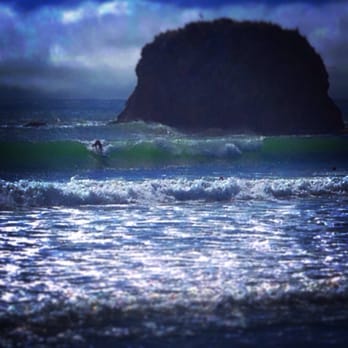
"It always makes me proud to love the world somehow- hate's so easy compared." ― Jack Kerouac, Big Sur I love the writing and photography of my Yelp friend Bradley N. He is one of the most interesting Yelpers because he brings passion, creativity and intelligence to any reviews he writes. Plus stunning photos! But I cannot believe he would only give Andrew Molera, as others did, 4 stars if he hiked the 9 mile Ridge, Bluffs and Panaromic Trail loop. This simply is one of the best day hike trails in Big Sur and is a must for the views of the Bluffs, Point Sur Lighthouse and Northern Big Sur Coastline. As others have mentioned, it costs $10.00 to park here. Alot of people skip that fee and park on Hwy 1 but I usually either have a park pass or just pay the fee. The upkeep and protection of the CA Coastline is not free and an incredibly small part of taxes collected goes to the Park system. Most people take the Creamery Trail or the Beach Trail to the Beach...and stop there. They take beautiful photos, maybe go up to the Bluffs, see the picturesque river...and call it a day. That's not the full Andrew Molera experience. First, about that stream crossing. It is only treacherous if for some reason you are absolutely terrified of taking off your shoes. I've done it both ways, walked on the rocks/planks or walked like a hobbit in bare feet. Bare feet is easier. even the Orcs agree on that ;-) The 9 mile hike includes the Creamery trail start to either the Ridge Trail or Bluffs Trail. i recommend going the Ridge Trail route. Get the uphill out of the way quickly plus it is far easier here then the uphill you do on the Bluffs Trail. as soon as you go up you get magnificent views of the Point Sur Lighthouse, Big Sur River and Molera State Beach. The higher up you go will lead to a small Redwood grove plus a really cool oak grove (see my photo). Going even higher, where you meet up with the Panoramic Trail gives one stunning vistas of the Big Sur coastline going both North and South. At the Bluffs Trail junction might be the best views. At this spot, stop and eat the food you brought (It is a 9 mile hike! Bring food and water. Some of this is muddy single track and it took us 4 hours with view and photo stops. We saw a struggling married couple and they were not prepared for this). Going down the Bluffs Trail can get slippery but the views are so worth it. You can detour to the Beach to make this an even longer hike or just return via the beach (depending on Tides). We returned via the Bluffs Trail and it is just non stop Coastal Bluffs views. depending on weather conditions, the scenery can be beautiful, dramatic, haunting...it really can change on a dime. Along with the Ewoldsen and Garrapata trails, this is one of the must do hikes in Big Sur. Highly recommend! read more




13 years ago
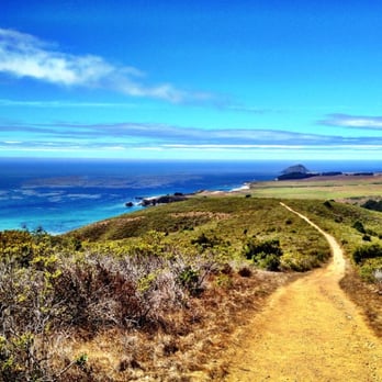
This is a review for both camping and hiking around Andrew Molera State Park... I reiterate the previous reviews that this is a great spot to get away from the crowds. There are only 24 spots - first come, first serve - that are greatly spaced out. You don't feel anxious about drinking beers, chatting around your campfire, post-night fall. Our story: we were group of 20-something friends coming from LA and SF. Of course we did not reserve a campsite six months in advance. The trip idea came about last minute. We arrived at 7am on Saturday of Labor Day and got a spot no problem here. Tips: Just hike in and just talk to people. Most people are up with sunrise and just ask them if they are leaving. Check out is at noon so you may not be able to completely load in but most people are chill and there is so much space you can set up as they are taking down. Plenty of fresh water spicket. Bathrooms were decent. There are some great hikes that leave directly from this State Park - two 9-milers. And for a more, chill relaxing close of day activity, you can easily stroll the one-mile path to the beach. There is an awesome lagoon. I can't speak from comparison but frequent visitors to this beach said it's better than the other Big Sur spots because not as crowded. For Labor Day weekend, the crowds were minimal. I am giving it 4 stars for two reasons: the hike in isn't the most convenient (for carrying our feast of food and beverages). The second, it's not the most scenic campsite. But for the flipside - not being crowded, surrounded by most people are our age (20 - 40)...I'd pick it over Pfeiffer Big Sur State Park (were we stayed on Friday night). Final tip: PUT ALL FOOD IN YOUR LOCKER. The squirrels will chew through backpacks, duffles, anything to get to your snacks. read more


7 years ago
This is one of those 'must see' beaches. There is purple sand from magnesium deposits, which is pretty tight. The beach itself has quite a few handmade 'huts' made out of driftwood, which are pretty cool. Also, the Big Sur River empties right into the ocean. I visited in early August, so the water was actually really warm...I was quite surprised. The bluff trail that goes above the beach is beautiful and if you hike long enough, you'll come to a really nice beach. From there, you can try your luck at rock climbing to the hidden beach beyond it, but you might die on your way like I did. So I recommend just sticking to the beach, unless you have a wetsuit and want to risk it because the waves are no joke and will smash you into a huge rock like a sledgehammer crushing a clay pot. The clay pot being you, so don't risk it. Again, I'm not the smartest lightbulb in the lightbulb drawer. read more


With much of Big Sur's coastline inaccessible due to its sheer cliffs and private properties, we're fortunate for the state parks in the area, which provide its visitors with coastal access. A day-use fee of $10 will be charged to park in the lot, but parking along the highway is also possible (and free!). We didn't make the time (read: lazy) to complete the 9-mile trek that everyone raves about. Instead, we took the 1-mile Creamery Trail directly to the beach. Since we came here towards the end of September and Fall had already begun, the meadow was mainly comprised of dry brush and shrubs. This was not the "meadow" I had envisioned. We'll need to come back here in Spring, so we can "bound and leap" through the flowers like the deer from Milo and Otis ("Bound and leap, like a gentle breeze! Bound, and of course, leap!"). Regardless, the beach was beautiful, clean, and well-worth the "hike" (it's more like a 20 minute walk; the terrain is mostly flat). I've also heard that tide pooling is a possibility here during low tide! I did manage to spot a sea anemone on a rock, which I promptly gave a (gentle) poke so I could watch it curl up. Just doin' my part to disturb wildlife, ma'am. And speaking of wildlife, we watched in awe as dozens of seagulls, several dolphins, some seals and a couple of large, audacious sea birds were vying for position in what turned out to be the raddest feeding frenzy ever. Move over, Planet Earth! We had fun here, but next time, we'll come back in the Spring so we can enjoy the hike like nature intended. A word to the wise: Before using one of the porta potties, always, ALWAYS remember to remove your cell phone from your back pocket. I cannot emphasize this enough. read more


15 years ago

I've been here twice and now they say site #1 is out of service because it doesn't have a bear box. It's a great place because there always seems to be room, when everywhere else is crowded. The less-than-a-mile hike in, usually deters most car campers, though I've seen people hike in with coolers, guitars, etc. It definitely helps to have a hiking backpack to transport some stuff in, but it is manageable without. The bathrooms are clean and well stocked. The fire pits clearly designated and the bear boxes super convenient. There are a few raccoons, curious deer and scavenging crows (they get aggressive and pick food off the picnic tables) to watch out for food-wise. You have to bring your own firewood or get there early enough to buy a bundle at the front for $9 (smells nice when you burn pine.) Easy walk to the beach or the headlands overlook through the butterfly grove. A more strenuous hike it the 8 mile loop up around the coast. It's a beautiful view, but the coast is ultra windy, so be prepared. The hardest thing about this hike was the fact that the trail was not kept up. The bushes were largely overgrown and it make it quite hard to discern the path and difficult to avoid the snakes (had to cross over two of them.) There's got to be a ranger to clear some of these overgrown plants... when its past shoulder high and the path feels like its disappearing... it needs a trim! read more


14 years ago
Went camping here for Labor Day weekend. The spots are first come first served basis. Only 1 car per site. If you have more than 1 car, then you will have to pay extra for parking. Only 2 tents per site. So, depending on the amount of people, you will have to deal with that. Other then the long walk in with all your stuff, overall it was a great camping experience. The hikes are beautiful here. You're near the Big Sur river and also the beach. So, feel free to bring your wetsuit and change of clothes. The water is a bit cold, but very clear and clean. There's great views; that is if you hike a bit. Bathrooms are pretty clean. Yes, it has running water. No showers! read more


5 years ago
there's a bridge going over the stream now, no need to get wet during that first part of the trail. read more

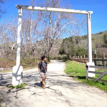


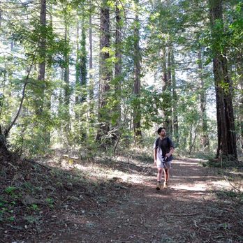


Big Sur is a spectacular destination and Andrew Molera SP, mostly open and undeveloped, offers a lot of what the area is known. Miles of trails wind through meadows, bluffs, beaches, rivers, and hilltops. The park has hiking, camping, horseback riding, bike trails, swimming, surfing, fishing, and other activities. It is noteworthy that there isn't a lot of shade on most of the trails or beach, so be prepared. There's also quite a bit of poison oak so be careful. My wife and I hiked the 'Andrew Molera Loop' a 10-mile moderately trafficked loop trail. We loved it, although it was a bit long and it got very hot (we went in the summer). Make sure to bring sunscreen and water. $10 per car, per day. Your entrance fee allows you access to all California state parks until sundown. read more


Page 1 of 4
More info about Andrew Molera State Park
45500 CA-1
Big Sur, CA 93920
Directions
(831) 667-2315
Call Now
Visit Website
http://www.parks.ca.gov
Hours
Indoor Amenities
Outdoor Amenities
Other Amenities
Ask the Community - Andrew Molera State Park
Is this a clothing optional beach?
I don't believe so-lots of families and kids. Also there might be rules in place given it's a state park
Review Highlights - Andrew Molera State Park
You might also consider




















Why does Yelp recommend reviews?
3 reviews that are not currently recommended
The reviews below are not factored into the business's overall star rating.

9 years ago

14 years ago
16 years ago
Andrew Molera State Park - parks - Updated September 2026
Best of Big Sur
People found Andrew Molera State Park by searching for…
Browse Nearby
BEST of Big Sur, California Restaurants near Andrew Molera State Park
BEST of Big Sur, California Coffee near Andrew Molera State Park
BEST of Big Sur, California Things to Do near Andrew Molera State Park
BEST of Big Sur, California Beaches near Andrew Molera State Park
BEST of Big Sur, California Breakfast near Andrew Molera State Park
BEST of Big Sur, California Shopping near Andrew Molera State Park
BEST of Big Sur, California Campgrounds near Andrew Molera State Park


