
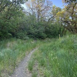
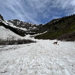
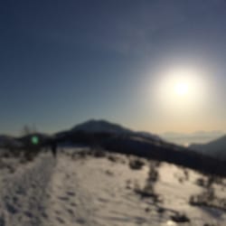
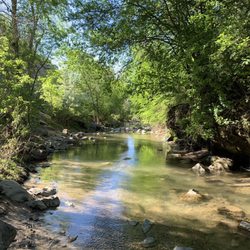
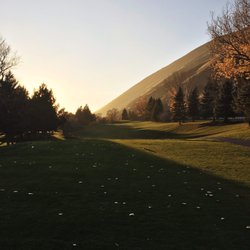
Big Springs Park Photos


You might also consider
More like Big Springs Park
Recommended Reviews - Big Springs Park
Start your review...

8 years ago
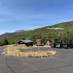
Great park, very pretty and quite big, could not do snowshoe as I was expecting during my last trip to Utah but I spent a nice long hike and took beautiful pictures in this awesome location. There is a river with some cute bridges for photo opps and kids and adults can enjoy different snow activities during the winter, mostly playing with the slides. Big parking lot and no entry fee. read more


10 years ago
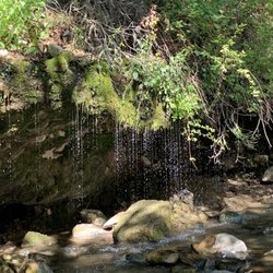
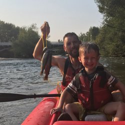
Enjoyed this park for the most part. Very clean, gorgeous scenery, beautiful green grass, cute mountain stream, picnic tables, grills, and bathrooms. But the layout kinda ended up stressing me out. We went there for a party with my husband's side of the family. I personally would choose to go to a different park next time. This is more to do with the age of my child than anything the park can change. The park is long and skinny with the river/stream running on one side, the small dirt road (where you park) on the other, with a big grassy area in the middle. Since I have a 2 year old my ENTIRE evening was spent chasing him and making sure he didn't jump in the river/stream or run into the road since both were so close. The river/stream is shallow so all the kids at the park were playing in it which made it impossible for my toddler to understand why he couldn't follow. If I had planned on getting in the water with him I would have gone to a lake! I didn't use the bathroom but one of my older nieces went in and came right back out saying she couldn't use it because it was so disgusting. So she asked her mom if she could hike into the woods and pee out there instead LOL, I thought it was hilarious. I have no idea of the outcome of that conversation. Needs more trash cans. If you have older kids you trust to explore in a mountain river/stream with a current this is a great place. The park was really pretty and high enough up that it was nice and cool but until my kid gets a few years older I won't feel comfortable with him in water with a current. And this park is just a little too skinny to get away from the temptation! Also, not a lot of people were there! read more

9 years ago
More info about Big Springs Park
7201 N South Fork Rd
Provo, UT 84604
Directions
(801) 852-6606
Call Now
Visit Website
http://www.provo.org
Hours
Indoor Amenities
Outdoor Amenities
Other Amenities
Ask the Community - Big Springs Park


Big Springs Park - hiking - Updated July 2026
Best of Provo
People found Big Springs Park by searching for…
Trending Searches in Provo, UT
Boat Tours near Big Springs Park
Cliff Jumping near Big Springs Park
Day Trips near Big Springs Park
Dog Friendly Trails near Big Springs Park
Dog Swimming near Big Springs Park
Free Picnic Areas near Big Springs Park
Fruit Picking near Big Springs Park
Jet Ski Rental near Big Springs Park
Kayak Rental near Big Springs Park
Lookout Points near Big Springs Park
Off Road Trails near Big Springs Park
Outdoor Activities near Big Springs Park
Parks For Picnics near Big Springs Park
Picnic Spots near Big Springs Park
Places To Swim near Big Springs Park
Public Shower near Big Springs Park
Public Swimming Pools near Big Springs Park
River Swimming near Big Springs Park
River Tubing near Big Springs Park
Rock Quarry near Big Springs Park
Scenic Night View near Big Springs Park
Scenic Overlook near Big Springs Park
Secluded Spots near Big Springs Park
Soccer Store near Big Springs Park
Sunrise View near Big Springs Park
Swimming Holes near Big Springs Park
Swimming Lakes near Big Springs Park
U Pick Farms near Big Springs Park
View Points near Big Springs Park
Volleyball Courts near Big Springs Park
Browse Brands
Related Searches in Provo, UT
Affordable Kayak Rental Services in Provo, Utah
Affordable Paddle Board Rental in Provo, Utah
Best Dog Hiking Trails Around Provo, Utah
Best Fishing Locations and Guides in Provo, Utah
Best Off Leash Dog Parks in Provo, Utah
Best Parks for Parties and Events in Provo, Utah
Best Places for Horseback Riding in Provo, Utah
Check Out Off Road Trails in Provo, Utah
Discover Dog Friendly Places to Go in Provo, Utah
Discover Dog Friendly Trails to Explore in Provo, Utah
Discover Dog Swimming Pools Near Provo, Utah
Discover Fun Toddler Parks in Provo, Utah for Your Little One
Discover Popular Bike Trails in Provo, Utah
Discover Scenic Mountain Bike Trails Near Provo, Utah
Discover a Hiking Trail in Provo, Utah
Discover the Best Beaches in Provo, Utah
Discover the Best Kids Park Spots in Provo, Utah
Discover the Best Night Hike Trails in Provo, Utah
Dog Daycare and Boarding in Provo, Utah
Dog-Friendly Hikes With Dogs in Provo, Utah
Effective Dog Training Programs Offered in Provo, Utah
Enjoy Camping Adventures Around Provo, Utah
Enjoy Kayaking Adventures in Provo, Utah
Enjoy Off Leash Dog Hikes in Provo, Utah
Enjoy River Tubing Adventures in Provo, Utah
Enjoy a Beautiful Waterfall Hike in Provo, Utah
Enjoy the Best Walking Trails in Provo, Utah
Explore Beautiful Parks and Green Spaces in Provo, Utah
Explore Dog Training Classes Available in Provo, Utah
Explore Easy Hikes Perfect for All in Provo, Utah
Explore Fun Activities to Do in Provo, Utah
Explore Picnic Parks Near Provo, Utah
Explore Popular Campgrounds Near Provo, Utah
Explore Popular Picnic Areas Around Provo, Utah
Explore Popular RV Parks Around Provo, Utah
Explore Scenic Lakes to Visit in Provo, Utah
Explore Top Dog Parks in Provo, Utah Near You
Explore Top Water Parks in Provo, Utah Today
Explore the Best Swimming Holes Around Provo, Utah
Family Friendly Hiking With Kids in Provo, Utah
Find Experienced Dog Trainers Near Provo, Utah
Find Local Dog Walkers in Provo, Utah
Find Parks and Recreation Activities in Provo, Utah
Find Popular Ziplining Spots Around Provo, Utah
Find Top Dog Friendly Parks to Visit in Provo, Utah
Find Top Dog Swimming Spots in Provo, Utah
Find Top Skate Parks in Provo, Utah for All Skill Levels


