Cancel

    Open app

    Search

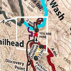
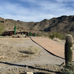
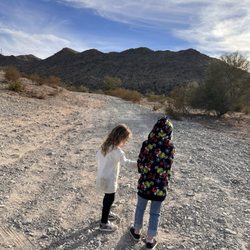
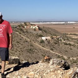
    Butterfield Trail

    5.0 (1 review)

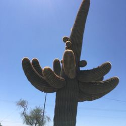
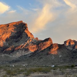
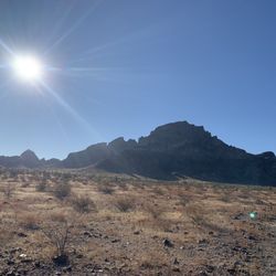
    Butterfield Trail Photos

    You might also consider

    Recommended Reviews - Butterfield Trail

    Your trust is our priority, so businesses can't pay to alter or remove their reviews. Learn more about reviews.
    Yelp app icon
    Browse more easily on the app
    Review Feed Illustration

    18 years ago

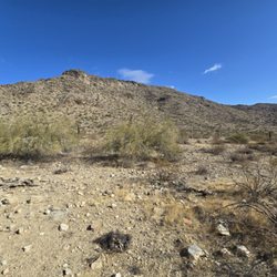
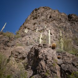
    A great example of the Sonoran Desert. Pristine, quiet and full of wildlife. Only 80 miles to solitude!

    Helpful 0
    Thanks 0
    Love this 0
    Oh no 0

    Verify this business for free

    Get access to customer & competitor insights.

    Verify this business

    Quartz Peak - View of the peak

    Quartz Peak

    5.0(5 reviews)
    23.4 mi

    A difficult hike with amazing views! I loved this hike. It's a long way back to the trailhead from…read morethe road and there are places where having 4x4 or higher clearance would be nice, but I saw a Prius at the trailhead. There are workarounds. It's a long and steady climb, definitely one of the more challenging hikes in the west valley. The last little bit there's some scrambling to get to the peak. The views are amazing and the giant slabs of quartz are beautiful.

    For years, I had stared out at the Sierra Estrella mountains wondering if I'd ever get the chance…read moreto hike to the top of Quartz Peak. I'm a Civic owner, so as soon as I heard about the sand roads and necessity of a high clearance/4x4 vehicle, I thought the day would never come (there's no way I'm buying a gas guzzling Jeep with a 30-mi each way work commute lol). That is, until I met some other awesome hikers from the Valley and coordinated an epic carpool! We met up in downtown Phoenix and headed out in the Jeeps to Goodyear. After getting off the 10 and heading down Estrella/Rainbow Ranch roads for what seemed like a good while, along came the sand/dirt roads. And man did they live up to their reputation! Some super fun off-roading action ensued, and let's just say I was so glad I wasn't in my own little car. One of the hiking buddies advised that he once tried to get to the trailhead in his Dodge Caravan but got stuck in the sand and wrecked the transmission. Yikes! Once we got to the trailhead (obviously an adventure in and of itself), it was a steady 5-6 mile uphill climb to the summit. There are definitely some false Peaks to conquer along the way that are grueling physically and mentally; however, once you get to the last half mile or so, it's a fairly short scramble and totally doable. Once you get to the top, you are greeted by a fantastic view of West Valley, South Mountain, Four Peaks, the Supes, East Valley, and the vast desert to the southwest. The way down is easier on the cardio but harder on the knees due to loose rocks so watch your step and don't rush it. Your legs will probably be sore for the next day or two but it'll be accompanied by the feeling of accomplishment! I also recommend going with a group as I did. Strength and support in numbers people! Plus, you may meet someone new and make friends along the way! I'm not sure when I'll get the chance to hike Quartz Peak again, but now every time I look out to the west at it, the memories will never fade!

    Photos
    Quartz Peak - Rian and me at the top

    Rian and me at the top

    Quartz Peak - Quartz

    Quartz

    Quartz Peak - Rian

    See all

    Rian

    Desert Foothills Trailhead

    Desert Foothills Trailhead

    4.7(23 reviews)
    32.7 mi

    Excellent trail on this chilly morning and I'm very proud of how all the kiddos did. The telegraph…read morepass trail has some incline to it, we went to the old rock "house" structure at the top. Great views. The parking lot here is big and there's a restroom and water fountain. We got started at 8am and it wasn't super busy yet. As day went on more people seemed to be on the trail. It's dog friendly which is great since my boy Flynn loves to hike. Great hike with my peoples.

    This review is for Telegraph Pass Trail. It is an easy to moderate 2.3-mile out-and-back trail in…read morethe Ahwatukee foothills area near the AZ-202. The facilities at the start of the trailhead are pretty nice and clean. I love doing this hike in the evening because you get gorgeous views of the Valley at night. Once you get to the top next to Summit Rd (the road is paved), there is bench that you can rest on. There you can get some great panoramic pictures of the Valley with Sky Harbor airport and Camelback Mountain in the background. Once at the top, you have the option of heading back or accessing one of a few trails that connect to it. There is a little stone house to the west and the transmitter towers that blink red at night on South Mountain to the east. We once brought up s'mores to the stone house at night and had some campfire fun over a mini propane stove. If you continue on with the Kiwanis trail from here, you can see some Hohokam rock art. Telegraph Pass is one of my favorite Valley trails and makes for a fun quick hike.

    Photos
    Desert Foothills Trailhead
    Desert Foothills Trailhead
    Desert Foothills Trailhead

    See all

    Picacho Peak State Park - Hunter trail

    Picacho Peak State Park

    4.6(87 reviews)
    53.2 mi

    An amazing hike! Start early, bring gloves, lunch/snacks, and water!…read more My friends and I hiked to the peak via the Sunset trail, taking the loop back down the Hunter trail (7.1 mi). The first part of the hike is very easy, just out in the open. Though, once you start climbing you are climbing! The gardening gloves we brought helped us feel more secure, so that we didn't lose our grip. Honestly, the pictures made it look more scary than doing it, but if you are afraid of heights do take caution. The cables felt very secure and I felt safe the whole time. The top is very rewarding! There are a lot of bees though, so I wouldn't recommend hanging out there too long. We ended up having our lunch at on of the campsite benches in the shade at the end of the Hunter trail, which was very nice. The last part of the hike is walking on the road, but we didn't mind it after the steep and rocky decline. The bathrooms in the park are incredibly nice for a state park and there were also water bottle fillers. This was a great hike and the Park is also very well-maintained!

    I checked out Picacho Peak State Park, not to be confused with Pikachu, on a Saturday afternoon…read more Located between Phoenix and Tuscon, Picacho was a hike unlike any I've done before. After arriving, you have to pay a $10 entrance fee per person to hike (a bit annoying for a state park but o well). You're given a pamphlet about the park and then it's time for what you came for. We did Hunter's Trail and there was a good amount of parking close to the start of the trail. It's a difficult trail on Alltrails and for good reason. There are parts of the hike where it's so narrow that only one person can go through at the time. There are other parts of the hike where there are steep inclines. And not only that. You'll have to climb using the cables that have been attached to the rock formations. Pro tip: bring gloves. That also means you have to be careful on the way down as you're going down on a decline. Which will be hard on your knees. It's all worth it though, because once you climb the mountain, you'll have breathtaking views of the park. And you'll be so high up that you can see both Tucson and Phoenix in the distance. All in all, if you go at a decent pace, the hike will take you 3-4 hours. There's at least one other trail. And you can also camp in the state park. Last but not least, there's a little museum in the visitor's center. And plenty of facilities. You'll get quite the workout!

    Photos
    Picacho Peak State Park - Going up

    Going up

    Picacho Peak State Park - Looking down

    Looking down

    Picacho Peak State Park

    See all

    Butterfield Trail - hiking - Updated August 2026

    Loading...
    Loading...
    Loading...