Camp Glenwood Photos


You might also consider
More like Camp Glenwood
Recommended Reviews - Camp Glenwood
Start your review...

7 years ago
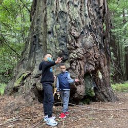
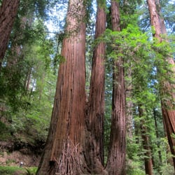
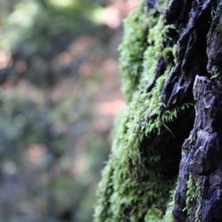
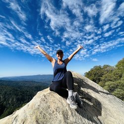
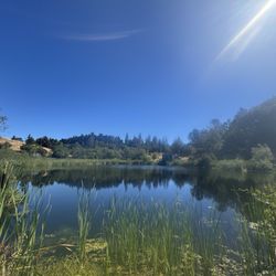
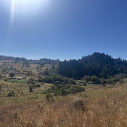
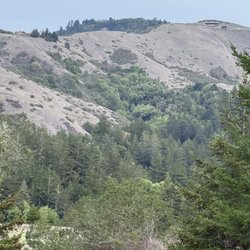
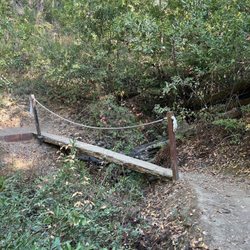
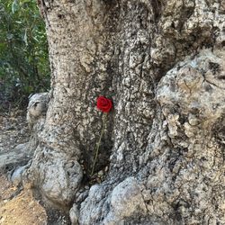
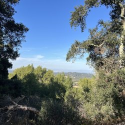
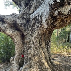
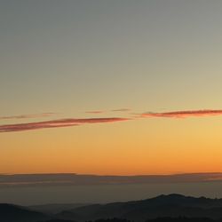
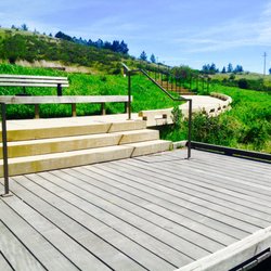
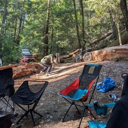
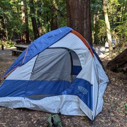
Camp Glenwood is located near the John Henge Rocks and Pacific Crest Trail Crossing. It is a little past Three Points and Camp Valcrest. The place is also known as Glenwood Dad's Club Cabin. You can reach it either by the PCT or Glenwood Camp Road. There is an interesting little cabin at the campground. It snows during the season and when there is enough rain. I believe there are 4 usable spots for camping, I happen to use 1 to set up my Tarp and my buddies Tent. I have only seen the club at the cabin once in all the times I have visited and I asked for permission to stay. This is a cool spot and I recommend staying overnight! Adventure Video https://www.youtube.com/watch?v=zNZeubPVHrI read more


More info about Camp Glenwood
La Honda, CA 94020
Directions
(626) 574-1613
Call Now
Hours
Outdoor Amenities
Other Amenities
You might also consider


Camp Glenwood - hiking - Updated July 2026
Best of La Honda
People found Camp Glenwood by searching for…
Things to Do in La Honda, California
Car Camping in La Honda, California
Waterfalls in La Honda, California
Tent Camping in La Honda, California
Scenic Views in La Honda, California
Rv Dump Station in La Honda, California
Camping Cabins in La Honda, California
Hiking Trails in La Honda, California
Sunset Views in La Honda, California
Walking Trails in La Honda, California
Picnic Areas in La Honda, California
Glamping in La Honda, California
Places to Stay in La Honda, California
Lodging in La Honda, California
Camping Sites in La Honda, California
Cabins in La Honda, California
Easy Hikes in La Honda, California
Picnic Areas BBQ Pits in La Honda, California
Off Leash Dog Hikes in La Honda, California
Public Shower in La Honda, California
Long Term Rv Parking in La Honda, California
Trending Searches in La Honda, CA
4th Of July Fireworks in La Honda, CA
Black Owned Nail Salons in La Honda, CA
Crabbing Location in La Honda, CA
Dog Friendly Trails in La Honda, CA
Jet Ski Rental in La Honda, CA
Long Term Rv Parking in La Honda, CA
Outdoor Activities in La Honda, CA
Places To Walk Around in La Honda, CA
Running Trails in La Honda, CA
Rv Campgrounds in La Honda, CA
Scenic Night View in La Honda, CA
Scenic Overlook in La Honda, CA
Secluded Spots in La Honda, CA
Strawberry Picking in La Honda, CA
Swimming Holes in La Honda, CA
Swimming Lakes in La Honda, CA
Browse Articles
Browse Nearby
BEST of La Honda, California Coffee near Camp Glenwood
BEST of La Honda, California Waterfalls near Camp Glenwood
BEST of La Honda, California Restaurants near Camp Glenwood
BEST of La Honda, California Things to Do near Camp Glenwood
BEST of La Honda, California Breakfast near Camp Glenwood
BEST of La Honda, California Parks near Camp Glenwood
BEST of La Honda, California Hot Springs near Camp Glenwood
Browse Brands
Related Cost Guides
Related Searches in La Honda, CA
Affordable Canoe Rental Options in La Honda, California
Affordable Long Term RV Parking in La Honda, California
Best Day Camps for Children in La Honda, California
Best Fishing Locations and Guides in La Honda, California
Best Places for Horseback Riding in La Honda, California
Best Summer Camps for Kids Located in La Honda, California
Best Waterfalls and Swimming Holes in La Honda, California
Browse Charming Cabins in La Honda, California
Browse Top Hotels in La Honda, California for Your Stay
Browse Vacation Rentals to Book in La Honda, California
Check Out Off Road Trails in La Honda, California
Discover Dog Friendly Beaches Near La Honda, California
Discover Dog Friendly Trails to Explore in La Honda, California
Discover Free Campgrounds in La Honda, California Area
Discover Lakes & Ponds to Explore in La Honda, California
Discover Public Beaches to Visit in La Honda, California
Discover Scenic Beach Camping Sites in La Honda, California
Discover Scenic Hiking Trails in La Honda, California
Discover Scenic Mountain Bike Trails Near La Honda, California
Discover Scenic Waterfall Spots in La Honda, California
Discover Top State Parks to Visit in La Honda, California
Discover Walking Parks in La Honda, California Near You
Discover a Hiking Trail in La Honda, California
Discover the Best Beaches in La Honda, California
Discover the Best Night Hike Trails in La Honda, California
Dog-Friendly Hikes With Dogs in La Honda, California
Enjoy Camping Adventures Around La Honda, California
Enjoy Exciting Mountain Biking Adventures in La Honda, California
Enjoy Hiking Adventures in La Honda, California
Enjoy Kayaking Adventures in La Honda, California
Enjoy RV Camping Adventures in La Honda, California
Enjoy Tent Camping Spots Around La Honda, California
Enjoy a Beautiful Waterfall Hike in La Honda, California
Enjoy a Dog Beach Day in La Honda, California
Enjoy the Best Picnic Spots and Ideas in La Honda, California
Enjoy the Best Walking Trails in La Honda, California
Explore Beautiful Parks and Green Spaces in La Honda, California
Explore Easy Hikes Perfect for All in La Honda, California
Explore Hotels & Travel Options in La Honda, California
Explore Popular Campgrounds Near La Honda, California
Explore Popular Picnic Areas Around La Honda, California
Explore Scenic Lakes to Visit in La Honda, California
Explore Summer Camps for All Ages in La Honda, California
Explore Top Dog Parks in La Honda, California Near You
Explore Top Water Parks in La Honda, California Today
Explore the Best Beach Spots in La Honda, California
Explore the Best Swimming Holes Around La Honda, California
Explore the Best Trail Options in La Honda, California
People who viewed Camp Glenwood also viewed
La Honda Creek Open Space Preserve
9 reviews
Dumbarton Quarry Campground
20 reviews
Sweetwood Camp Site
3 reviews
Sam McDonald Park
25 reviews
Butano Creek Girl Scout Camp
3 reviews
Black Mountain Backpack Camp
4 reviews
Pescadero Creek Park
12 reviews
Berry Creek Falls
8 reviews
Teague Hill Open Space Preserve
5 reviews
Burleigh H Murray Ranch
8 reviews