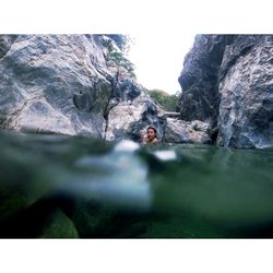
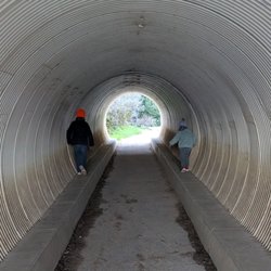
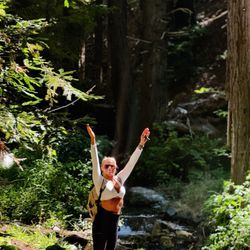
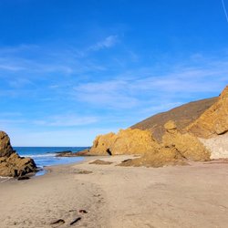
Coast Ridge Road Hike Photos


You might also consider
More like Coast Ridge Road Hike
Recommended Reviews - Coast Ridge Road Hike
Start your review...

2 months ago


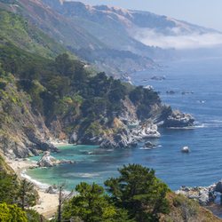
To get to this trail/fire road go to the Ventana Inn/Restaurant. Just before you get to the hotel you'll see a gate on your right that's the trail head. The winding path takes you high above the ocean, there are also some cuts through beautiful shady wooded areas. It's an uphill route, but with a gentle incline so fine for all ages and physical fitness levels. There is no loop so when you're pooped, turn around and head back down! read more


More info about Coast Ridge Road Hike
48123 Hwy 1
Ventana Inn
Big Sur, CA 93920
Directions
Hours
Outdoor Amenities
You might also consider


Coast Ridge Road Hike - hiking - Updated June 2026
Best of Big Sur
People found Coast Ridge Road Hike by searching for…
Hiking Trails With Waterfalls in Big Sur, California
Things to Do in Big Sur, California
Easy Hikes in Big Sur, California
Waterfall in Big Sur, California
Stroller Friendly Hikes in Big Sur, California
Waterfalls and Swimming Holes in Big Sur, California
Redwood Trees in Big Sur, California
Tent Camping in Big Sur, California
Night Hike in Big Sur, California
View Points in Big Sur, California
Scenic View in Big Sur, California
Off Road Trails in Big Sur, California
Walking Trails in Big Sur, California
Fishing Spots in Big Sur, California
River Swimming in Big Sur, California
Shaded Hike in Big Sur, California
Nature Trails in Big Sur, California
Stuff to Do in Big Sur, California
Lookout Points in Big Sur, California
Browse Nearby
BEST of Big Sur, California Restaurants near Coast Ridge Road Hike
BEST of Big Sur, California Coffee near Coast Ridge Road Hike
BEST of Big Sur, California Things to Do near Coast Ridge Road Hike
BEST of Big Sur, California Beaches near Coast Ridge Road Hike
BEST of Big Sur, California Breakfast near Coast Ridge Road Hike
BEST of Big Sur, California Horseback Riding near Coast Ridge Road Hike
BEST of Big Sur, California Campgrounds near Coast Ridge Road Hike
BEST of Big Sur, California Hot Springs near Coast Ridge Road Hike
BEST of Big Sur, California Sightseeing near Coast Ridge Road Hike