Coyote Creek Bike Path Photos



More like Coyote Creek Bike Path
Recommended Reviews - Coyote Creek Bike Path
Start your review...


Reviews With Photos
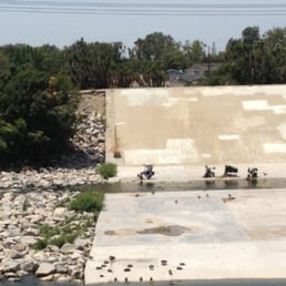

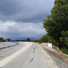
I love riding my bike on this trail to the beach early in the mornings. My ride starts in Cypress right off of Lincoln near the bridge. I take it to Seal Beach and back, roundtrip it's about 14 miles. For the most part, it's a fairly flat ride, with a few dips and inclines when going under overpasses, nothing that a moderate cycler can't keep up with. However, the ride to the beach is slightly more difficult than the ride back, because you are riding against the on-shore winds. Coyote Creek Trail connects to the San Gabriel River Trail on the southern end, right as you are passing the 405 freeway, and follows the bank of the creek through residential and industrial neighborhoods with limited natural connections. The scenery, well there's not much of it, other than people's backyards, most of which are not so beautiful & you also see a lot of factories as you're going through the industrial area. As you get closer to the ocean, the scenery improves, with views of the marina & beautiful homes. I love that it's a fairly easy ride, not too crowded, and it's paved the whole way, which makes for an enjoyable quick ride to the ocean!

7 months ago
Once or twice a year I bike or jog or just show up. A few hours or miles of peace... what a blessing !!! read more

3 years ago

5 years ago

I love riding my bike on this trail to the beach early in the mornings. My ride starts in Cypress right off of Lincoln near the bridge. I take it to Seal Beach and back, roundtrip it's about 14 miles. For the most part, it's a fairly flat ride, with a few dips and inclines when going under overpasses, nothing that a moderate cycler can't keep up with. However, the ride to the beach is slightly more difficult than the ride back, because you are riding against the on-shore winds. Coyote Creek Trail connects to the San Gabriel River Trail on the southern end, right as you are passing the 405 freeway, and follows the bank of the creek through residential and industrial neighborhoods with limited natural connections. The scenery, well there's not much of it, other than people's backyards, most of which are not so beautiful & you also see a lot of factories as you're going through the industrial area. As you get closer to the ocean, the scenery improves, with views of the marina & beautiful homes. I love that it's a fairly easy ride, not too crowded, and it's paved the whole way, which makes for an enjoyable quick ride to the ocean! read more


14 years ago

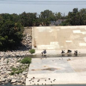
I use this Coyote Creek Bike Path as a connector to get me to the lower section of the San Gabriel River Trail and then to the Shoreline Pedestrian Bike Path that ends at the Catalina Express in Long Beach. All of these river trails are an excellent way to ride a bike a long distance and not have to compete with the cars on the street! For that reason alone, I give this trail five stars. Plus the trail from Katella to Marina Drive was newly paved this year (2012). The Coyote Creek Bike Path merges with the San Gabriel Trail at the bridge crossing just South of Katella. http://www.yelp.com/biz_photos/san-gabriel-river-bike-trail-seal-beach?select=y2m_leYu9H4av0S043GHGA&userid=RoGuDu1egfAvVgb4WmZwUw&utm_campaign=www_photo_share_popup&utm_medium=copy_link&utm_source=(direct) This is where the canal always has an ocean water level and some wildlife habitat. You will most likely see pelicans there. Heading South, you will pass by the Haynes Steam Power Plant between 7th and 2nd Street. At night, the lights from the Power Plant illuminate the trail. After going under PCH, the trail seems to end at Marina Drive. But if you cross Marine Drive, the San Gabriel River Trail actually goes anther half mile or so and ends up at the Rivers End Café. http://www.yelp.com/biz/rivers-end-caf%C3%A9-seal-beach-2?utm_campaign=www_business_share_popup&utm_medium=copy_link&utm_source=(direct) If you go back to Marina Drive, you can take it to go around Alamitos Bay Marina and head for the Shoreline Pedestrian Bike Path to the Queen Mary! http://www.yelp.com/biz_photos/san-gabriel-river-bike-trail-seal-beach?select=4sIxunB7Brmbzk0TlFLKQw&userid=RoGuDu1egfAvVgb4WmZwUw&utm_campaign=www_photo_share_popup&utm_medium=copy_link&utm_source=(direct) After Alamitos Bay Marina you will take a left at 2nd Street, a left at Bay Shore Avenue and another left at 54th Place, which will take you right to the beginning of the Shoreline Pedestrian Bike Path. This trail will take you by the Belmont Plaza Olympic Pool, through Shoreline Village, go around the Aquarium of the Pacific and end at the Catalina Express. If you haven't had enough miles by then or you forgot that you have to ride back... you can stay to your left after you go around the Catalina Express and catch the Los Angeles River Bicycle Path! read more

14 years ago

14 years ago

16 years ago

14 years ago

15 years ago

10 years ago
11 years ago
9 years ago
More info about Coyote Creek Bike Path
Ask the Community - Coyote Creek Bike Path
Is there parking for cars?