Cancel

    Open app

    Search

    Creek Walk

    4.3 (7 reviews)

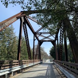
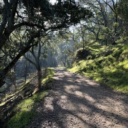
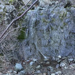
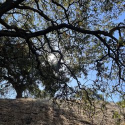
    Creek Walk Photos

    You might also consider

    Recommended Reviews - Creek Walk

    Your trust is our priority, so businesses can't pay to alter or remove their reviews. Learn more about reviews.
    Yelp app icon
    Browse more easily on the app
    Review Feed Illustration

    10 months ago

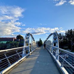
    Beautiful walk in the middle of the city. Can cut through from downtown to other areas of town.

    Helpful 0
    Thanks 0
    Love this 0
    Oh no 0
    Photo of David N.
    215
    2960
    4377

    7 years ago

    Helpful 10
    Thanks 0
    Love this 11
    Oh no 0

    13 years ago

    Helpful 6
    Thanks 0
    Love this 5
    Oh no 1
    Photo of Noor A.
    1853
    260
    369

    5 years ago

    Helpful 15
    Thanks 0
    Love this 11
    Oh no 0
    Photo of Eric B.
    2393
    7744
    7046

    14 years ago

    Helpful 5
    Thanks 0
    Love this 5
    Oh no 0
    Photo of Lydia E.
    13
    95
    47

    7 years ago

    Helpful 0
    Thanks 0
    Love this 0
    Oh no 0
    Photo of Jules T.
    1026
    27
    41

    11 years ago

    Helpful 1
    Thanks 0
    Love this 0
    Oh no 0

    Ask the Community - Creek Walk

    You might also consider

    Verify this business for free

    People searched for Hiking 6,324 times last month within 15 miles of this business.

    Verify this business

    Iron Horse Trail

    Iron Horse Trail

    4.0(48 reviews)
    0.5 mi

    If it weren't for outdoor spaces, I'm not sure where I would have gone during the pandemic lock…read moredown! I've never seen this trail so packed as it was in these past few years! It's been great to start to see the same people and greet one another with a nod, smile, or a hello. What a nice way to connect while social distancing : ) This trail goes on and on, if you look at the regional map: www.traillink.com/trail/iron-horse-regional-trail During the summertime, there are more or less shaded areas, depending on where you go on the trail. You can find the die-hard runners, bikers, and walkers out during the hottest temperatures! During the wintertime, it's refreshing to be in the crisp air, and you'll find A LOT of people exercising as their New Year's Resolutions ; - ) In the fall, the winds can pick up and bring up the dirt on the trails. In the springtime, it's perfect weather, which seems to bring out the most people on weekends. Watch for bunches of people in the middle of the trail or strollers with dogs if you go mid-day. Recently, there have been signs posted alerting people to call out when passing and that there is a maximum of 15 MPH on the trail. This may be due to all of the new trail users who are unfamiliar with which side to walk on or it may be due to the electric bike and scooter riders on the trail. The dogs seem to really like the trail and there are complimentary poop bags that can be found in dispensers along the way to keep the trail clean. The added automatic signal lights are a plus to alert vehicles to oncoming pedestrians and bicyclists. *Note: You can find parking at some of the trail head locations.

    First let me say that this trail is far from uniform from one part to another. The northern portion…read morenear Concord COULD be scenic if all the encampments and trash was cleared out. This portion, miles 0-4, was recently repaved However there are no restrooms along this section. Miles 4-8 can be very congested with people walking dogs and pushing strollers. Even sections with "pedestrian only access" are largely unused and the multi purpose trail has most of the traffic. Miles 8-14 are not very scenic. Mostly backyards. Lots of cross streets making cycling less enjoyable. Miles 14-20 are more backyards and several more cross streets. There are a few narrow bridges over small creeks. Miles 20-24 are fairly industrial. The trail is much cleaner and better patrolled from Walnut Creek south. North is a totally different story. One park employee told me he thought I was brave to ride on that section of the trail. Not a place for families for sure.

    Photos
    Iron Horse Trail - Crossing over the bridge in Walnut Creek

    Crossing over the bridge in Walnut Creek

    Iron Horse Trail
    Iron Horse Trail - Bridge

    See all

    Bridge

    Diablo Foothills Regional Park - Trail

    Diablo Foothills Regional Park

    4.5(45 reviews)
    3.7 mi

    Perhaps unfairly, but as an outsider, I tend to view this part of Contra Costa County as, how do I…read moreput it diplomatically...snooty. There are tract homes that are really mansions in gated communities here. You get a pretty good indication when you take the Livorna Road exit off 680 and head toward the hills. There's a convenient parking lot at the staging area, and the walk begins along a tree-laden path that leads into the Shell Ridge Trail. This is where the open rolling hills provide some challenges to the calves. You eventually make it to the most picturesque portion of the hike on the Mokelumne Coast-to-Crest Trail. This is where the residential areas disappear and you're at one with nature...except for the occasional mountain biker. Small mouth was warranted during such disturbances, but they didn't prevent me from a scenic view of Mt. Diablo (photo: https://bit.ly/3hZ96M1). Now I could've gone deeper into Mt. Diablo State Park, but hey, I'm not a rugged mountaineer. Instead I made a turn and precariously made my way downward to the Alamo Trail. I didn't realize I exited the park until I saw distracted people on the path yelling into their mobile phones as they let their dogs do their business. Hey, where's your scooper, sister? I think with more thoughtful planning, you can probably avoid the ritzy people with their ritzy homes. Maybe not. RELATED - Exploring this part of Contra Costa County? Here's a collection of places I've visited and reviewed: https://bit.ly/2x1rlsD

    This review is for the trail starting at the livorna road staging area…read more I really liked this trail. It's a lot of up and down. The map on all trails leaves out a few mountain top options, so I went off trail a few times and followed an alternative route. This is definitely a trail that you will need your map in order to stay on. I hiked on a cloudy September day, temperature around 75 to 80°. On a hot day with direct sunlight this would be potentially unbearable.

    Photos
    Diablo Foothills Regional Park
    Diablo Foothills Regional Park
    Diablo Foothills Regional Park

    See all

    East Bay Regional Park District - Reinhardt Redwood Regional Park

    East Bay Regional Park District

    4.7(595 reviews)
    8.4 mi

    I went hiking at the Reinhardt Regional Redwood Park for the first time and loved it!…read more Plenty of street parking at the Redwood Bowl lot and we had no issues with vehicle break ins, luckily, although there were a few warning signs up to remind you to put your valuables away. There are bathrooms by the Redwood Bowl but we couldn't find any helpful maps so just used our phones to navigate. The trail we ended up taking was around 4 miles and took 2 hours. Most of it was shaded and among redwood trees so I really enjoyed that this could work as an afternoon hike. It's a moderate difficulty level with some steep areas. There's also a popular picnic area with grills and an archery range. You could even walk to the nearby swimming pool or visit the Chabot. We only did one half of the hiking loop so will be back to check out the other side.
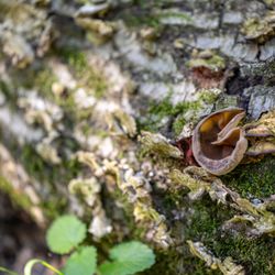
    Peak My Interest…read more ***PLEASE NOTE THIS IS THE YELP PAGE FOR REINHARDT REDWOODS REGIONAL PARK*** I was attempting to change the name to the proper moniker that included "Reinhardt," but Yelp mods, being the highly regarded sort, somehow decided in their infinite wisdom that they should change it to "East Bay Regional Park District"?! What the what?? 0_o So, that's on me, kids. My bad. Onto the review... A giant ±1,833-acre redwood forest nestled in the Oakland Hills, this park was a former logging site back in the 1800s. Fortunately, there has been a nice resurgence of redwoods to replace those that were cut down. It ain't old-growth, but we'll take what we can these days. The Good: * Free at certain times of year and at certain entrances (more below) * Mountain biking on certain trails (check map and trail signage) * Horseback riding on certain trails (check map and trail signage) * Camping available (check website for info and reservations) * Reservable and non-reservable picnic tables (check map & website) * Restrooms available in parking lots, as well as at some campsites * Nearly forty miles of trails with something for everyone * If you're looking for a moderate ±4.5-mile loop, go to the Skyline entrance and take the Serpentine Prairie Trail to Dunn Trail to Golden Spike Trail, then back to Dunn Trail The Meh: * $5/vehicle entrance fee on weekends and major holidays between April and October, only at the Redwood Gate entrance * Most of the trails are pretty decent, but some are in rough shape due to water damage The Ugly: * One of the few parks I've seen with "off-leash" sections for dogs--which is fine, except you know there's a good majority of dog owners who think they can control their dogs but really can't. We saw a panicked guy chasing his dog down a trail at one point, and who knows when--if ever--he caught up to it. ¯_(ツ)_/¯ Conclusion: Great park with tons of trails and lots to see and do.

    Photos
    East Bay Regional Park District - Reinhardt Redwood Regional Preserve

    Reinhardt Redwood Regional Preserve

    East Bay Regional Park District - Reinhardt Redwood Regional Park

    Reinhardt Redwood Regional Park

    East Bay Regional Park District - Reinhardt Redwood Regional Preserve

    See all

    Reinhardt Redwood Regional Preserve

    Creek Walk - hiking - Updated September 2026

    Loading...
    Loading...
    Loading...