Lafayette-Moraga Regional Trail Photos



You might also consider


More like Lafayette-Moraga Regional Trail
Recommended Reviews - Lafayette-Moraga Regional Trail
Start your review...


Reviews With Photos


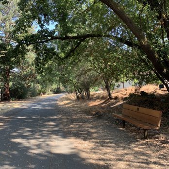
Neat trail with various versions of scenery along its path - I especially liked the wide cement road that stretched across residential neighborhoods where the trail is literally in between houses. It's sort of interesting watching what others have in their backyard! I also liked that the residential part of the trail is 98% shade. Only complaint is that the entrance/ exit to the trail is not available as often... of course, unless you live in one of the houses where your back gate leads you directly to the trail! :)
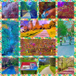

Mule Train! (giddyup, pah, giddahh) *whip crack* (heah)...*whip crack* Mule Train! (yeah-ha) *whip crack* Clippity-cloppin' *whip crack* over hill and plain Seems as how they never stop Clippity-clop, clippity-clop Clippity-clippity, clippity-clippity Clippity-cloppin' along Contra Costa County sure has its share of walking paths. Like the much longer Iron Horse Trail (review: https://bit.ly/3xQqkBU), this one is not really a trail but what the park district accurately describes as a "linear park". That's because it's completely paved, crosses over residential streets, and is surrounded by a variety of foliage that provide at least a visual barrier for the adjacent homeowners. It's about 7-1/2 miles long, and I started at the northern point in Lafayette at the Olympic Blvd staging area where conveniently, there was a parking lot. The route was first used by mule trains to carry redwood from Oakland to Sacramento *whip crack*. I could understand how those pack animals must have felt as a certain monotony crept in as I went further south into Moraga. It was basically upscale suburban life passing me by with kids on their bikes and joggers with their AirPods. I decided to turn around when I reached St. Mary's College and retraced the same suburban path in the other direction. It's pleasant enough, but I imagine those mule started to yawn at some point. Time to crack the whip again. Mule Train! (eeh, heahy-ah) *whip crack...whip crack* Mule Train! (weuh) *whip crack...whip crack* RELATED - Up for a hike? Here's a collection of trails I've walked and reviewed: https://bit.ly/2OrC8nU


Walking in it doesn't look ( on a Sunday ) like there's many people but you'll have multiple you'll run into . Many runners with their kids so perfect if that's what you're looking to do! Just a simple walk. I like more of a scenic route instead only reason it wasn't rated higher. I'd come back for a simple walk if in the area. I would recommend if you don't like steep inclines :) ! Many doggos to say hi to also. There are so many pros, just not my cup of tea! It was fairly cold today but I think I was just unlucky with that since it's usually pretty warm! Thanks for reading hope this helps!


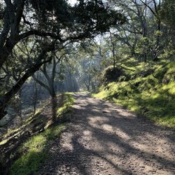
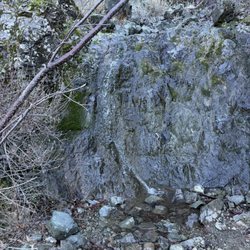
St. Mary's Road Staging Area I was in the Lafayette area, and drove by this trail, and decided to give it a whirl. The staging area is across the street from St. Mary's playing field. There is a parking lot. Their bulletin board could use some attention--it was too small of print to catch my attention. The trail is 7.25 miles. Where I walked, it was wide enough for a truck to drive on. I strolled and took pictures for an hour or so. At one time the trail hosted mule trains; next a steam train moved trees/lumber; and then with collaboration it became a recreational trail for hikers, runners, bikes, wheel chairs, dogs on a leash, and horses. As I was walking, I heard: the shrill call of two hawks overhead; the sound of a creek below (but very difficult to see); birds chattering; and frogs croaking. I did my best to tune out the sounds of cars, and a tree limbing work crew on the road below. There are lots of trees to see--some from previous homesteads/gardens. The poison oak was starting to leaf out--if you stay on the path, you don't have to worry about it. There are benches along the way for resting. There was even a waterfall that was sputtering. There is a lot to look at, and if you wish take pictures of. Also, I saw two nests in one tree. One seemed like it was almost three feet across, but I couldn't get a picture that really showed it. Oh, well. Wonder what you will find?
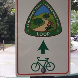

We parked at Moraga Commons and biked north roughly 8 miles to Olympic Blvd staging area. The ride north was easy as you could feel the slight downward grade of the path. At each road crossing the path is clearly marked and you can tell the local drivers know to watch for trail foot traffic. Take a light snack to refuel because once you head back south, the real work begins! The grade is barely noticeable, but on a warm or hot day, it can be a challenge especially as you approach Moraga Commons. There is water and restrooms at Moraga Commons and one other water fountain near the Moraga pumping station about halfway to Olympic Blvd complete with a water bowl for dogs! Nice touch. Great path for walking, biking or running. Beautiful mature oak trees for shade throughout. I went early morning and it wasn't crowded but I can see it getting crowded in the afternoons.


I had the pleasure of walking a few miles on the Moraga side of the Lafayette-Moraga Trail from Moraga Road to Rheem Road and back. The trail is nice and easy to walk on with very little incline. The whole trail is paved which us very nice for walking or riding on, and it's wide enough that you don't have to move for people coming the opposite direction and you can pass others with plenty of space. The part of the trail that I walked on in Moraga was half shaded under trees (the part next to Moraga Commons) and half in the open air in the middle of the field with some houses. The view wasn't too spectacular, but it was nice watching the sun break through the clouds at 7am. The trail wasn't too crowded when I went, but I did pass by a few friendly folks walking or running who would always say hi and good morning. The perks of living in a small town! There is also a small parking lot for the trail in Moraga as well as poop bags and garage cans for dog waste and trash throughout the trail. If in Moraga again I would definitely come back to the trail and try walking on the Lafayette side this time. It's a great asset to the community and a nice way to enjoy the outdoors instead of just walking up and down the streets in the neighborhood.
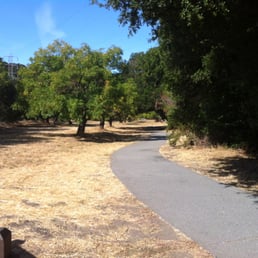

I'm not usually a fan of paved trails, but this one is quite nice. The whole path is 7.65 miles from the Valle Vista Staging Area to the Olympic Blvd Staging Area (though the painted signs on the ground only go up to 7.25 miles, FYI). I've run this trail twice, once starting in Lafayette and once in Moraga. I definitely recommend the Lafayette side of things -- there is more shade and less stop lights. You're basically running through residential neighborhoods and the cross streets are generally small and controlled by stop signs. There's a false flat from Lafayette to Moraga -- meaning that it seems flat, but is actually a 300+ foot climb over 2 miles. Nothing horrendous, but just in case you start wondering why your pace is slower than normal. The one thing I don't like about this trail is the lack of water fountains and bathrooms. There is one water fountain about 1 mile from the Olympic Blvd Staging Area and one at Moraga Commons. For bathrooms, there are flush toilets at Moraga Commons and one porta potty at Valle Vista. Surprisingly, there are no porta potties at Olympic Staging Area. The map says there is also a bathroom at the Lafayette Community Center; however, I tend to forget that it's there because it's a little off the trail and looks like it's private property. As for navigation, it's pretty easy to follow. The places that I found slightly confusing were (1) crossing St. Mary's Road; (2) Moraga Commons; and (3) the slight detour at School St.


I Have biked and hiked and geocached on this trail numerous times. It's t's one of my favorite places to visit, but I don't think there's any bathroom facilities along the way. If you're looking for a beautiful bike ride, this is a great option. read more


I love visiting the east bay city of Lafayette. There are so many beautiful outdoor trails and the town itself is adorable. I was looking to get a morning walk in and a family member brought me to this trail which she typically runs. We parked at the community center off of St Mary's road. Just one of many locations that you can catch the trail. Plenty of parking was available. The 7.65 mile trail runs on both sides of St Mary's road through Lafayette and Moraga We decided to cross over to the other side of the street from the community center and walk towards Moraga. The paved trail can be used for biking and horses as well. The trail towards Moraga has quite a bit of inclines and makes for a good workout. I went 2 miles in and turned around at Rheem Blvd for a 4 mile round-trip walk. Beautiful scenery and lots of people walking their dogs. read more
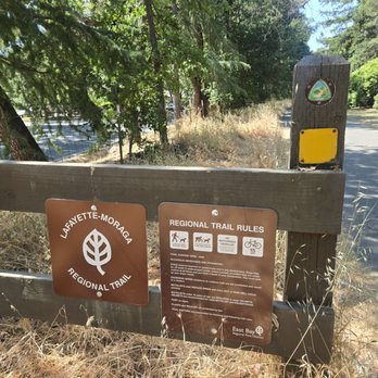


Neat trail with various versions of scenery along its path - I especially liked the wide cement road that stretched across residential neighborhoods where the trail is literally in between houses. It's sort of interesting watching what others have in their backyard! I also liked that the residential part of the trail is 98% shade. Only complaint is that the entrance/ exit to the trail is not available as often... of course, unless you live in one of the houses where your back gate leads you directly to the trail! :) read more
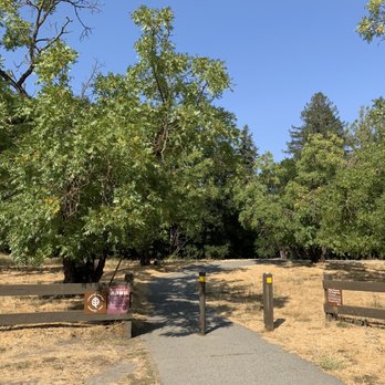


Mule Train! (giddyup, pah, giddahh) *whip crack* (heah)...*whip crack* Mule Train! (yeah-ha) *whip crack* Clippity-cloppin' *whip crack* over hill and plain Seems as how they never stop Clippity-clop, clippity-clop Clippity-clippity, clippity-clippity Clippity-cloppin' along Contra Costa County sure has its share of walking paths. Like the much longer Iron Horse Trail (review: https://bit.ly/3xQqkBU), this one is not really a trail but what the park district accurately describes as a "linear park". That's because it's completely paved, crosses over residential streets, and is surrounded by a variety of foliage that provide at least a visual barrier for the adjacent homeowners. It's about 7-1/2 miles long, and I started at the northern point in Lafayette at the Olympic Blvd staging area where conveniently, there was a parking lot. The route was first used by mule trains to carry redwood from Oakland to Sacramento *whip crack*. I could understand how those pack animals must have felt as a certain monotony crept in as I went further south into Moraga. It was basically upscale suburban life passing me by with kids on their bikes and joggers with their AirPods. I decided to turn around when I reached St. Mary's College and retraced the same suburban path in the other direction. It's pleasant enough, but I imagine those mule started to yawn at some point. Time to crack the whip again. Mule Train! (eeh, heahy-ah) *whip crack...whip crack* Mule Train! (weuh) *whip crack...whip crack* RELATED - Up for a hike? Here's a collection of trails I've walked and reviewed: https://bit.ly/2OrC8nU read more





1 year ago

4 years ago
Walking in it doesn't look ( on a Sunday ) like there's many people but you'll have multiple you'll run into . Many runners with their kids so perfect if that's what you're looking to do! Just a simple walk. I like more of a scenic route instead only reason it wasn't rated higher. I'd come back for a simple walk if in the area. I would recommend if you don't like steep inclines :) ! Many doggos to say hi to also. There are so many pros, just not my cup of tea! It was fairly cold today but I think I was just unlucky with that since it's usually pretty warm! Thanks for reading hope this helps! read more


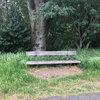


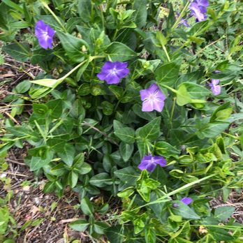
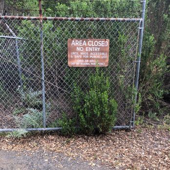


St. Mary's Road Staging Area I was in the Lafayette area, and drove by this trail, and decided to give it a whirl. The staging area is across the street from St. Mary's playing field. There is a parking lot. Their bulletin board could use some attention--it was too small of print to catch my attention. The trail is 7.25 miles. Where I walked, it was wide enough for a truck to drive on. I strolled and took pictures for an hour or so. At one time the trail hosted mule trains; next a steam train moved trees/lumber; and then with collaboration it became a recreational trail for hikers, runners, bikes, wheel chairs, dogs on a leash, and horses. As I was walking, I heard: the shrill call of two hawks overhead; the sound of a creek below (but very difficult to see); birds chattering; and frogs croaking. I did my best to tune out the sounds of cars, and a tree limbing work crew on the road below. There are lots of trees to see--some from previous homesteads/gardens. The poison oak was starting to leaf out--if you stay on the path, you don't have to worry about it. There are benches along the way for resting. There was even a waterfall that was sputtering. There is a lot to look at, and if you wish take pictures of. Also, I saw two nests in one tree. One seemed like it was almost three feet across, but I couldn't get a picture that really showed it. Oh, well. Wonder what you will find? read more


We parked at Moraga Commons and biked north roughly 8 miles to Olympic Blvd staging area. The ride north was easy as you could feel the slight downward grade of the path. At each road crossing the path is clearly marked and you can tell the local drivers know to watch for trail foot traffic. Take a light snack to refuel because once you head back south, the real work begins! The grade is barely noticeable, but on a warm or hot day, it can be a challenge especially as you approach Moraga Commons. There is water and restrooms at Moraga Commons and one other water fountain near the Moraga pumping station about halfway to Olympic Blvd complete with a water bowl for dogs! Nice touch. Great path for walking, biking or running. Beautiful mature oak trees for shade throughout. I went early morning and it wasn't crowded but I can see it getting crowded in the afternoons. read more
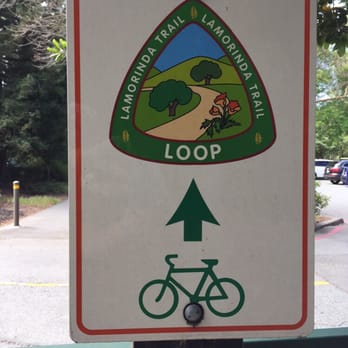
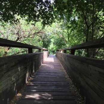


I had the pleasure of walking a few miles on the Moraga side of the Lafayette-Moraga Trail from Moraga Road to Rheem Road and back. The trail is nice and easy to walk on with very little incline. The whole trail is paved which us very nice for walking or riding on, and it's wide enough that you don't have to move for people coming the opposite direction and you can pass others with plenty of space. The part of the trail that I walked on in Moraga was half shaded under trees (the part next to Moraga Commons) and half in the open air in the middle of the field with some houses. The view wasn't too spectacular, but it was nice watching the sun break through the clouds at 7am. The trail wasn't too crowded when I went, but I did pass by a few friendly folks walking or running who would always say hi and good morning. The perks of living in a small town! There is also a small parking lot for the trail in Moraga as well as poop bags and garage cans for dog waste and trash throughout the trail. If in Moraga again I would definitely come back to the trail and try walking on the Lafayette side this time. It's a great asset to the community and a nice way to enjoy the outdoors instead of just walking up and down the streets in the neighborhood. read more


14 years ago
I'm not usually a fan of paved trails, but this one is quite nice. The whole path is 7.65 miles from the Valle Vista Staging Area to the Olympic Blvd Staging Area (though the painted signs on the ground only go up to 7.25 miles, FYI). I've run this trail twice, once starting in Lafayette and once in Moraga. I definitely recommend the Lafayette side of things -- there is more shade and less stop lights. You're basically running through residential neighborhoods and the cross streets are generally small and controlled by stop signs. There's a false flat from Lafayette to Moraga -- meaning that it seems flat, but is actually a 300+ foot climb over 2 miles. Nothing horrendous, but just in case you start wondering why your pace is slower than normal. The one thing I don't like about this trail is the lack of water fountains and bathrooms. There is one water fountain about 1 mile from the Olympic Blvd Staging Area and one at Moraga Commons. For bathrooms, there are flush toilets at Moraga Commons and one porta potty at Valle Vista. Surprisingly, there are no porta potties at Olympic Staging Area. The map says there is also a bathroom at the Lafayette Community Center; however, I tend to forget that it's there because it's a little off the trail and looks like it's private property. As for navigation, it's pretty easy to follow. The places that I found slightly confusing were (1) crossing St. Mary's Road; (2) Moraga Commons; and (3) the slight detour at School St. read more
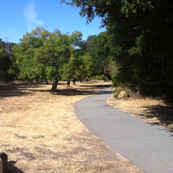


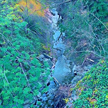
Beautiful walking and biking trail that hugs the contours of Las Trampas Creek and San Leandro Creek, as it wanders through the Moraga Valley. We parked at the staging area at Lafayette Community Center, which has water fountains and nice restrooms. Then biked along the trail for about 4 miles to the Valle Vista terminus. It's a very pleasant trail, passing by horse stables, the creeks, and cows on hills. The only reason it doesn't get five stars is that you can hear and see the main streets with cars for a good portion of the time (though not most of the time). And the bike path turns into surface street sidewalks by the Safeway in downtown Moraga. Other than that - a great way to spend the day! Check out the pleasant scenery in my picture of Valle Vista. read more


12 years ago

13 years ago

13 years ago

13 years ago
More info about Lafayette-Moraga Regional Trail
Ask the Community - Lafayette-Moraga Regional Trail
I read that the trail is closed due to a landslide, is this true?
Review Highlights - Lafayette-Moraga Regional Trail
You might also consider





















Why does Yelp recommend reviews?
2 reviews that are not currently recommended
The reviews below are not factored into the business's overall star rating.

5 years ago
Lafayette-Moraga Regional Trail - hiking - Updated September 2026
Best of Walnut Creek
People found Lafayette-Moraga Regional Trail by searching for…
Hiking Trails With Waterfalls in Walnut Creek, CA
Walking Trails in Walnut Creek, CA
Places to Take Pictures in Walnut Creek, CA
Beautiful Views in Walnut Creek, CA
Redwood Trees in Walnut Creek, CA
Running Trails in Walnut Creek, CA
Scenic View in Walnut Creek, CA
Scenic Drive in Walnut Creek, CA
Off Leash Dog Hiking Trails in Walnut Creek, CA
Off Road Trails in Walnut Creek, CA
Walking Groups in Walnut Creek, CA
Abandoned Places in Walnut Creek, CA
Mountain Bike Trails in Walnut Creek, CA
Fishing Spots in Walnut Creek, CA
Shaded Hike in Walnut Creek, CA
Stroller Walk in Walnut Creek, CA
Star Gazing in Walnut Creek, CA
Parks for Kids in Walnut Creek, CA
Playgrounds in Walnut Creek, CA
Trending Searches in Walnut Creek, CA
Apple Orchards near Lafayette-Moraga Regional Trail
Apple Picking near Lafayette-Moraga Regional Trail
Archery near Lafayette-Moraga Regional Trail
Barbershop near Lafayette-Moraga Regional Trail
Blow Dry Bar near Lafayette-Moraga Regional Trail
Cliff Jumping near Lafayette-Moraga Regional Trail
Consignment Shops near Lafayette-Moraga Regional Trail
Corn Maze near Lafayette-Moraga Regional Trail
Dog Friendly Things To Do near Lafayette-Moraga Regional Trail
Dog Swimming near Lafayette-Moraga Regional Trail
Eyelash Extensions near Lafayette-Moraga Regional Trail
Formal Wear near Lafayette-Moraga Regional Trail
Hiking Trails near Lafayette-Moraga Regional Trail
Kids Birthday Party near Lafayette-Moraga Regional Trail
Makeup Artists near Lafayette-Moraga Regional Trail
Mens Suits near Lafayette-Moraga Regional Trail
Off Road Trails near Lafayette-Moraga Regional Trail
Parks near Lafayette-Moraga Regional Trail
Photo Spots near Lafayette-Moraga Regional Trail
Picnic Areas near Lafayette-Moraga Regional Trail
Places To Take Pictures near Lafayette-Moraga Regional Trail
Private Schools near Lafayette-Moraga Regional Trail
Public Shower near Lafayette-Moraga Regional Trail
Pumpkin Patches near Lafayette-Moraga Regional Trail
Rock Quarry near Lafayette-Moraga Regional Trail
Scenic Night View near Lafayette-Moraga Regional Trail
Scenic Overlook near Lafayette-Moraga Regional Trail
Browse Articles
Browse Nearby
BEST of Walnut Creek, California Coffee near Lafayette-Moraga Regional Trail
BEST of Walnut Creek, California Restaurants near Lafayette-Moraga Regional Trail
BEST of Walnut Creek, California Things to Do near Lafayette-Moraga Regional Trail
BEST of Walnut Creek, California Breakfast near Lafayette-Moraga Regional Trail
BEST of Walnut Creek, California Walking Trails near Lafayette-Moraga Regional Trail
BEST of Walnut Creek, California Parks near Lafayette-Moraga Regional Trail
BEST of Walnut Creek, California Caves near Lafayette-Moraga Regional Trail
BEST of Walnut Creek, California Campgrounds near Lafayette-Moraga Regional Trail
BEST of Walnut Creek, California Sightseeing near Lafayette-Moraga Regional Trail
Browse Brands
Related Searches in Walnut Creek, CA
Best Dog Hiking Trails Around Walnut Creek, California
Best Fishing Locations and Guides in Walnut Creek, California
Best Nature Trails for Hiking in Walnut Creek, California
Best Places for Horseback Riding in Walnut Creek, California
Best Sightseeing Experiences Available in Walnut Creek, California
Check Out Off Road Trails in Walnut Creek, California
Discover Dog Friendly Trails to Explore in Walnut Creek, California
Discover Easy Hiking Trails Near Walnut Creek, California
Discover Kid Friendly Hiking Trails in Walnut Creek, California
Discover Popular Bike Trails in Walnut Creek, California
Discover Scenic Mountain Bike Trails Near Walnut Creek, California
Discover Walking Parks in Walnut Creek, California Near You
Discover a Hiking Trail in Walnut Creek, California
Discover the Best Night Hike Trails in Walnut Creek, California
Dog-Friendly Hikes With Dogs in Walnut Creek, California
Enjoy Camping Adventures Around Walnut Creek, California
Enjoy Kayaking Adventures in Walnut Creek, California
Enjoy Off Leash Dog Hikes in Walnut Creek, California
Enjoy Scenic Places to Walk in Walnut Creek, California
Enjoy a Beautiful Waterfall Hike in Walnut Creek, California
Enjoy the Best Walking Path in Walnut Creek, California
Enjoy the Best Walking Trails in Walnut Creek, California
Explore Beautiful Parks and Green Spaces in Walnut Creek, California
Explore Easy Hikes Perfect for All in Walnut Creek, California
Explore Fun Activities to Do in Walnut Creek, California
Explore Popular Campgrounds Near Walnut Creek, California
Explore Popular Dog Walking Trails in Walnut Creek, California
Explore Top Dog Parks in Walnut Creek, California Near You
Explore the Best Beach Spots in Walnut Creek, California
Family Friendly Hiking With Kids in Walnut Creek, California
Find Beautiful Views in Walnut Creek, California
Find Cozy Camping Cabins in Walnut Creek, California
Find Top Dog Friendly Parks to Visit in Walnut Creek, California
Find Top-Rated Waterfalls in Walnut Creek, California Now
Find the Best Parks for Picnics in Walnut Creek, California
Hiking Trails With Waterfalls in Walnut Creek, California
Off Leash Dog Hiking Trails in Walnut Creek, California
Popular Outdoor Activities to Try in Walnut Creek, California
Popular Picnic Spots to Visit in Walnut Creek, California
Popular Waterfall Hiking Trails in Walnut Creek, California
Safe River Swimming Areas in Walnut Creek, California
Safe and Fun Parks for Kids in Walnut Creek, California
Top Hiking Trails to Explore in Walnut Creek, California
Top Playgrounds for Kids to Enjoy in Walnut Creek, California
Top Running Trails to Explore in Walnut Creek, California
Top Swimming Lakes to Enjoy in Walnut Creek, California
Top Swimming Spots and Pools in Walnut Creek, California
Walk Dog Friendly Hiking Trails in Walnut Creek, California
Walk the Best Paved Walking Trails in Walnut Creek, California


