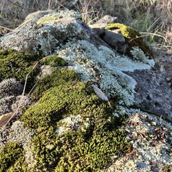
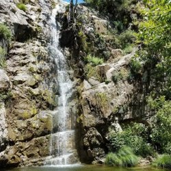
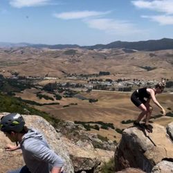
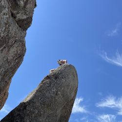
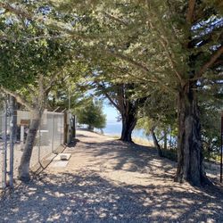
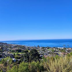
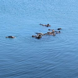
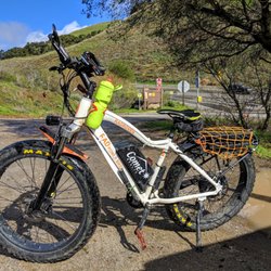
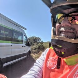
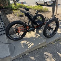
Cuesta Ridge Photos


You might also consider
More like Cuesta Ridge
Recommended Reviews - Cuesta Ridge
Start your review...

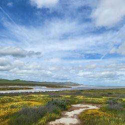
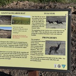
Local Eval.: A rather challenging scenic 1.4 hour all downhill hike on historic ole Stagecoach Rd. [where Stagecoaches used to run] with some complications. This past Saturday morning we had a hiking mission, to park one car at the bottom of Stagecoach Rd., which is typically deserted [where we also discovered a mysterious dark pedestrian/bike tunnel under the 101], and our other car at the top, of the West side of Cuesta Ridge. While most hike up to TV tower road, we wanted to enjoy only a one way downhill historic route. Most of the dirt road had amazing views, including forrest, trees, mountain streams, flowers, & views of the train tunnels built long ago by Chinese laborers by hand. Almost right as we started, we ran into 2 mountain bikers, & 2 vehicles [e.g. a Jeep] going up the steep grade, and we had a nice long friendly chat with a local biker, & the driver of the Jeep. They both reassured us that the way down was clear & scenic. As we made it about 1/3 of the way down, we realized that we had forgotten the bottom car's keys in the top one. Ugh! What to do? I decided to continue enjoying our trek & hopefully find another way back up as we descended. Not sure if Uber was an option at the edge of SLO. My i-watch claimed that we went 2.5 miles & took about 1.4 hours. Of course we took a few stops to gaze at the views & admire wild flowers, streams, & more. As we reached the bottom of the valley & saw lots of cows, and then some houses, I was hopeful. We then happen to meet some nice people & one kindly offered to drive us back up, the way we came. My honey was quite terrified with passenger side views of the shear drop! Once we drove back to the bottom to rescue our other car, we found 2 friendly police cars were right next to our car & another. The other car may have been speeding [which is quite common & dangerous down the steep grade]? While we were happy to see them, I would imagine that the others were not. Fortunately, both our car & we were intact! What a "historic", thrilling, & yet another, successful scenic local adventure almost in our glorious "backyard"! Near the summit, you will find an plaque dedicated to the engineers that built Cuesta Grade, from the ASCE in 2004. If you do turn off for hiking/biking on Stagecoach Rd., try not to drive up/down Stagecoach Rd.. Not only can you fall off the cliff, but there are falling rocks. It is a wide steep path...but use CAUTION! "Alltrails.com" has info. on these Cuesta Trails & I also posted some pics. In the past, before the ole 101 was build, many a Stagecoach, went flying down this steep grade, since brakes failed. People were advised to walk down, like we did over a hundred years later! The local Tribune Newspaper had a fairly recent article & pics on some of the history. It was: "From stagecoach robberies to railroads, SLO's new train tracks signaled end of an era" by D. Middlecamp on 8/29/19, which went on to say..."About a dozen people pose for a photo with a six-horse stagecoach outside the Ramona Hotel in San Luis Obispo on May 5, 1894... The last stagecoach over the Cuesta Grade departed as the Southern Pacific Railroad arrived in town...San Luis Obispo was finally connected to the larger world by rail. The Santa Lucia Range had terminated the line five years earlier in Santa Margarita. The 17 miles of track Southern Pacific built over the Cuesta Grade would be the highest elevation and most expensive 17 miles on the Coast Line between San Francisco and Los Angeles. Estimates vary but the track cost the railroad between $1.5 and $3 million to build. The original tunnels removed 1,100,000 cubic yards of rock from under the Santa Lucia Range. A later expansion removed more rock, making the amount of earth moved similar to the amount removed for the footing of the Hoover Dam. The Sept. 21, 1950, edition of Engineering News-Record called the work "a world's record for hand-drilled tunnels that may well still be unbeaten today."... Freight wagons, which required six or eight horses, could take eight hours to cross the grade with the teamster jamming his foot on the brake on the road down. Old Stage Coach Road was built with Chinese labor and a $20,000 county bond in 1876. It was an improvement over the bottom-of-the-canyon padre's trail between the Mission and Santa Margarita." Read more here: sanluisobispo.com/news/l... There is tons of history surround this, and nearby areas. You may want to Goggle the history of Santa Margarita, Ah Louis & his Chinese cohorts who built the railroad tunnels, SLO Mission, Chumash, Spanish, Pozo,& the first Motel in the USA. Link: http://historic101.com/Cuesta/main.htm While there is the aforementioned plaque, there is now no commemoration of how Chinese immigrants somehow carved the railroad, tunnels, & more [except for the statue honoring the Chinese at SLO's rail station]. read more


5 years ago
More info about Cuesta Ridge
Forest Rte 29S11
Santa Margarita, CA 93453
Directions
Hours
Outdoor Amenities
You might also consider


Cuesta Ridge - hiking - Updated July 2026
Best of Santa Margarita
People found Cuesta Ridge by searching for…
Off Road Trails in Santa Margarita, California
Hiking Trails With Waterfalls in Santa Margarita, California
Running Trails in Santa Margarita, California
Scenic Drive in Santa Margarita, California
Walking Trails in Santa Margarita, California
Scenic View in Santa Margarita, California
Parks in Santa Margarita, California
Things to Do in Santa Margarita, California
Canyoneering in Santa Margarita, California
Trail in Santa Margarita, California
Fall Colors in Santa Margarita, California
Forest in Santa Margarita, California
Lookout Points in Santa Margarita, California
Swimming Holes in Santa Margarita, California
Splash Pad in Santa Margarita, California
Bike Paths in Santa Margarita, California
Shaded Hike in Santa Margarita, California
Photo Spots in Santa Margarita, California
Stroller Friendly Hikes in Santa Margarita, California
Off Leash Dog Hikes in Santa Margarita, California
Dirt Bike Trails in Santa Margarita, California
Wildflowers in Santa Margarita, California
Trending Searches in Santa Margarita, CA
4th Of July Fireworks in Santa Margarita, CA
Boat Rental in Santa Margarita, CA
Cliff Jumping in Santa Margarita, CA
Jet Ski Rental in Santa Margarita, CA
Kayak Rental in Santa Margarita, CA
Outdoor Activities in Santa Margarita, CA
Public Pools in Santa Margarita, CA
Public Shower in Santa Margarita, CA
River Swimming in Santa Margarita, CA
River Tubing in Santa Margarita, CA
Rock Quarry in Santa Margarita, CA
Scenic Night View in Santa Margarita, CA
Secluded Spots in Santa Margarita, CA
Soccer Store in Santa Margarita, CA
Splash Pad in Santa Margarita, CA
Strawberry Picking in Santa Margarita, CA
Sunrise View in Santa Margarita, CA
Swimming Holes in Santa Margarita, CA
Swimming Lakes in Santa Margarita, CA
U Pick Farms in Santa Margarita, CA
Browse Articles
Browse Nearby
BEST of Santa Margarita, California Restaurants near Cuesta Ridge
BEST of Santa Margarita, California Coffee near Cuesta Ridge
BEST of Santa Margarita, California Breakfast near Cuesta Ridge
BEST of Santa Margarita, California Things to Do near Cuesta Ridge
BEST of Santa Margarita, California Wineries near Cuesta Ridge
BEST of Santa Margarita, California Hot Springs near Cuesta Ridge
BEST of Santa Margarita, California Campgrounds near Cuesta Ridge
BEST of Santa Margarita, California Thrift Stores near Cuesta Ridge
Browse Brands
Related Searches in Santa Margarita, CA
Affordable Kayak Rental Services in Santa Margarita, California
Best Fishing Locations and Guides in Santa Margarita, California
Best Places for Horseback Riding in Santa Margarita, California
Check Out Off Road Trails in Santa Margarita, California
Discover Dog Friendly Trails to Explore in Santa Margarita, California
Discover Scenic Mountain Bike Trails Near Santa Margarita, California
Discover Scenic Waterfall Spots in Santa Margarita, California
Discover Top Boat Tours in Santa Margarita, California for All Ages
Discover Top State Parks to Visit in Santa Margarita, California
Discover a Hiking Trail in Santa Margarita, California
Discover the Best Night Hike Trails in Santa Margarita, California
Discover the Best Running Track in Santa Margarita, California
Enjoy Camping Adventures Around Santa Margarita, California
Enjoy Kayaking Adventures in Santa Margarita, California
Enjoy Tent Camping Spots Around Santa Margarita, California
Enjoy Water Activities and Fun in Santa Margarita, California
Enjoy a Dog Beach Day in Santa Margarita, California
Enjoy the Best Walking Trails in Santa Margarita, California
Exciting Cliff Jumping Spots in Santa Margarita, California
Experience Thrilling White Water Rafting in Santa Margarita, California
Explore Beautiful Parks and Green Spaces in Santa Margarita, California
Explore Easy Hikes Perfect for All in Santa Margarita, California
Explore Fun Activities to Do in Santa Margarita, California
Explore Popular Campgrounds Near Santa Margarita, California
Explore Top Dog Parks in Santa Margarita, California Near You
Explore the Best Beach Spots in Santa Margarita, California
Explore the Best Boating Spots in Santa Margarita, California
Explore the Best Swimming Holes Around Santa Margarita, California
Family Friendly Hiking With Kids in Santa Margarita, California
Find Beautiful Views in Santa Margarita, California
Find Fun Kids Activities Outdoor in Santa Margarita, California
Find Parks and Recreation Activities in Santa Margarita, California
Find Popular Ziplining Spots Around Santa Margarita, California
Find the Best Parks for Picnics in Santa Margarita, California
Find the Best Playgrounds to Visit in Santa Margarita, California
Hiking Trails With Waterfalls in Santa Margarita, California
Off Leash Dog Hiking Trails in Santa Margarita, California
Plan Nature Center Visits in Santa Margarita, California
Popular Fishing Spots to Explore in Santa Margarita, California
Popular Outdoor Activities to Try in Santa Margarita, California
Popular Picnic Spots to Visit in Santa Margarita, California
Popular Things to Do in Santa Margarita, California
Safe River Swimming Areas in Santa Margarita, California
Safe and Fun Parks for Kids in Santa Margarita, California
Top Playgrounds for Kids to Enjoy in Santa Margarita, California
Top Running Trails to Explore in Santa Margarita, California
Top Swimming Lakes to Enjoy in Santa Margarita, California
Top Things to Do With Kids in Santa Margarita, California
Visit Popular BBQ Park Locations in Santa Margarita, California
Walk Dog Friendly Hiking Trails in Santa Margarita, California