Cancel

    Open app

    Search

    El Scorpion Canyon Park

    4.6 (14 reviews)

    El Scorpion Canyon Park Photos

    You might also consider

    Recommended Reviews - El Scorpion Canyon Park

    Your trust is our priority, so businesses can't pay to alter or remove their reviews. Learn more about reviews.
    Yelp app icon
    Browse more easily on the app
    Review Feed Illustration

    Reviews With Photos

    Kendra R.

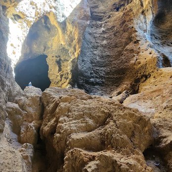
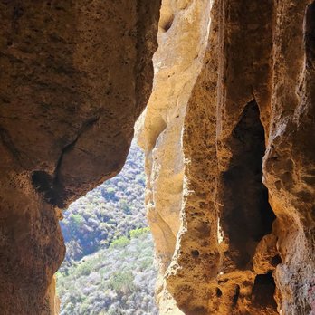
    I'd rate this hike scale of 1-10 on difficulty 4.5/10 depending on the weather. I went at 90° weather so that was what made it a bit difficult for me. Little to no shade in certain areas if you're trying to see this cave section so be prepared! The cave is small but really cool to see! I also recommend bringing your own equipment for a certain section if you do like climbing.

    Cave of Munits
    Andrea E.

    I love this this place so much. It's my home away from home. There's so many trails to choose from. Your hike can be as easy or intense as you're craving - El Scorpion Park has something for everyone.

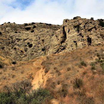
    Castle Rock
    Isobel L.

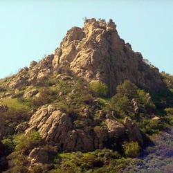
    El Scorpion Canyon Park holds an honored place in Southern California history, as it takes its name from the Native American village located near the base of Castle Rock (the village was called Ati'vsng, meaning scorpion, and was a location for trading between the Chumash and Gabrielino). This land has an unusual history for the area; it was given as part of a Mexican land grant to a Chumash chief and his family who called it Rancho El Escorpión (most often land grants were given to soldiers and those in power rather than the Native Americans who had lived there for hundreds of years before the European invasion). In addition to this history, the location plays an important part in the literature of the Gabrielino/Tongva. The Cave of Munits and Castle Rock both lie within the park. These landmarks are where according to the story, a sorcerer murdered the son of a chief in the cave and then was killed himself (on top of Castle Rock, which although it does look like a castle, is actually named after the Chumash "Kas'elew", meaning tongue.) The actual Cave of Munits has reportedly caved in but it's close enough. It's possible to visit both locations during your hike; it's about a 2.5 mile loop trail, with steep climbs towards the peak. As a place to hike, I love El Scorpion. The trails are well-maintained and it's possible to take either a short scenic stroll or a longer, more strenuous hike. Look out for mountain bikers whizzing down the trails. I parked on Vanowen, near the Vanowen trailhead. Street parking is free. Take water and sunscreen and, of course, your camera. Enjoy.

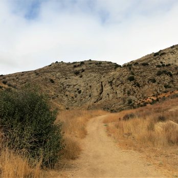
    Hot 108 degree day 2021
    Franklin M.

    Who would have known that this cool hiking trail park is in this neighborhood. I arrived before sunset and was kind of scared because no one was around and I thought what a perfect place to get attacked by a mountain lion LOL. I ended up seeing more hikers and bikers after a few minutes as I headed toward the caves.
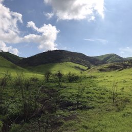
    Mountains
    Stefany M.

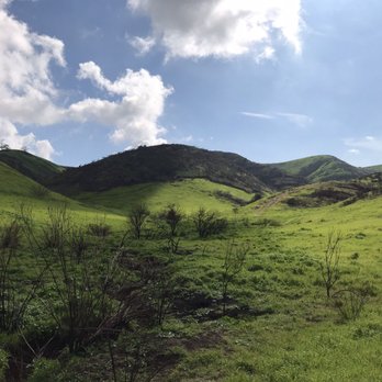
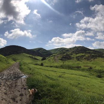
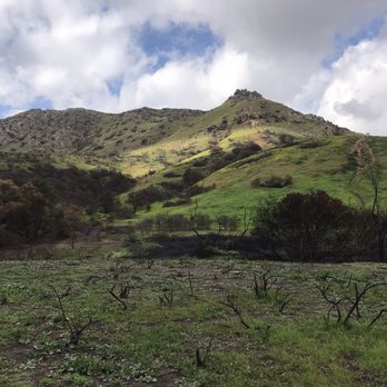
    One of my favorite spots to come to, sadly everything burned down a couple months ago due to the fires. But everything is now growing beautifully, and everything is so green it's definitely a must visit. You'll be in awe.

    Surrounded in residential neighborhood- Hand made bonfire pit near trees, dried leaves, weeds/ bushes. Could turn easily into large fire.

    See all

    9 months ago

    Helpful 1
    Thanks 1
    Love this 0
    Oh no 0

    8 months ago

    Helpful 0
    Thanks 0
    Love this 1
    Oh no 0

    9 months ago

    Helpful 1
    Thanks 0
    Love this 1
    Oh no 0

    9 months ago

    Helpful 0
    Thanks 0
    Love this 1
    Oh no 0
    Photo of Amanda C.
    118
    14
    4

    8 months ago

    Helpful 0
    Thanks 0
    Love this 0
    Oh no 0

    2 years ago

    Helpful 0
    Thanks 0
    Love this 0
    Oh no 0

    6 years ago

    Helpful 33
    Thanks 0
    Love this 22
    Oh no 0

    5 years ago

    Helpful 2
    Thanks 0
    Love this 2
    Oh no 0
    Photo of A H.
    2
    146
    21

    8 years ago

    Helpful 5
    Thanks 0
    Love this 1
    Oh no 0

    7 years ago

    Helpful 1
    Thanks 0
    Love this 1
    Oh no 0

    9 years ago

    Helpful 0
    Thanks 0
    Love this 0
    Oh no 1

    6 years ago

    favorite hiking place! wear good shoes if you want to climb on the rocks. i fell once but if you are careful you can do it. beautiful views

    Helpful 0
    Thanks 0
    Love this 0
    Oh no 0

    9 years ago

    Helpful 1
    Thanks 0
    Love this 1
    Oh no 0

    8 years ago

    Helpful 0
    Thanks 0
    Love this 0
    Oh no 0

    Ask the Community - El Scorpion Canyon Park

    Review Highlights - El Scorpion Canyon Park

    I would say to come earlier in the day as there aren't many shady areas to rest under on a hot day.

    Mentioned in 2 reviews

    Read more highlights

    You might also consider

    Verify this business for free

    People searched for Hiking 5,340 times last month within 15 miles of this business.

    Verify this business

    Grandma Prisbrey's Bottle Village

    Grandma Prisbrey's Bottle Village

    4.1(17 reviews)
    7.7 km

    The world loves a dreamer. And dreamers come in all different forms. Grandma Prisbrey began living…read moreher dream at age 60, on her third marriage, by using found materials from a local landfill and creating her own art environment called Bottle Village. Grandma P lived on the property after a colorful life; she had 7 children with her husband who was 37 years older than her and reportedly worked as a singer in a bar at one point. She may have been something of a hoarder (she build one building just to store her pencil collection) and used her collections as raw materials for the art and buildings on her property including the Pencil House and the Round House. A group of us attended a private tour (suggested donation $15 per person) led by our fantastic tour guide, Debbie. She provided us with fascinating local history of Bottle Village including how a developer almost tricked Grandma P out of the property (he committed suicide three months later, guilty conscience?) and how some local politicians blocked FEMA funds from helping Bottle Village rebuild after the Northridge earthquake. Luckily, a nonprofit was organized to support and maintain this unique work of art. We learned that Bottle Village has appeared in a number of architecture and history books. It is truly a unique art expression on so many levels, not the least of which is the age and gender of the artist. Please contact the nonprofit at the internet link below if you would like to schedule a tour. Highly recommended. http://www.bottlevillage.com/
    I live in this area. Went to see it, I thought what the heck. I was not impressed. It looks like…read morea bunch of garbage thrown together and I definitely would not pay to get in. Its chain length fenced off right now. I can see why it didnt get any fema funds. Coming from a trained professional artist all I can say is, everything is NOT art. And this is one of them.

    Photos
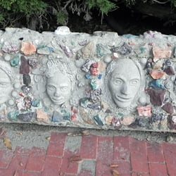
    Grandma Prisbrey's Bottle Village
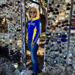
    Grandma Prisbrey's Bottle Village - Her doll heads

    Her doll heads

    Grandma Prisbrey's Bottle Village - In one of her rooms 3/2010

    See all

    In one of her rooms 3/2010

    Bowers Cave - Then and now.

    Bowers Cave

    5.0(2 reviews)
    24.0 km

    Bowers Cave, also known as Cave of the San Martins, is a little-known cave that sits high near the…read moretop of a steep mountain at the northeastern border of the Chiquita Canyon Landfill located in Castaic. It has been described as the most significant archaeological site on the North American continent. In 1884 two brothers, McCoy and Everette Pyle, discovered a "treasure trove" of Native American artifacts that had been hidden away by Tataviam Indians hundreds of years earlier. Shortly after the discovery the items were sold to Stephen Bowers who later resold most of the collection to the Peabody Museum at Harvard where it is still kept today. Why the cave is named after the person who purchased the artifacts and not the people who discovered them is beyond me. Nevertheless, it is still an interesting piece of history in the most unexpected place. The location can be seen from a distance from inside the landfill. I would never advise visiting the site without permission, but if you did, I would hike from a northern approach, preferably on a Sunday. Make your way towards the large water tanks and you will eventually spot a path that will take you to the backside of the mountain. The climb to the cave looked way too steep for me so I chose to appreciate it from a distance. I am really curious whether or not the sandstone carvings seen in historic photographs are still present. You can read a lot more about the cave on SCVTV's web site and there is also a very odd 20 minute documentary that you can find online.

    Thank you for the information. My great-grandfather was McCoy Pyle, so it was interesting to find…read moreout why he didn't get credit for the collection at Harvard. I didn't realize the artifacts were sold first!

    Photos
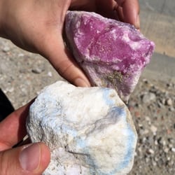
    Bowers Cave - Cool rocks founds near the site.

    Cool rocks founds near the site.

    Bowers Cave
    Bowers Cave - Path that takes you to the backside of the mountain.

    See all

    Path that takes you to the backside of the mountain.

    The Oakridge Estate

    The Oakridge Estate

    4.6(10 reviews)
    14.1 kmNorthridge

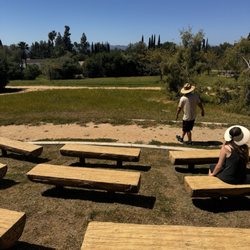
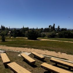
    So I'm just doing a little park hopping today since I had a long drive home and I'm always in the…read morelookout for good parks to come to with my dog. This park showed along my route so I quickly turned in and I did not know what to expect arriving to the Oakridge Estate park but when I pulled in I was excited because it looks like a very well paved trail. I walked along the dirt path a little ways and came across a cute little kids play area with a small tractor and horses to play on. There are some really nice wood benches shaped like tree trunks and from afar I could see the "ampitheatre" that someone had mentioned. I didn't get to stay very long to explore more because parks and recreations arrived to lock up the park so I had to go, I asked them how long is the trail but they didn't know so i did a quick Google search and it says it's a short leisurely walk but that they do offer 75 minute docent led walking tours of the estate. This is a VERY beautiful well maintained area that I definitely plan to come back and explore more when it's earlier! They are open from sunrise to sunset.

    The park itself gets five stars. It's lovely. Parking is decent and the trail is perfect for my…read moreelderly parents. There's also a cute amphitheater and plenty of seating for outdoor activities. I hope Recs and Parks starts hosting events. It'd be a great location for music and movies. Zero stars for the estate tour. The majority of the house is still being restored and I did not feel safe walking around. A lot of the information given cannot be verified and the guides are primarily just reading a script. Our guide was also very insistent about squeezing our large group into small spaces and only watching him instead of letting us look around.

    Photos
    The Oakridge Estate
    The Oakridge Estate
    The Oakridge Estate

    See all

    Three Sisters Rock - This is the very first part of the trail; keep going straight until you reach the railroad tracks and crossover them onto the PCT

    Three Sisters Rock

    4.5(2 reviews)
    45.9 km

    I've been eying these giant rocks for awhile after spotting them on a map; They're also a filming…read morelocation, although I'd never heard of them, but they are pretty damn cool. This stretch of the PCT was nice and had great vistas and you can scramble and play just about anywhere, although I didn't get to see it all because I was losing the sun faster than I expected, but I'll get back out there for certain. Once you reach the first rock, you'll need to take a side trail off the fire road that will lead you directly up to the rock and then follow the base around until a small crevice and climb your way up. Once you get on top you'll realize that you can't get to the others without climbing back down this rock and going either on a downhill adventure or back to the road and then all the way around to the base of the other rocks There are a couple branches off the fire road and trail that you will need to take, so I suggest you download the all trails app and follow those GPS Tracks PARKING: There is a big KOA sign welcome in PCT hikers right off the main road; park here and take the trail down. I pulled into the KOA to ask directions and the girl that worked there told me to go down to the back and that I could park there, but when I got back to my truck the manager (with her undeserved power trip) Had parked their big Duley in front of me and proceeded to berate me about parking there despite me telling her that her own staff told me where to park. So, do yourself a favor and don't even enter the KOA. Park on the road.

    To view this impressive rock formation up close you will either have to hike from the west,…read morestarting at the corner of Agua Dulce Canyon Rd and Briggs Edison Rd, or from the south via the Pacific Crest Trail located off of Soledad Canyon Rd (opposite Indian Canyon). From the west it's a an 8-mile round trip hike. You'll start by passing through a locked iron gate with a sign that warns that you are entering a private road. Private land maps clearly show that the road runs through land owned by either Southern California Edison, Santa Clarita Watershed Recreation and Conservation Authority or Bureau of Land Management. The path of the road roughly follows power lines so it's pretty hard to get lost. Unfortunately, the rock formation and 100 acres of land surrounding it is located on private property so you won't be able to venture between the rocks or explore its caves. Never-the-less, it's still a fun hike and you can still appreciate the majestic pinnacles from a close enough distance.

    Photos
    Three Sisters Rock
    Three Sisters Rock
    Three Sisters Rock

    See all

    Bell Canyon Park - Entrance to Bell Canyon Park, heading in to the Upper Las Virgenes Canyon Open Space Preserve

    Bell Canyon Park

    4.6(10 reviews)
    2.5 kmWest Hills

    This has been my home away from home for as long back as I can remember. Basically, the park…read moreencompasses El Escorpion Canyon, a sparely wooded canyon on the south side of Castle Peak along El Escorpion creek, Castle Peak and its ridge, and Bell Canyon north of the peak along Bell Creek, all up to the Ventura County line. It is attached to the Upper Las Virgenes Canyon Open Space Preserve via El Escorpion Trail. There are a number of trails through the park, the best being the entire Castle Peak loop. There is a naming issue with this place. Basically, the two canyons are sometimes called separate parks. But recently Google maps has been showing them both as "Bell Canyon Park," and although I prefer El Escorpion Canyon, I'm willing to swallow my pride and call it all one park. Be careful throughout the park as there is lots of poison oak, bee hives, and rattlesnakes. You can also find some tarantulas and quail if you are lucky! While it is closed from dusk to dawn, this is an excellent place to go chill and look at the stars. Many a meteor shower was seen from these trails. Also look out for a sick BMX area. One of the best things about this park is that it is close to the city, yet remote. You can go out here and no one will usually bother you. But in recent years, that has been its downfall as well. More and more people are retreating out here, and there is a lot more graffiti and trash as of late. The Castle Peak Loop begins at the gate where Vanowen turns into Sunset Ridge. From there, you start hiking up the canyon. The first little part is often called Dog Shit Canyon cause of all the people who walk their dogs on this little part that is closest to suburbia. From there you head right across the creek and then straight up Castle Peak on the south side. Castle Peak is a tough hike. You can do it in less than 30 minutes if you know the terrain and are in good shape. Other than that, take it slow. There are 5 phases up this side of the peak. The first phase is kinda slippery and very steep. The second phase has this red soil and is a little more uneven than phase 1, if not as steep. Phase 3 is basically large rocks and gravel. Very slippery. Phase 4 is the section after the big white chalk part at the end of phase 3. It is rocky and has lots of smaller intersecting trails and is fairly solid. The last phase is the approach, where it gets even more rocky before you hit the top. From the top of Castle Peak is the best view of the west valley you'll find. Watch for different birds over the seasons. The swifts and the hummingbirds both do awesome dive bombs and are my favs. Then head west along the ridge. There, you will meet a fork in the trials. Head straight along the most traveled path and bear right until you end up on a very well maintained wide trail that goes down into Bell Canyon. This part ends at a little park with a baseball diamond and some picnic tables. Get some water at the park and then head down the trail along the creek, this one being Bell Creek, down to the horse trail. This horse trail along the suburban streets will take you back to the gate for the full loop. This can be done in reverse as well, duh. Interesting tidbit, where Bell Creek and El Escorpion Creek meet is the official start of the LA river. Check it out, and please help pick up any liter you see. Let's keep this park clean for future generations. Hope to see you there!

    This park is a spectacular place to spend as little as an hour, or the entire day in! The trail…read moreloops in Bell Canyon take you West into El Escorpion Park and South into the larger Upper Las Virgenes Canyon Open Space Preserve (a.k.a. Ahmanson Ranch) and provide miles of trails to walk, hike, and mountain bike among ancient oaks, mesas, caves, and chaparral. In the winter, the cooler temps make the breeze sing through the mesa along the Old Ranch Road trail. There are plenty of spots to stop for lunch, but please remember to pack your trash when you leave to keep it beautiful! Many hikers bring their leashed dogs through and the majority of trails are easy for young children as well. In the summer, don't forget your sun protection and plenty of water as there is very little to no shade on several trail loops. And of course, bring your camera for pics of your visit. I posted summer and winter pics so you can see the changes.

    Photos
    Bell Canyon Park - One the main trail in Bell Canyon Park, heading towards street parking on Sunset Ridge Court and Vanowen St.

    One the main trail in Bell Canyon Park, heading towards street parking on Sunset Ridge Court and Vanowen St.

    Bell Canyon Park - At the entrance to the Cave of Munits in El Escorpion Park, entering in from Bell Canyon Park

    At the entrance to the Cave of Munits in El Escorpion Park, entering in from Bell Canyon Park

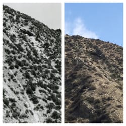
    Bell Canyon Park - Castle Peak March 2003

    See all

    Castle Peak March 2003

    El Scorpion Canyon Park - hiking - Updated August 2026

    Loading...
    Loading...
    Loading...