Escalante Interagency Visitor Center Photos



You might also consider

More like Escalante Interagency Visitor Center
Recommended Reviews - Escalante Interagency Visitor Center
Start your review...


Reviews With Photos
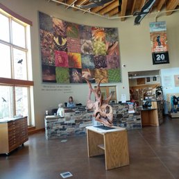

Looks to be a brand new center to keep the elements out. Staff is helpful and informative about the the trails, terrain and the area in general. The inside is wide open and adorned with helpful information regarding the surrounding habitat. There is also free Wi-Fi provided here. Outside and towards the back of the building there is a little trail that leads to the hills (i'm assuming because I saw the trail, but didn't take it). The bathroom are super clean and lots of seating and tables to have a snack. Most importantly there is a drinking water pump towards the unpaved parking lot where you can fill your water jugs prior to going out on expeditions. Highly recommend making a stop here to find out what the current weather conditions are before making the trek out the hikes. Flash flooding seems to happen quite frequently out here.


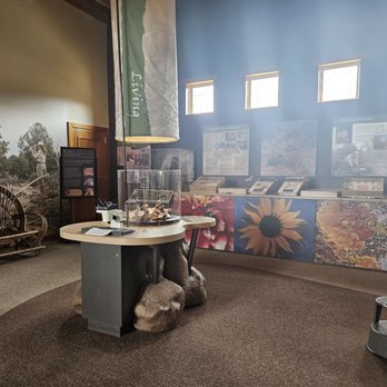
After a two day stay in the Bryce Canyon/Zion area of Utah, we planned our epic road trip to continue north to the magnificent Capital Reef National Park. No trip is complete without travelling up the Highway 12, the view is magnificent and varied. Unexpectedly we passed by this beautiful, new Visitors' Center just outside the small town of Escalante. And since I was making a supreme sacrifice by not stopping at each and every historical marker along the way, I insisted we at least stop here. First of all, there was a small folding table and chairs and some strange bird feeders covered with netting set up outside the center and a couple of warmly clad folks with pencils and note pads. It turns out, they were a group of scientists doing an annual study on hummingbird migration to South America. Those lucky little darlings (the wee birds, not the scientists), in exchange for a leg tag and being tallied, received a well earned rest and tummy fill-up, the fuel they needed in order to continue their incredibly long trip to sit out the Winter. Yeah, they probably would have been just fine anyway, but hey, even we appreciate the occasional coffee break and potty stop. Inside the beautiful building was a small but still interesting display, even a scull of a triceratops found in the nearby sandstone beds, a recently discovered, rich depository for dinosaur bones. There were several rangers who manned the counter and provided many services to visitors and hikers. They provide free maps, information on hiking trails, issuing of hiking permits, and most importantly, give you alerts for dangerous weather conditions. There is a small theater where you can sit and catch a free movie about the history of the area. Well worth the 18 minutes. Very, very nice bathroom facilities too.


Excellent visitor center. We got Mai's and recommendations. As a result, we visited this beautiful little slot canyon.
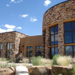

The Escalante Interagency Visitor Center is one of four visitor centers in the Grand Staircase-Escalante National Monument. Yup, this national monument is so large, it needs multiple visitor centers! This national monument seems to be overlooked as its neighbors seem to get a lot more attention. This visitor center focuses on the geology, ecosystem, and fossils of the area. Unfortunately, I forgot to ask the rangers for some hiking recommendations. I heard there were some hikes that lead to exposed fossils, but wasn't able to get much information online. Oh well. I found that the exhibits were quite informative, and some of them were hands on-great for little ones. There are exhibits both indoors and outdoors. If you want to rest and enjoy a snack, there's a covered picnic area which sits directly across from the restrooms. read more

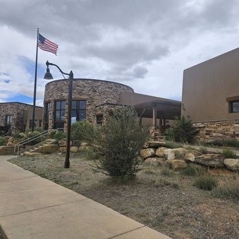

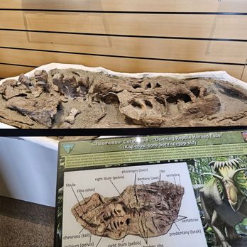


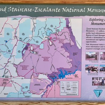
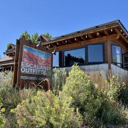
The Escalante Interagency Visitor Center is a terrific place to start your explorations of wondrous Grand Staircase - Escalante National Monument. Alright, well I'll start abbreviating, lol...GSENM. It covers a huge area of Southern Utah, specifically, 1.9 million acres of public land. If you don't come prepared ahead of time, it can be an intimidating adventure and you can stumble on how to efficiently navigate your way around this remote, yet beautiful part of the country. That's why I believe if you start at the Interagency VC...you can handcraft the places and stops you'd like to see and best of all, when I visited, there were multiple park rangers standing behind the counter patiently waiting to assist tourists with their questions. Inside the VC...it's relatively small in stature...and there's a tiny little gift shop for picking up GSENM souvenirs. Plus, they have various stamping options to put into your Parks Passport. Of course, for myself, the ritual is to punch every page (front and back) even including using the Junior Ranger stamp, lol. Speaking with the park rangers was necessary because...I arrived here on a whim without a set game-plan. What I never realized about GSENM is that about half of the territory can only be accessed by 4x4 - off road vehicles. And that I did not have with me. So...certain attractions, landmarks and hikes are off-limit to cars not accommodative for dirt/gravel roads. And...this was informative because I was able to better design my itinerary with the park ranger once I told him I only had a midsize car with me. Still, here were some fun highlights that the ranger recommended.... - Hike to Lower Calf Creek Falls. - Hike to Escalante Natural Bridge. - Escalante Petrified Forest State Park. - Anasazi State Park Museum. - Walk among the Toadstools. - Kodachrome Basin State Park. Another good aspect to this Interagency VC is that it's located in the quiet town of Escalante, Utah...good for convenience stores, filling up your gas tank, purchasing supplies/necessities and sitting down at restaurants. After stopping here midday and before venturing out on my journey, I drove down the road to the Escalante Outfitters Restaurant for homemade pizza and cold beer. Overall, I'm really happy I made the effort to stop in at this Escalante Interagency Visitor Center before attempting to explore GSENM on my own. It was worthwhile to speak with the park rangers and to narrow down the activity options appropriate for my participation level. read more



6 years ago
The Escalante Interagency Visitor Center checks all the boxes for an excellent visitor center - ample parking, easy to access location, clean bathrooms, interesting exhibits inside, functioning air conditioning, and plenty of information available. This was a stop on our road trip to the "big 5" national parks in Utah, and it was definitely worth it. The building and facilities were all clean and new-looking, with a modern look that apparently has sustainability in the design. The rangers here were helpful and were apparently glad to have someone to talk to, as when we drove through over Labor Day there weren't too many people around. Fortunately things were more or less open despite COVID-19, and everyone followed proper safety protocols - masks, distancing, hand sanitizer, etc. Though the exhibit space in the building was closed, temporarily. We were able to have our junior rangers participate in the junior ranger program, so they got their badges. Note if you ever visit a national park center with kids, ask about this program. They can do a few activities and get a neat souvenir reward. read more


Looks to be a brand new center to keep the elements out. Staff is helpful and informative about the the trails, terrain and the area in general. The inside is wide open and adorned with helpful information regarding the surrounding habitat. There is also free Wi-Fi provided here. Outside and towards the back of the building there is a little trail that leads to the hills (i'm assuming because I saw the trail, but didn't take it). The bathroom are super clean and lots of seating and tables to have a snack. Most importantly there is a drinking water pump towards the unpaved parking lot where you can fill your water jugs prior to going out on expeditions. Highly recommend making a stop here to find out what the current weather conditions are before making the trek out the hikes. Flash flooding seems to happen quite frequently out here. read more
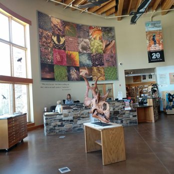


After a two day stay in the Bryce Canyon/Zion area of Utah, we planned our epic road trip to continue north to the magnificent Capital Reef National Park. No trip is complete without travelling up the Highway 12, the view is magnificent and varied. Unexpectedly we passed by this beautiful, new Visitors' Center just outside the small town of Escalante. And since I was making a supreme sacrifice by not stopping at each and every historical marker along the way, I insisted we at least stop here. First of all, there was a small folding table and chairs and some strange bird feeders covered with netting set up outside the center and a couple of warmly clad folks with pencils and note pads. It turns out, they were a group of scientists doing an annual study on hummingbird migration to South America. Those lucky little darlings (the wee birds, not the scientists), in exchange for a leg tag and being tallied, received a well earned rest and tummy fill-up, the fuel they needed in order to continue their incredibly long trip to sit out the Winter. Yeah, they probably would have been just fine anyway, but hey, even we appreciate the occasional coffee break and potty stop. Inside the beautiful building was a small but still interesting display, even a scull of a triceratops found in the nearby sandstone beds, a recently discovered, rich depository for dinosaur bones. There were several rangers who manned the counter and provided many services to visitors and hikers. They provide free maps, information on hiking trails, issuing of hiking permits, and most importantly, give you alerts for dangerous weather conditions. There is a small theater where you can sit and catch a free movie about the history of the area. Well worth the 18 minutes. Very, very nice bathroom facilities too. read more


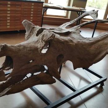


8 years ago

An extreamly nice new building with a nice walking tour with information on the area. They have tons of info packets and maps for your tour through the parks. We were not there to hike much mostly for some of the off road trails if the weather was ok. The ranger on duty was extreamly knowledgable on the trails and road conditions. Very helpful this time of year! If you need any info on any of the surrounding parks, hiking or off road conditions make a stop here before you go on. read more
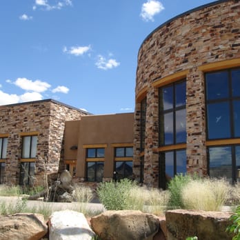


7 years ago
More info about Escalante Interagency Visitor Center
Ask the Community - Escalante Interagency Visitor Center
Review Highlights - Escalante Interagency Visitor Center





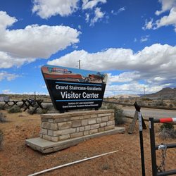
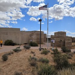
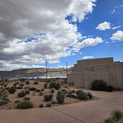


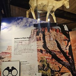







Escalante Interagency Visitor Center - visitorcenters - Updated September 2026
Best of Escalante
People found Escalante Interagency Visitor Center by searching for…
Off Road Trails in Escalante, UT
Hiking Trails in Escalante, UT
Transportation in Escalante, UT
Travel Services in Escalante, UT
Hotels & Travel in Escalante, UT
Waterfront Hotels in Escalante, UT
Motels and Hotels in Escalante, UT
Things to See in Escalante, UT
Things to Do With Kids in Escalante, UT
Things to Do on a Rainy Day in Escalante, UT
Natural Hot Springs in Escalante, UT
Places to Take Pictures in Escalante, UT
Walking Trails in Escalante, UT
Trending Searches in Escalante, UT
Browse Articles
Browse Nearby
BEST of Escalante, Utah Hotels near Escalante Interagency Visitor Center
BEST of Escalante, Utah Restaurants near Escalante Interagency Visitor Center
BEST of Escalante, Utah Coffee near Escalante Interagency Visitor Center
BEST of Escalante, Utah Hiking near Escalante Interagency Visitor Center
BEST of Escalante, Utah Star Gazing near Escalante Interagency Visitor Center
BEST of Escalante, Utah Things to Do near Escalante Interagency Visitor Center
BEST of Escalante, Utah Breakfast near Escalante Interagency Visitor Center
BEST of Escalante, Utah Museums near Escalante Interagency Visitor Center
BEST of Escalante, Utah Lodging near Escalante Interagency Visitor Center
Browse Brands
Related Cost Guides
Related Searches in Escalante, UT
Best Lookout Points to Visit in Escalante, Utah
Best Nature Trails for Hiking in Escalante, Utah
Best Waterfalls and Swimming Holes in Escalante, Utah
Book a Guided Cave Tour in Escalante, Utah Today
Check Out Off Road Trails in Escalante, Utah
Discover Free Campgrounds in Escalante, Utah Area
Discover Popular Photo Spots in Escalante, Utah
Discover Scenic Creeks to Explore in Escalante, Utah
Discover Top Nature Parks to Visit in Escalante, Utah
Discover the Best Campground Spots in Escalante, Utah
Discover the Best Caves to Explore in Escalante, Utah
Enjoy Hiking Adventures in Escalante, Utah
Enjoy Scenic Night View Experiences in Escalante, Utah
Enjoy Stroller Walk Routes and Parks in Escalante, Utah
Enjoy the Best Night View Spots in Escalante, Utah
Enjoy the Best Walking Trails in Escalante, Utah
Explore Easy Hikes Perfect for All in Escalante, Utah
Explore Free Picnic Areas Around Escalante, Utah
Explore Popular Picnic Areas Around Escalante, Utah
Explore Popular Scenic Overlook Points in Escalante, Utah
Explore Popular Scenic Views Near Escalante, Utah
Explore Popular State Park Destinations in Escalante, Utah
Explore Scenic National Park Locations in Escalante, Utah
Explore Scenic Sunset Hike Trails Around Escalante, Utah
Explore the Best Places to Run in Escalante, Utah
Explore the Best Swimming Holes Around Escalante, Utah
Explore the Scenic River Walk in Escalante, Utah
Family Friendly Hiking With Kids in Escalante, Utah
Find Beautiful Views in Escalante, Utah
Find Picnic Tables for Outdoor Fun in Escalante, Utah
Find Top Dog Friendly Parks to Visit in Escalante, Utah
Find the Best Bridge Spots in Escalante, Utah
Find the Best State Parks Camping Spots in Escalante, Utah
Hiking Trails With Waterfalls in Escalante, Utah
Perfect Spots to Watch Sunset in Escalante, Utah
Plan Nature Center Visits in Escalante, Utah
Plan a Scenic Drive Route Near Escalante, Utah
Popular Dog Walking Areas in Escalante, Utah
Popular Fishing Spots to Explore in Escalante, Utah
Relax at Natural Hot Springs Near Escalante, Utah
Safe Bike Trails for Kids in Escalante, Utah
Safe River Swimming Areas in Escalante, Utah
Safe and Fun Parks for Kids in Escalante, Utah
Stair Climbing Activities and Gyms in Escalante, Utah
Top Spots for Night Hiking in Escalante, Utah
Top Swimming Lakes to Enjoy in Escalante, Utah
Top-Rated Camping Sites in Escalante, Utah
Top-Rated Hikes in Escalante, Utah to Explore


