1. Frog Lake

    1. Frog Lake

    0

    South Lake Tahoe, CA

    Cancel

    Open app

    Search

    Frog Lake

    4.0 (2 reviews)

    Frog Lake Photos

    You might also consider

    Recommended Reviews - Frog Lake

    Your trust is our priority, so businesses can't pay to alter or remove their reviews. Learn more about reviews.
    Yelp app icon
    Browse more easily on the app
    Review Feed Illustration

    5 years ago

    Helpful 27
    Thanks 0
    Love this 27
    Oh no 0

    10 years ago

    Helpful 0
    Thanks 0
    Love this 1
    Oh no 0

    You might also consider

    Verify this business for free

    People searched for Hiking 1,091 times last month within 15 miles of this business.

    Verify this business

    Mount Tallac Trail

    Mount Tallac Trail

    4.7
    (92 reviews)
    15.8 mi

    I did this trail in late May when there was still a lot of snow on the mountain. I started the hike…read moreearly in the morning (7 a.m.) to make sure the snow was packed and not slippery (because of the sun beating down on it). There were only 2 other cars in the lot when I got there. That already signaled me that this trail may not be as safe to hike as I had initially thought. The hike started easy, but soon after I passed the second lake, it became tricky because it was really hard to keep track of the trail. Parts of the trail were either buried under the snow or harder to identify due to the fallen trees, bushes, and streams of water. I definitely went off the trail a few times, but thankfully, I had the map downloaded on AllTrails (yayyy AllTrails+ subscription), which came in clutch. The trail is mostly covered until you get past the 3rd lake. After the third lake, it was all rocky and exposed. It was really hard to follow the trail from that point on because of the snow. It gets steeper from there on out. Since the trail was convere in snow, I decided to rock scramble straight to the top. It was probably not the best idea. Having done that, I'd advise against it because the rocks were loose. One wrong step, and you are either falling or twisting your ankle. I did this hike with no poles, spikes, or gloves. Spikes would have helped because some areas required going downhill on snow-covered patches (some steeper than the others). I don't think you need gloves or warm layers. The views throughout the hike were amazing. Don't forget to stop and look back on your way up (and look up on your way down). Avoiding snow-covered areas in some cases will lead you off the trail, so take your time when going through those patches of snow. Don't let your ego get in the way and turn back if you start having doubts. A tip (shouldn't be a surprise) - When going through a patch of snow, make sure your first step is somewhat bigger so you don't step on the edges of the snow patch where the snow is usually thin and chances of you falling through are high.

    This trail is a killer! I've done strenuous hikes before, but I think part of my soul left on this…read moretrail. Not sure if it's the 80° weather, all the rocks, or I was just out of shape, but this trail really tested my mind over matter. The trailhead is easy to find, with a small parking lot but there's tons of parking nooks along the road for overflow. I would say this hike has 3 sections to conquer. 1. The trail starts off easy, soft dirt path with some shade alongside great views of Lake Tahoe. There's some slight parts of incline, but nothing too elevated. You pass by several lakes that are great picnic spots and we saw many dogs taking a swim. Butterflies everywhere. 2. The trail starts getting rocky the further you go, like walking along a dry creek. You hike uphill for what seems like a lifetime, then finally get to the base of the mountain.. of boulders. SO many rocks, BIG rocks, and switchbacks! ALL incline. And no shade. This took some time to get to the top. 3. You made it to the top! But oh no, you're not done yet. To get to the summit is about another mile to the right. The trail eventually splits with a less noticeable trail to the right. Keep right to get to the summit. This was probably the most beautiful part of the trail with open plains, soft grass, and wildflowers along both sides of the path. However, at this point I was so exhausted that my steps were like the mini steps of a toddler. The struggle was real ya'll. Every uphill was a battle. Finally, after what felt like a lifetime, you climb up some rocks and you're at the top of the summit, greeted by a metal sign "Mt Tallac 9,739" elevation. Whoo! It was a spectacular 360 view. There were oddly a ton of flies up there. Also, lots of butterflies and chipmunks. Of course going down was much faster but beware if you have bad knees. My knees usually never hurt going downhill but I definitely felt it on this hike. With 9.5 miles (out and back) of rocky trail and the 3,284 ft elevation gain, hiking sticks are a must! On part two of the trail, certain parts you can hear rattlesnakes so make sure you stay on the trail. Cover up and bring more water than you think you'd need. I plowed thru my hydropack and additional two bottles. At the end, the sight of the trailhead sign and our car was like heaven on earth.

    Photos
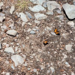
    California tortoiseshell butterflies were everywhere
    California tortoiseshell butterflies were everywhere
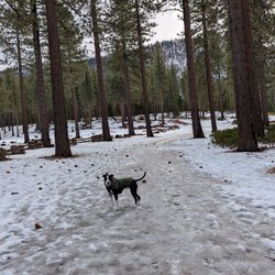
    Doggo in the lake
    Doggo in the lake
    A cool stretch of forest running along a plateau above Fallen Leaf Lake. Awesome section of the trail.

    See all

    A cool stretch of forest running along a plateau above Fallen Leaf Lake. Awesome section of the trail.
    Spooner Summit

    Spooner Summit

    4.4
    (17 reviews)
    20.6 mi

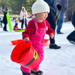
    This is a great little spot for snow play during the winter season. Parking is a little tough. The…read moreonly facilities are Porta potties. There is a very small parking lot, and along the sides of the road, but it's a tight squeeze going down the lane. The area is beautiful and there's plenty of space and small hills for sledding. And best of all - it's free! We had *snow* much fun! Yelp 2026 Challenge: 03/30

    From my Genoa perspective, I usually take the Kingsbury grade to go to South Lake Tahoe and Back…read more I'll drive up from the Valley to the Spooner Summit if I'm going to the State Park of that name, Sand Harbor, Incline, and destinations North. I might drive back to the Valley via Spooner if I'm coming from South Lake and need to run errands in Carson City. Observations 1. As "The Lake" doesn't have a Costco or a Trader Joes, there can be decent visitor traffic coming down to the Valley from Spooner Summit. That includes considerable cheaper gas prices available at Costco gas. 2. The scenery coming down Spooner into the Valley is stunning. So can car speed of which a Carson Sherriff's car may happily pull you over. And that stop light can come into view fairly quickly. 3. One thing you might notice coming down are the distinct large piles of logs associated with the new Carson City Sawmill (in partnership with the Washoe Tribe). Tahoe Forest Products processes timber salvaged from wildfires, forest thinning projects. 4. I make it a point to drive this route (in either direction) for the fall colors. 5. What I always marvel at is the transition between Alpine and High Desert, in either direction. 6. In wintertime at the Alpine Summit, you'll find scores of cars and families taking advantage of sledding opportunities. Parking can be challenging. Some of those cars don't know how to drive in the winter (or understand chains) of which I saw first hand last Saturday as Gayle and I were dropping off Darling Granddaughter. Lots of slipping and sliding and 2 overturned vehicles were noted. 7. There are also hiking opportunities at the Spooner Summit of which I've only done the easy trek around nearby Spooner Lake.
    Photos
    Spooner Summit
    Spooner Summit
    Spooner Summit

    See all

    Lam Watah Trail to NV Beach

    Lam Watah Trail to NV Beach

    4.7
    (20 reviews)
    19.7 mi

    I just found out about Lam Watah Trail (in South Lake Tahoe/Stateline in the Nevada side) and…read morewalked it recently. The name in Washoe means permanent mortar by the stream. The trailhead is right within walking distance from the casinos and Stateline/Highway 50. If walking the strip/Stateline is not your thing, don't forget about the free Lake Link shuttle service. The trail leads to Nevada Beach. It's 2.8 miles roundtrip. Flat, no inclines. My kind of walk. Portions of the trail are packed dirt or paved with the majority of it paved. The trailhead has a small paved parking lot, it's free with no time limits but no overnight parking allowed. There are public restrooms. If they're open, I suggest using those because in the winter all the other restrooms on the trail and the beach are closed. We discovered that the hard way. There are two options of trails at the trailhead parking lot. You can use the paved path or the dirt path. The dirt path provides a view of Jennings pond and field as it is right next to it. Even though the pond itself is about 4 feet, you or your fur babies don't want to fall into that ice cold water so stay on the path. The field and pond tend to blend together in the winter scenery. The paved path doesn't provide views of the meadow or pond. Both trails link together. At this intersection, there is a foot bridge that crosses the Burke Creek. Even in the middle of winter, the creek had a trickling flow of water. The sound was relaxing and serene. The path from this point on is paved. Right now, sections of the path have ice and snow even on a warm sunny winter day. So be prepared with the right footgear. Along the way, there are info boards describing the history. I found out that the indigenous Washoe lived in the area before European settlers, and Rabe meadow served as the Sky Harbor casino and air landing strip in the 1940s. Crazy to think there was a casino and air strip here. On the opposite side of the meadow are large, beautiful granite boulder clusters viewable from the path. And Aspen grooves which I imagine are flaming gorgeous in the Fall. The trail leads to the beach. The beach has a walking path made of a composite grooved decking about 3-4 feet wide. The beach can also be reached by driving to it; it has a paved parking lot and street parking. On the weekday I walked the trail, it had a good number of folks and dogs. Leashed dogs are allowed on the trail but not allowed on the beach.
    Short walk from Stateline also accessible via free Lake Link shuttle service is this flat level…read morepath that goes to the beach also connects to other trails. Bikes and pedestrians. Lot of dogs some not leashed. Lots of fowl wildlife and waters along the way.

    Photos
    Pond path from the trailhead. You can use this path or the other which is paved (towards the left).
    Pond path from the trailhead. You can use this path or the other which is paved (towards the left).
    Paco!!
    Paco!!
    Beach at the end of the trail

    See all

    Beach at the end of the trail
    Glen Alpine Trailhead

    Glen Alpine Trailhead

    4.6
    (7 reviews)
    14.1 mi

    We started out from the trailhead about 9 am on Labor Day weekend and went up to grass lake. We had…read moreto park just outside the parking lot but as we set off we noticed some earlier risers were pulling out. The 6 mile round trip hike included a little creek fording, a nice visit to the soda spring, and of course lunch by the lake. The trail is pretty rocky so puppies may do better with booties. Our girl has a 5 mile max and had to be carried for about .5 miles on the rocky path back.

    The drive to the falls is beautiful ! Going along Fallen Leaf Lake is a sight to see. The road can…read moreget a little rough with holes in some parts and narrow so be careful as you drive on it and pass other cars. No phone reception so make sure the gps is already going. Once you drive by the fire station you are almost there. Parking is free along the dirt road across from the falls (you can see the falls to the right as you drive on the road). Tends to fill up toward noon so if it is full continue driving up the hill and there's more parking. Give yourself a little room to back out. I started with checking out below the falls first. Wow! What a sight to see! The water was roaring down ! Great sight for photos (see attached photos )! Here you can explore a little by going down the rocks and getting as close to the water as you feel comfortable . As you continue to follow the water runoff , there's a nice shot of the stream as it continues down (see attached photo ). You can touch and if you have enough courage to go in haha. It's VERY cold! You can walk back to the road and follow it up above the falls for more great photos and view (see attached photos ). The road continues but I'm not sure where it goes . I wanted to explore more but had other destinations on my list. If you're in the Lake Tahoe area this is a MUST SEE. I wanted to come in the winter but the road leading to it (along the lake)is sketchy and covered in snow (4x4 required). Come soon while the falls is still roaring !

    Photos
    Glen Alpine Trailhead
    Glen Alpine Trailhead
    Grass Lake 6/2014

    See all

    Grass Lake 6/2014

    Frog Lake - hiking - Updated July 2026

    Loading...
    Loading...
    Loading...