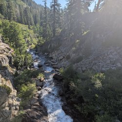
Horsetail Falls Hike Photos


You might also consider


More like Horsetail Falls Hike
Recommended Reviews - Horsetail Falls Hike
Start your review...


Reviews With Photos


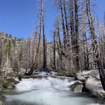
A must hike at least once a year ! The waterfall was gorgeous and cascading along the whole entire trail ! It's not overly hard to hike , short in length , great for all ages and the view is amazing I'm so glad we finally decide to do a day trip from Elk Grove
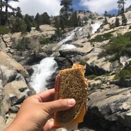

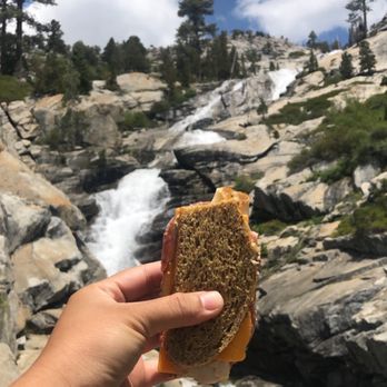
Hiked: June 12, 2020 Oh man, this hike. It has got to be one of the most beautiful, challenging and adventurous hikes I have ever done. I'll start off by saying that this is definitely not a beginner hike and I don't recommend very young children or dogs unless you don't go all the way to the top. Even the hike to the 'base' of the falls is still a challenge. That's because you'll literally be climbing up some steep rocks, hugging boulders, walking over logs on streams, and deal with elevation on a poorly marked trail. With that being said, all of it was totally worth it. You'll not only be be rewarded with gorgeous views and scenery but also self accomplishment of tackling this hike. Key things: -It's about 1hr 25mins from Sacramento & about 20 mins from South Lake Tahoe. The parking lot is easily found off highway 50. Parking fee $8. It says you need a permit to enter desolation wilderness but we didn't have one and no one was checking. -Wear sturdy hiking shoes. Nike's or vans won't cut it here. There are a lot of loose gravel around and smooth slippery granite as well. We actually saw a man fall in front of us when we were walking over logs to cross a shallow creek. -The trail is not well marked. There are a few trees and rocks that are marked with blue spray paint. Follow that to know you're heading towards the falls. If you keep the river on your right on the way up will help you towards the falls too. Or download the AllTrails map of this hike if you're worried about getting lost. -About a 3.5 mile hike that took us 4-4.5hrs to do. This included stops around mini pools, picture taking and lunch at the falls. Check this trail out if you're ready for an adventure.


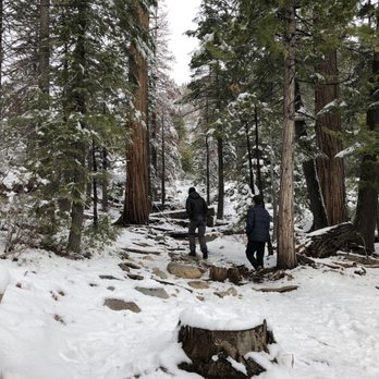
Beautiful hiking trail that looks especially magical during the winter time. We made a small detour on our way home from South Lake Tahoe and it was worth it. The hiking trial is not difficult but is a little trickier when there is ice/snow. With or without snow, hiking shoes are necessary because of the rocky terrain (protect your ankles!). There is a couple of small waterfalls and lots of big, beautiful trees all around. Great short hike (less than three miles RT) especially after a day of snowboarding/falling. Highly recommend if you are on the area.


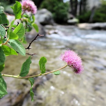
Nirvana, that is what this place is. Each year we camp in S. Lake Tahoe and pass Horsetail Falls. We usually stop here on our way home if we've gotten an early enough start. It's such a beautiful hike with fantastic vistas and microclimates. It is steep so you do have to have good shoes and footing, but I've seen people stop and hike around in flip flops as well as saw one woman in dressy slip on sandals (not recommended). You can hike as little or as far as you are inclined, but the way is up, up, up! Most of the hike takes you alongside Pyramid Creek which is just beautiful. There are some falls fairly soon into the hike so if you don't want to keep going up, you can enjoy a little meditative state here. The view of Horsetail Falls is worth it though... quite easy to scramble up granite rocks. There's areas where it's thickly forested and quiet inlets of the creek to sit and gather your thoughts or take a sip of water. The best part (if you happen to have a dog) is this is all off leash and there's no danger of poison oak at this elevation. You DO need to be mindful of shady rocks however as our last visit we saw a young rattlesnake coiled up and resting in the shade of a rock. That being said your dogs will enjoy scrambling up the rock faces using 4 wheel drive and if they love water there's plenty of opportunity for safe exploration of cool Alpine water. Do be sure to leash them in the steeper areas with swift falls, just to be safe. The trailhead lot is often crowded and you must pay $5 entry to park. You park and pay via envelope with your license plate info and place in a tube. It's well worth the fee and visit!!! Restore your energy, balance your mind, and stick your toes in cool, clear Alpine water as you ruminate on your place in the Universe. Breathe the clear air and enjoy "being". :)
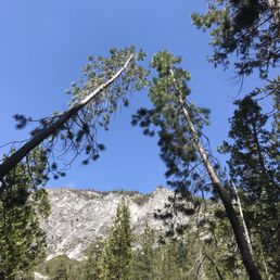

This hike was probably the best my group and I have ever done! It was absolutely stunning. We saw the high ratings on AllTrails and decided to do it last second before leaving the area. We were so glad we picked this specific hike! The entrance for the hike is right off the freeway (there's a good size parking lot) and the hike is 3.1 miles round trip. It starts off easy, then gets more moderate as you have to hike up through a steep rocky trail and on rocks to get to the waterfall. We did it in late April so if you do this in the winter you'd definitely need the equipment and shoes for it. There's not a lot of shady areas, maybe one by the river about halfway, so I would recommend eating here or waiting until the end to enjoy a picnic by the mist of the falls. There're not a lot of signs to mark the trail and we went off it a couple of times, but felt like it was more fun this way. It did help when we saw other groups to help us continue down the right path (although we had kind of an adventure trying to cross the river because we didn't see the huge tree log that people were using to cross lol). Right when you start the trail, there's a fast flowing river and you can get right next to the water. What I loved about this hike was the different scenery leading up the magnificent falls: walking though open rocky areas overlooking the mountains and crossing rivers through a more foresty space to get to the top. We saw people of all ages doing this hike and a lot of dogs, so even though it's a moderate hike, it's definitely doable. The distance feels shorter coming back because it's downhill. I'd hands down do this again!!


Bucket list! I'm so glad I did this hike! I am 50 years old and it's only taken me 45 years to slow down long enough to plan and actually do this hike. It's a moderate hike for those younger and in shape. For me it was at times arduous. I suggest wearing bike/workout shorts and sports bra- for comfort and to jump in the beautiful pools along the way. Wear really good tennis shoes that allow grip AND that won't allow your toes to slide. The hardest part was coming down. My toes were feeling very jammed! A great hike that CAN be leisurely taken. You don't have to go ALL the way to enjoy the beauty all around. The best part was at the very end. We thoroughly enjoyed bathing in the pool at the base. It was very healing on our hot bodies and hammered toes. MUST HAVE: Water, lots- we went through 6 bottles and wanted more Sunscreen! Lather up before and again at the top! Good shoes- people say boots- but I'm partial to good tennis that keep your feet in place with descent tread for gripping. Movable clothes, with spandex, workout attire, ok to get wet Sunglasses! Protein style snack NICE TO HAVE: A lightweight chair to perch and gaze A towel for the post dip in pools


June 25,2016 ~ Finally made it up the falls. There was so much more climbing than I expected. It took us approximately 2 hours going average pace with breaks to get up there. Make sure you have proper footwear as the rocks could be slippery. Take your time going up and especially coming down. There are no obvious trail but you will notice the trail markers. Follow them up and keep to the left of the falls coming back down. We hiked in mid 80 degree weather which can be extremely hot and draining so pack plenty of water and snacks to enjoy. Once you get to the top, keep going. You will see a little lake. I must warn you that the water is ice cold, but definitely worth a swim. It's a totally different world up there, just simply beautiful. Although I have not seen them (fingers crossed for next time) there are rattlers out there so beware of shades rocks. All in all, this hike was definitely a workout more than I expected. Make sure to breath in and out of your nose due to the elevation which can be hard on some people. Have fun, take lots of photos and enjoy the beauty Mother Nature has to offer :) Previous review: 5 shining stars although we did not make it all the way up to Horsetail Falls. We started the hike around noon with a temperature of around 48 degrees. We took the Pyramid Creek Trail and made it to the cascade and the creek. We spent most of our time just absorbing the beauty of Mother Nature. The giant granite rocks (can be slippery) makes a perfect spot yoga pictures though. I can't wait to go back. Make sure you bring $5 for parking. The parking lot is on the left side of HWY 50 after the little town of Strawberry. I love strawberries. I recommend bringing snacks/lunch because it's such a lovely place to have a picnic. Will be back to update this review once I actually get to hike this place up the falls. Aloha!
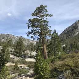

Beautiful hike! Some challenging spots and scrambling from midway up the falls to the top. Totally worth it! Will go again.
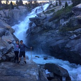

This was my first and probably my last time doing this hike. It's really beautiful The river and the waterfall is pretty cool. If you go all the way to the top of the waterfall and then go beyond it for about a mile or so you come to a gorgeous lake. However, this is a strenuous hike. Lots and lots of rock, climbing, and at times I just felt exhausted and I wasn't even sure that I wanted to complete it. I'm glad I did, but I probably won't do it again. The only downfall other than it just being strenuous is that the hike and trail itself is not well marked. read more


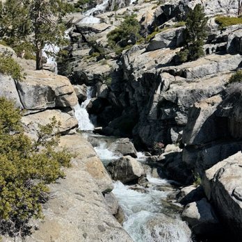

Great hike, not very difficult unless you want to climb all the way up which isn't even necessary to enjoy the falls, but be mindful of slippery rocks especially if wet. Easy to find secluded spots for bathing. Water is cold! remember it is all melted snow runoff. This is the largest waterfall in the Tahoe area. You may view the Cascade falls near the base, or hike on up to Horsetail. Parking costs $10. unless you have a federal permit, which is available for sale, for seniors, and free for the disabled. We went in late July and the water was gushing nicely, and the weather was fine even though it rained a bit that day. read more


2 years ago
This has probably been my favorite hike this far!! It has such beautiful scenery and I like that we are able to see the falls throughout the entire walk. We did a little over 4 miles. We got in the water and it felt so amazing (cold as all hell) but amazing!! read more

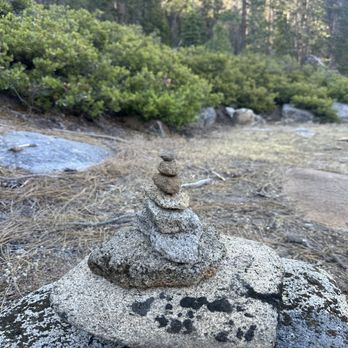

A must hike at least once a year ! The waterfall was gorgeous and cascading along the whole entire trail ! It's not overly hard to hike , short in length , great for all ages and the view is amazing I'm so glad we finally decide to do a day trip from Elk Grove read more




6 years ago
Hiked: June 12, 2020 Oh man, this hike. It has got to be one of the most beautiful, challenging and adventurous hikes I have ever done. I'll start off by saying that this is definitely not a beginner hike and I don't recommend very young children or dogs unless you don't go all the way to the top. Even the hike to the 'base' of the falls is still a challenge. That's because you'll literally be climbing up some steep rocks, hugging boulders, walking over logs on streams, and deal with elevation on a poorly marked trail. With that being said, all of it was totally worth it. You'll not only be be rewarded with gorgeous views and scenery but also self accomplishment of tackling this hike. Key things: -It's about 1hr 25mins from Sacramento & about 20 mins from South Lake Tahoe. The parking lot is easily found off highway 50. Parking fee $8. It says you need a permit to enter desolation wilderness but we didn't have one and no one was checking. -Wear sturdy hiking shoes. Nike's or vans won't cut it here. There are a lot of loose gravel around and smooth slippery granite as well. We actually saw a man fall in front of us when we were walking over logs to cross a shallow creek. -The trail is not well marked. There are a few trees and rocks that are marked with blue spray paint. Follow that to know you're heading towards the falls. If you keep the river on your right on the way up will help you towards the falls too. Or download the AllTrails map of this hike if you're worried about getting lost. -About a 3.5 mile hike that took us 4-4.5hrs to do. This included stops around mini pools, picture taking and lunch at the falls. Check this trail out if you're ready for an adventure. read more


6 years ago

9 years ago
Beautiful hiking trail that looks especially magical during the winter time. We made a small detour on our way home from South Lake Tahoe and it was worth it. The hiking trial is not difficult but is a little trickier when there is ice/snow. With or without snow, hiking shoes are necessary because of the rocky terrain (protect your ankles!). There is a couple of small waterfalls and lots of big, beautiful trees all around. Great short hike (less than three miles RT) especially after a day of snowboarding/falling. Highly recommend if you are on the area. read more



Nirvana, that is what this place is. Each year we camp in S. Lake Tahoe and pass Horsetail Falls. We usually stop here on our way home if we've gotten an early enough start. It's such a beautiful hike with fantastic vistas and microclimates. It is steep so you do have to have good shoes and footing, but I've seen people stop and hike around in flip flops as well as saw one woman in dressy slip on sandals (not recommended). You can hike as little or as far as you are inclined, but the way is up, up, up! Most of the hike takes you alongside Pyramid Creek which is just beautiful. There are some falls fairly soon into the hike so if you don't want to keep going up, you can enjoy a little meditative state here. The view of Horsetail Falls is worth it though... quite easy to scramble up granite rocks. There's areas where it's thickly forested and quiet inlets of the creek to sit and gather your thoughts or take a sip of water. The best part (if you happen to have a dog) is this is all off leash and there's no danger of poison oak at this elevation. You DO need to be mindful of shady rocks however as our last visit we saw a young rattlesnake coiled up and resting in the shade of a rock. That being said your dogs will enjoy scrambling up the rock faces using 4 wheel drive and if they love water there's plenty of opportunity for safe exploration of cool Alpine water. Do be sure to leash them in the steeper areas with swift falls, just to be safe. The trailhead lot is often crowded and you must pay $5 entry to park. You park and pay via envelope with your license plate info and place in a tube. It's well worth the fee and visit!!! Restore your energy, balance your mind, and stick your toes in cool, clear Alpine water as you ruminate on your place in the Universe. Breathe the clear air and enjoy "being". :) read more



3 years ago

6 years ago

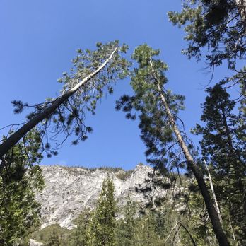
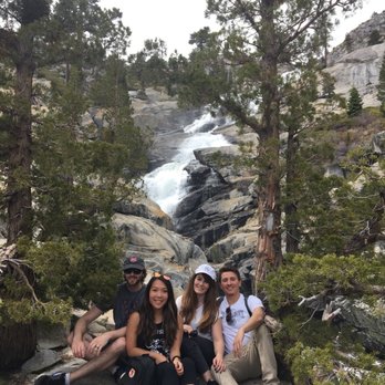
This hike was probably the best my group and I have ever done! It was absolutely stunning. We saw the high ratings on AllTrails and decided to do it last second before leaving the area. We were so glad we picked this specific hike! The entrance for the hike is right off the freeway (there's a good size parking lot) and the hike is 3.1 miles round trip. It starts off easy, then gets more moderate as you have to hike up through a steep rocky trail and on rocks to get to the waterfall. We did it in late April so if you do this in the winter you'd definitely need the equipment and shoes for it. There's not a lot of shady areas, maybe one by the river about halfway, so I would recommend eating here or waiting until the end to enjoy a picnic by the mist of the falls. There're not a lot of signs to mark the trail and we went off it a couple of times, but felt like it was more fun this way. It did help when we saw other groups to help us continue down the right path (although we had kind of an adventure trying to cross the river because we didn't see the huge tree log that people were using to cross lol). Right when you start the trail, there's a fast flowing river and you can get right next to the water. What I loved about this hike was the different scenery leading up the magnificent falls: walking though open rocky areas overlooking the mountains and crossing rivers through a more foresty space to get to the top. We saw people of all ages doing this hike and a lot of dogs, so even though it's a moderate hike, it's definitely doable. The distance feels shorter coming back because it's downhill. I'd hands down do this again!! read more



3 years ago


8 years ago
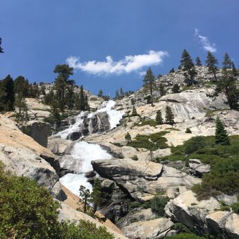
Bucket list! I'm so glad I did this hike! I am 50 years old and it's only taken me 45 years to slow down long enough to plan and actually do this hike. It's a moderate hike for those younger and in shape. For me it was at times arduous. I suggest wearing bike/workout shorts and sports bra- for comfort and to jump in the beautiful pools along the way. Wear really good tennis shoes that allow grip AND that won't allow your toes to slide. The hardest part was coming down. My toes were feeling very jammed! A great hike that CAN be leisurely taken. You don't have to go ALL the way to enjoy the beauty all around. The best part was at the very end. We thoroughly enjoyed bathing in the pool at the base. It was very healing on our hot bodies and hammered toes. MUST HAVE: Water, lots- we went through 6 bottles and wanted more Sunscreen! Lather up before and again at the top! Good shoes- people say boots- but I'm partial to good tennis that keep your feet in place with descent tread for gripping. Movable clothes, with spandex, workout attire, ok to get wet Sunglasses! Protein style snack NICE TO HAVE: A lightweight chair to perch and gaze A towel for the post dip in pools read more


7 years ago
Super cool hike We didn't go all the way up since we had dogs and it said Most Difficult. But we did nice 2 mile hike read more


6 years ago

11 years ago
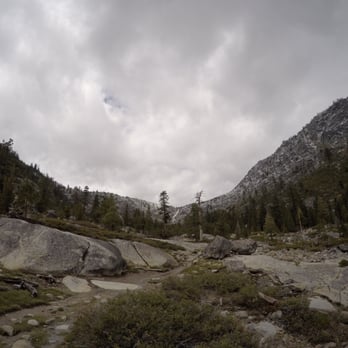
June 25,2016 ~ Finally made it up the falls. There was so much more climbing than I expected. It took us approximately 2 hours going average pace with breaks to get up there. Make sure you have proper footwear as the rocks could be slippery. Take your time going up and especially coming down. There are no obvious trail but you will notice the trail markers. Follow them up and keep to the left of the falls coming back down. We hiked in mid 80 degree weather which can be extremely hot and draining so pack plenty of water and snacks to enjoy. Once you get to the top, keep going. You will see a little lake. I must warn you that the water is ice cold, but definitely worth a swim. It's a totally different world up there, just simply beautiful. Although I have not seen them (fingers crossed for next time) there are rattlers out there so beware of shades rocks. All in all, this hike was definitely a workout more than I expected. Make sure to breath in and out of your nose due to the elevation which can be hard on some people. Have fun, take lots of photos and enjoy the beauty Mother Nature has to offer :) Previous review: 5 shining stars although we did not make it all the way up to Horsetail Falls. We started the hike around noon with a temperature of around 48 degrees. We took the Pyramid Creek Trail and made it to the cascade and the creek. We spent most of our time just absorbing the beauty of Mother Nature. The giant granite rocks (can be slippery) makes a perfect spot yoga pictures though. I can't wait to go back. Make sure you bring $5 for parking. The parking lot is on the left side of HWY 50 after the little town of Strawberry. I love strawberries. I recommend bringing snacks/lunch because it's such a lovely place to have a picnic. Will be back to update this review once I actually get to hike this place up the falls. Aloha! read more



8 years ago
Beautiful hike! Some challenging spots and scrambling from midway up the falls to the top. Totally worth it! Will go again. read more
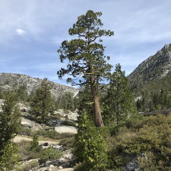

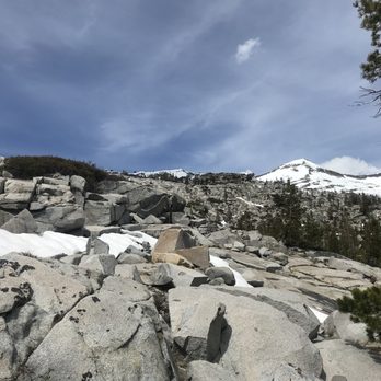

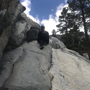

8 years ago
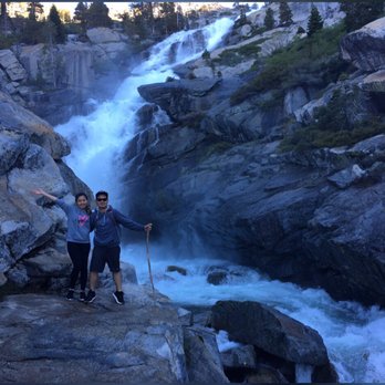
Hard to stay in the trail - no trail marks just follow the water and you will find the falls. We made it and it was worth it! read more

6 years ago


12 years ago
11 years ago
Driving up to South Lake Tahoe, the parking lot is on the left side of HWY 50. Parking is $5, so don't forget to bring cash! I recommend hiking early in the morning because the parking lot can get very full. During my several visits to South Lake Tahoe, I've been to Horsetail Falls Hike 3x. Unfortunately on my 1st and 2nd hike, I did not make it to the falls because my friends weren't experienced hikers and we decided to go swimming at the lower lake instead. On my 3rd hike, I FINALLY MADE IT TO THE FALLS! Horsetail Falls Hike is a moderate 3 mile hike. The most difficult part of the hike is that there is no clear markings. There are a few distinct paths, but sometimes you have to get lost in order to find them. Getting to the falls requires a little bit of bouldering, but it's worth it. Just climb climb climb and eventually you'll get to the falls. Don't forget to bring your swimsuit because it is a perfect place to take a dip and tan! read more
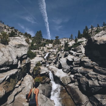

12 years ago
I did this hike today, what a great difficult hike. I will be going back to hike up to the top of the waterfall. I really did enjoy getting lost and just finding my way. read more
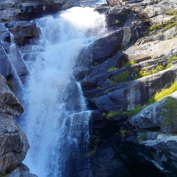


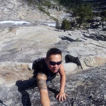


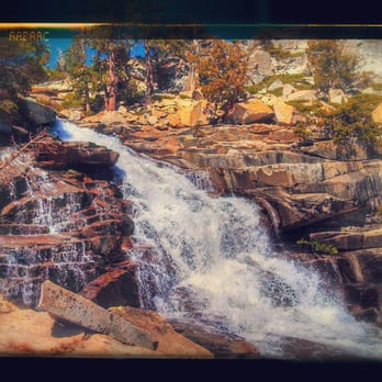

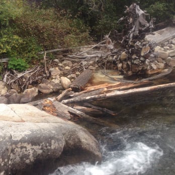
The scenery on this hike is beautiful. It isn't an easy hike but it's not too difficult either. The hardest part is staying on the trail, and not because it's rocky (it is) but because it is very poorly marked. There's only 1 sign and there's no spray paint or any other indicators of where to go except for footprints. However these footprints can also lead you astray and to a place where you can't get down easily. When I went this happened and we had to climb down from a massive boulder. It was dangerous so be very careful. It That's my only complaint about it. Be careful not to get lost and if you do just head down toward the river and follow it down stream to the end. If you're driving there from Sacramento the trail parking lot will be on your left side. It's pretty easy to miss. If you hit the Sierra ski lodge you've gone too far. Definitely worth checking this hike out. read more






8 years ago

12 years ago
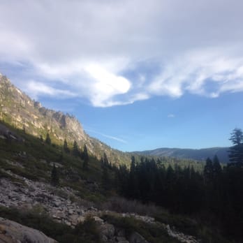
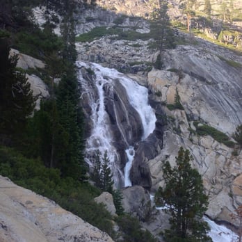
This was a great hike, even though we never actually made it to the lakes. Our goal was to take Pyramid Creek Trail to the lake and beyond, but the hike was a lot tougher than we had anticipated. Nevertheless, the scenery leading up to that point was fantastic as you follow the raging river most of the way. There is a steady incline most of the way until you reach closer to the falls. Once you are near the falls, you will be challenged to find your own trail up rocky inclines to the peak of the mountain. Overall, it was a really nice hike and definitely recommended! read more


12 years ago
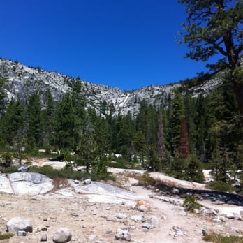
Beautiful views in all directions. In just one hike you get some if the best views of Horsetail Falls as well as Lover's Leap. In my opinion hike is difficult once you hit the wilderness boundary, about 3/4 mile in. Trail becomes a bit confused in this area. Several nice ponds along the trail that allow you to get wet. Plenty of parking at Twin Bridges. Great half day adventure. read more


11 years ago

12 years ago

9 years ago
Loved Horsetail falls and Desolation Wilderness!!! This was my first time here, easy to find, the parking lot is off Hwy 50, downfall is a small lot. We went on Memorial Day, so of course it was busy, so we had to park across the road to the trail entrance, which wasn't fun with lots of traffic and two dogs. The trails are not well marked is the only reason I gave it 4 stars. Yes there are tree markers but I didn't notice them until the end of the hike back to the car, maybe I was too busy enjoying there views!! You can explore all over this area, it's in a canyon and you can see the falls from the beginning of the hike so you can't really get lost but we tried following the pyramid loop and ended up just hiking wherever we felt inclined to explore. There are rock slabs everywhere to run and climb for panoramic views and streams with rapids with stunning scenery and sounds. The water rushing so quickly was amazing to see and hear! Very dog friendly too, definitely an easy hike but we did not venture up the falls into the wilderness area because we had the dogs and you need a day permit. Also tons of spots to set up camp and have an enjoyable lunch! Will definitely return! read more

12 years ago

10 years ago
10 years ago
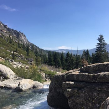
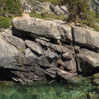
Love the hike. My bf, his sister and I took a day off for this hike. It was worth a hike. Such a beautiful scenic view with all the mountains around and trees. There was a lot of bees buzzing around when you hang out around certain trees or there by the falls. The falls was so beautiful as well! It can be a tiring hike so do bring lots of water and some energy snacks. read more

10 years ago
8 years ago
More info about Horsetail Falls Hike
Twin Bridges, CA 95735
Directions
Hours
Outdoor Amenities
Ask the Community - Horsetail Falls Hike
The parking lot is currently "closed for the season". Does anyone know when it opens? I'm guessing May 1, but if anyone knows for sure that would be helpful. Thanks!
Review Highlights - Horsetail Falls Hike
You might also consider















Why does Yelp recommend reviews?
1 review that is not currently recommended
The reviews below are not factored into the business's overall star rating.

9 years ago
Horsetail Falls Hike - hiking - Updated September 2026
Best of Twin Bridges
People found Horsetail Falls Hike by searching for…
Hiking Trails With Waterfalls in Twin Bridges, CA
Waterfalls and Swimming Holes in Twin Bridges, CA
Things to Do in Twin Bridges, CA
Star Gazing in Twin Bridges, CA
Redwood Trees in Twin Bridges, CA
Waterfalls in Twin Bridges, CA
Swimming Lakes in Twin Bridges, CA
Scenic Overlook in Twin Bridges, CA
Easy Hikes in Twin Bridges, CA
Beautiful Views in Twin Bridges, CA
Scenic Drive in Twin Bridges, CA
River Access in Twin Bridges, CA
Photo Spots in Twin Bridges, CA
Hikes With Dogs in Twin Bridges, CA
Lookout Points in Twin Bridges, CA
River Swimming in Twin Bridges, CA
Dog Friendly Hiking Trails in Twin Bridges, CA
Rock Climbing in Twin Bridges, CA
Browse Nearby
BEST of Twin Bridges, California Parks near Horsetail Falls Hike
BEST of Twin Bridges, California Restaurants near Horsetail Falls Hike
BEST of Twin Bridges, California Things to Do near Horsetail Falls Hike
BEST of Twin Bridges, California Coffee near Horsetail Falls Hike
BEST of Twin Bridges, California Breakfast near Horsetail Falls Hike
BEST of Twin Bridges, California Campgrounds near Horsetail Falls Hike
BEST of Twin Bridges, California Sledding near Horsetail Falls Hike
BEST of Twin Bridges, California Snow Tubing near Horsetail Falls Hike


