Cancel

    Open app

    Search

    Genoa Town of

    5.0 (5 reviews)

    Genoa Town of Photos
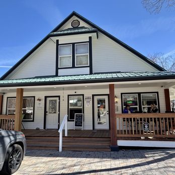
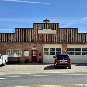
    Recommended Reviews - Genoa Town of

    Your trust is our priority, so businesses can't pay to alter or remove their reviews. Learn more about reviews.
    Yelp app icon
    Browse more easily on the app
    Review Feed Illustration

    1 year ago

    Helpful 44
    Thanks 11
    Love this 42
    Oh no 0

    10 months ago

    Helpful 0
    Thanks 0
    Love this 0
    Oh no 0

    2 years ago

    Helpful 1
    Thanks 0
    Love this 1
    Oh no 1

    8 years ago

    Helpful 2
    Thanks 0
    Love this 2
    Oh no 0
    Photo of Sherry M.
    23
    196
    187

    7 years ago

    Everything in around in about this town is clean, tourist friendly, beautiful, and mostly open on the weekend.

    Helpful 0
    Thanks 0
    Love this 0
    Oh no 0

    Verify this business for free

    People searched for Hiking 1,491 times last month within 15 miles of this business.

    Verify this business

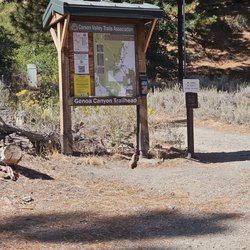
    Genoa Loop Trail

    Genoa Loop Trail

    5.0
    (4 reviews)
    0.2 mi

    It's been years since I last hiked this loop on a hot Summer day in July…read more This is a steep trail and there are parts that narrowed out, but hubby and I walked single file through those parts. We spent a day hanging out here, but we stopped halfway for a break and lunch in some shade. There are plenty of little rivers that flow below the waterfall. Hearing the waterfall kept us chugging along because we were ready to cool off. This wasn't the biggest waterfall, but we enjoyed our time in it. It was very private once we actually got down there and so happy we were in our own little oasis; we had the whole place to ourselves. With all the precipitation we received this year I can only imagine how beautiful and full everything is. I'm planning on revisiting this Summer to see how everything has grown.

    Beautiful hike, spectacular views with a waterfall, this hike offers up rewarding treasures that…read moreonly Genoa can deliver. We set off on this trail that starts in the historic town of Genoa at the end of Carson Street which is north of Main Street (same side as the Genoa Bar - look for the Orchard House). You will see a gravel parking lot and the Genoa Loop Trail sign at the start of the trail. We opted for the 6 mile round trip to the waterfall adventure on this particular day as we headed out. With an elevation gain of 1410ft and many switchbacks be sure to carry plenty of H20, wear appropriate footwear, maybe bring something like a granola bar or fruit and as always pack out, what you pack in. The trail is well maintained, but can be narrow & steep at times with bicyclists and furry companions allowed on the trail too. Please be sure to bring leashes along with doggy mutt mitts aka poop bags, there is a trash can and mutt mitts at the beginning of the trail but better to be prepared and there are no poop fairies. Remember everyone is out there to enjoy the beauty of the Great Outdoors so ENJOY IT! We thoroughly enjoyed this hike, stopping along the way to take in the spring flowers, beautiful views, grab our binoculars to look upon Genoa, the Carson River & Jacks Valley. We crossed the creek throughout the trail with foot bridges, butterflies, and the reward of our hiking adventure was the Genoa Waterfall as it cascade over as we listened to it surrounded by the pine trees. So get out there, this is a GREAT waterfall hike with stunning views added bonus you are already in the quaint historic town of Genoa so why not check out the cute town and grab a bite to eat or libation. Enjoy and #moveyourbody!!

    Photos
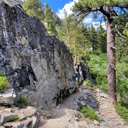
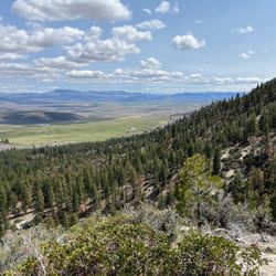
    Views while walking up :) Didn't make it up to the waterfall but still worth the view.
    Views while walking up :) Didn't make it up to the waterfall but still worth the view.
    Genoa Loop Trail
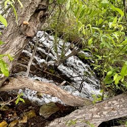
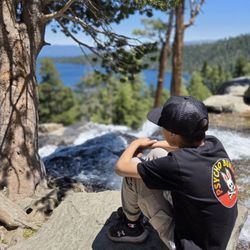
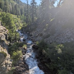
    Waterfall in the Genoa loop

    See all

    Waterfall in the Genoa loop
    Mormon Station State Historic Park

    Mormon Station State Historic Park

    4.8
    (16 reviews)
    0.1 mi

    A tiny museum in a beautiful park. The museum has well-curated and preserved artifacts from the era…read moreof the first settlers in the state. Despite this being tiny, they have many interesting artifacts I have not seen in similar establishments. The guide has many stories to tell. Well worth the stop! Great selection of books about the local history too. The museum entrance is just a dollar, so bring cash!

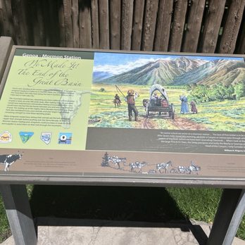
    Clean park, Cool artifacts [Genoa NV]…read more The park is free, the museum is $1. Very nice, clean park/museum with lush grassy area and shade trees. HISTORIC Mormon Station is the site of Nevada's first permanent non-native settlement and replicates the original 1851 Mormon Station trading post that burned down in 1910. It was rebuilt in 1947 as a museum and today it stores many original pioneer era artifacts. It was referred to as a fort but it was never one. There was never any military presence here nor did any battles take place. It was actually a stockade. BUILT AS A TRADING POST We took a self-guided walking tour inside the stockade (the enclosure of walls built with logs placed vertically, side by side). There were informative boards, one sign asked to imagine if you were standing at that very place and what would you expect to see... we would likely see oxen grazing, stable sheds, a haystack or two and a small vegetable garden. The stockade was used as corral for the oxen, horses and mules. COOL ARTIFACTS There were authentic exhibits used during that period. I especially found the semi trucks of the 1800's amusing. There was a real life piece of a freight wagon as one of the exhibits. The wagon displayed is a California rack-bed freight wagon. Mormon Station was worth a visit. I would recommend to include a stop here for a perfect loop around Lake Tahoe. Review #3736

    Photos
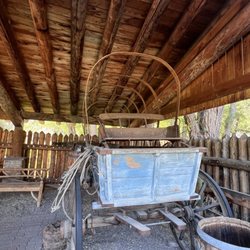
    Old covered wagon
    Old covered wagon
    03.09.25 the semi trucks of the 1800's
    03.09.25 the semi trucks of the 1800's
    Mormon Station State Historic Park

    See all

    Carson Valley Trails

    Carson Valley Trails

    4.7
    (3 reviews)
    5.6 mi

    It was a perfect day to hike this past weekend. It wasn't too hot nor cold. With our local weather…read morecooling it was probably the warmest weekend we'll have in awhile. I'm glad I was outdoors and got some much needed vitamin D and my blood pumping. It's not the easiest trail so I'd rethink this if you're bringing smaller children. We ran into other couples on the trail, but we were able to stop and enjoy our lunch midday away from anyone and start heading out before it started cooling down. We thoroughly enjoyed hiking this trail and look forward to returning next year.

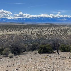
    The Carson Valley Trails are a diverse cluster of expertly built and maintained trails in the…read moreCarson Valley. I spent the most time on the Pinyon Trail, the only Carson Valley Trail east of Gardnerville. It was carved into the side of the desert mountain with stunning views of the Sierra Nevada range. The trail wound around the side of the mountain with lots of turns, elevation gain, and elevation loss. It is the best Carson Valley trail for mountain biking if you want something manageable and not too dangerous. It has the most "flow" of any of the trails for biking. The best overall trail for mountain biking was the Clear Creek Trail. It started in a fire scorched desert section near a school and slowly wound its way up into the dense pine mountains. I could tell how much effort it took to build the trail because some sections hung on to the side of the mountain. Maybe I was overly cautious, but I slowly crept up each bend in the trail, cognizant of a potently biker whizzing down from above. The trail wasn't big enough for two bikers unless one biker was hugging the mountainside. I made it up to Knob Point before I was thoroughly exhausted and turned around. This was only about half of the trail. It's hard to explore all of the trails and still have a full time job. Fortunately, when I turned around I didn't have to exert much energy besides slamming on the brakes and guiding the bike down the mountain. It's a trail that one could push to their limit, then turn around and the let gravity bring them back.

    Photos
    Carson Valley Trails
    Carson Valley Trails
    Last view of the Eastern Sierras from the Carson Valley

    See all

    Last view of the Eastern Sierras from the Carson Valley
    Mount Tallac Trail

    Mount Tallac Trail

    4.7
    (92 reviews)
    10.6 mi

    I did this trail in late May when there was still a lot of snow on the mountain. I started the hike…read moreearly in the morning (7 a.m.) to make sure the snow was packed and not slippery (because of the sun beating down on it). There were only 2 other cars in the lot when I got there. That already signaled me that this trail may not be as safe to hike as I had initially thought. The hike started easy, but soon after I passed the second lake, it became tricky because it was really hard to keep track of the trail. Parts of the trail were either buried under the snow or harder to identify due to the fallen trees, bushes, and streams of water. I definitely went off the trail a few times, but thankfully, I had the map downloaded on AllTrails (yayyy AllTrails+ subscription), which came in clutch. The trail is mostly covered until you get past the 3rd lake. After the third lake, it was all rocky and exposed. It was really hard to follow the trail from that point on because of the snow. It gets steeper from there on out. Since the trail was convere in snow, I decided to rock scramble straight to the top. It was probably not the best idea. Having done that, I'd advise against it because the rocks were loose. One wrong step, and you are either falling or twisting your ankle. I did this hike with no poles, spikes, or gloves. Spikes would have helped because some areas required going downhill on snow-covered patches (some steeper than the others). I don't think you need gloves or warm layers. The views throughout the hike were amazing. Don't forget to stop and look back on your way up (and look up on your way down). Avoiding snow-covered areas in some cases will lead you off the trail, so take your time when going through those patches of snow. Don't let your ego get in the way and turn back if you start having doubts. A tip (shouldn't be a surprise) - When going through a patch of snow, make sure your first step is somewhat bigger so you don't step on the edges of the snow patch where the snow is usually thin and chances of you falling through are high.
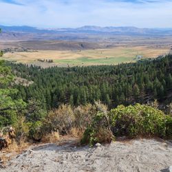
    This trail is a killer! I've done strenuous hikes before, but I think part of my soul left on this…read moretrail. Not sure if it's the 80° weather, all the rocks, or I was just out of shape, but this trail really tested my mind over matter. The trailhead is easy to find, with a small parking lot but there's tons of parking nooks along the road for overflow. I would say this hike has 3 sections to conquer. 1. The trail starts off easy, soft dirt path with some shade alongside great views of Lake Tahoe. There's some slight parts of incline, but nothing too elevated. You pass by several lakes that are great picnic spots and we saw many dogs taking a swim. Butterflies everywhere. 2. The trail starts getting rocky the further you go, like walking along a dry creek. You hike uphill for what seems like a lifetime, then finally get to the base of the mountain.. of boulders. SO many rocks, BIG rocks, and switchbacks! ALL incline. And no shade. This took some time to get to the top. 3. You made it to the top! But oh no, you're not done yet. To get to the summit is about another mile to the right. The trail eventually splits with a less noticeable trail to the right. Keep right to get to the summit. This was probably the most beautiful part of the trail with open plains, soft grass, and wildflowers along both sides of the path. However, at this point I was so exhausted that my steps were like the mini steps of a toddler. The struggle was real ya'll. Every uphill was a battle. Finally, after what felt like a lifetime, you climb up some rocks and you're at the top of the summit, greeted by a metal sign "Mt Tallac 9,739" elevation. Whoo! It was a spectacular 360 view. There were oddly a ton of flies up there. Also, lots of butterflies and chipmunks. Of course going down was much faster but beware if you have bad knees. My knees usually never hurt going downhill but I definitely felt it on this hike. With 9.5 miles (out and back) of rocky trail and the 3,284 ft elevation gain, hiking sticks are a must! On part two of the trail, certain parts you can hear rattlesnakes so make sure you stay on the trail. Cover up and bring more water than you think you'd need. I plowed thru my hydropack and additional two bottles. At the end, the sight of the trailhead sign and our car was like heaven on earth.

    Photos
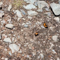
    California tortoiseshell butterflies were everywhere
    California tortoiseshell butterflies were everywhere
    Doggo in the lake
    Doggo in the lake
    A cool stretch of forest running along a plateau above Fallen Leaf Lake. Awesome section of the trail.

    See all

    A cool stretch of forest running along a plateau above Fallen Leaf Lake. Awesome section of the trail.
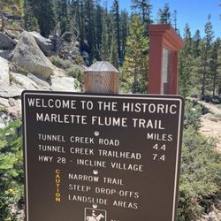
    Marlette lake trail

    Marlette lake trail

    5.0
    (6 reviews)
    11.5 mi

    We hiked the Marlette Lake Trail from Spooner Lake to Marlette Lake as a backpacking trip for my…read morefriend's bachelorette party! We added some extra distance at the end by hiking to the Marlette Peak Campground to stay for the night. From the parking lot to the campground was about 7 miles each way. The trail itself was well-maintained, moderate difficulty, and had everything you'd want in a good hike! Solid trail conditions. Beautiful mountain and lake views. Some sections of wildflowers. A good amount of sun but also some shaded parts. Gradual incline that never felt super steep, so the elevation gain felt manageable. We saw people hiking as well as mountain biking on this trail. There are several sections of aspen trees along this hike, so it's a great one to come back and do in the fall once the leaves turn yellow. The trailhead area has great facilities, the bathrooms were clean and there is ample parking. The park rangers I spoke to were friendly and helpful. There is a $10/car entry into this area but it's totally worth it, especially when you see how well they take care of it. I loved this hike and will continue to come back to Spooner for hikes in the future!

    There are a few ways to reach Marlette Lake, all of them totally worth it, especially this time of…read moreyear. This trail takes you around Spooner Lake and up to Marlette. It's a 9 mile out and back with fairly gradual elevation gain, up through the trees, until you reach the lake. A great little workout. Marlette sits along the Flume Trail, so you're likely to see a lot of mountain bikers. Fun fact: The Flume Trail got its name because Marlette and the tributaries that feed it were part of a log flume system to carry logs used to build our region all the way down from as far as Virginia City! Marlette has a short fishing season, but people say it's grand if you make the trip. Of course you need to hike in to have that experience. This is definitely a trail worth checking out in our area!

    Photos
    Marlette lake trail
    Marlette lake trail
    Marlette lake trail

    See all

    Genoa Town of - hiking - Updated July 2026

    Loading...
    Loading...
    Loading...