Guadalupe River Trail Photos


You might also consider
More like Guadalupe River Trail
Recommended Reviews - Guadalupe River Trail
Start your review...

Reviews With Photos

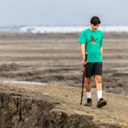
I'm going to be honest...... I felt really uncomfortable running on this trail. I started at the trailhead at W Virgina and Harris and was immediately greeted by a homeless encampment. That's fine but the men there were watching me and appeared as if they might follow me. I kept running since I just started my jog but then a quarter mile into the run (~0.25 miles in), I saw a bunch more encampments with people standing close to the trail and couldn't justify continuing on and risking my safety so I turned around and was out of there. Maybe it would have been different had I started my run at a different point on the trail so please take my 1 Star review with a grain of salt. If you are a single female, I wouldn't recommend this trail - running or biking. But that's just my POV. Of course, there may be some of you out there who know how to kick some booty/self defense but I don't (aside from screaming and biting and scratching).
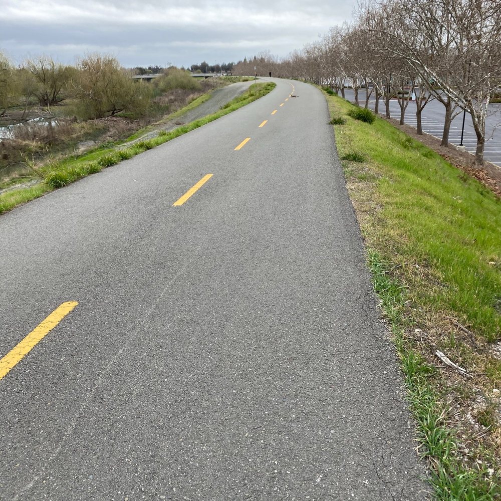
I've been on this trail many times. I try to avoid going during busy times which is usually after work hours or during lunch. On weekends, it does get busy from late mornings to mid afternoon. I always go early mornings. This works for me since I am a morning person. Also there is not a lot of people during that time. There is not much shade. So sunscreen is a must! I am fortunate enough to live close by so I don't have to drive to get to the trail. The areas that I typically go on are suburban neighborhoods between San Jose and Santa Clara. Pretty quiet and clean area. Levi stadium is close by. People come here to walk, run, and cycle. There are a couple of parks along this trail or at least the area of the trail I go on. Plenty of space to have the kids and dogs play. One of the parks has a tennis and basketball court.

This is a clear 4 star trail to take a long bicycle ride from San Jose to Alviso where you can enjoy the southern most part of the San Francisco Bay. I love the freedom and safety of never having to cross a busy street or wait for a stoplight. Oh , please do be mindful of pedestrians . We bicyclists need to share the road. The trail follows the Guadalupe River (actually more of a creek than a river). It is a lovely for the most part, but can be improved upon. City planners should take another look at the Trail to see how it can be further developed with public parks and public transportation stops nearby for easier access to the trailheads. Then, it would be a 5 Star rating.

This is a go-to trail not only for me, but for many as well. I've walked, ran, biked in this trail multiple times and have always felt goodness about this trail. There's also a residential park just at the start of the trail, which people can enjoy if they want to. There's CorePower Yoga before the start of the trail and again people can opt to use CPY out of convenience too. Since there are lots of options available in this trail like walking/ running/ jogging/ biking, this is my go-to place and thankfully I also live in the same area. Since this also comes with outside options like park or yoga, it's very easy for me to combine any two, either walking at the trail and yoga or running/ biking at the trail and relaxing in the park side. Overall, I Highly Recommend Guadalupe River Trail !


This is is the trail I have been looking for since I moved back, an urban trail with paved roads (some part are gravel) to walk or jog on (biking is also allowed on the trail), it is also long enough for me not getting bored and just long enough for my to run a loop. I read on Wiki that the trail is 11 miles long connects the Upper Guadalupe River and Lower Guadalupe River, but the Upper Guadalupe River is disconnected from the rest. I parked in the River Oaks VTA station and ran a loop of almost 3 miles You can also get to the Ulistac Natural Area from the trail. Too bad, this trail isn't close to my house, sigh.

Urban trail, perfect for a walk or jogging, although looks like the bike riders are the most abundant. I have been at different times of the day and afternoon, and I prefer the afternoon hours where there are some families from the close by condo complexes walking around. Otherwise it can get a little solitary (not that I have ever feel unsafe walking alone there, but you can get that sense of what the hell I am doing jogging here by myself and no soul to be seen). I like to walk around the area close to the river (sometimes you are lucky and can see real water, it is has rain,otherwise it can get pretty dry).It is an easy, well maintained trail perfect for all ages.

An excellent road trail for bikers, runners, and walkers. The road is well maintained, in good condition, and is enough wide for two-way traffic. The trail, 9 mi long, connects the Guadalupe River Trail from Gold St in Alviso in north to San Jose downtown in south. The trail is in the open with hardly any shade, so be sure to wear sunscreen and cap. There are slopes and inclines in the trail near the underpasses. I usually park at the River Oaks VTA station.
")
2 years ago
I frequently run the lower trail as it's closer to home, it's quiet and clean for the most part, I often pass by adorable waterbirds along the pathway, and good for me it connects to Alviso Marina Park (over the train tracks and past South Bay Yacht Club). The full trail is at least 11 miles long, but I usually try not to go more than a few miles beyond Alviso and definitely try to avoid the downtown SJ area, a less desirable portion of the trail, littered with trash and graffiti, and I've crossed paths with foul-smelling homeless camps and questionable characters, it just doesn't feel very safe. But on my recent run through the Guadalupe River Park on a Saturday afternoon, it was emptier than usual, still a few shady looking individuls around, and beautiful murals tarnished by dirt, graffiti, and wear and tear, but the area as a whole was tolerable, for a daytime run at least. Lupe the Columbian Mammoth, a life size sculpture made up of bent steel pipes, is a cool statue to check out along the trail as well, near West Trimble Road, about 4 miles from Alviso. read more
 - Hiking Near Me - San Jose, California")
 - Hiking Near Me - San Jose, California")
 - Hiking Near Me - San Jose, California")


 - Hiking Near Me - San Jose, California")


 - Hiking Near Me - San Jose, California")


2 years ago
Water is pretty high up the tree in the middle of the river, but there's more capacity up the banks. Got a nice rainbow shot due to the break in the weather. read more


I'm going to be honest...... I felt really uncomfortable running on this trail. I started at the trailhead at W Virgina and Harris and was immediately greeted by a homeless encampment. That's fine but the men there were watching me and appeared as if they might follow me. I kept running since I just started my jog but then a quarter mile into the run (~0.25 miles in), I saw a bunch more encampments with people standing close to the trail and couldn't justify continuing on and risking my safety so I turned around and was out of there. Maybe it would have been different had I started my run at a different point on the trail so please take my 1 Star review with a grain of salt. If you are a single female, I wouldn't recommend this trail - running or biking. But that's just my POV. Of course, there may be some of you out there who know how to kick some booty/self defense but I don't (aside from screaming and biting and scratching). read more


I've been on this trail many times. I try to avoid going during busy times which is usually after work hours or during lunch. On weekends, it does get busy from late mornings to mid afternoon. I always go early mornings. This works for me since I am a morning person. Also there is not a lot of people during that time. There is not much shade. So sunscreen is a must! I am fortunate enough to live close by so I don't have to drive to get to the trail. The areas that I typically go on are suburban neighborhoods between San Jose and Santa Clara. Pretty quiet and clean area. Levi stadium is close by. People come here to walk, run, and cycle. There are a couple of parks along this trail or at least the area of the trail I go on. Plenty of space to have the kids and dogs play. One of the parks has a tennis and basketball court. read more


This is a clear 4 star trail to take a long bicycle ride from San Jose to Alviso where you can enjoy the southern most part of the San Francisco Bay. I love the freedom and safety of never having to cross a busy street or wait for a stoplight. Oh , please do be mindful of pedestrians . We bicyclists need to share the road. The trail follows the Guadalupe River (actually more of a creek than a river). It is a lovely for the most part, but can be improved upon. City planners should take another look at the Trail to see how it can be further developed with public parks and public transportation stops nearby for easier access to the trailheads. Then, it would be a 5 Star rating. read more


This is a go-to trail not only for me, but for many as well. I've walked, ran, biked in this trail multiple times and have always felt goodness about this trail. There's also a residential park just at the start of the trail, which people can enjoy if they want to. There's CorePower Yoga before the start of the trail and again people can opt to use CPY out of convenience too. Since there are lots of options available in this trail like walking/ running/ jogging/ biking, this is my go-to place and thankfully I also live in the same area. Since this also comes with outside options like park or yoga, it's very easy for me to combine any two, either walking at the trail and yoga or running/ biking at the trail and relaxing in the park side. Overall, I Highly Recommend Guadalupe River Trail ! read more

5 years ago
6 years ago
This is underwhelming urban park with lots of potential to be great. Some public art is up, rose garden in need of TLC. Amid COVID, people walk and bike the trails. Upkeep is low and trash, debris around the area. Albert, great place to walk and connects to parts of downtown. read more


7 years ago
Nice trail for starters . As this is a flat trail no mountain etc so it is good way to spend some time on a weekend before going back in city life (malls movie etc) I have started with this trail and gonna say i loved it . read more


7 years ago
7 years ago
Great way get around San Jose by bike or take a daily walk or run. The trail goes thru San Jose for miles and there Are plenty of blue ford gobikes to rent along the way. read more


10 years ago
This is is the trail I have been looking for since I moved back, an urban trail with paved roads (some part are gravel) to walk or jog on (biking is also allowed on the trail), it is also long enough for me not getting bored and just long enough for my to run a loop. I read on Wiki that the trail is 11 miles long connects the Upper Guadalupe River and Lower Guadalupe River, but the Upper Guadalupe River is disconnected from the rest. I parked in the River Oaks VTA station and ran a loop of almost 3 miles You can also get to the Ulistac Natural Area from the trail. Too bad, this trail isn't close to my house, sigh. read more


Urban trail, perfect for a walk or jogging, although looks like the bike riders are the most abundant. I have been at different times of the day and afternoon, and I prefer the afternoon hours where there are some families from the close by condo complexes walking around. Otherwise it can get a little solitary (not that I have ever feel unsafe walking alone there, but you can get that sense of what the hell I am doing jogging here by myself and no soul to be seen). I like to walk around the area close to the river (sometimes you are lucky and can see real water, it is has rain,otherwise it can get pretty dry).It is an easy, well maintained trail perfect for all ages. read more

6 years ago
12 years ago
An excellent road trail for bikers, runners, and walkers. The road is well maintained, in good condition, and is enough wide for two-way traffic. The trail, 9 mi long, connects the Guadalupe River Trail from Gold St in Alviso in north to San Jose downtown in south. The trail is in the open with hardly any shade, so be sure to wear sunscreen and cap. There are slopes and inclines in the trail near the underpasses. I usually park at the River Oaks VTA station. read more


 - Hiking Near Me - San Jose, California")
 - Hiking Near Me - San Jose, California")


9 years ago
I just read one quote saying " Sometimes people didn't recognize and appreciate your presence until it disappear ". So true ..;-) This trail is close by where I live, perfect for daily exercise if people don't want to pay for the Gym's membership, lol. You can come here to walk, jog, bicycle, roller skate, walk your dogs or even for having a cheap date ( fresh air, holing hands & watching sunset, sounds romantic huh ? ). I've committed to myself to come here more often. The trail is flat, nice, clean and easy but trust me you can have a good sweat and your legs can get sore as well if you run for a long time ( this trail is long enough to make you feel that ). Get your shoes on or flip flop ( you can do it at this trail ..;-) get some fresh air, some sun, some wind on your face. Enjoy the nature, the sound of singing birds, frogs, also when you pass the route 237 and see terrible traffic you will appreciate your feet more than a car, lol..;-) It's just boring for me to just get on the trail to walk or run, I do enjoy taking pictures every time I go. I do share them with you guys a little bit of course .:-) I believe your eyes will get the real images than that. Just come and experience for yourself.. Love this trail. Feeling blessed and appreciated for what I have in life now.. Keep on moving ..;-) read more
 - Hiking Near Me - San Jose, California")

 - Hiking Near Me - San Jose, California")
 - Hiking Near Me - San Jose, California")
 - Hiking Near Me - San Jose, California")


 - Hiking Near Me - San Jose, California")
 - Hiking Near Me - San Jose, California")
 - Hiking Near Me - San Jose, California")
9 years ago
9 years ago
10 years ago
Guadalupe trail is the best for walking/running or biking! I love this trail for morning walks mainly because it is so fresh and it is never deserted and you can always find people on the trail. It is clean and well maintained. The two roads run parallel to each other with one being the tar road and another gravel. The one with tar is best for biking and the other for walk/jog. The gravel road is adjacent to the Ulistac Natural Area and has direct entrances. There are some really pretty flowers on that side of the road. read more


 - Hiking Near Me - San Jose, California")
7 years ago
7 years ago
11 years ago
10 years ago
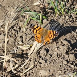
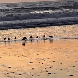
The Guadalupe trail is one of my top trails for biking, running or simply taking a nice walk during the evening sunset time. The Levi Stadium can be seen from the trail and there are just enough hills and slopes to make this a great joyous workout since you can simply go from one end to the other and back again as often as you'd like. There are 3 different paths I like to take and each one leads to another great trail. One direction the trail connects through to the Mineta airport onward to Downtown San Jose. Second direction with just a quick detour off the path will take you to the beautiful and scenic Shoreline in Mountain View onward to Palo Alto. The third direction takes you to Alviso headlands where there are birds galore and beautiful scenic views all around. Willow Glen, Downtown Campbell and near Los Gatos can also be crossed all from the Guadalupe river trail. There are connecting paths that will take you to Google, Downtown Mountain View and just about anywhere your heart desires. Numerous happy and friendly folks, dogs, birds, dragonflies, butterflies, bunnie rabbits and squirrels as well. It's always a great adventure and road trip when cruising along on the bike. Would highly recommend always wearing sunglasses as there have been numerous times bugs have squashed on my lenses and if it were not for the shades the bugs would have ended up in my eye for sure. Eeeks! Anytime and any day of the week there are numerous of folks enjoying the trail. Sunset time is simply beautiful and breathtaking especially when there are clouds galore up above. read more

8 years ago
9 years ago
I've done this trail halfway a few times from Alviso but still have not gone all the way to downtown SJ. read more


11 years ago
I am a regular on this trail ! Perfect place to do your cardio before gym . There is a nature reserve hidden on the side closer to stadium , which is serene . read more


8 years ago
9 years ago
9 years ago
Page 1 of 2
More info about Guadalupe River Trail
1 Guadalupe River Trl
San Jose, CA 95134
North San Jose
Directions
Hours
Outdoor Amenities
Ask the Community - Guadalupe River Trail
Review Highlights - Guadalupe River Trail
You might also consider


Why does Yelp recommend reviews?
5 reviews that are not currently recommended
The reviews below are not factored into the business's overall star rating.
3 years ago
7 years ago
6 years ago
6 years ago
7 years ago
Guadalupe River Trail - hiking - Updated June 2026
Best of San Jose
People found Guadalupe River Trail by searching for…
Hiking Trails in San Jose, California
Scenic Drives in San Jose, California
Running Trails in San Jose, California
Walking Trails in San Jose, California
Waterfall Hike in San Jose, California
Scenic View in San Jose, California
Fall Foliage in San Jose, California
Sunset View in San Jose, California
Dog Friendly Hiking Trails in San Jose, California
Watch Sunset in San Jose, California
Beautiful Views in San Jose, California
Easy Hikes in San Jose, California
Shaded Hike in San Jose, California
Scenic Overlook in San Jose, California
Trails in San Jose, California
Great View Points for Sunset in San Jose, California
Fall Colors in San Jose, California
Wildflowers in San Jose, California
Stroller Friendly Hikes in San Jose, California
Scenic Places to Walk in San Jose, California
View Points in San Jose, California
Trending Searches in San Jose, CA
Amusement Parks near Guadalupe River Trail
Beaches near Guadalupe River Trail
Bird Sanctuary near Guadalupe River Trail
Black Owned Nail Salons near Guadalupe River Trail
Boat Rental near Guadalupe River Trail
Cliff Jumping near Guadalupe River Trail
Creeks near Guadalupe River Trail
Dog Friendly Things To Do near Guadalupe River Trail
Fishing Spots near Guadalupe River Trail
Free Kids Activities near Guadalupe River Trail
Jet Ski Rental near Guadalupe River Trail
Lakes near Guadalupe River Trail
Outdoor Activities near Guadalupe River Trail
Public Pools near Guadalupe River Trail
Public Shower near Guadalupe River Trail
Rock Quarry near Guadalupe River Trail
Running Trails near Guadalupe River Trail
Scenic Drive near Guadalupe River Trail
Secluded Spots near Guadalupe River Trail
Soccer Store near Guadalupe River Trail
Splash Pad near Guadalupe River Trail
Strawberry Picking near Guadalupe River Trail
Sunrise View near Guadalupe River Trail
Swimming Holes near Guadalupe River Trail
Swimming Lakes near Guadalupe River Trail
Swimming Pools near Guadalupe River Trail
Watch Sunset near Guadalupe River Trail
Browse Articles
Browse Nearby
BEST of San Jose, California Coffee near Guadalupe River Trail
BEST of San Jose, California Restaurants near Guadalupe River Trail
BEST of San Jose, California Things to Do near Guadalupe River Trail
BEST of San Jose, California Walking Trails near Guadalupe River Trail
BEST of San Jose, California Parks near Guadalupe River Trail
BEST of San Jose, California Breakfast near Guadalupe River Trail
BEST of San Jose, California Hot Springs near Guadalupe River Trail
BEST of San Jose, California Campgrounds near Guadalupe River Trail
BEST of San Jose, California Sightseeing near Guadalupe River Trail
Browse Brands
Related Searches in San Jose, CA
Affordable Kayak Rental Services in San Jose, California
Best Fishing Locations and Guides in San Jose, California
Best Nature Trails for Hiking in San Jose, California
Best Places for Horseback Riding in San Jose, California
Check Out Off Road Trails in San Jose, California
Discover Dog Friendly Trails to Explore in San Jose, California
Discover Kid Friendly Hiking Trails in San Jose, California
Discover Scenic Hiking Trails in San Jose, California
Discover Scenic Mountain Bike Trails Near San Jose, California
Discover Scenic Waterfall Spots in San Jose, California
Discover Walking Parks in San Jose, California Near You
Discover a Hiking Trail in San Jose, California
Discover the Best Night Hike Trails in San Jose, California
Dog-Friendly Hikes With Dogs in San Jose, California
Enjoy Camping Adventures Around San Jose, California
Enjoy Exciting Mountain Biking Adventures in San Jose, California
Enjoy Kayaking Adventures in San Jose, California
Enjoy Tent Camping Spots Around San Jose, California
Enjoy a Beautiful Waterfall Hike in San Jose, California
Enjoy a Peaceful Nature Walk in San Jose, California
Enjoy the Best Walking Path in San Jose, California
Enjoy the Best Walking Trails in San Jose, California
Exciting Cliff Jumping Spots in San Jose, California
Experience Thrilling White Water Rafting in San Jose, California
Explore Beautiful Parks and Green Spaces in San Jose, California
Explore Easy Hikes Perfect for All in San Jose, California
Explore Fun Activities to Do in San Jose, California
Explore Popular Campgrounds Near San Jose, California
Explore the Best Beach Spots in San Jose, California
Explore the Best Boating Spots in San Jose, California
Explore the Best Trail Options in San Jose, California
Family Friendly Hiking With Kids in San Jose, California
Find Popular Ziplining Spots Around San Jose, California
Find the Best Parks for Picnics in San Jose, California
Find the Best Scenic View Locations in San Jose, California
Great Places to Walk in San Jose, California
Hike the Popular Waterfall Trail in San Jose, California
Hiking Trails With Waterfalls in San Jose, California
Off Leash Dog Hiking Trails in San Jose, California
Plan a Scenic Drive Route Near San Jose, California
Popular Outdoor Activities to Try in San Jose, California
Popular Picnic Spots to Visit in San Jose, California
Safe River Swimming Areas in San Jose, California
Safe and Fun Parks for Kids in San Jose, California
Top Climbing Spots and Gyms in San Jose, California
Top Paddleboarding Activities in San Jose, California
Top Running Trails to Explore in San Jose, California
Top Swimming Spots and Pools in San Jose, California
People who viewed Guadalupe River Trail also viewed
San Tomas Aquino Creek Trail
61 reviews
St Joseph's Hill Open Space Preserve
61 reviews
Los Alamitos Creek Trail
44 reviews
Mount Umunhum
34 reviews
Berryessa Creek Trail
2 reviews
Bear Creek Redwoods Preserve
32 reviews
Montgomery Hill Park
37 reviews
Evergreen
Alum Rock Park - Lariat Trail
1 review
Hunter's Point
36 reviews
El Sereno Open Space Preserve
5 reviews