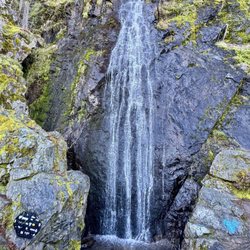
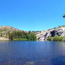
Lover's Leap Campground Photos


You might also consider
More like Lover's Leap Campground
Recommended Reviews - Lover's Leap Campground
Start your review...

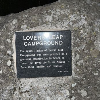
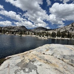
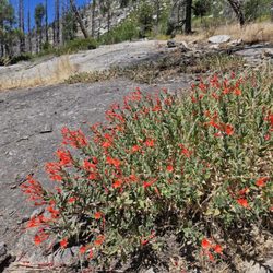
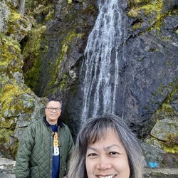
Wow this is a beautiful campground! Situated right under lover's leap, there are day and overnight use sites and parking. Clean pot toilets (well as clean as they can be). And running faucet outside. Each campsite is equipped with bear proof boxes, a wood burning bbq, picnic bench and small fire pit. There are several marked hiking trails. A stream. Posted signs about the Pony Express that once traveled through these parts. Normal warnings about the local environment and wildlife that may and do frequent the area, are posted. We watched several guys all geared up and ready to climb to face of cliff. I picked my future home site (err, I mean campsite ;)) for our next visit. This place is beautiful! Looking for something nice and not expensive?? No need to go ask the way to Tahoe. You'll find serenity here! read more


19 days ago
3 years ago
Beautiful campground. I stayed here with some friends for two nights of a three day weekend and it wasn't hard to find a spot. It's only a 30 minute drive to South Lake which make it an easy choice when other campsites were packed to the brim. We paid $27 into a drop box for the night and chose our own site to pitch up on. Each site is a good size and gives you space from your neighbors. There's a fire pit and bear box for every site. Lots of fun and definitely looking to return! read more
5 years ago
More info about Lover's Leap Campground
Slippery Ford Trl
Twin Bridges, CA 95735
Directions
Hours
Outdoor Amenities
You might also consider


Lover's Leap Campground - hiking - Updated July 2026
Best of Twin Bridges
People found Lover's Leap Campground by searching for…
Summer Camps in Twin Bridges, CA
Campgrounds in Twin Bridges, CA
Hiking Trails in Twin Bridges, CA
Camping Sites in Twin Bridges, CA
Things to Do in Twin Bridges, CA
Picnic Areas in Twin Bridges, CA
Indoor Rock Climbing in Twin Bridges, CA
Easy Hikes in Twin Bridges, CA
Night Hiking in Twin Bridges, CA
Stair Climbing in Twin Bridges, CA
Bouldering in Twin Bridges, CA
Fun Things to Do With Kids in Twin Bridges, CA
Running Trails in Twin Bridges, CA
Camping Cabins in Twin Bridges, CA
Tent Camping in Twin Bridges, CA
Swimming Holes in Twin Bridges, CA
Climbing Gear in Twin Bridges, CA
Places to Visit in Twin Bridges, CA
Waterfalls in Twin Bridges, CA
Browse Nearby
BEST of Twin Bridges, California Restaurants near Lover's Leap Campground
BEST of Twin Bridges, California Coffee near Lover's Leap Campground
BEST of Twin Bridges, California Breakfast near Lover's Leap Campground
BEST of Twin Bridges, California Sledding near Lover's Leap Campground
BEST of Twin Bridges, California Thrift Stores near Lover's Leap Campground
BEST of Twin Bridges, California Snow Tubing near Lover's Leap Campground


