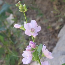
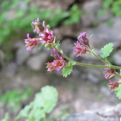
1. King Nature Park

1. King Nature Park

0

North Logan, UT

Cancel

Open app

Search

King Nature Park

5.0 (1 review)

King Nature Park Photos

Recommended Reviews - King Nature Park

Your trust is our priority, so businesses can't pay to alter or remove their reviews. Learn more about reviews.
Yelp app icon
Browse more easily on the app
Review Feed Illustration
Photo of Al B.
0
23
0

4 years ago

Helpful 0
Thanks 3
Love this 0
Oh no 0

Ask the Community - King Nature Park

Verify this business for free

Get access to customer & competitor insights.

Verify this business

Mueller Park Trail

Mueller Park Trail

4.8(6 reviews)
62.6 mi

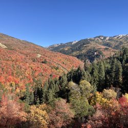
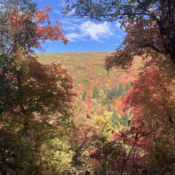
One of my favorite local trails. You can choose your own adventure here, going all the way to…read moreElephant Rock, connecting to the BST, or just taking the park trail as far as you want before returning back. There's plenty of tree cover and it's gorgeous in all seasons. It's perfect right now with the Fall colors. Very gentle incline, great for various ages and abilities. Plenty of street parking, and though it may look busy, many people are only here for picnicking and picture taking near the trailhead. Watch out for mountain bikers here if you're hiking!

It's about 7 miles round trip, but very doable! The terrain is pretty flat with bumps from rocks…read morebut nothing to be concerned about. There are tons of mountain bikers going up and down on these narrow trails. Hikers do have the right of way, but it's courteous to stand on the side to let them slide by. Changing colors are beautiful on this hike! Reminds me that fall is still here, but winter is coming. There were a couple of spots where there was snow, and some places where it was recently melted causing mud. Dogs are allowed on a leash and please pick up after your pups. Once you get to the end of the trail, elephant rock or big rock, there is another path that continues going up! Luckily there are benches to rest your tired feet at the end. I didn't go down to the rock since it was a steep drop, but there are some dare devils that did it.

Photos
Mueller Park Trail
Mueller Park Trail
Mueller Park Trail

See all

Wheeler Creek Trail

Wheeler Creek Trail

5.0(1 review)
35.8 mi

So far this is my favorite hike. Not too long, not too short, not too hard. Just enough...well, for…read moreme. It located just south of Pineview dam. This is the Wheeler Canyon trail that follows Wheeler Creek. The trail is wide and heavily traveled. Great for hiking, biking, horseback riding, skiing and snowshoeing. I did the loop, it took me 2.5 hours and 5.73 miles. That was stopping frequently to take pictures because it's so pretty all over. From the beginning it's gorgeous. You're surrounded by towering, rocky mountains and the sound of the river below. As you get farther on the trail, the leaves are gold, red, and orange. One day we took our toddler to walk up the trail and explore a bit. It was easy and fun for her. Lots of birds, butterflies and caterpillars to check out. That's when I knew I had to come back and take a hike. After Wheeler Canyon there's a fork that takes you to Ice Box Canyon on the right or Art Nord trailhead to the left. I read about this trail and many prefer to go counterclockwise and go through Ice Box first. I also recommend going this route. It's a steady climb, not hard and shaded the entire way until you get to the south slope meadows. Ice Box Canyon was magical. The birds were singing, the sound of the water was hypnotic, and the red leaves blanketed the trail like a celebrity red carpet, minus the paparazzi and a little less narcissism. I had to stop and take pictures every second. I couldn't help it. If you're doing the loop, you'll run into another fork (on the south slope) once you're out of Ice Box Canyon. The sign is missing off the post. Go left. That will take you down through some meadows across a couple of bridges and then uphilll to the Art Nord Drive/trailhead. You will see Snowbasin Road on the right as you approach a trail map kiosk. Keep following the trail. You will descend on a windy trail towards a parking area. Keep going and you'll soon be back in Wheeler Canyon. I think about .65 miles. Take a jacket and plenty of water. When I went it started pouring the last quarter mile and the wind was awful tunneling through that canyon. It about knocked me over. I came out of the canyon only to find out there were 2 freaking tornadoes taht touched down. I'm not sure of the odds of that happening again but just be prepared for the weather. This would be a great hike for a family. Do the loop, go check out Ice Box Canyon, or just go up a little and back. No matter what you choose I think you'll enjoy it!

Photos
Wheeler Creek Trail
Wheeler Creek Trail
Wheeler Creek Trail

See all

Intermittent Spring

Intermittent Spring

4.8(5 reviews)
81.0 mi

What a great family hike! Toddlers? No problem. Babies? No problem. Drive as far up the road as you…read morecan go and park at either the upper or lower parking lot. We went in late July and were so enthralled with the scenery the whole way to the spring. It is vastly green, with plenty of wildflowers along the trail. Stop and see some raspberries, and even some wildlife hanging out in the water (there was a mama and baby moose there along our hike!) The River coming down from the spring is absolutely gorgeous, but of course, fast and freezing, so even though it goes without saying, don't let your little ones get too close. Although there are plenty of spots for adults to stop and dip in their toes or hands for a quick cool off. Once you walk to the top of the trail and the base of the spring, (about a mile walk) the hike gets much steeper and more difficult. I actually didn't know we were going on this hike so I wore sandals up the trail with no problem, but I wouldn't recommend it for hiking to the top, there are steep rocks and slippery slopes of dirt that require shoes with good traction. The top of the spring is such a delight! With a fantastic view cascading down the mountain, you can see the intermittent spring turning on and off every 12-18 minutes. It honestly feel like magic! Once we got to the top of the spring I felt like my kids were safe there. We all had a great time playing on the rocks and filling our water bottles with cool fresh spring water! Right before the steep trail at the top are picnic tables for those travelers wanting to take it easy. There are also some picnic tables at the parking lots. I would absolutely recommend this hike in star valley with or without kids, for older people, or even those who want to take it easy with a little extra exercise. July was around 80° and not too hot. I'm sure it'd be a great one to hike in the fall as well!

So this is what I hear. That because if some very odd geology this spring runs for 15-20 minutes…read morethen almost like you turned off the spigot stops for 15-20 minutes then restarts again for another round. A little research later on reveals that this is one of only a couple places in the world with a cold water, intermittent spring. Well this I gotta see!! Getting to the spring in late July is beautiful. All sunshine, bubbly creek, flowers and butterflies. A five mile drive and a mile or so hike and you're there. But it turns out this intermittent thing has a seasonality to it and we're just a touch early. Well that's OK. It's a beautiful area, lovely day.... Hey, what is that? There's some big thing covering part of the creek and it's got branches and other debris on top. Wait... that's snow... in July. That's a bridge of snow that crosses the creek. And on the uphill side it's at least 30 feet tall!!!! Unreal!! This spring is located in a steep sided canyon that rarely gets any sun. The snow that falls here apparently slides down the walls and accumulates at a pinch point. It compresses and becomes more like ice than snow. Dust and tree debris cover the top insulating it and slowing melting from the top. And voila.... ice bridge!! The path to the head of the spring leads on top of this bridge so on the way up and down you can pelt all your friends with snowballs, ....in July. Got to climb further up the canyon and got some pretty interesting photos. The spring water was delicious and the chance to hang out with the fam and enjoy this beautifulI canyon was awesome. Wish we'd been able to see the spring do it's thing but the chance to see this ginormous ice bridge made up for any dissatisfaction.

Photos
Intermittent Spring - Group photo at the top

Group photo at the top

Intermittent Spring
Intermittent Spring

See all

Crystal Lake Trailhead - Reflection

Crystal Lake Trailhead

4.5(2 reviews)
86.2 mi

First off, note that this is sometimes called the Crystal Trailhead, and also referred to by the…read moreForest Service as Lakes Country Trail #066. The latter refers to a specific route, but we'll get to that. You will also see references to Notch Mountain Trail #081 and Clyde Lake Trail. We'll get to those, too. Oh, and while the following list of trails don't leave right from this trailhead, it's the most popular (and in some cases only) connections to North Fork Provo River Trail, Marjorie Lake Trail, Duck Lake Trail, Long Lake Loop Route Trail, and the Middle Fork Weber River Trail. It's all the same place, though -- this trailhead. Confused yet? Let's dive in. First things first, you've got to find the trailhead. To do that, get to Kamas and then travel up Highway 150 (The Mirror Lake Highway) about 25 miles until you see the signs to turn off for Trial Lake and Washington Lake. You'll turn north, pass Trial Lake, and at the signs, turn right and pass the Washington Lake Campground and continue on the dirt road (easily passable in all types of cars) for a few hundred yards until reaching the parking area. There is lots of parking, a few picnic tables, and vault toilets. In the busy summer months, this parking lot fills up fast on weekends. Like, fills WAY up. With all kinds of creative parking. I've watched over the last decade as it went from a somewhat busy spot to outright chaos on Saturdays. When it's full, they have overflow parking back down the road to the last junction and further west, but it will tack on almost 2/3 mile onto your hike each way. That's been a real bummer to see, and a nuisance when you just want to get out and hike and end up going over a mile on pavement because the main parking lot was full. But enough of the downsides of the popularity, let's dive into why so many people pick this hike. The reason, really, is that it's not just one hike, it's many. I will preface this with one giant note: GET A MAP. Seriously, the Forest Service has worked hard to make great trails and have a 2016 edition map that's very detailed and much more realistic that the USGS or other maps. Here, more than at any other trailhead, I've noticed that Forest Service maps are wildly different (and more accurate) than other versions. Below are the hikes that take off from this trailhead: Lakes Country Trail #066 This is one of three trails that have their terminus at the parking lot proper. This is the most popular, and it goes due west from the outer apex of the parking loop. It's signed and is the one that takes you to the northeastern shore of Crystal Lake. From there, it starts to rise and there's a turnoff to Clyde Lake (next paragraph), then past that you'll hit more switchbacks before cutting through a mountain pass with views of Mt. Watson. Then you traverse the rocks and have all kinds of decisions to make: you can peel off and go to the North Fork Provo River Trail which takes you towards Marjorie Lake and eventually allllll the way back down (nearly 10 miles) to the Highway, popping out about 3 miles below Soapstone. Or you can turn north on the Middle Fork Weber River Trail, but few do. There's another turn for Weir, Pot, and Duck Lakes (not shown on the maps) as well, but most people pass the Marjorie turnoff and press on to Long Lake. This aptly named, long, skinny lake is at around 2.5 miles in from the trailhead. It's a fine destination, but if you have the will, grit it out another mile and a half or so to Island Lake. It's gorgeous. From here, the Lakes Country Trail #066 goes on a bit, then ends at a junction with the Smith-Morehouse Trail and the Big Elk Lake Trail. Clyde Lake Trail Technically, you begin on the Lakes Country Trail #066, but only go a half mile or so before turning uphill to the right towards Clyde Lake. The Forest Service cut a new trail here in the last couple of years, so don't be confused by a sign in the old trail, with an arrow pointing away from what you think is that old trail. Now you pass Crystal Lake before turning off to Clyde, instead of turning off just before. It makes sense. This trail climbs up and delivers you to Cliff Lake, Watson Lake, and eventually Clyde, but most people veer east at Watson and go up to Wall Lake. This also isn't shown on the map, but makes a nice loop. Wall Lake/Notch Mountain Trail This trail also takes off from the Crystal Lake Trailhead. It bisects the Lily Lakes and runs right up the chute to Wall Lake. Then you can jog east and go past Hope Lake, turn back west and go right through a big notch in the mountain to overlook Lovenia Lake. The trail goes on north, downhill for miles before hitting the Main Fork Weber River Trail. Crysal Lake (South) Trail My own name for it, but you can take a short trail to the south shore of Crystal Lake. It leaves from the southwest end of the parking loop. This area is rife with lakes and hikes. I've kept some secrets. It gets heavy usage but is still so special. Be safe and enjoy!

This trail head gives access to many, many different trails, many of which lead to spectacular…read morelakes. The trails around here aren't too difficult or strenuous, but they are breathtaking. I highly recommend for all levels!

Photos
Crystal Lake Trailhead - Some areas closed to camping

Some areas closed to camping

Crystal Lake Trailhead - Lake

Lake

Crystal Lake Trailhead - One of many lakes

See all

One of many lakes

King Nature Park - hiking - Updated July 2026

Loading...
Loading...
Loading...