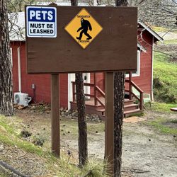
1. Lacks Creek Management Area

    1. Lacks Creek Management Area

    0

    Blue Lake, CA

    Cancel

    Open app

    Search

    Lacks Creek Management Area

    5.0 (1 review)

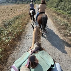
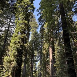
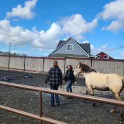
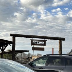
    Lacks Creek Management Area Photos

    You might also consider

    More like Lacks Creek Management Area

    Recommended Reviews - Lacks Creek Management Area

    Your trust is our priority, so businesses can't pay to alter or remove their reviews. Learn more about reviews.
    Yelp app icon
    Browse more easily on the app
    Review Feed Illustration

    9 years ago

    Helpful 2
    Thanks 1
    Love this 0
    Oh no 0

    Verify this business for free

    Get access to customer & competitor insights.

    Verify this business

    Trillium Falls Trail

    Trillium Falls Trail

    4.5(6 reviews)
    26.7 mi

    This is coming from a middle aged out of shape non-hiker. This trail is a trial for a person like…read moreme. Steep-ish in places, roots to stumble over and crazy long...2 hours of walking when you are not used to going on trails like this? Holy crap. They could have done a huge public service and placed a restroom mid way through as well. It was easy to find parking in September. I parked right next to the trailhead thinking this was going to be a 45 min flat jaunt. I was so wrong! There are proper restrooms next to the parking lot with flush toilets and non potable sink water. It is beautiful though and you can really get an immersive redwood experience. The falls themselves are kinda baby falls compared to others I've seen.

    I hiked two of my favorite hikes in one day while exploring the Redwood Coast - Lady Bird Johnson…read moreGrove and Trillium Falls. This is such an amazing hike and easy to do. Trillium Falls Trail is a 2.6 mile loop trail off the 101 near Orick that starts off in the Elk Meadow Day Use area. It is part of Redwood National Park. Parking is at Elk Meadow and there are plenty of spots. The loop trail climbs a hill with switchbacks to a steel bridge over Trillium Falls. This shady redwood forest is so beautiful. There are redwoods and ferns everywhere. The sun peeking through the trees is just gorgeous on sunny days. The waterfall is small but makes for nice photos. The trail then loops around back around to the parking lot. I highly recommend doing this nature hike. It is one of the prettiest hikes in the park.

    Photos
    Trillium Falls Trail
    Trillium Falls Trail
    Trillium Falls Trail - Trillium Falls.

    See all

    Trillium Falls.

    Skunk Cabbage Trail - Another view of the tiny creek, and ferns, next to Skunk Cabbage Trail.

    Skunk Cabbage Trail

    5.0(1 review)
    25.6 mi

    The "Skunk Cabbage section" of COASTAL TRAIL starts at the edge of Route 101, and follows along…read morenear Skunk Cabbage Creek, and brings you to the beach at the Pacific Ocean. This trail is also called, "Skunk Cabbage Trail." The one way distance from Route 101 to the beach is about two and a half miles. According to Google maps, Skunk Cabbage Creek disappears at the half-way point to the Pacific Ocean. The trail keeps a distance of about 50 feet from the creek. It is possible to walk from the trail to the creek to get closer to the huge number of colorful skunk cabbages growing near the creek, but you might need to push yourself through a blanket of small plants and small bushes. Only a few skunk cabbages grow next to the trail (we saw about 20 of them), and some of these have big holes in the leaves and look deteriorated. MAGICAL THINGS TO SEE. As shown by my photographs, the magical things to see along the Skunk Cabbage Trail include the abundant ferns blanketing the landscape, green-colored lichens hanging from branches of nearby trees and, of course, the redwood trees. One of the redwood trees by the trail has a monsterously huge bizarre-looking burl. I decided to post only one photo of this burl because it is ugly looking. Another magical thing are the shelf fungi. We saw two trees with shelf funguses growing from them, and the shelf funguses looked like pancakes with a brown upper side and a white bottom side. Shelf funguses having a brown upper face and a white lower face include, Ganoderma applanatum, Ganoderma sessile, and some species of Trametes versicolor. SKUNK CABBAGE (Symplocarpus foetidus). This plant has large leaves (50-135 centimeters long and 30-80 centimeters wide). The flowers are produced in a spadix. The skunk cabbage produces heat. The goal of the plant is to use the heat to melt snow, and ensure its survival in the winter. The temperature of the flowers can be about 20 degrees centigrade higher than the surrounding air. Skunk cabbages have a stinky odor that attracts insects that help pollinate the plant. Skunk cabbages have a hood, which is a modified leaf called a "spathe." The spathe wraps itself around a space that encloses a sphere of flowers called a "spadix." See, 1-page article on skunk cabbage published by California Native Plant Society (Calscape). See also, Skunk Cabbage by Craig Holdrege (9 pages) published in Fall 2000 in the newsletter, "In Context." MY PHOTOS. My photos show the parking lot where the trailhead is located, a huge sign at the edge of the parking lot, where the sign explains things about Skunk Cabbage Trail. My photos show shelf fungi growing on a tree next to the trail. My photos also show thick bushy lichens hanging from small trees, a few skunk cabbages, and a photo of me wearing a Cal Berkeley hat and a Cal Oski bear T-shirt. Other photos show a view of a huge ugly burl that grows on a redwood tree, and two photos 5 redwood trees growing in a tight bunch. One photo shows the area near the ground, where the 5 trees are bunched together. Another photo shows a higher area, where the 5 trees are separated from each other. ATTRACTIONS TO THE SOUTH ALONG ROUTE 101. We hiked to the half-way point along the Skunk Cabbage section, and then turned back. The town of Orick is a one minute drive south from the trailhead. Bald Hills Road is even closer. Bald Hills Road takes you to the east, and to the trailhead for Lady Bird Grove Trail. Both of these trails include some gentle up-and-down sections, and wooden footbridges crossing over tiny creeks. Trinidad is 17 miles south of Orick (see, my YELP review of Trinidad Head in Trinidad). Holiday Inn at McKinleyville is about six miles south of Trinidad. We stayed at this Holiday Inn. This Holiday Inn is elegant and very clean, and I felt like a king during our stay here.

    Photos
    Skunk Cabbage Trail - Hiker (me) kneeling next to the trail.  I'm wearing a Cal hat and a Cal Oski bear T-shirt.

    Hiker (me) kneeling next to the trail. I'm wearing a Cal hat and a Cal Oski bear T-shirt.

    Skunk Cabbage Trail - Redwood tree next to the trail.  This tree has amazing spiralling bark.

    Redwood tree next to the trail. This tree has amazing spiralling bark.

    Skunk Cabbage Trail - Parking lot and restroom.  The trailhead is at the side of this parking lot.

    See all

    Parking lot and restroom. The trailhead is at the side of this parking lot.

    Headwaters Forest Reserve

    Headwaters Forest Reserve

    5.0(4 reviews)
    27.1 mi

    Headwaters Forest Reserve is an amazing place and full of natural beauty! The Reserve is managed by…read morethe Bureau of Land Management in consultation with the California Department of Fish and Wildlife. The trails are well maintained and there is a decent size parking lot. This Reserve protects 7,472 acres of old growth redwood groves, other forest stands, streams, and wildlife. This is an amazing place to go hiking at there is a Headwaters Education Center if you want to learn more about this area. There are different hikes you can take varying in length. Some of the trails are paved and some are unpaved. Dogs and bikes are allowed on some of the trails and not on others. The Elk River Trail is the longest trail and it is 11 miles roundtrip. This area is so peaceful and tranquil and loved that this area has been preserved so that everyone can enjoy it!

    The land consistently gets trimmed and cared for…read more I have come here for doggie hikes, walks, forest runs and to admire the river/nature. Overall, the high review comes after the expansion of their parking lot. If you are familiar with this place you will know that it used to be a two-way entrance now it is a one-way. Careful when coming in because a car might be backing up or confused it is a one way! I highly appreciate that on the trail they consistently have signs to show you if you are allowed off trailing or not. It is helpful to see a map in case you are unsure how far you want to go in. Take into consideration the amount of miles going in and out. Usually my partner and I go up to the 2nd mile maker which is the bridge overlooking the river. And building up your tolerance from there.

    Photos
    Headwaters Forest Reserve
    Headwaters Forest Reserve
    Headwaters Forest Reserve

    See all

    Damnation Creek Trail - The stream

    Damnation Creek Trail

    4.8(5 reviews)
    57.4 mi

    To get to Damnation Creek Trail, you'll have to follow a short bit of the Coastal Trail (which…read morefollows the old Highway 101). It's a fun descent to the ocean, over some little bridges and through some high brush at times. Time your hike with the tides. If you reach the trail's end at low tide, you can scramble down the rocks to the rocky beach. There are succulents clinging to the rocky bluffs, wildflowers growing above the beach, and waves crashing on the seastacks. You can find tidepools with all kinds of sea life. Wear waterproof shoes. The hard part is the walk back. The hike is a dead end, and the first half is downhill. That means you'll be walking up hill (the hike begins/ends with a 1000-foot elevation) for the second leg of your hike, so pace yourself. But the views are well worth the effort. You can even cool off by walking a bit of the coastal trail when you're done. It covers part of the old highway, so it's flat and paved. In the spring there are some pretty wildflowers, too. One of my favorite hiking trails in the area.

    Beautiful ending to a hike. By the time you get to the bottom (1000 ft) on the ocean, you just…read morewant to stay. However, the climb back will hit you. If you jump into the stream it refreshes you and gets you ready for the hike back up. Takes about 2 -3 hours on a decent pace. Make sure you head down. Don't make a left or right. You will see a sign that says 1.7 miles and dead end. Follow that one. Wear hiking shoes, it gets slippery. I wouldn't do it if it was raining. It can be dangerous.

    Photos
    Damnation Creek Trail - At the bottom

    At the bottom

    Damnation Creek Trail
    Damnation Creek Trail - Set up our own crossing bridge. Or you can use the giant logs

    See all

    Set up our own crossing bridge. Or you can use the giant logs

    Lacks Creek Management Area - hiking - Updated September 2026

    Loading...
    Loading...
    Loading...