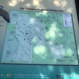
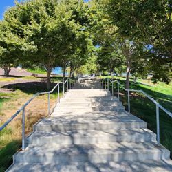
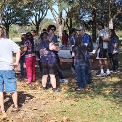
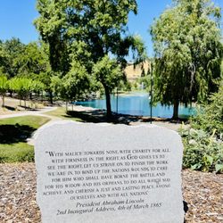
Las Trampas Regional Wilderness Photos


You might also consider
More like Las Trampas Regional Wilderness
Recommended Reviews - Las Trampas Regional Wilderness
Start your review...

Reviews With Photos

Super clean trail, started my hike near the Hap Magee side. The trail is dog friendly and the views of beautiful houses and open areas. There are shaded areas of the trails that have great tunneling of winds. Took my 7 month old puppy and we did a little bit over 2 miles before turning around. A mile in, there is a nice water station for dogs and people if you forgot to bring water and/or refill.

An excellent spot for a heart pumping hike along the East Bay hills! I don't know what took me so long to finally hike here, but I'm so glad that I finally did. I think I've become so spoiled by the shaded hikes in Berkeley and Oakland. But, hiking in Las Trampas reignited my love for being amongst the open rolling hills. Hiked the 5 mile Rocky Ridge View loop trail with a friend, and it was an excellent little workout. Nothing too strenuous, but just the right amount of inclines to get the heart pumping. I'd say a moderate hike with a few difficult hills to climb. The Rocky Ridge View trail is basically completely exposed. We started our hike around 9:30 am which is honestly kind of late for me for this type of exposed hike, but luckily we ended it right before it started to get really hot. We started counterclockwise on the paved path. This part of the trail inclines for about a good mile to a mile and a half until it levels off to some spectacular views of the city and beyond. You'll even have some amazing views of Diablo in the distance. The trail switches from paved to dirt as you ascend higher up the hill. We hiked this trail during mid-summer, so the hills were pretty much all brown. I'm sure it's beautiful and green during the early spring time. Despite the brown hills, I was still able to find a few wildflowers along the trail. Pretty sparse around that time of the season, but it was still great to see them out there. The trails seem to be endless, and you can connect to so many different side trails to lengthen your hike. Definitely lather up on the sunscreen and bring plenty of water to keep yourself hydrated. One thing that I've learned about hiking in these types of hills is that the sun can really be deceiving at times. Luckily there was a bit of a breeze, so it didn't feel as warm as it actually was. There actually weren't too many people out during COVID, and most of the people that we saw were wearing masks. Also, the parking lot fills up quickly here. I arrived around 9 am, and I snagged one of the last few spots in the lot. There's an overflow lot available and some street parking if you can't find any in the main lot. All in all, I'm pretty impressed with this park. Would love to explore some new trails here when the hills are green.
Back at Las Trampas Reg Park for a hike Sat 4/10/21. Free parking at the end of the road w/ vault toilets. During Covid19 everyone is a hiker so you have to go before 9am at all park, otherwise you gotta park further out on the road and walk in. Did Rocky Ridge View trail going up, then we went into EBMUD land (friend has a permit). Lots of climbing with rolling hills. Wildflowers are nice right now, lots of poppies, fiddlenecks, & lupines. After lunch we went back into Las Trampas, back on Rocky Ridge View trail, left on Elderberry Trail. Lots of up and down the entire park. Just ok to meh park for me. Friend likes it.

As I stand in a 30-person line of mask-wearers to buy spaghetti sauce and milk I remember Tuesday when we walked from the Redwood Gate on Skyline to Danville almost 20 miles through the lands I'd spy from the sky on the final approach to OAK and wonder what's down there. Down there along the San Leandro reservoir is largely comprised of the protected EBMUD watershed but east of that making up the last wall of hill before Danville is Trampas. There's parking reached via Bollinger Canyon and a combination of mask wearers and people without them a few jumping into the bushes as one approaches just in case. Cows, hawks, outcroppings of rocks that tempt you to climb, and a network of looping and longer trails that offer something for just about every single body. It took stay at home guidance to get me here and I say without hesitation thank you reaction to this condition that motivates these outside activities bc but for that who knows when I'd have visited. Even though every time I flew over I'd say to myself: self, we really need to go check that out. It looks cool. Seeing that nobody is flying anymore what better time to do it. Do it. You. Yes you. Do it now. Sunshine is the best disinfectant. Even better than drinking bleach. It is.

Lots of trails with excellent views both to the east and to the west. The ridges are absolutely wonderful to hike on and have a diversity of flora and fauna. In the late spring there are tons of hummingbirds and butterflies. Gates close at 8pm, but if you park in the lot before the gate it only adds on a short walk to get to most of the trail heads. There are ticks out in good numbers come spring, so always make sure to do a tick check when your done.

"Try Secret Entrance through the Nudist Colony!" No I am not making that up! Here's the rest of the story: This park is one of the largest in the East Bay Park system. It is also a rugged park, with a huge variety of trails, many of which are for advanced hikers. There are a large number of entrances, some well-known, some secret. If you continue down Bollinger, you will come to the main entrance. There is a good-sized parking lot, which is normally free to use. There are also some outhouses there. When you are driving inside the park, watch out for the huge speed bumps. If you're not ready for them they will really rattle your brain! Be sure to plan your hike carefully, and especially bring lots of water. Many of the trails do not have water supplies, or restrooms, for that matter. In fact, I don't think I've ever seen a restroom anywhere, except in the parking lot. Today I went on a 6 hour hike, which was really challenging. I started near the stables, goimg up the Elderberry Trail. Today, after recent rains, it was muddy and steep. Technically, you can take a mountain bike on the trail, but I would be astonished if any mountain biker actually did. Today, it was non-ideal conditions. It is not one of my favorite things to have mounds of sticky mud on my boots. On the other hand, it probably works off more calories having several pounds more on each foot. It's sort of like putting your foot in a big tub of mush. From the Elderberry Trail, I went up to Rocky Ridge View Trail, Devil's Hole Trail, and then to a remote trail called Ramage Peak. This last trail is actually on East Bay MUD land, and you need to get a permit ahead of time to hike on that trail. You can do it online, and it's cheap. There is actually a secret entrance to the park's Devil's Hole Trail, but to use it you have to go through a nudist colony. I was not brave enough to ask, so I used the more traditional route, where one actually stays clothed during the hike. I guess I'm sort of stuck in my ways. If one of you Yelpers tries hiking through the nudist colony, please report back with your results.

5/1/2021 Saturday Location: 18012 Bollinger Canyon Rd, San Ramon, CA 94583 We parked by the sign "Las Trampas Ridge Regional Park " and walked to the Chamise Trailhead since the parking at the trailhead was full already. Took the Chamise Trail to the junction which branches out to Las Trampas Ridge Trail, Mahogany Trail . The Chamise Trail was in the grassy area and the view of the hills all around is green and really pretty this time of the year. Up to this point is an easy peasy hike. We then took the Las Trampas Ridge Trail, hiked to the Eagle Rock and ate our cheese steak sandwich by the rocks . There were lupines , vetches and lots of other wildflowers blooming. The trail to get here gets narrow and you are up pretty high. I'm vertigo so it made me a bit nervous but if you're not vertigo like me you should be fine. I try not to look down in the canyons. We continued on the Las Trampas Ridge Trail till we reached another junction which splits to sulfur springs trail , Las Trampas Ridge Trail and Mahogany Trail. The area by the marker is filled with wildflowers so beautiful. Up to this point is pretty easy hike. We made a mistake of taking the mahogany trail and the reason I say that is because there are three areas where the trail gets super steep , loose dry sand on the dry gravel. I was seriously nervous going down on those areas , my hands sweaty , my heart pounding and my legs shaking. I didn't want to plunge into the canyon or break my ankles in middle of the wilderness. I wished there were some railings you can hold on to but there is absolutely nothing to hold on to. Even with the trekking poles it was challenging going down on these areas. Thanks goodness we had our poles though , would've been absolutely nightmare without them. We managed to get down those scary steep areas and the trail started ascending and we thought "oh no we are lost cuz its supposed to be descending not going up" and this area is deep in the canyon kind of dark so I was scared. Nobody else was on the trail except us. As we were hiking uphills thinking we are lost , I remembered that from the junction on top of the hill , mahogany trail went down so if we're going up we should be on the right track. And we were. We finally arrived to the junction which splits up mahogany trail, Chamise trail and the ridge trail. Phew .. .. It was fun , a bit scary , a bit challenging but all in all it was a great hike as always. (I definitely wouldn't take small kids on mahogany trail nor trapline trail )

I hiked the Rocky Ridge Loop Trail. It was a beautiful sunny spring day. It was a Thursday morning so no one but my hiking friend and I were on the trail until our descent where we ran into 2 other hikers. It's uphill most of the way up on a paved road then we hiked on a dirt path that was more uphill. Beautiful clear view of the green hills. This is a great workout. It's about 5 miles and took us 2 hours. Lots of wildflowers but also lots of lizards. We also encountered a garter snake which caught us by surprise. The lizards were enough to startle us but the snake got us screaming! Hahaha. Good thing it was the only one we saw. A few cow pies, one fresh one. We could hear the cows mooing but didn't run into any. The hike downhill (Elderberry Trail) can be slippery and muddy. Be sure to wear good hiking shoes and socks with decent traction.
")
Open during quarantine but very crowded on weekends!! The first time I came here was at 6am on a Thursday and during the whole hike, I only saw a couple other hikers on the trail. During the early mornings however, the California poppy flowers that Las Trampas is so recognized for don't open up yet and it can't be seen in its full glory. The elevation of the mountains and the mist also results in some areas to become super muddy even without rainy weather so hiking boots are definitely recommended! Second time I came was on a Sunday morning at 8am (right as the gate opened). Wasn't too crowded initially but around 10am it got suuuper busy which made staying 6ft apart difficult with most of the paths being really narrow. Everyone still makes an effort to respect their distance but it also gets hard to move out of the way without trampling on the flowers on either side. I'd say the flowers open up into full bloom after 11am or so but with how crowded it is, I'd try to come on a weekday if possible. Besides the vast amount of poppies, it's also a nice hike with view of the open mountain ranges and wildlife.

12,000 steps, 106 flights (based on my Apple watch), ~2,000 elevation (based on Snapchat lol), and ~6 miles to the top and back. It took a little under 2 hours to complete and I think I found my favorite hike in the Tri-Valley so far! I came after a night of rain so there were parts that were muddy, making it a bit more challenging. This hike resembles Mission Peak in Fremont, but a bit more fun since you can see beautiful hills, walk under forest shade, and have a steep incline to work your butt off! Usually hikes feel eerie when I am alone, but this hike, with its wide paved & well lit paths, proved to be both beautiful and easy to navigate. I saw people of all ages: children, adults, and some elderly. It does eventually rise to 2,000 ft (Mt. Diablo is ~3,800) so it's not an easy hike. I probably should have done more research beforehand but luckily I hike and run pretty often so it wasn't a problem and I enjoyed the uphill battle! For beginners looking to hike to the peak, it will be a good idea to take rest breaks and bring water. For those with knee or joint problems, I'd consider wearing a brace/bringing a hiking stick. It's also probably worthy to note there isn't cell reception in some areas. Most people wore masks and it was nice to see/greet so many people on the hike. I guess everyone thought it was a good idea to hike New Year's Eve! I recommend parking by the "Las Trampas" sign off to the side instead of the parking lot because there's a trailhead close by.

This easily steals the crown for my favorite Bay Area hiking spot (yes, even winning over Mt. Diablo). The cool thing about Las Trampas is that there is less foot traffic than Mission peak and Mt. Diablo and way better views. From the very top, you can see the entire Bay Area and even a stunning view of Mount Diablo in the distance. There are many reasons I could delve into about why you should go to Las Trampas, but that would surely exceed any word limit Yelp has to offer. Pros: -Great cardio workout (uphill really works your quads and booty) -More Scenic regional park in the area -Not super crowded on weekdays -Bathrooms at the bottom of the hill -Ample Parking -Lots of wildlife to view (Lizards, butterflies, and various rodents) -Numerous trails to pick from that range in difficulty -Windy at the top, so you won't overheat too much! Cons: -No cell service, if that matters to you. -Windy, if you don't like wind. Bring a jacket for the top of the hill. Difficulty: 5/10, not the hardest hike to do, but may be limiting to some with bad knees and back problems. I loved being able to explore this area -- it truly is a magnificent place to hike. I can't wait to come back and go a little farther up the trails when I have more time. :)

This is my go-to spot for hiking if I want a steep incline and to break a sweat. I consider myself pretty fit but I always leave this place with sore glutes and thighs. This is open during COVID-19 and has parking for free which is a HUGE plus. If you want a easy walk, you might consider another trail as this one can be pretty intense. You can also take the path that leads you towards the horse stable or just walk along the road that leads you to the dead end ( were the parking lot is) and enjoy the scenery from there. Both of those paths are pretty flat. I believe there are many trails you can take on this path but I've only taken three, both of which were incredibly steep and filled with deep inclines. Since you're so far tucked way into the mountains, the views here are breathtaking and the trails are very quiet and peaceful. The higher you go up the trail, the more stunning the scenery is. You'll find panoramic views of rolling hills and adjoining mountainsides. At the top of the mountainside is a nice ilttle bench where you can recline and relax. If I had one complaint, it's that there is a ton of cow manure on certain sections of the trail. There are herds of cows that frequent this place so depending on where you walk, you'll have to constantly hopscotch over piles of dung. The higher you go up the trail the less droppings you'll find however. Bring your water, snacks, camera and have fun! Ji


HEMME CREEK TRAIL REVIEW: First time on this trail and it's easily one of my top 10 trails in the Bay Area. You can park at the Ringtail Cat Staging Area, where there's about 8-10 parking spots. This trail is a loop that takes you literally through a stream. It's lush and woodsy, and there's a pretty steep elevation before you get a breather through a meadowy field of trees and grass. It wasn't crowded, so we took our time and enjoyed the Zen-ness of our hike. From the parking area, there's about a 1/4 mile path before you reach a metal gate where the loop begins. If you go right, you'll start with the Shred Wizard Creek part of the loop. If you go left, you'll start with the Ringtail Cat part of the loop. It's about 3 miles with a 720 foot elevation. There aren't many markers, so I recommend using AllTrails to keep you on track. We started with the creek, and it was so fun. The trail zig zags over the stream at least 25 times. There was one part of the trail where you had to walk in the stream, but it's so shallow we didn't get our socks wet at all. It can be a bit muddy. This was our favorite part of the hike. It's so green and lush. Once the creek part is done, there's a pretty steep climb to get to the Ringtail Cat part of the loop. This part is also very nice as you walk through grassy fields and trees. There's less shade here. There's still more hills and valleys along this part. Overall, this was so much fun, the scenery was beautiful, and you get quite a workout. read more


Went Sunday afternoon to get some exercise and fresh air. Paved Rocky Ridge Trail - AllTrails rate it as moderate and steep. Definitely steep, pass by some grazing cows, minimal shade which was fine on cloudy day but I can imagine this to be quite hot in summer. Great view on top of Mt Diablo and SF Bay. Free entry/parking. Pit toilets at parking lot. read more


5 months ago
Not a bad walk. I did the round-trip 3 miles. I will say once you do the switchbacks at the very beginning and see the hill, that's really the most of where you're going to see any of the wildlife. After that, it's really just looking at expensive houses. So if you're into walking through that neighborhood, then you can continue on, but if you're just looking to see some cool animals, you really don't need to go far. Unfortunately I did not see any of the other exotic animals besides the large goats. But driving on the highway I was able to see some zebra and a camel. So on your way over there be sure to look over at the hills for the wildlife. read more


2 years ago
Super clean trail, started my hike near the Hap Magee side. The trail is dog friendly and the views of beautiful houses and open areas. There are shaded areas of the trails that have great tunneling of winds. Took my 7 month old puppy and we did a little bit over 2 miles before turning around. A mile in, there is a nice water station for dogs and people if you forgot to bring water and/or refill. read more


An excellent spot for a heart pumping hike along the East Bay hills! I don't know what took me so long to finally hike here, but I'm so glad that I finally did. I think I've become so spoiled by the shaded hikes in Berkeley and Oakland. But, hiking in Las Trampas reignited my love for being amongst the open rolling hills. Hiked the 5 mile Rocky Ridge View loop trail with a friend, and it was an excellent little workout. Nothing too strenuous, but just the right amount of inclines to get the heart pumping. I'd say a moderate hike with a few difficult hills to climb. The Rocky Ridge View trail is basically completely exposed. We started our hike around 9:30 am which is honestly kind of late for me for this type of exposed hike, but luckily we ended it right before it started to get really hot. We started counterclockwise on the paved path. This part of the trail inclines for about a good mile to a mile and a half until it levels off to some spectacular views of the city and beyond. You'll even have some amazing views of Diablo in the distance. The trail switches from paved to dirt as you ascend higher up the hill. We hiked this trail during mid-summer, so the hills were pretty much all brown. I'm sure it's beautiful and green during the early spring time. Despite the brown hills, I was still able to find a few wildflowers along the trail. Pretty sparse around that time of the season, but it was still great to see them out there. The trails seem to be endless, and you can connect to so many different side trails to lengthen your hike. Definitely lather up on the sunscreen and bring plenty of water to keep yourself hydrated. One thing that I've learned about hiking in these types of hills is that the sun can really be deceiving at times. Luckily there was a bit of a breeze, so it didn't feel as warm as it actually was. There actually weren't too many people out during COVID, and most of the people that we saw were wearing masks. Also, the parking lot fills up quickly here. I arrived around 9 am, and I snagged one of the last few spots in the lot. There's an overflow lot available and some street parking if you can't find any in the main lot. All in all, I'm pretty impressed with this park. Would love to explore some new trails here when the hills are green. read more


Back at Las Trampas Reg Park for a hike Sat 4/10/21. Free parking at the end of the road w/ vault toilets. During Covid19 everyone is a hiker so you have to go before 9am at all park, otherwise you gotta park further out on the road and walk in. Did Rocky Ridge View trail going up, then we went into EBMUD land (friend has a permit). Lots of climbing with rolling hills. Wildflowers are nice right now, lots of poppies, fiddlenecks, & lupines. After lunch we went back into Las Trampas, back on Rocky Ridge View trail, left on Elderberry Trail. Lots of up and down the entire park. Just ok to meh park for me. Friend likes it. read more


As I stand in a 30-person line of mask-wearers to buy spaghetti sauce and milk I remember Tuesday when we walked from the Redwood Gate on Skyline to Danville almost 20 miles through the lands I'd spy from the sky on the final approach to OAK and wonder what's down there. Down there along the San Leandro reservoir is largely comprised of the protected EBMUD watershed but east of that making up the last wall of hill before Danville is Trampas. There's parking reached via Bollinger Canyon and a combination of mask wearers and people without them a few jumping into the bushes as one approaches just in case. Cows, hawks, outcroppings of rocks that tempt you to climb, and a network of looping and longer trails that offer something for just about every single body. It took stay at home guidance to get me here and I say without hesitation thank you reaction to this condition that motivates these outside activities bc but for that who knows when I'd have visited. Even though every time I flew over I'd say to myself: self, we really need to go check that out. It looks cool. Seeing that nobody is flying anymore what better time to do it. Do it. You. Yes you. Do it now. Sunshine is the best disinfectant. Even better than drinking bleach. It is. read more

4 years ago
Lots of trails with excellent views both to the east and to the west. The ridges are absolutely wonderful to hike on and have a diversity of flora and fauna. In the late spring there are tons of hummingbirds and butterflies. Gates close at 8pm, but if you park in the lot before the gate it only adds on a short walk to get to most of the trail heads. There are ticks out in good numbers come spring, so always make sure to do a tick check when your done. read more


"Try Secret Entrance through the Nudist Colony!" No I am not making that up! Here's the rest of the story: This park is one of the largest in the East Bay Park system. It is also a rugged park, with a huge variety of trails, many of which are for advanced hikers. There are a large number of entrances, some well-known, some secret. If you continue down Bollinger, you will come to the main entrance. There is a good-sized parking lot, which is normally free to use. There are also some outhouses there. When you are driving inside the park, watch out for the huge speed bumps. If you're not ready for them they will really rattle your brain! Be sure to plan your hike carefully, and especially bring lots of water. Many of the trails do not have water supplies, or restrooms, for that matter. In fact, I don't think I've ever seen a restroom anywhere, except in the parking lot. Today I went on a 6 hour hike, which was really challenging. I started near the stables, goimg up the Elderberry Trail. Today, after recent rains, it was muddy and steep. Technically, you can take a mountain bike on the trail, but I would be astonished if any mountain biker actually did. Today, it was non-ideal conditions. It is not one of my favorite things to have mounds of sticky mud on my boots. On the other hand, it probably works off more calories having several pounds more on each foot. It's sort of like putting your foot in a big tub of mush. From the Elderberry Trail, I went up to Rocky Ridge View Trail, Devil's Hole Trail, and then to a remote trail called Ramage Peak. This last trail is actually on East Bay MUD land, and you need to get a permit ahead of time to hike on that trail. You can do it online, and it's cheap. There is actually a secret entrance to the park's Devil's Hole Trail, but to use it you have to go through a nudist colony. I was not brave enough to ask, so I used the more traditional route, where one actually stays clothed during the hike. I guess I'm sort of stuck in my ways. If one of you Yelpers tries hiking through the nudist colony, please report back with your results. read more


5/1/2021 Saturday Location: 18012 Bollinger Canyon Rd, San Ramon, CA 94583 We parked by the sign "Las Trampas Ridge Regional Park " and walked to the Chamise Trailhead since the parking at the trailhead was full already. Took the Chamise Trail to the junction which branches out to Las Trampas Ridge Trail, Mahogany Trail . The Chamise Trail was in the grassy area and the view of the hills all around is green and really pretty this time of the year. Up to this point is an easy peasy hike. We then took the Las Trampas Ridge Trail, hiked to the Eagle Rock and ate our cheese steak sandwich by the rocks . There were lupines , vetches and lots of other wildflowers blooming. The trail to get here gets narrow and you are up pretty high. I'm vertigo so it made me a bit nervous but if you're not vertigo like me you should be fine. I try not to look down in the canyons. We continued on the Las Trampas Ridge Trail till we reached another junction which splits to sulfur springs trail , Las Trampas Ridge Trail and Mahogany Trail. The area by the marker is filled with wildflowers so beautiful. Up to this point is pretty easy hike. We made a mistake of taking the mahogany trail and the reason I say that is because there are three areas where the trail gets super steep , loose dry sand on the dry gravel. I was seriously nervous going down on those areas , my hands sweaty , my heart pounding and my legs shaking. I didn't want to plunge into the canyon or break my ankles in middle of the wilderness. I wished there were some railings you can hold on to but there is absolutely nothing to hold on to. Even with the trekking poles it was challenging going down on these areas. Thanks goodness we had our poles though , would've been absolutely nightmare without them. We managed to get down those scary steep areas and the trail started ascending and we thought "oh no we are lost cuz its supposed to be descending not going up" and this area is deep in the canyon kind of dark so I was scared. Nobody else was on the trail except us. As we were hiking uphills thinking we are lost , I remembered that from the junction on top of the hill , mahogany trail went down so if we're going up we should be on the right track. And we were. We finally arrived to the junction which splits up mahogany trail, Chamise trail and the ridge trail. Phew .. .. It was fun , a bit scary , a bit challenging but all in all it was a great hike as always. (I definitely wouldn't take small kids on mahogany trail nor trapline trail ) read more


I hiked the Rocky Ridge Loop Trail. It was a beautiful sunny spring day. It was a Thursday morning so no one but my hiking friend and I were on the trail until our descent where we ran into 2 other hikers. It's uphill most of the way up on a paved road then we hiked on a dirt path that was more uphill. Beautiful clear view of the green hills. This is a great workout. It's about 5 miles and took us 2 hours. Lots of wildflowers but also lots of lizards. We also encountered a garter snake which caught us by surprise. The lizards were enough to startle us but the snake got us screaming! Hahaha. Good thing it was the only one we saw. A few cow pies, one fresh one. We could hear the cows mooing but didn't run into any. The hike downhill (Elderberry Trail) can be slippery and muddy. Be sure to wear good hiking shoes and socks with decent traction. read more


6 years ago
Open during quarantine but very crowded on weekends!! The first time I came here was at 6am on a Thursday and during the whole hike, I only saw a couple other hikers on the trail. During the early mornings however, the California poppy flowers that Las Trampas is so recognized for don't open up yet and it can't be seen in its full glory. The elevation of the mountains and the mist also results in some areas to become super muddy even without rainy weather so hiking boots are definitely recommended! Second time I came was on a Sunday morning at 8am (right as the gate opened). Wasn't too crowded initially but around 10am it got suuuper busy which made staying 6ft apart difficult with most of the paths being really narrow. Everyone still makes an effort to respect their distance but it also gets hard to move out of the way without trampling on the flowers on either side. I'd say the flowers open up into full bloom after 11am or so but with how crowded it is, I'd try to come on a weekday if possible. Besides the vast amount of poppies, it's also a nice hike with view of the open mountain ranges and wildlife. read more
 - Parks Near Me - San Ramon, California")

12,000 steps, 106 flights (based on my Apple watch), ~2,000 elevation (based on Snapchat lol), and ~6 miles to the top and back. It took a little under 2 hours to complete and I think I found my favorite hike in the Tri-Valley so far! I came after a night of rain so there were parts that were muddy, making it a bit more challenging. This hike resembles Mission Peak in Fremont, but a bit more fun since you can see beautiful hills, walk under forest shade, and have a steep incline to work your butt off! Usually hikes feel eerie when I am alone, but this hike, with its wide paved & well lit paths, proved to be both beautiful and easy to navigate. I saw people of all ages: children, adults, and some elderly. It does eventually rise to 2,000 ft (Mt. Diablo is ~3,800) so it's not an easy hike. I probably should have done more research beforehand but luckily I hike and run pretty often so it wasn't a problem and I enjoyed the uphill battle! For beginners looking to hike to the peak, it will be a good idea to take rest breaks and bring water. For those with knee or joint problems, I'd consider wearing a brace/bringing a hiking stick. It's also probably worthy to note there isn't cell reception in some areas. Most people wore masks and it was nice to see/greet so many people on the hike. I guess everyone thought it was a good idea to hike New Year's Eve! I recommend parking by the "Las Trampas" sign off to the side instead of the parking lot because there's a trailhead close by. read more


This easily steals the crown for my favorite Bay Area hiking spot (yes, even winning over Mt. Diablo). The cool thing about Las Trampas is that there is less foot traffic than Mission peak and Mt. Diablo and way better views. From the very top, you can see the entire Bay Area and even a stunning view of Mount Diablo in the distance. There are many reasons I could delve into about why you should go to Las Trampas, but that would surely exceed any word limit Yelp has to offer. Pros: -Great cardio workout (uphill really works your quads and booty) -More Scenic regional park in the area -Not super crowded on weekdays -Bathrooms at the bottom of the hill -Ample Parking -Lots of wildlife to view (Lizards, butterflies, and various rodents) -Numerous trails to pick from that range in difficulty -Windy at the top, so you won't overheat too much! Cons: -No cell service, if that matters to you. -Windy, if you don't like wind. Bring a jacket for the top of the hill. Difficulty: 5/10, not the hardest hike to do, but may be limiting to some with bad knees and back problems. I loved being able to explore this area -- it truly is a magnificent place to hike. I can't wait to come back and go a little farther up the trails when I have more time. :) read more


This is my go-to spot for hiking if I want a steep incline and to break a sweat. I consider myself pretty fit but I always leave this place with sore glutes and thighs. This is open during COVID-19 and has parking for free which is a HUGE plus. If you want a easy walk, you might consider another trail as this one can be pretty intense. You can also take the path that leads you towards the horse stable or just walk along the road that leads you to the dead end ( were the parking lot is) and enjoy the scenery from there. Both of those paths are pretty flat. I believe there are many trails you can take on this path but I've only taken three, both of which were incredibly steep and filled with deep inclines. Since you're so far tucked way into the mountains, the views here are breathtaking and the trails are very quiet and peaceful. The higher you go up the trail, the more stunning the scenery is. You'll find panoramic views of rolling hills and adjoining mountainsides. At the top of the mountainside is a nice ilttle bench where you can recline and relax. If I had one complaint, it's that there is a ton of cow manure on certain sections of the trail. There are herds of cows that frequent this place so depending on where you walk, you'll have to constantly hopscotch over piles of dung. The higher you go up the trail the less droppings you'll find however. Bring your water, snacks, camera and have fun! Ji read more


5 years ago
Lots of parking on a Wednesday afternoon. Maps available at the entrance but I was a little confused where to start. Good workout with lots of vertical, beautiful views and tons of cows to meet. read more


7 years ago
Wonderful spot to hike. They have easier trails and more advanced trails. Doing the hike with a lot of smaller ones on this day had us choose the easier trail that didn't climb as much elevation. The trails were kept up nicely and we got to see some beautiful nature and wildlife. Only complaints were that the restrooms needed to be cleaned, and there should be a hand washing station. Good thing I came prepared with sanitizer and wipes for the kids. The kids enjoyed the hike and got to pick up brochures that helped them identify things we saw on our walk. One disappointment, was the amount of dog waste we came across. People, please pick up after your dogs! And if you do happen to bag it, that's only half the battle, please then take that bag to the trash. read more


7 years ago
Gorgeous place for a hike! We hiked the Rocky Ridge View trail and it was filled with green hills and wildflowers. We did encounter lots of lizards, butterflies and even a small snake. I enjoyed how peaceful it was with very few people on the trails. read more


7 years ago
We finally got a chance to visit Las Trampas, a huge hiking area literally in our back yard. Its located in San Remote (I mean San Ramon), and its definitely rustic. You won't have good cell phone signal here, and I don't remember seeing any restrooms, signage, or any park rangers. What you do get are multiple choices of hiking trails. PARKING/ENTRANCE Easy - you basically drive to the end of the road and pull over to the curb, or go down a little hill toward the picnic area where there's a huge lot. Be sure to pick up a free paper map. Then, pick your poison in terms of trails. BOLLINGER CANYON TRAIL The wife was not feeling 100% so we only hiked maybe a third of the trail. Nice background and large trees, and gentle slope that wasn't too bad. Lots of cow and horse manure all over the trail so step carefully! We did not see any wildlife - maybe we need to hike the entire trail. Next time. Definitely a fun and convenient place to hike in San Ramon. Bring water and use the restroom before you start! I wished there was more signage along the trail to help you gauge progress, though. read more


Got a good work out today. Love the trails. I have to agree with fellow helpers, some of the hike trails are pretty steep. What I like is the fact that there's some areas that has shades. Today was a beautiful day to be Hiking. It was in the upper 60's when we first started and there was a cool breeze. As we got to the upper section of the hike, it got windy and much cooler. Make sure to bring a light sweater or jacket and plenty of water. Also, Don't forget your phone or camera, there's a nice view from the top. Be careful with cow poop, they are everywhere. Overall, great experience and we would like to come back and try other trails. read more


7 years ago
Las Trampas is a huge Regional Park and the trail difficulty depends on the entrance that you choose, your trail choice, and your experience with hiking Today we parked on Hemme Ave and took the Ringtail Cat, Madrone, Las Trampas Ridge and Corduroy Hills Loop. This loop is a 7.9 miles that is a moderately trafficked loop trail located near Alamo and is rated as difficult. Tip - As you head up Ringtail you'll hit a clearing and at the top of the hill make a RIGHT onto Madrone Trail. Later on in the hike you'll hit a few rocks and it is easier to climb up the rocks than down them. This is the suggested route on AllTrails app and they were right on with this tip! Tip- This Ringtail trail has a ton of forks that go directly up the hill or around and gradually up the hill but they all end up in the same place. It's easy to get lost and I'd suggest to get a map! Elevations - You will hike approx 1,900 feet up on this trail with elevation changes throughout the trail. The first 1/2 mile is flat but the next 1.5 miles head up the hill in a hurry. Pictures- Tons of opportunities to take pictures after the 3 mile mark on this loop. Bring sunscreen and water! Terrain- The terrain on these trails are mixed throughout the hike. Portions are on skinny trails with packed dirt, fire roads, and on a portion of the Corduroy trail you'll do a little rock climbing but nothing crazy. Caution that the fire road is muddy in the Spring. Parking - Hemme Ave - Minimal parking at the end of Hemme Ave. As you head up Hemme Ave head to the end of the road. You'll see a sign that states private property on Hemme Ave but keep going and the park entrance is at the end. Bollinger Canyon Rd Entrance has additional parking with facilities/water and is the main entrance for the park. Dogs - Dogs are also able to use this trail but must be kept on leash per park regulations. FYI - Most dogs were off leash but look out for SNAKES!! Bathrooms and water are available at the park entrance on Bollinger Canyon but but not available at the Hemme Ave entrance. If you want to avoid the crowds, head to Hemme Ave. read more


I've lived here all my life and never realized we had a hiking trail nearby with such an amazing view! If you follow Rocky Ridge Trail, you will get an amazing view of Mt. Diablo on one side, SF Bay on the opposite side, and everything in between (you can tell geography's my strong point). After taking Rocky Ridge View Trail, my friends and I decided to detour onto Sycamore Trail and come back up on Devil's Hole Trail. I would highly recommend hiking boots and long pants if you are going to take this route and going on a day where the trails are dry! My friends and I were practically snowboarding down the dirt path of Sycamore Trail and taking breaks every 10-15 minutes along the 60 degree dirt incline up Devil's Hole Trail. Devil's Hole Trail eventually connects back to Rocky Ridge View Trail where we ended up taking lots of pictures of the Bay. Definitely the picturesque spot of the hike. We then proceeded down Elderberry Trail and looped back to the start point on Bollinger Creek Trail (cows!) In summary, here is the route we took: Rocky Ridge View Trail - Sycamore Trail - Devil's Hole Trail - Rocky Ridge View Trail - Elderberry Trail - Bollinger Creek Loop Trail (Yelp won't let me use the "greater than" sign to make an arrow). Overall, it was a 6-7 mile hike that took us about 3-4 hours to complete. Here's a useful website that maps out all the different routes you can take and how long each one is: http://gurmeet.net/hiking/park /Las_Trampas_Regional_Wilderness.html Despite the pain and complaints, my friends and I all agreed it was a great workout. read more

 and Elderberry Trail (right) - Parks Near Me - San Ramon, California")

I'd never been out to Las Trampas before, despite having grown up in the East Bay. We finally made this the destination for our Sunday hike, and this place definitely did not disappoint! Park in the trailhead parking lot, and start up the paved trail to the Rocky Ridge View Trail - it starts right before you hit the restricted-access gate. We did a long, 7-mile meandering hike that lasted about 4 hours, but if you're looking for the 5-star experience, stick to the top of the ridge and enjoy those gorgeous, sweeping vistas. I honestly had no idea how much of the East Bay was protected regional parks - it's amazing! There's a lot of wildlife out here - birds, deer, newts (don't step on em'!), making this an awesome place to bring the particularly-ripped children in your life. If they can make it up the initial mile of straight-up-incline, they'll have a great time. Keep them off the Cuesta Trail for now, though - we found a gigantic cow's skeleton right on the trail, mostly (but not entirely) picked clean by resident turkey vultures. Unless, you know, they've just watched The Lion King and are jamming on the circle of life. I had to knock a star off for the crazy incline, the wind chill in the colder months, and the lack of clearing on many of the side trails - it looks like some of them (Cuesta) haven't been traversed in years. If you're looking for one hell of a challenge, run up that initial access road out of the parking lot that starts the Rocky Ridge Trail. If your heart doesn't explode on the way up, your mind will once you reach those beautiful views at the top. :-) read more


 - Parks Near Me - San Ramon, California")


10 years ago
We come to Las Trampas once or twice a month to hike before 6am. In this way, we get an early start. There's always parking available. I love how we can get a good workout while enjoying the good scenery. Sometimes we get an added bonus of seeing some wildlife: deers, hare, etc. The view is spectacular at various peaks. But it can get really windy and cold. On one occasion, we had to go through the fog. It was like hiking on an icy mountain on a storm. The good news is, thereare various trails to choose from. So you don't have to venture into the windy cold. read more


5 years ago
Went there the first time. It was like going to a four season trail. A sudden humidity in the middle of the trail and a super foggy and cold and windy on the top. Will go there again in spring and see the difference. read more


LAS TRAMPAS is a vastly under-used park located near Castro Valley, CA. For east bay residents, this park can best be accessed by taking the CROW CANYON ROAD exit from highway 580, and then continuing in CROW CANYON ROAD until you reach Bollinger Canyon Road, and then turning left (north) on this road and then driving north for about five miles until the road ends. Parking is free, and you do not need any permit. Also, if you live in San Leandro or Hayward, it will be very easy to bicycle from home to Las Trampas and then lock your bike in one of the parking lots at the end of Bollinger Canyon Road. Along Bollinger Canyon are several ranches, and there is nothing to stop you from taking photographs of the horses that meander here and there near their fenced enclosures (see, my photographs of horses near Bollinger Canyon Road). WHAT RESIDES IN THE EAST. You will discover that you are in a deep valley (Bollinger Canyon). To the east are many trails, and this area to the east has more moisture, and flowers can be found, such as Indian Paintbrush (see my attached photos). Also, to the east are some scenic rocky outcroppings. Moreover, to the east you can find some exposed boulders with embedded seashells (these seashells have a geological story to tell you). The trails to the east will provide you with a very pleasant hour or so of aerobics. If you continue hiking eastward, then you will soon reach Danville (and so, you need not be afraid of getting lost). WHAT RESIDES IN THE WEST. The west is more dry and barren than the east, and here you will find grazing cows (see my attached photographs). The hike to the top of the ridge is not especially demanding, and because you'll be able to see miles and miles in every direction, you will might be inspired to break out into song by the time you reach the top. Once at the top, you can take a trail that leads you southwards, and that loops around and brings you back down to Bollinger Canyon Road. But if you want to hike further to the west, then you will need to buy an EBMUD permit. I bought one of these permits. It costs ten bucks for a year. About 25 years ago, I was hiking in this area and a helicopter swooped down and somebody with a megaphone in the helicopter said this to me: "GET OUT OF THIS AREA." It is still not clear to me how I can hold up my EBMUD permit so that the helicopter dude can see that I do, in fact, have a permit. Anyway, not far from the ridge trail (not requiring any permit) and about 200 feet to the west (requiring a permit) are some shallow caves, and in these caves are some mysterious stone formations, and these are called, "tafoni." According to the map, the trail lead west, west, west, and more west, and then into Chabot Park (EBMUD permit required). My present goal in life, starting right now (January 2020), is to explore the western half of Las Trampas (and to make sure to bring my EBMUD permit, and also to hide from helicopters if any come near). To conclude, "Great aerobics, to you!!!" ATTACHED PHOTOGRAPHS. My photographs of horses, located a few steps from Bollinger Canyon Road. My pictures of cows, located on west ridge of Las Trampas. My photos of tafoni stone formations in cave, located in EBMUD territory on west ridge. My photo the colorful Indian Paintbrush is from east side of Las Trampas. read more


. Also embedded seashells are found here. - Parks Near Me - San Ramon, California")
 near top of west ridge of Las Trampas. - Parks Near Me - San Ramon, California")

This was a great place to hike. Living in south bay I've already lost count of the amount of times I've been to Mission Peak and Rancho. This was a nice change up, I don't think this hike is that difficult but there are a lot of rolling hills, you are constantly going up and down. Some parts are steeper than others and you do run into a small herd of cows every so often. The view is nice because once you get near the top you can see parts of East Bay when you look west and you can see Mt Diablo towards the East. I don't recall which trail I took as I was just following my friend who runs here regularly. We did about 8-9 miles in a couple of hours. I think the whole time we were hiking we saw just a hand full of people on the trail. It was nice peaceful hike and we did run into a snake--so be careful. Would definitely come back here again but maybe one a month, just because it's a bit a drive from south bay. PARKING: Free and fits ~40 cars. If the lot gets full you can park outside the parking lot along the street. read more


This is a beautiful trail for hiking that lets you get in touch with nature. It's best to get started on this trail early. Because once that sun comes out, it's hott. There is plenty of parking here and the area is secure. They have two unisex restrooms that are clean. Beware of lizards they like to hide in there. There are two ways you can tackle this trail. You can start from the main entrance which starts with a paved walkway. Or you can go on the gravel trail. We chose the elderberry trail which was the longest and had the most incline with the smooth pavement. The Elderberry trail did have its fair share of gravel towards the end which makes it difficult to walk. I saw people with walking sticks and they were making it through just fine. You'll be fine, just think of the end result. This is definitely not a hiking trail for beginners. I am not in the best shape but I regularly walk 5 miles a day. This was different since it was mostly incline. Bring lots of water and a few granola bars and you'll be great. Once you make it halfway the view at the top is gorgeous. Definitely picture worthy so take a few selfies! I plan to come here once a month to stay committed to a healthy lifestyle. read more


9 years ago
Great local hiking spot! Family and I started at around 10 AM in early September - sunny/clear skies/ 70-85°F. Parked at the Staging Area and picked up a trail map from a case on the far side of the lavatories. Bring a hat, sunscreen, 1L+ water/person, and shoes with good traction. Beware of flies and poison oak. No wildflowers in late summer but plenty of hawks, lizards, cows, and the occasional deer. Start early to avoid the heat. We hiked the loop clockwise (total 6 miles, 2000 ft elevation), starting from the Staging Area and Bollinger Creek Loop Trail (we took the right fork through the trees although either is fine) and continuing right onto Las Trampas Ridge Trail, then left onto Corduroy Hills. We took a right onto Madrone Trail, left onto Virgin Williams, then left onto Madrone again, continuing past the pond and Eugene O'Neill Historic Site on the second leg of Madrone - both were pretty fun milestones, would recommend. Madrone continues onto Del Amigo, and from there there are many routes to slightly shorten or lengthen your trail back to the trailhead, but we followed the hiking path onto Sulphur Springs, then Trapline, Mahogany, and Chamise. We ended at the Chamise trailhead and walked the short distance back to the Staging Area. The first half of the hike was an easy/moderate, with lots of shade in the woods, some slopes, and both rocky and dirt terrain. I'd say the best views are during this part of the hike. There are a couple short but steep stretches between Bollinger Creek and Eagle Peak to keep things interesting. Since we hiked the loop clockwise, Corduroy Hills was mostly downhill for us. It looked pretty strenuous in the other direction - a continuous incline with virtually no tree cover. Something to try on a cooler day. This trail was virtually downhill until Del Amigo. From there, expect uphill and a switchbacks until Sulphur Springs. There is shade and tree cover here - by now the afternoon sun was in full force. Back to easy/moderate along Trapline-Mahogany; a nice cooldown back to the trailhead. The trail was lightly trafficked - we saw a few hikers, dogs, and the occasional biker, but were alone for most of the route. Great variety of dirt and rocky terrain, up/downhill slopes, and forest/open landscapes. Lovely views of Mt. Diablo, Danville, and the surrounding areas. Would love to come back and try the loop counterclockwise or one of the variations. read more


Amazing that you can drive minutes out of San Ramon and be isolated in a beautiful canyon of green rolling hills and horse trails. Did a 7 mile hike on the east side that takes you to the top of Eagle Peak lookout (Chamise to Corduroy) and gives fantastic views of I-680, Walnut Creek and Danville. Watch out for the lurking vultures that look eerie but fly gracefully. On a clear day, there's grand views of Mount Diablo and as far North as the Carquinez bridge. Del Amigo Trail is quite windy and steep. Excellent workout and a great way to spend a weekend out in nature. read more


Really beautiful trail. Lots of interesting things to see. I enjoyed walking by the creek and looking at the fallen trees. It was also fun to see the cows. The trail wasn't super difficult and we saw lots of people with their kids. read more


Page 1 of 4
More info about Las Trampas Regional Wilderness
18012 Bollinger Canyon Rd
San Ramon, CA 94583
Directions
(925) 837-3145
Call Now
Hours
Indoor Amenities
Outdoor Amenities
Ask the Community - Las Trampas Regional Wilderness
Review Highlights - Las Trampas Regional Wilderness
You might also consider


Why does Yelp recommend reviews?
9 reviews that are not currently recommended
The reviews below are not factored into the business's overall star rating.
9 years ago
15 years ago
6 years ago
7 years ago
13 years ago
13 years ago
7 years ago
13 years ago
13 years ago
Las Trampas Regional Wilderness - parks - Updated July 2026
Best of San Ramon
People found Las Trampas Regional Wilderness by searching for…
Hiking Trails in San Ramon, California
Snow Park in San Ramon, California
Photo Spots in San Ramon, California
Beaches in San Ramon, California
Scenic Drive in San Ramon, California
Scenic View in San Ramon, California
Things to Do With Kids in San Ramon, California
Waterfall Hike in San Ramon, California
Campgrounds in San Ramon, California
Walking Trails in San Ramon, California
Rock Climbing in San Ramon, California
Dog Parks in San Ramon, California
Waterfall in San Ramon, California
Dog Friendly Beaches in San Ramon, California
Attractions in San Ramon, California
Secret Spots in San Ramon, California
Beautiful Views in San Ramon, California
Sunset View in San Ramon, California
Fall Foliage in San Ramon, California
Sea Shell Beaches in San Ramon, California
Parks With Pull Up Bars in San Ramon, California
Fall Colors in San Ramon, California
Trending Searches in San Ramon, CA
Black Owned Nail Salons near Las Trampas Regional Wilderness
Boardwalk near Las Trampas Regional Wilderness
Boat Rental near Las Trampas Regional Wilderness
Cliff Jumping near Las Trampas Regional Wilderness
Day Trips near Las Trampas Regional Wilderness
Dog Friendly Beaches near Las Trampas Regional Wilderness
Fishing Spots near Las Trampas Regional Wilderness
Free Picnic Areas near Las Trampas Regional Wilderness
Free Water Parks near Las Trampas Regional Wilderness
Jet Ski Rental near Las Trampas Regional Wilderness
Kayak Rental near Las Trampas Regional Wilderness
Kids Activities Outdoor near Las Trampas Regional Wilderness
Lakes near Las Trampas Regional Wilderness
Off Road Trails near Las Trampas Regional Wilderness
Outdoor Activities near Las Trampas Regional Wilderness
Outdoor Basketball Courts near Las Trampas Regional Wilderness
Paddle Boat Rentals near Las Trampas Regional Wilderness
Places To Walk Around near Las Trampas Regional Wilderness
Pool Day Pass near Las Trampas Regional Wilderness
Public Beaches near Las Trampas Regional Wilderness
Public Pools near Las Trampas Regional Wilderness
Public Shower near Las Trampas Regional Wilderness
River Swimming near Las Trampas Regional Wilderness
Rock Quarry near Las Trampas Regional Wilderness
Running Trails near Las Trampas Regional Wilderness
Scenic Night View near Las Trampas Regional Wilderness
Scenic Overlook near Las Trampas Regional Wilderness
Secluded Spots near Las Trampas Regional Wilderness
Soccer Store near Las Trampas Regional Wilderness
Splash Pad near Las Trampas Regional Wilderness
Strawberry Picking near Las Trampas Regional Wilderness
Sunrise View near Las Trampas Regional Wilderness
Swimming Holes near Las Trampas Regional Wilderness
Swimming Lakes near Las Trampas Regional Wilderness
Watch Sunset near Las Trampas Regional Wilderness
Browse Nearby
BEST of San Ramon, California Coffee near Las Trampas Regional Wilderness
BEST of San Ramon, California Restaurants near Las Trampas Regional Wilderness
BEST of San Ramon, California Things to Do near Las Trampas Regional Wilderness
BEST of San Ramon, California Hiking near Las Trampas Regional Wilderness
BEST of San Ramon, California Breakfast near Las Trampas Regional Wilderness
BEST of San Ramon, California Museums near Las Trampas Regional Wilderness
Browse Brands
Related Searches in San Ramon, CA
Affordable Kayak Rental Services in San Ramon, California
Best Dog Hiking Trails Around San Ramon, California
Best Fishing Locations and Guides in San Ramon, California
Best Nature Trails for Hiking in San Ramon, California
Best Off Leash Dog Parks in San Ramon, California
Best Parks for Parties and Events in San Ramon, California
Best Places for Horseback Riding in San Ramon, California
Best Sightseeing Experiences Available in San Ramon, California
Best Water Parks for Kids in San Ramon, California
Check Out Great Playgrounds in San Ramon, California
Check Out Off Road Trails in San Ramon, California
Discover Baseball Fields Around San Ramon, California
Discover Dog Friendly Trails to Explore in San Ramon, California
Discover Easy Hiking Trails Near San Ramon, California
Discover Fun Toddler Parks in San Ramon, California for Your Little One
Discover Kid Friendly Hiking Trails in San Ramon, California
Discover Lakes & Ponds to Explore in San Ramon, California
Discover Popular Bike Trails in San Ramon, California
Discover Popular Photo Spots in San Ramon, California
Discover Scenic Mountain Bike Trails Near San Ramon, California
Discover Soccer Fields in San Ramon, California Near You
Discover Top Nature Parks to Visit in San Ramon, California
Discover Top State Parks to Visit in San Ramon, California
Discover Walking Parks in San Ramon, California Near You
Discover a Hiking Trail in San Ramon, California
Discover the Best Beaches in San Ramon, California
Discover the Best Kids Park Spots in San Ramon, California
Discover the Best Night Hike Trails in San Ramon, California
Dog-Friendly Hikes With Dogs in San Ramon, California
Enjoy Camping Adventures Around San Ramon, California
Enjoy Kayaking Adventures in San Ramon, California
Enjoy Off Leash Dog Hikes in San Ramon, California
Enjoy Scenic Places to Walk in San Ramon, California
Enjoy a Beautiful Waterfall Hike in San Ramon, California
Enjoy the Best Picnic Spots and Ideas in San Ramon, California
Enjoy the Best Walking Path in San Ramon, California
Enjoy the Best Walking Trails in San Ramon, California
Explore Beautiful Parks and Green Spaces in San Ramon, California
Explore Easy Hikes Perfect for All in San Ramon, California
Explore Free Picnic Areas Around San Ramon, California
Explore Fun Activities to Do in San Ramon, California
Explore Parks With Pull Up Bars in San Ramon, California
Explore Picnic Parks Near San Ramon, California
Explore Popular Campgrounds Near San Ramon, California
Explore Popular Dog Walking Trails in San Ramon, California
Explore Popular Kids Parks Throughout San Ramon, California
Explore Popular Picnic Areas Around San Ramon, California