Cancel

    Open app

    Search

    Lost Creek Wilderness - Ben Tyler Trail

    5.0 (2 reviews)

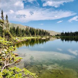
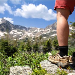
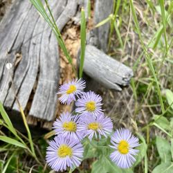
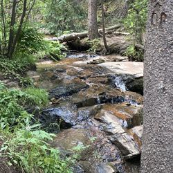
    Lost Creek Wilderness - Ben Tyler Trail Photos

    You might also consider

    More like Lost Creek Wilderness - Ben Tyler Trail

    Recommended Reviews - Lost Creek Wilderness - Ben Tyler Trail

    Your trust is our priority, so businesses can't pay to alter or remove their reviews. Learn more about reviews.
    Yelp app icon
    Browse more easily on the app
    Review Feed Illustration
    Photo of Janet D.
    2605
    2981
    26239

    7 years ago

    Helpful 12
    Thanks 0
    Love this 9
    Oh no 0

    18 years ago

    Helpful 5
    Thanks 0
    Love this 0
    Oh no 0

    Verify this business for free

    People searched for Hiking 250 times last month within 15 miles of this business.

    Verify this business

    Diamond Lake Trail

    Diamond Lake Trail

    5.0(9 reviews)
    36.0 mi

    One of the most beautiful hikes we have ever gone on…read more Wildflowers, streams, waterfalls and an amazing lake to top it off. High elevation and quite tough going up but so worth it!! Took us about 4 hours total. Stop in Nederland on the way down for early dinner or lunch. Fantastic day

    So effing beautiful. Let's just start there. Like the whole way up. Views of trees and mountainous…read moreviews. My legs hurt and I was dehydrated as shit because my moron friends didn't want to stop for food / water beforehand (big mistake). This wasn't the end of the world though due to the natural streams throughout the trek. Just dip your head in for some of the coolest most refreshing water you have ever tasted. Seriously, it beats the hell out of a bottle of Poland Spring or Fiji or whatever your posh ass is used to. I may retract that statement in a week when I have a tadpole making a nest (or whatever tadpoles do) inside of my stomach but for now ... yeah ... refreshing :) Get there early and have a car that you can beat up a little / SUV since there is about 4 miles of hilly dirt roads to get to the trail-head. I recommend hiking boots but I was fine in sneakers. Definitely take snacks / water and if your friends convince you otherwise just poke them hard in the gut with your hiking poles / stick (yes you probably want these too) until they cave in and stop the car for you. The trail is easy to follow. There is a split after about 1 - 1.5 miles up that has you chose between Apache Trail and Diamond Lake. We went for the lake. You will know you are there. If you miss it, congrats, you will probably be some giant grizzly bear's dinner that night. It was one of the more beautiful hiking sites I have bore witness to. For an added bonus and guys if you don't mind your balls retreating up into your stomach for warmth, take off those shoes and climb onto that rock in the center of the lake for some incredible panorama photos. The area surrounding the lake is great for a nap, a picnic, a read, etc. On our way down we stumbled across a man who sprained his ankle about 2 miles in. As a 9 person bachelor party we helped carry him 2 miles to the bottom. Humanitarian mission of Colorado has been complete, sites have been seen, and headache from altitude sickness is quickly on-setting due to lack of nutrients and H20. Despite hunger and a pounding headache, I definitely want to get back to the area and try a few other trails. Such an amazing escape from my normal city life.

    Photos
    Diamond Lake Trail - Sunflowers!

    Sunflowers!

    Diamond Lake Trail
    Diamond Lake Trail - Hiking away

    See all

    Hiking away

    Mount  Bailey - Entry to the 1st half of the Aspen Tree easy trail

    Mount Bailey

    5.0(2 reviews)
    2.2 mi

    Mt. Bailey is the visually prominent peak you see every time you drive east bound through the town…read moreof Bailey on your way to Denver and the Front Range plains. It is a mountain summit in the Front Range of the Rocky Mountains of CO. The 9,089 foot peak is located 1.0 miles northeast of the community of Bailey in Park County, CO. This area is surrounded by private property, and the only known public access is the trail leading to the summit. The cliffs, while appealing for rock climbing, are also private property. You park and start at a children's playground. The trail head is visible and you will begin with a gradual but steady climb. Once at the summit area you will see the communications tower area, complete with barbed wire. Please do NOT disturb the area - disturbing the private property could jeopardize everyone's access to this peak. This trail is not really a good trail for mountain bikes or horses. It is only a half mile each way not worth the effort of bringing a bike here. The trail gets LOTS of use by the locals, one of them introduced me to this trail. I was told when it snows, it gets packed down and turns icy. So bring your microspikes or other traction devices. Tip: This is not a backpacking destination since its too short of a trail. This is more of a day hike when you want your heart to go pitter patter :0 Directions:From Denver, drive on Highway 285 west (signs say south) through Aspen Park. Continue to Annex Lane (about 26 miles west of C-470/285 intersection). Turn south and drive on CO RD 72, turn right (south)on Burland Dr. Drive until you see the parking area and the playgound (about a mile). Yes. You can bring your four legged bff!

    Short 1/2 mile hike with great views from the top. Please stay to the left as you head up, to the…read moreright is private property and we want to be good neighbors. No trash cans here so pack out your picnic lunch. Cliffs at top so monitor your children. Most things done here are by volunteers and you are welcome to help too. If heading to the top is too steep, the 1st half of an easy trails stays in the aspens at the bottom.

    Photos
    Mount  Bailey - Rob digging the trail

    Rob digging the trail

    Mount  Bailey - Volunteers building the Aspen Tree easy trail in 2016

    Volunteers building the Aspen Tree easy trail in 2016

    Mount  Bailey - Just starting the entry posts

    See all

    Just starting the entry posts

    Crater Lakes

    Crater Lakes

    4.6(8 reviews)
    33.3 mi

    This is a great trail in summer & winter. Minimum is 7 miles with 1800 ft elevation, slightly…read morelonger to explore around any of the lakes more than the shortest trail provides. It's easy to reach in all seasons: due to the train tunnel, the dirt road to the trailhead is kept well maintained and plowed. Definitely way way more crowded on summer weekends than in winter. Several little waterfalls and tons on wildflowers even in late August made it a rewarding trail along the way, not only payoffs at the lakes. The trail from the lower two lakes to the upper lake is much steeper, but worth the added effort. Just note that when you first reach what you think is the upper lake, it's actually the drainage (albeit also lovely, see my attached photo); you need to go just a bit further over the boulders & through some bushes to reach the final upper cirque.

    James Peak Wilderness area is one of my favs close to Denver. That and Indian peaks wilderness…read more Crater lakes is a moderate hike to 5 fantastic lakes that you can hike, camp, backpack, fish at. Last time I was there I saw two amazing Moose...just gorgeous. Area gets insane on the weekends with tons of peoples and dogs. Last three times I have been there I have been in thunder and hails storms after 1 pm. So if you are planning to hike getting off the mountain before might be a good idea. You can also take the more strenuous Heart Lake trail which is also fantastic and if you really want to kick your ass go up to Rogers pass for beautiful vistas. Great parking.

    Photos
    Crater Lakes
    Crater Lakes
    Crater Lakes

    See all

    Cheesman Canyon Fishing Access Trailhead

    Cheesman Canyon Fishing Access Trailhead

    4.5(2 reviews)
    17.0 mi

    Beautiful trail with good views of the river. Not strenuous and worth doing even if you're not…read morefishing. The coverage isn't there when the sun is up mid day so highly recommend doing this earlier because it gets really hot. Was able to get parking easily which was a bonus.

    This hike captures what I envision as a picture postcard Colorado. The crystal clear Platte River…read morereflect the surrounding colors of nature. There were just as many fly fishermen as hikers. As a hiker it does not get full stars because signage is near non-existent. Many hikers note the frustration of getting lost. My party still got lost even though we had two people who hiked it multiple times. You can't get too lost since it is a Canyon. If you aim to get to the dam, you will need to head towards the rim of the canyon. One tends to gravitate toward the river trail, and lose site of the path towards the top. The hike is moderate with "treacherous" conditions. The loose gravel earth and getting lost makes it tricky with the constant sliding. Poles will prove helpful. It totals about 7 miles. We opted to take the loop even though it is a tad longer and less scenic because of getting lost. After reaching the dam, note if you decide to take the loop it goes through a section recovering from forest fires. The last 1.5 miles goes through a dirt road shared by two way car traffic. Choose the lesser of two evils.

    Photos
    Cheesman Canyon Fishing Access Trailhead
    Cheesman Canyon Fishing Access Trailhead
    Cheesman Canyon Fishing Access Trailhead

    See all

    Goose Creek Trail in Lost Creek Wilderness

    Goose Creek Trail in Lost Creek Wilderness

    4.7(3 reviews)
    18.7 mi

    I did this as part of a larger loop last weekend. The trail conditions for this segment were really…read moregood. It's a long trail, but not too difficult for a reasonably in shape person. Usually, you can walk two abreast and the river crossings are not hard. Lots of nice campsites every mile or so, visible right next to the trail. Once you get away from the trailhead, firewood is plentiful. Some camp sites are right next to water, so you can filter it and you're good. Others, you may have to carry water there. We did have some wet weather, which wasn't bad if you have good raincoats. Naturally, if you go to higher elevations, the rain comes down as snow, or hail, even in June. If you're just doing Goose Creek, within the first 7-8 miles, it's super easy to follow. However, good maps are available for free from the USGS web site. We also had a good map for Lost Creek from Amazon. Not too hard to get to the trail head, although you do have to drive about 15 miles of windy dirt road. It takes about 45 minutes for that part, especially if you have to back up to let someone go the other way on one of the single lane parts.

    When Spring hits Colorado snow is most likely still in the mountains... but towards the end of…read morespring there is one wilderness that most locals know will most likely NOT have snow, and that is why the Lost Creek Wilderness becomes so popular. People want out of their homes and into the mountains and they want it now, so they all go. This is a great trail to either take a short hike on or a trek. I did a one night day/trek and saw my first bear in person! I am still so excited to this day that I tell people about seeing my first bear in person. He saw us first and was walking away from us, but I was scared the rest of the trek. We found the most amazing camp site under these beautiful grove of Aspens and by a nearby running river. At that particular time, we were allowed to have fires, so we made a nice controlled fire, had an amazing dinner of burritos and rice and enjoyed ourselves as the night grew cooler. You better bet your booty that we hung all of our food, wrappers, and trash in a high high tree, far, far away from our tents... You are not a true hiker if you don't! Make sure to see the shaft house.. The short mile hike will grant you awesome sites of gigantic boulders and rock formations... A sure different view then the rest of the hike. * Star one for my first bear sighting ** Raise your hands tall or talk low star two is for learning what to do if a bear approaches you talk that lasted a mile *** Wow this is old star three is for the old not-in-use shafthouses that are a perfect short trek off of the main trail **** Fire fire star four is for the first mile which shows you in person how a much a forest fire rips apart a wilderness... But the star is for the new growth... I am so cheesy! 239.

    Photos
    Goose Creek Trail in Lost Creek Wilderness
    Goose Creek Trail in Lost Creek Wilderness

    See all

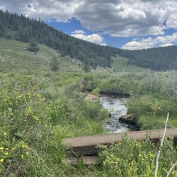
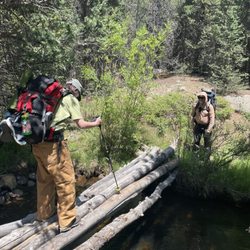
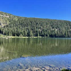
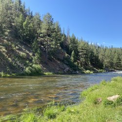
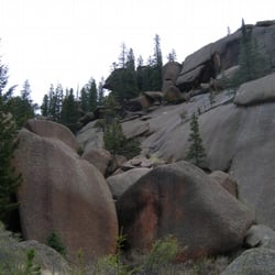
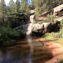
    Lost Creek Wilderness - Ben Tyler Trail - hiking - Updated June 2026

    Loading...
    Loading...
    Loading...