Cancel

    Open app

    Search

    Mount Bailey

    5.0 (2 reviews)

    Mount Bailey Photos

    You might also consider

    Recommended Reviews - Mount Bailey

    Your trust is our priority, so businesses can't pay to alter or remove their reviews. Learn more about reviews.
    Yelp app icon
    Browse more easily on the app
    Review Feed Illustration
    Photo of Janet D.
    2604
    2987
    26351

    10 years ago

    Helpful 13
    Thanks 0
    Love this 12
    Oh no 0

    10 years ago

    Helpful 0
    Thanks 0
    Love this 0
    Oh no 0

    Verify this business for free

    People searched for Hiking 150 times last month within 15 miles of this business.

    Verify this business

    Lost Creek Wilderness - Ben Tyler Trail

    Lost Creek Wilderness - Ben Tyler Trail

    5.0(2 reviews)
    3.6 km

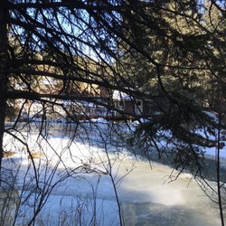
    Easy to get to just off 85. Easy hike/snowshoeing as well…read more Just got back from hiking the full 11.5 miles. It's a very quite lightly trafficked location. As of today not enough snow to snow shoe and not enough to wear spikes as well. So we decided to get rid of both. About eight or more short switchbacks and a gradual uphill nothing strenuous. When you enter the Pike National Forest you're about halfway to your destination. Trail is well marked and only horses and hikers are allowed here. Solitude and enough length of trail to keep a hiker happy.

    Awesome trail for snowshoeing. It is well marked on Hwy 285, with parking along the road. It…read morestarts quickly on an incline with switchbacks to accommodate the climb, but levels off after a while. Within a few minutes we were far enough up the trail that we did not hear any traffic. From there on out, it was just us. No animal sightings, but we did see tracks and scat. It was a windy day, but once in the trees and after working just a little bit, we were amply warm and happy. I felt like we could have hiked for hours and never seen another person. It was the perfect first time experience at snowshoeing. I think the Lost Creek Wilderness would be great during any season. In fact I learned of this hiking/snowshoeing destination from an REI employee who helped me find the right snowshoeing shoes. He got married in this forest preserve. I envy him that beauty and experience. The Ben Tyler trailhead is at 8260ft elevation and over 11 miles in length. The link I provide is of a map. Each trail name is linked to a history and description of the trail.

    Photos
    Lost Creek Wilderness - Ben Tyler Trail
    Lost Creek Wilderness - Ben Tyler Trail
    Lost Creek Wilderness - Ben Tyler Trail

    See all

    Mount Blue Sky Scenic Byway

    Mount Blue Sky Scenic Byway

    4.8(79 reviews)
    24.7 km

    I prefer Mt Blue Sky over Pikes Peak (Pikes Peak and Mt Blue Sky are the only 14ers in Colorado…read morethat you can drive to the top of). I think the views at the top are better. You can see a lot of other mountains from Mount Blue Sky and feel more in the wilderness. Fun fact, It is also the highest paved road in America! On our visit we got to see mountain goats. This was my first time seeing mountain goats in the wild. We did the quick walk up to the top of the mountain which was really cool and stopped over at summit lake. Make sure to reserve your timed entry! I actually do not mind that they do this because I feel like it would be hazardous if too many people were on the road up to Mt Blue Sky. There are no guard rails, cliffs off the side of the road, potholes, and the roads can be narrow in areas so not the ideal road to be busy. Very much a bucket list activity, though I definitely want to come back again vs just checking it off my list.

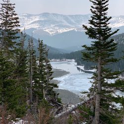
    Although I've lived in Colorado for nearly 40 years, I'd never visited Mount Blue Sky Scenic Byway…read more when it was still called Mount Evans because I'd heard the road was very steep. When I saw news reports about the name change, I realized the scenery was indeed stunning, and the road was entirely flat asphalt. Although most of the route runs along the edge of a cliff, if you drive slowly and pull over a bit when there's no oncoming traffic, it probably isn't as heart-stopping as the legends suggest. I was just planning to go when, unexpectedly, the scenic byway closed for two years. So as soon as it reopened--while there was still snow on the summit and road conditions were good--I hurried over. Driving from the city on I-25, then taking Highway 6 and connecting to I-70, it took about 40 minutes to reach the small town of Idaho Springs at the base of the mountain. On a Sunday afternoon, the town wasn't too crowded. While there are restrooms further up the mountain, they aren't as clean or convenient as the ones at the town's visitor center, so many tourists take care of business here before heading up. The visitor center also houses a paid museum where you can learn more about the history of this mining town. Across the street from the visitor center stands a statue honoring American pilots from World War II, modeled after the famous comic book hero Steve Canyon. This is also the last place before entering the mountains where you'll have a stable cell phone signal; once you're in the mountains, the signal disappears. The 14-mile drive from Idaho Springs to Echo Lake--located at an elevation of 10,600 feet just before the scenic byway entrance--follows a lush forest road that's a pleasure to drive. Since fishing is free in Colorado this weekend, there are quite a few anglers at Echo Lake. With its rippling turquoise waters and the lush, layered mountains in the background, the scenery is truly breathtaking and refreshing. There is an outdoor picnic area next to Echo Lake, and if you find the sun too strong or the weather unfavorable, you can take a break in the picnic area inside the stone building nearby. Less than a minute's drive from Echo Lake, a right turn leads to the Scenic Byway ticket booth. The attendant will tell you about the wildlife you might see on the mountain that day and remind everyone to just watch them--do not feed or touch them. The drive from the entrance to the Mount Goliath Natural Area at 11,540 feet is about 3 miles. Although the road follows the cliffside, towering pine and evergreen trees line both sides. Except for the final stretch, the valley is only faintly visible for most of the journey, making it a relatively easy drive. Looking out from the rest area, you'll see endless, layered mountain vistas. There's a trail through the tundra nearby that leads to the summit of Mount Goliath. After passing the Mount Goliath rest area, it's 6.2 miles to Summit Lake at an elevation of 12,830 feet. The entire route consists of tundra and mountain roads with no guardrails on one side--just a sheer cliff. Since the road winds around the mountain, the route runs half on the inner side and half on the outer side of the mountain, and it's very winding. It's fine when you're on the inner side, but when you're on the outer side, the cliff is right there. Fortunately, everyone drives slowly, but it's still quite nerve-wracking. Just before reaching Summit Lake, there's a patch of snow that hasn't melted yet by the roadside. Set against the western ridge of the summit, it looks as if you're on a glacier--it's a whole new world. Not far from there is Summit Lake, a high-altitude glacial lake. A short walk from the parking lot leads to the lakeshore. The surface of Summit Lake is as smooth as a mirror, reflecting the snow-capped ridges with such clarity that they appear to be exact replicas on the water--truly a scene of icy mountains mirrored in the water, ethereal and crystal-clear. The 5.3-mile stretch from Summit Lake to the summit at 14,264 feet is steeper and more rugged than the previous section. Many visitors turn back at Summit Lake, and I, too, didn't have the confidence or fortitude to drive another 10-plus miles of mountain road round-trip. So, after taking in the scenic beauty of Summit Lake, I headed back as well. Although it's only about 9 miles from the ticket booth to Summit Lake, the speed limit is no more than 20 miles per hour, so the round trip takes roughly an hour. Adding in the time spent at the scenic area, the total trip takes a little over two hours.

    Photos
    Mount Blue Sky Scenic Byway
    Mount Blue Sky Scenic Byway
    Mount Blue Sky Scenic Byway

    See all

    Goose Creek Trail in Lost Creek Wilderness

    Goose Creek Trail in Lost Creek Wilderness

    4.8(4 reviews)
    27.4 km

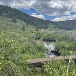
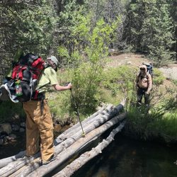
    It's a tough thing to be from CO and recommend great trails. Coloradans naturally want to gatekeep…read morebeautiful secrets, but had to write a review for this incredible hiking trail (which I'm sure isn't really a secret). Took my 12 year old daughter backpacking on this trail and we had a fantastic time. There are plenty of areas to set up a tent along the creek for the first 2 miles. After that the elevation climbs and you have to wait until 4 miles or so and you aren't as close to water. There were hardly any mosquitos, but a lot of flies. The flies were relentless, and only one type seemed to bite. Some bug spray helped a little. The scenery was beautiful. Greener than a lot of spots in CO due to the creek and massive boulders everywhere. There's a lot of bird activity including humming birds. There wasn't a ton of foot traffic either. The trail is narrow but maintained. I do not suggest going on the unmaintained trail on the other side of the creek. We hiked the maintained trail in and the unmaintained trail out and there were several spots that were difficult with a 40 lb backpack on due to loose dirt and gravel. Just stay on the main trail especially if you have kids packing in. The water level was pretty low in some areas and the only fish we saw in our spot were tiny ones, so it's probably not great for anglers. The road leading there is a long dirt road and goes down to a single lane in some spots so take it slow. One driver was being very irresponsible and driving as fast as possible and taking turns quickly so as to spin out and nearly hit us! You can't see around curves and there are steep drop offs, so please drive cautiously. There's no cell service out there (AT&T), so remember the turns you made driving and landmarks like campgrounds and ranches. Beautiful spot. Would recommend.

    I did this as part of a larger loop last weekend. The trail conditions for this segment were really…read moregood. It's a long trail, but not too difficult for a reasonably in shape person. Usually, you can walk two abreast and the river crossings are not hard. Lots of nice campsites every mile or so, visible right next to the trail. Once you get away from the trailhead, firewood is plentiful. Some camp sites are right next to water, so you can filter it and you're good. Others, you may have to carry water there. We did have some wet weather, which wasn't bad if you have good raincoats. Naturally, if you go to higher elevations, the rain comes down as snow, or hail, even in June. If you're just doing Goose Creek, within the first 7-8 miles, it's super easy to follow. However, good maps are available for free from the USGS web site. We also had a good map for Lost Creek from Amazon. Not too hard to get to the trail head, although you do have to drive about 15 miles of windy dirt road. It takes about 45 minutes for that part, especially if you have to back up to let someone go the other way on one of the single lane parts.

    Photos
    Goose Creek Trail in Lost Creek Wilderness
    Goose Creek Trail in Lost Creek Wilderness
    Goose Creek Trail in Lost Creek Wilderness

    See all

    Mount Bailey - hiking - Updated July 2026

    Loading...
    Loading...
    Loading...