Rubicon Trail Photos


You might also consider


More like Rubicon Trail
Recommended Reviews - Rubicon Trail
Start your review...


Reviews With Photos


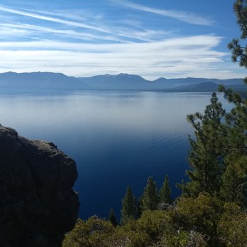
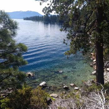
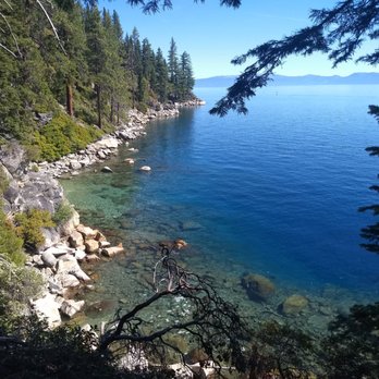
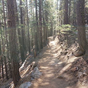
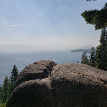
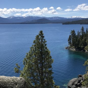
We hike this trail after a few days in town to get used to the 6000 feet altitude, and come on a weekday morning when its not as busy. You can drive about a mile into the DL Bliss State park before you reach a ranger station, where you need to pay $10 by credit card. Limited parking in paved lot before the ranger station. It's another 1.5 miles of one way traffic at the 15mph speed limit through beautifully paved road, with picturesque forests and not so picturesque campgrounds. We cruised past the empty lighthouse parking lot, and past two more small parking lots. We reach the Calawee Cove beach parking lot by 8:15am. Come here at 9am, and all 15 parking spots will be filled, in which case you will have to park at the Lighthouse parking lot closer to the ranger station entrance. Beautiful setting overlooking the lovely beach below, reachable by a steep pathway. Flush toilet bathrooms here for pit stops and changing in and out of swim suits for going to the beach just below. Northern tip of the Rubicon trail, which goes 4.5 miles to Vikingsholm, or 6.5 miles to the Emerald Bay State Park trail entrance. Sign at start of the trail says no dogs and no bikes. Narrow trail, single file in many places, wouldn't want to step in your dog droppings that you were too lazy to pick up! Stairs in places, with climbing over boulders on occasion. 6000 feet altitude at lake level. The first mile here is like climbing stairs over a beautiful lakeside trail, rising higher and higher over the deep blue waters, through the green forests. Areas where there are safety railings, due to cliff like overhangs. Periodic vista points, where the trail widens, but no bathrooms, and no cover for going in the bushes. The trail gradually goes inland, away from the lake, through the forests, one area of fire torched forests. Sandy dirt trail in the forests, hard gravel rising above the lake. 2.8 miles into the hike we come back to the lake along the path, and stop at the Emerald Bay peninsula. Other side of the peninsula is the boat dock area on Emerald Bay, with camp sites, eye sores not worth checking out. 4.5 hours and 7 miles after starting, we are back to our parking lot. Surprisingly there are available parking spots. This time we did do a detour and checked out the lighthouse. More appropriate to call the small shack shaped like an outhouse!


We arrived to Tahoe in the afternoon but definitely wanted to get in a little hiking on our first day. Emerald Bay was very busy and parking was a bit of a disaster, so we continued on to DL Bliss which came to me on recommendation from a good friend who visits this area often. We continued down the road to the top parking lot and snagged a spot with no problem at all around 330P. We walked down from the top free lot to get more steps, if you aren't into that type of thing you can drive down and pay $10 near the bottom in one of two different lots for the beach below. We said we'd do the hike to the lighthouse, which is very short. A few miles tops from the top parking lot off of the highway. I love light houses and have visited them in so many places but I've never visited the highest altitude lighthouse :) Now I have! We ended up deciding to keep going along the trail down to the beach to check it out, then returned. We were keeping a totally slow pace since I was experiencing a little altitude adjustment headache but spent about two hours out here. The trail was so peaceful, we were alone most of the time only spotting a handful of people here and there. Things were so much more calm here than the area down the road at Emerald Bay which we decided to return to on another day, much earlier in the morning. If you enjoy hiking, this is a stunning hike along the lake. I'd say skip parking at Emerald Bay and park at DL Bliss then hike the Rubicon trail out and back. Spotted the most gorgeous Western Tanager, this little birding nerd was so excited. I think he was on the welcome committee because he flew up very early the hike. Very helpful friendly service at the visitor office. Portable restrooms at top lot and regular restrooms if you happen to hike down to the beach. Great spot for a little hike and taking in great views on this side of the lake.


Beautiful and serene hike. It's not too challenging going down but get ready for the journey back up, as there are a lot of areas with inclines. But this is a great place to visit and to get a good workout in.


If you plan to hike the entire thing, I sure hope you are in great shape. Bring lots of water. The trail wraps around the Emerald Bay Area. So we are talking MILES and MILES of hiking. Lol. I hiked some of the trail on both sides of the bay. Did the hike from Emerald bay state park down to the water. And also did part of the hike from the opposite end down to Boat camp area and down towards Vikingsholm. Wherever you decide to join in on the trail , you will be taken away by how beautiful this Emerald Bay Area really is. If this is your first trip to Tahoe. This is a hike you must put down on your to do list.


Beautiful and well maintained trail with amazing views. Loved that it goes through forested areas as well as along the coast line. I would highly recommend this trail!


Must go early in busy Summer season, before 9am for good parking. Otherwise you'll be forced to park on the busy road and walk about a mile to the trail head. Excellent hike with lots of amazing views. We only did about 30 minutes in and 30 minutes out, not the whole trail. Bring lots of water if its hot, really heats up after 1PM. $8 for parking, but if you park on the road its free.


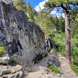
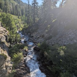
W. O. W. So, even if you haven't been there, you know Tahoe is beautiful. It's just one of those things you know, like that it's cold in Antarctica. Like you know that Christmas is on December 25. Like you know that you are your parents' favorite child. But, you are not prepared to realize just how beautiful it is until you take a hike along the Rubicon Trail. My guess is it's impossible to hike this entire trail inside of three days, simply because you stop every four feet to take in another beautiful vista or snap a few shots on your camera. Getting to the trail head is simple enough: a winding, downhill drive from the highway through DL Bliss State Park. Pay your $10 entry fee, and follow the signs to Calawee Cove and the Rubicon Trail. Park in the Calawee Cove lot, and the trail head is at the far end of the lot. I wasn't afforded the time to make it through the entire trail down to Emerald Bay and Vikingsholm, and I'm certainly no seasoned hiker, but I would rate this trail as easy, if not quite beginner. At least the first mile or so from the trail head wasn't tough at all. There are steps where there need to be, bridges over boulders and waterfalls, and some ropes to keep you away from the steepest sections. Enough can not be said for how gorgeous the views are from this trail, and I didn't even get to the honeypot. This is, literally, the #1 item on my "When-I-Return-to-Tahoe Bucket List". Definitely a quintessential experience when in the region!
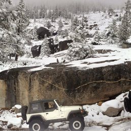

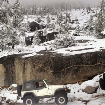
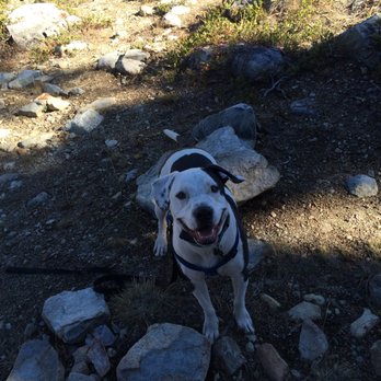
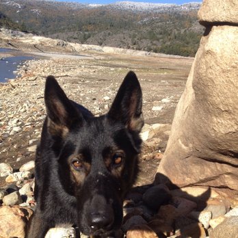
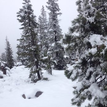
Driving 6 hours in the morning to get to the trail head with the gorgeous Loon lake. Then it would take another 3.5 hours wheeling and crawling on the Sierra rocks, passing Buck's Island to the Observation Point. Definitely, wheeling on Rubicon trail is like wheeling to heaven -- assuming you make it past the gatekeeper! Wheeling on snow was definitely not easy but worth it to see the beautiful scenery and snow serenity of the Sierra. With snow, we could not make it far. We turned around at the Wentworth junction and drove to Hell Hole Reservoir to camp over night. I definitely would not wheel in the snow alone. There would be many winch points so make sure you have a reliable winch with you! The best part about this trail is the williness to help and not leaving you behind made by other wheelers. It's just a matter of when others will show up. So, live it and I guarantee it will worth the drive, the time and the effort! Another yelper reviewed an knocked off one star because he stated that this trail is not dog friendly. I totally disagree. I don't have a dog but love all dogs I met every time when I was on the trail. Tip: Garbage in, garbage out. Take your own trash with you. Please try to keep this place clean and spotless. Be safe. Always buckle up and please go easy on the booze! And yes, I see sheriffs on the trail!


If you are looking for an easy hike with lots of beauty at the same time then you must check out this hiking trail. This is an out and back hike, you can go for a long hike or keep it short. So many pretty spots to take pictures so you wont want to forget your camera. This trail does get pretty busy when the weather is nice so if you like to hike alone your going to be pretty safe out here. One thing to remember is this is a state park so do not bring your dog with you because the ranger will ask you to leave. If your not looking to hike as much than just relax by the beautiful Lake Tahoe and have fun swimming or just hanging out by the beach. Whatever you decide to do you will want to check out the Rubicon Trail soon


Starting from D.L Bliss Park using the Emerald Bay Shuttle / Route 30 was a breeze. I can't recommend this shuttle enough. (Pickup at South Y transit center, by Raleys and KMart) Don't have to park once you're there, $5 for all day unlimited use, 20-30 min quick and very scenic ride and amazingly friendly drivers. It was a 1.5 mile trek to the trolley drop off at D.L Bliss park to the trailhead but pretty simple to follow. Great moderate hike with some narrow trails, some "stairs" but amazing sights to behold at every corner. Very well maintained trails with restrooms at the start of the trail and another at Vikingsholm (midway) before you continue onward to Eagle Falls. Be wary if you're catching the trolley back, from Vikingsholm. You will need to double back on The Eagle Falls trail (don't bother going past the waterfall, because it leads you to the campground and is not particularly scenic) there is no trolley stop at that end. At Vikingsholm, there's a great beach and a lovely little castle that is $10 for toured entry (must go down a ways to the log cabin to buy tickets) Restrooms were well maintained though no running water inside. Bring hand sanitizer or hand wipes. Highly recommend bringing at least two bottles of water, three if you plan on the whole of Rubicon trail to the Eagle Point campgrounds. There are some water spigots at vikingsholm, but not sure if they are for drinking. Took us 5.5 hours from D.L Bliss point to Eagle Point Campgrounds (with a lunch break) but we came out at the wrong point for a trolley pickup.... so we trekked to 30 min to Inspiration Point for a pickup on a very narrow and harrowing highway. Wonderful for a day trip and gorgeous views all around. (Note, the trolley back to the Y is in front of the Bayview Campgrounds, across the parking lot of Inspiration Point. They don't have a red trolley sign up, unfortunately. So it was confusing. Flag them down, if you see them.)


Spent the morning hiking the rubicon trail. It was our last hike before becoming husband and wife :) we wanted some calm time before the craziness. The trail itself is relatively easy with a couple small inclines that are over before you get too out of breath. The best part about this trail is the views. You follow the lake the whole time -- almost. There was one part where we traveled through the tall pine trees, but that view isn't bad either and it creates lots of shade. I think we hiked in about 2 miles or so and had to get back. We did not get attacked by mosquitos which was nice. We went early and on our way back there were quite a few people hiking in. I prefer seeing less people on my hikes , and it's not dog friendly .. that's why I gave it 4 stars.


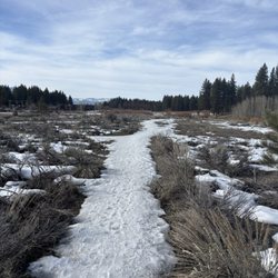
We went close to New Year's. Beautiful trail, I'll have to go back when it's not under snow! Because I had a hard time figuring out beforehand how hikeable the trail would be in the snow, I wanted to put up a few photos from our trip, to give others an idea. We parked in the Emerald Bay Overlook parking lot (free to park in the off-season). The road down to the trailhead is about a mile and goes past Vikingsholm, which was closed til Spring. The Lake was frozen over by the edge, which was fun for my daredevil husband! The steps up to the bridge were covered in snow, we had to use all four limbs to scale them! The trail itself stays close to the lake edge and has very little elevation change, some mild ups/ downs, which probably felt more dramatic with the snow. It was certainly slow-going, and we probably only went 2 miles. We stopped when the other human tracks stopped... it was getting dark anyways, and unless you have snowshoes, it's impossible to keep your feet dry while forging your own path. Amazing views, and neat to go when there weren't many other visitors. It was a cold, peaceful, gorgeous hike.


Yesssssssss! If you're thinking about hiking here, do it! The address on yelp doesn't help so google the DL Bliss State Park address. It's $10 per car for the day. There was plenty of parking when we went on June 4th around 10am. This was the highlight of our stay in Tahoe, by far! The hike has beautiful views the whole way. It isn't like you are hiking to only have a pretty view at the end, so you can turn around whenever you want and still feel satisfied. My fiancé proposed on this hike - it was perfect! We were lucky with amazing weather. We will definitely come back to do this hike every time we visit Tahoe.


The Rubicon Trail was certainly a hike that we stumbled upon by chance. After visiting Baldwin Beach, we were looking for somewhere to see the infamous Emerald Bay and see the lake from a different viewpoint. After paying the $10 entrance fee to park, we saw that there was an option for a hike to get to a waterfall. One thing to keep in mind is the steep incline throughout most of the trail - this would definitely be a hike that I would consider as moderate difficulty. Overall, I believe that my Apple Watch clocked 3.75 miles for the hike round trip! Getting to the waterfall and spending time in the visitors center and around the base of the lake was a treat! read more


I picked the perfect day to hike; temp was 70 around 2 pm. I had read that the D.L Bliss Camp access to the Rubicon trail was closed but Emerald Bay was open. We headed to EB camp grounds. Being this the first time we attempted to hike at The Rubicon, we had questions. The park rangers gave us a free 20 min pass to drive inside and see where the trail was. We explored the area; some construction was happening but trail was accessible. We were happy with what we saw, it was a beautiful day and I had a backpack full of water and snacks. We went back to pay the 10 dollar fee for the day pass and we headed out towards our journey. The path was pretty easy heading to Vikingsholm Castle hardly broke a sweat. We enjoyed clear beautiful panoramic views of the lake. It was quite breathtaking. Not too many people on the trail and that was quite peaceful and enjoyable. A lot of people when we arrived at the Vikingholm Castle. We took a few photos there and enjoyed the cool breeze then headed back. Boy oh boy did I underestimate that climb back to camp. My mind was saying "yes you can" but my old bones and lungs were not very convinced. I hadn't been hiking like this in about 5 years but I survived without reaching for my Life Alert pendant; kidding, not kidding. It was just a reminder that I have to do this more often to get conditioned again. It was a nice accomplishment even though I just did 1.5 miles of the 12 mile hike. I'll push to do 3 next time. It was really great to get out and enjoy nature like that. We are so lucky to live so close to all this beautiful scenery. It was quite refreshing, I felt great. We stopped at Camp Richardson on our way back and enjoyed some ice cream; a perfect ending to our beautiful day. read more

5 years ago
ºlllllllº This is Jeep paradise, tried and true. If you're not a Jeeper and don't know the history, The Rubicon Trail is world famous and known to be the crown jewel and most difficult of all offroad 4x4 trails. It's 22 miles long, but because of the degree of difficulty and all of the obstacles, it will take several arduous days to complete. Located in the Sierra Nevadas, you enter at Loon Lake (past Georgetown) and exit at Lake Tahoe. The views high atop that granite are absolutely stunning to say the least. I first backpacked this trail from Loon Lake to Rubicon Reservoir, but nothing compares to taking your own Jeep on it. Absolutely nothing. /l ,[____], l---L-OlllllllO- ()_) ()_)--O-)_) read more


We hike this trail after a few days in town to get used to the 6000 feet altitude, and come on a weekday morning when its not as busy. You can drive about a mile into the DL Bliss State park before you reach a ranger station, where you need to pay $10 by credit card. Limited parking in paved lot before the ranger station. It's another 1.5 miles of one way traffic at the 15mph speed limit through beautifully paved road, with picturesque forests and not so picturesque campgrounds. We cruised past the empty lighthouse parking lot, and past two more small parking lots. We reach the Calawee Cove beach parking lot by 8:15am. Come here at 9am, and all 15 parking spots will be filled, in which case you will have to park at the Lighthouse parking lot closer to the ranger station entrance. Beautiful setting overlooking the lovely beach below, reachable by a steep pathway. Flush toilet bathrooms here for pit stops and changing in and out of swim suits for going to the beach just below. Northern tip of the Rubicon trail, which goes 4.5 miles to Vikingsholm, or 6.5 miles to the Emerald Bay State Park trail entrance. Sign at start of the trail says no dogs and no bikes. Narrow trail, single file in many places, wouldn't want to step in your dog droppings that you were too lazy to pick up! Stairs in places, with climbing over boulders on occasion. 6000 feet altitude at lake level. The first mile here is like climbing stairs over a beautiful lakeside trail, rising higher and higher over the deep blue waters, through the green forests. Areas where there are safety railings, due to cliff like overhangs. Periodic vista points, where the trail widens, but no bathrooms, and no cover for going in the bushes. The trail gradually goes inland, away from the lake, through the forests, one area of fire torched forests. Sandy dirt trail in the forests, hard gravel rising above the lake. 2.8 miles into the hike we come back to the lake along the path, and stop at the Emerald Bay peninsula. Other side of the peninsula is the boat dock area on Emerald Bay, with camp sites, eye sores not worth checking out. 4.5 hours and 7 miles after starting, we are back to our parking lot. Surprisingly there are available parking spots. This time we did do a detour and checked out the lighthouse. More appropriate to call the small shack shaped like an outhouse! read more




5 years ago
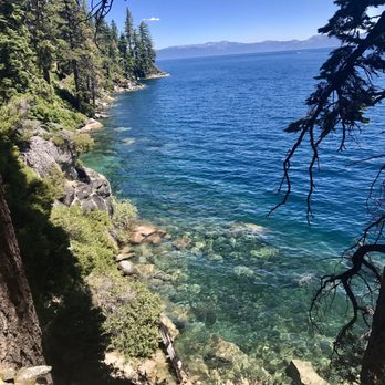
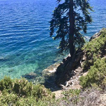
We arrived to Tahoe in the afternoon but definitely wanted to get in a little hiking on our first day. Emerald Bay was very busy and parking was a bit of a disaster, so we continued on to DL Bliss which came to me on recommendation from a good friend who visits this area often. We continued down the road to the top parking lot and snagged a spot with no problem at all around 330P. We walked down from the top free lot to get more steps, if you aren't into that type of thing you can drive down and pay $10 near the bottom in one of two different lots for the beach below. We said we'd do the hike to the lighthouse, which is very short. A few miles tops from the top parking lot off of the highway. I love light houses and have visited them in so many places but I've never visited the highest altitude lighthouse :) Now I have! We ended up deciding to keep going along the trail down to the beach to check it out, then returned. We were keeping a totally slow pace since I was experiencing a little altitude adjustment headache but spent about two hours out here. The trail was so peaceful, we were alone most of the time only spotting a handful of people here and there. Things were so much more calm here than the area down the road at Emerald Bay which we decided to return to on another day, much earlier in the morning. If you enjoy hiking, this is a stunning hike along the lake. I'd say skip parking at Emerald Bay and park at DL Bliss then hike the Rubicon trail out and back. Spotted the most gorgeous Western Tanager, this little birding nerd was so excited. I think he was on the welcome committee because he flew up very early the hike. Very helpful friendly service at the visitor office. Portable restrooms at top lot and regular restrooms if you happen to hike down to the beach. Great spot for a little hike and taking in great views on this side of the lake. read more



2 years ago
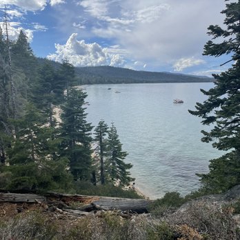
Beautiful and serene hike. It's not too challenging going down but get ready for the journey back up, as there are a lot of areas with inclines. But this is a great place to visit and to get a good workout in. read more


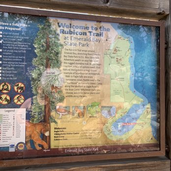
If you plan to hike the entire thing, I sure hope you are in great shape. Bring lots of water. The trail wraps around the Emerald Bay Area. So we are talking MILES and MILES of hiking. Lol. I hiked some of the trail on both sides of the bay. Did the hike from Emerald bay state park down to the water. And also did part of the hike from the opposite end down to Boat camp area and down towards Vikingsholm. Wherever you decide to join in on the trail , you will be taken away by how beautiful this Emerald Bay Area really is. If this is your first trip to Tahoe. This is a hike you must put down on your to do list. read more




5 years ago
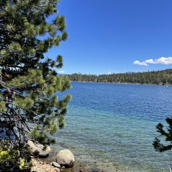
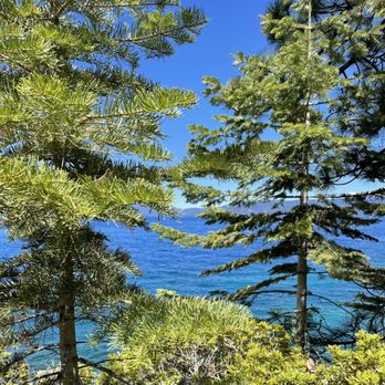
Beautiful and well maintained trail with amazing views. Loved that it goes through forested areas as well as along the coast line. I would highly recommend this trail! read more




5 years ago
Must go early in busy Summer season, before 9am for good parking. Otherwise you'll be forced to park on the busy road and walk about a mile to the trail head. Excellent hike with lots of amazing views. We only did about 30 minutes in and 30 minutes out, not the whole trail. Bring lots of water if its hot, really heats up after 1PM. $8 for parking, but if you park on the road its free. read more


W. O. W. So, even if you haven't been there, you know Tahoe is beautiful. It's just one of those things you know, like that it's cold in Antarctica. Like you know that Christmas is on December 25. Like you know that you are your parents' favorite child. But, you are not prepared to realize just how beautiful it is until you take a hike along the Rubicon Trail. My guess is it's impossible to hike this entire trail inside of three days, simply because you stop every four feet to take in another beautiful vista or snap a few shots on your camera. Getting to the trail head is simple enough: a winding, downhill drive from the highway through DL Bliss State Park. Pay your $10 entry fee, and follow the signs to Calawee Cove and the Rubicon Trail. Park in the Calawee Cove lot, and the trail head is at the far end of the lot. I wasn't afforded the time to make it through the entire trail down to Emerald Bay and Vikingsholm, and I'm certainly no seasoned hiker, but I would rate this trail as easy, if not quite beginner. At least the first mile or so from the trail head wasn't tough at all. There are steps where there need to be, bridges over boulders and waterfalls, and some ropes to keep you away from the steepest sections. Enough can not be said for how gorgeous the views are from this trail, and I didn't even get to the honeypot. This is, literally, the #1 item on my "When-I-Return-to-Tahoe Bucket List". Definitely a quintessential experience when in the region! read more


9 years ago
Driving 6 hours in the morning to get to the trail head with the gorgeous Loon lake. Then it would take another 3.5 hours wheeling and crawling on the Sierra rocks, passing Buck's Island to the Observation Point. Definitely, wheeling on Rubicon trail is like wheeling to heaven -- assuming you make it past the gatekeeper! Wheeling on snow was definitely not easy but worth it to see the beautiful scenery and snow serenity of the Sierra. With snow, we could not make it far. We turned around at the Wentworth junction and drove to Hell Hole Reservoir to camp over night. I definitely would not wheel in the snow alone. There would be many winch points so make sure you have a reliable winch with you! The best part about this trail is the williness to help and not leaving you behind made by other wheelers. It's just a matter of when others will show up. So, live it and I guarantee it will worth the drive, the time and the effort! Another yelper reviewed an knocked off one star because he stated that this trail is not dog friendly. I totally disagree. I don't have a dog but love all dogs I met every time when I was on the trail. Tip: Garbage in, garbage out. Take your own trash with you. Please try to keep this place clean and spotless. Be safe. Always buckle up and please go easy on the booze! And yes, I see sheriffs on the trail! read more





If you are looking for an easy hike with lots of beauty at the same time then you must check out this hiking trail. This is an out and back hike, you can go for a long hike or keep it short. So many pretty spots to take pictures so you wont want to forget your camera. This trail does get pretty busy when the weather is nice so if you like to hike alone your going to be pretty safe out here. One thing to remember is this is a state park so do not bring your dog with you because the ranger will ask you to leave. If your not looking to hike as much than just relax by the beautiful Lake Tahoe and have fun swimming or just hanging out by the beach. Whatever you decide to do you will want to check out the Rubicon Trail soon read more




9 years ago
Starting from D.L Bliss Park using the Emerald Bay Shuttle / Route 30 was a breeze. I can't recommend this shuttle enough. (Pickup at South Y transit center, by Raleys and KMart) Don't have to park once you're there, $5 for all day unlimited use, 20-30 min quick and very scenic ride and amazingly friendly drivers. It was a 1.5 mile trek to the trolley drop off at D.L Bliss park to the trailhead but pretty simple to follow. Great moderate hike with some narrow trails, some "stairs" but amazing sights to behold at every corner. Very well maintained trails with restrooms at the start of the trail and another at Vikingsholm (midway) before you continue onward to Eagle Falls. Be wary if you're catching the trolley back, from Vikingsholm. You will need to double back on The Eagle Falls trail (don't bother going past the waterfall, because it leads you to the campground and is not particularly scenic) there is no trolley stop at that end. At Vikingsholm, there's a great beach and a lovely little castle that is $10 for toured entry (must go down a ways to the log cabin to buy tickets) Restrooms were well maintained though no running water inside. Bring hand sanitizer or hand wipes. Highly recommend bringing at least two bottles of water, three if you plan on the whole of Rubicon trail to the Eagle Point campgrounds. There are some water spigots at vikingsholm, but not sure if they are for drinking. Took us 5.5 hours from D.L Bliss point to Eagle Point Campgrounds (with a lunch break) but we came out at the wrong point for a trolley pickup.... so we trekked to 30 min to Inspiration Point for a pickup on a very narrow and harrowing highway. Wonderful for a day trip and gorgeous views all around. (Note, the trolley back to the Y is in front of the Bayview Campgrounds, across the parking lot of Inspiration Point. They don't have a red trolley sign up, unfortunately. So it was confusing. Flag them down, if you see them.) read more


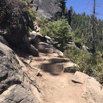


18 years ago

Spent the morning hiking the rubicon trail. It was our last hike before becoming husband and wife :) we wanted some calm time before the craziness. The trail itself is relatively easy with a couple small inclines that are over before you get too out of breath. The best part about this trail is the views. You follow the lake the whole time -- almost. There was one part where we traveled through the tall pine trees, but that view isn't bad either and it creates lots of shade. I think we hiked in about 2 miles or so and had to get back. We did not get attacked by mosquitos which was nice. We went early and on our way back there were quite a few people hiking in. I prefer seeing less people on my hikes , and it's not dog friendly .. that's why I gave it 4 stars. read more


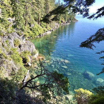

12 years ago
We went close to New Year's. Beautiful trail, I'll have to go back when it's not under snow! Because I had a hard time figuring out beforehand how hikeable the trail would be in the snow, I wanted to put up a few photos from our trip, to give others an idea. We parked in the Emerald Bay Overlook parking lot (free to park in the off-season). The road down to the trailhead is about a mile and goes past Vikingsholm, which was closed til Spring. The Lake was frozen over by the edge, which was fun for my daredevil husband! The steps up to the bridge were covered in snow, we had to use all four limbs to scale them! The trail itself stays close to the lake edge and has very little elevation change, some mild ups/ downs, which probably felt more dramatic with the snow. It was certainly slow-going, and we probably only went 2 miles. We stopped when the other human tracks stopped... it was getting dark anyways, and unless you have snowshoes, it's impossible to keep your feet dry while forging your own path. Amazing views, and neat to go when there weren't many other visitors. It was a cold, peaceful, gorgeous hike. read more


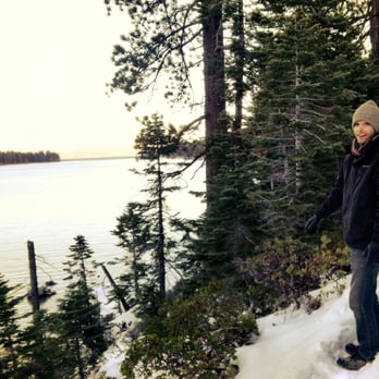


8 years ago
Yesssssssss! If you're thinking about hiking here, do it! The address on yelp doesn't help so google the DL Bliss State Park address. It's $10 per car for the day. There was plenty of parking when we went on June 4th around 10am. This was the highlight of our stay in Tahoe, by far! The hike has beautiful views the whole way. It isn't like you are hiking to only have a pretty view at the end, so you can turn around whenever you want and still feel satisfied. My fiancé proposed on this hike - it was perfect! We were lucky with amazing weather. We will definitely come back to do this hike every time we visit Tahoe. read more


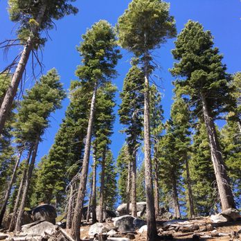
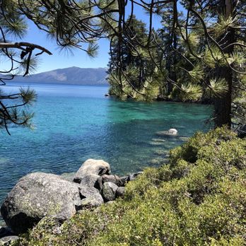

8 years ago

6 years ago

9 years ago
This trail will absolutely be a staple on any future South Lake Tahoe trips I make. The trail was easy to navigate, not too strenuous, and the views of both the lake and the colors of the mountainside were breathtaking. PARKING We got to the area on a Monday morning in June around 10. We tried to park in the Vikingsholm parking lot (which is not terribly big to begin with) but it was full and there were plenty of cars waiting to find spots. We turned back around to the even smaller Eagle Falls parking lot but that too was full. We managed to find street parking though that too is fairly limited. By the time we got back though there were tons of cars parked in tow away zones that clearly just figured there was strength in numbers. There is a small fee to park at Vikingsholm but street parking is free. GETTING TO THE TRAIL From the Vikingsholm lot, you'll find the trail head. You'll start by going down a fairly steep hill that's roughly .5 - .75mi. Coming back up this hill on your way back will probably be the most strenuous part of the hike so just remember to factor in this extra mile or so when planning your time + water. When you get to the bottom you'll see a sign directing you to the right for Eagle Falls. Turn left to go to the Rubicon Trail. We started down by the dock and were able to see a lot of swallowtail butterflies along the sand. ON THE TRAIL * The actual Rubicon Trail is 4.5mi but it is an out and back trail so if you go the entire way you're looking at closer to 10mi round trip + getting to the parking lot. You can always turn back whenever you like if you're getting tired or are short for time. * Once you're on the trail it's pretty straight shooting. You'll walk along the lake for a good portion of the trail. At one point fairly early on, there will be a split that directs you either up or continues along the water - take the higher ground. * Around 2mi in to the actual trail, you'll come to a campsite. Get on the asphalt and follow this for a quarter mile or so and it'll shoot you back to the trail. (There's trash cans and bathrooms here if you need either of those.) * Around 3mi in you'll come to a little waterfall runoff crossing. Your shoes will probably get wet here and if you're a little unstable walking sticks might come in handy, but this isn't terribly big. *Full disclosure, this is where we unfortunately had to turn around because we were cutting it short for other plans we'd made. This trip took us about 4 hours.* * Parts of the trail are shaded by the big, beautiful redwoods and there's many places to set up an impromptu picnic or jump in the lake, so pack your snacks and layers! * If you enjoy stopping take pictures or soak in the view, plan on the full hike taking 6-7 hours. GEAR Water is a must. We felt a little lightheaded towards the end of the hike but that could very well be due to the altitude. Trail shoes or hiking boots aren't necessary but highly recommended to protect from some of the gravel/a few slippery rocks. I will ABSOLUTELY be doing this trail again the next time I go back! read more


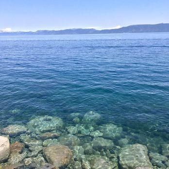


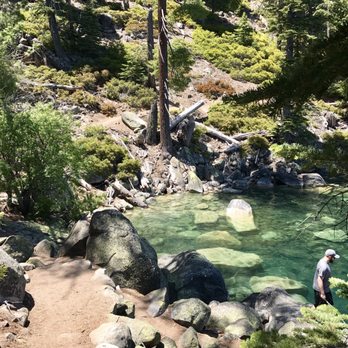

14 years ago

17 years ago

7 years ago

16 years ago


12 years ago

10 years ago
This was my first hike in California , I'm from Canada which is at mostly sea level. Why I mention this is because a lot of people who will walk this trail are from out of state. A word of caution for all of you: This is a stunning trail, however do not attempt it your first 1-3 days at this elevation if you're not a fit person. This trail averages at elevation about 6000-6500 ft. I do intense cardio on a daily basis and I found this trail not to be too difficult but it did wind me at spots. Let yourself acclimate to lake Tahoe's elevation just to be sure you can full enjoy what the trail has to offer. That being said, this is a 4.5 (one way) or 6.7ish mile (one way) hike depending on where you stop. I do not recommend bringing your infants or dogs beyond the one mile mark as it does become a little bit hazardous for them. The scenery is beautiful. read more


Hiked a portion of the Rubicon trail down to the vikingsholm castle during the summer. Great hike. Saw some Ospreys nesting in the treetops. Saw a Western Tanager. Experienced waterfalls and Vikingsholm castle, And just some amazing views. read more


This is an amazing trail. We hiked it over two days. The first day we parked at the trailhead in DL Bliss State Park. The second day we parked outside the gate of Emerald Bay State Park (which was closed). Both days we hiked until we reached Vikingsholm. For us, the route from DL Bliss to Vikingsholm was the better hike. It was more challenging, but also more scenic. read more
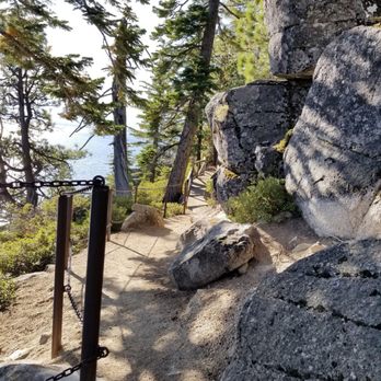

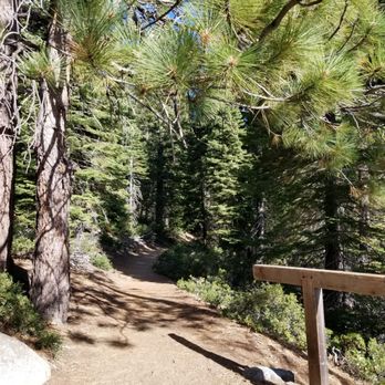


15 years ago

15 years ago


11 years ago
Beautiful beautiful beautiful!!! We took our 4 year old son on this hike last week and while it was challenging, it was beautiful and worth it. The lake was emerald blue. I wish we would of camped in DL Bliss campground so it would of been more accessible. Will be back:) read more


Best hike ever! We ended up hiking about 10 miles this day on October 1st. It was cold and windy especially at the top at the vikinhgholm entrance. We ended up hiking down, to vikinhgholm to the falls the rubicon. Best views of the lake! Fairly traveled trail but less so the further you go in. This should be a bucket list hike for anyone wanting to explore the natural beauty of Tahoe. read more
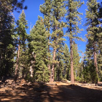


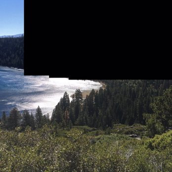

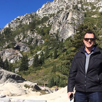

13 years ago
Went ATV up through millers lake. so much fun and really pretty to look at. If you are into off roading, this is a must go to. Have fun and be careful! read more

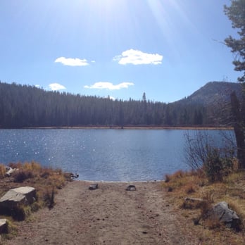

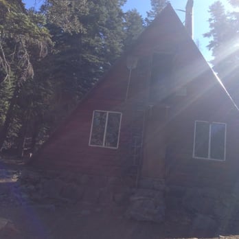
8 years ago
Great trail!! Breathtaking views and very manageable hike. We hiked down the rubicon to the beAch and back on lighthouse. The lighthouse is anticlimactic... but still a best part of history!! read more
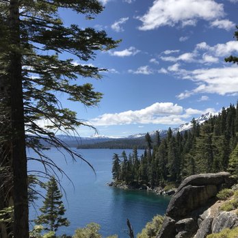
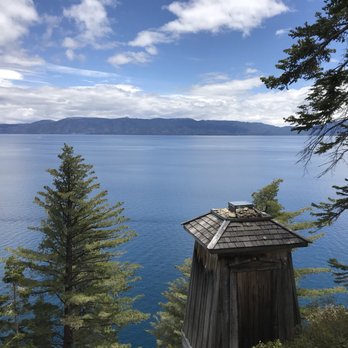



Page 1 of 2
More info about Rubicon Trail
Ask the Community - Rubicon Trail
Hello , I would like to book a rental for today. What is the process?
The hiking trail is free
Review Highlights - Rubicon Trail
You might also consider





























Why does Yelp recommend reviews?


Rubicon Trail - hiking - Updated August 2026
Best of South Lake Tahoe
People found Rubicon Trail by searching for…
Hiking Trails in South Lake Tahoe, CA
Things to Do in South Lake Tahoe, CA
Free Snow Play in South Lake Tahoe, CA
Off Road Trails in South Lake Tahoe, CA
Campgrounds in South Lake Tahoe, CA
Waterfall Hike in South Lake Tahoe, CA
Dog Friendly Beaches in South Lake Tahoe, CA
Beaches in South Lake Tahoe, CA
Redwood Trees in South Lake Tahoe, CA
Running Trails in South Lake Tahoe, CA
Walking Trails in South Lake Tahoe, CA
Lakes & Ponds in South Lake Tahoe, CA
Easy Hikes in South Lake Tahoe, CA
Swimming Holes in South Lake Tahoe, CA
Dog Friendly Hiking Trails in South Lake Tahoe, CA
Trails in South Lake Tahoe, CA
Secret Spots in South Lake Tahoe, CA
Free Campgrounds in South Lake Tahoe, CA
Stairs Workout in South Lake Tahoe, CA
Waterfalls in South Lake Tahoe, CA
Trending Searches in South Lake Tahoe, CA
Baseball Card Shop near Rubicon Trail
Cliff Jumping near Rubicon Trail
Dog Friendly Things To Do near Rubicon Trail
Ear Piercing near Rubicon Trail
Flower Fields near Rubicon Trail
Hair Stylists near Rubicon Trail
Kids Haircut near Rubicon Trail
Lookout Points near Rubicon Trail
Movie Theatre near Rubicon Trail
Picnic Areas near Rubicon Trail
Psychic Readings near Rubicon Trail
Rock Quarry near Rubicon Trail
Scenic Drive near Rubicon Trail
Shopping Malls near Rubicon Trail
Souvenir Shops near Rubicon Trail
Sports Card Shops near Rubicon Trail
Sunrise View near Rubicon Trail
Swimming Holes near Rubicon Trail
Trading Card Shops near Rubicon Trail
Used Book Stores near Rubicon Trail
Browse Articles
Browse Nearby
BEST of South Lake Tahoe, California Restaurants near Rubicon Trail
BEST of South Lake Tahoe, California Coffee near Rubicon Trail
BEST of South Lake Tahoe, California Things to Do near Rubicon Trail
BEST of South Lake Tahoe, California Breakfast near Rubicon Trail
BEST of South Lake Tahoe, California Beaches near Rubicon Trail
BEST of South Lake Tahoe, California Fishing near Rubicon Trail
BEST of South Lake Tahoe, California Campgrounds near Rubicon Trail
BEST of South Lake Tahoe, California Sledding near Rubicon Trail
BEST of South Lake Tahoe, California Snow Tubing near Rubicon Trail
Browse Brands
Related Searches in South Lake Tahoe, CA
Affordable Kayak Rental Services in South Lake Tahoe, California
Best Dog Hiking Trails Around South Lake Tahoe, California
Best Fishing Locations and Guides in South Lake Tahoe, California
Best Places for Horseback Riding in South Lake Tahoe, California
Best Sightseeing Experiences Available in South Lake Tahoe, California
Check Out Off Road Trails in South Lake Tahoe, California
Discover Dog Friendly Trails to Explore in South Lake Tahoe, California
Discover Easy Hiking Trails Near South Lake Tahoe, California
Discover Kid Friendly Hiking Trails in South Lake Tahoe, California
Discover Popular Bike Trails in South Lake Tahoe, California
Discover a Hiking Trail in South Lake Tahoe, California
Discover the Best Night Hike Trails in South Lake Tahoe, California
Dog-Friendly Hikes With Dogs in South Lake Tahoe, California
Enjoy Camping Adventures Around South Lake Tahoe, California
Enjoy Kayaking Adventures in South Lake Tahoe, California
Enjoy Off Leash Dog Hikes in South Lake Tahoe, California
Enjoy Tent Camping Spots Around South Lake Tahoe, California
Enjoy a Beautiful Waterfall Hike in South Lake Tahoe, California
Enjoy the Best Picnic Spots and Ideas in South Lake Tahoe, California
Enjoy the Best Walking Path in South Lake Tahoe, California
Enjoy the Best Walking Trails in South Lake Tahoe, California
Experience Thrilling White Water Rafting in South Lake Tahoe, California
Explore Easy Hikes Perfect for All in South Lake Tahoe, California
Explore Fun Activities to Do in South Lake Tahoe, California
Explore Popular Campgrounds Near South Lake Tahoe, California
Explore Popular State Park Destinations in South Lake Tahoe, California
Explore Top Dog Parks in South Lake Tahoe, California Near You
Explore the Best Beach Spots in South Lake Tahoe, California
Family Friendly Hiking With Kids in South Lake Tahoe, California
Find Fun Kids Activities Outdoor in South Lake Tahoe, California
Find Parks and Recreation Activities in South Lake Tahoe, California
Find Popular Ziplining Spots Around South Lake Tahoe, California
Find Top Dog Friendly Parks to Visit in South Lake Tahoe, California
Find Top-Rated Waterfalls in South Lake Tahoe, California Now
Hiking Trails With Waterfalls in South Lake Tahoe, California
Off Leash Dog Hiking Trails in South Lake Tahoe, California
Popular Outdoor Activities to Try in South Lake Tahoe, California
Popular Picnic Spots to Visit in South Lake Tahoe, California
Popular Waterfall Hiking Trails in South Lake Tahoe, California
Safe and Fun Parks for Kids in South Lake Tahoe, California
Top Hiking Trails to Explore in South Lake Tahoe, California
Top Playgrounds for Kids to Enjoy in South Lake Tahoe, California
Top Running Trails to Explore in South Lake Tahoe, California
Top Swimming Lakes to Enjoy in South Lake Tahoe, California
Top Swimming Spots and Pools in South Lake Tahoe, California
Top Things to Do With Kids in South Lake Tahoe, California
Top-Rated Camping Sites in South Lake Tahoe, California
Walk Dog Friendly Hiking Trails in South Lake Tahoe, California
Walk the Best Paved Walking Trails in South Lake Tahoe, California


