Cancel

    Open app

    Search

    Pine Hollow Trailhead

    5.0 (1 review)

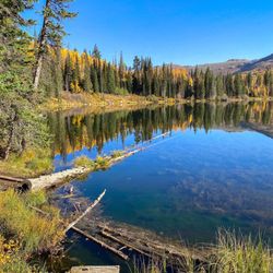
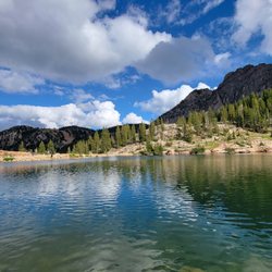
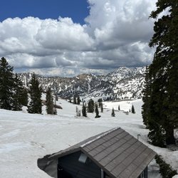
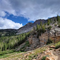
    Pine Hollow Trailhead Hiking Photos

    You might also consider

    Recommended Reviews - Pine Hollow Trailhead

    Your trust is our priority, so businesses can't pay to alter or remove their reviews. Learn more about reviews.
    Yelp app icon
    Browse more easily on the app
    Review Feed Illustration
    Photo of Jeffrey S.
    3070
    2527
    8089

    5 years ago

    Helpful 6
    Thanks 0
    Love this 4
    Oh no 0

    You might also consider
    Verify this business for free

    People searched for Hiking 1,462 times last month within 15 miles of this business.

    Verify this business

    Battle Creek Falls Trail - On the top of the waterfall

    Battle Creek Falls Trail

    4.5(11 reviews)
    6.3 mi

    Wow! Can't believe I've lived in Utah my entire life and never tried this easy, but beautiful hike!…read moreThanks to ChatGPT for recommending this hike me. Searched up easy, short winter hikes for solo hikers and this popped up, super glad it did! This hike is an absolute must try if you live in Utah county. It is just 1.3 miles round-trip and only took about 15 minutes to get up to the frozen waterfall. The waterfall was absolutely beautiful, all of the ice crystals and trees were stunning. It is pretty slippery this time of year so I would bring hiking poles or hiking boots that have good traction so that you can get down to the waterfall. I unfortunately wore the wrong shoes so I couldn't go all the way down. Would've broke my assWill definitely be doing this again, it's nice that it's so close and such a short easy hike for the winter time!

    On Monday, April 7, 2025 (Yesterday), I decided to take advantage of the warmer weather and hike at…read moreBattle Creek Falls. Parking lot: Free Size: Small Bathroom: Yes Men and women Toilet: Regular; water-based. From the parking lot to the waterfall, took 15 minutes, give or take. The trail is slightly incline, some parts more, than others and since I haven't worked out in the past few months, I was slightly out of breath, but nothing extreme before the waterfall. Moreover, there is also a path down to the waterfall, with a log to sit on, and taken in the beautiful waterfall. If one decides to go further up, the path does continue on top of the waterfall, right hand side. This trail is easy and no way of getting lost to the water fall. In additon, If you're looking for more beyond the waterfall, there is a much smaller one shortly ahead, but after that, there is not much to see. A lot of snow and mud, and dry plants. And after the second smaller waterfall, the trail does get challenging because it's all uphill. Unfortunately, I did not make it to the meadows. I came across two hikers who said they did go to meadows and it was ugly right now. I wanted to see for myself and on the way there, the path itself was very ugly, muddy and dry. Henced, I turned back. Overall, family friendly, easy hike, and make sure to bring a hat because a lot of the trail after the waterfall is direct sunlight, no shade.

    Photos
    Battle Creek Falls Trail - Battle Creek Falls Hike - Pleasant Grove Utah

    Battle Creek Falls Hike - Pleasant Grove Utah

    Battle Creek Falls Trail - Battle Creek Falls Hike - Pleasant Grove Utah

    Battle Creek Falls Hike - Pleasant Grove Utah

    Battle Creek Falls Trail

    See all

    Dry Canyon Trail Head - Sunset glow from stairway portion of trail

    Dry Canyon Trail Head

    5.0(3 reviews)
    7.7 mi

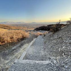
    Our first time visit to this trail had us drooling for more…read more Visiting in late March, there were grassy and rocky cliffs/rock formations on each side of the canyon with a perfectly snow-capped peak right in the center. Just before sunset, the whole canyon was warmly lit - glistening in grandeur - begging to be photographed. We were short on time - needing to return to the Bonneville Shoreline Trailhead (about 1.75 miles away) before dark but this scene beaconed us in such a way that we had to press on up its steep steps - curious to see how the view might shift with each step! Leaving the trail with only a taste of what these Dry Canyon trails could offer, we placed this high on our list of considerations for a post-work hike!

    An easy trail with a nice ascent, jagged cliffs, gentle slopes, and rewarding view of Utah Valley…read more Parking is free and easy. A liter of water per person should be fine for the easy loop. There is a little spot where someone had built a fire (not sure if allowed) where you can rest and enjoy the lake views. For something intermediate there is a trail that ascends further into a meadow that is a great place to rest for lunch. I recommend good sun block and a hat on very sunny days since there is very little coverage most of the trail. This is perfect for a family hike on the weekend, or a relaxing hike even during the weekdays.

    Photos
    Dry Canyon Trail Head - Hikes ranging from 0.5-5.5 miles

    Hikes ranging from 0.5-5.5 miles

    Dry Canyon Trail Head - View from canyon looking down stairs toward parking and trailhead

    View from canyon looking down stairs toward parking and trailhead

    Dry Canyon Trail Head - Sneak peak

    See all

    Sneak peak

    Fifth Water Hot Springs - Taken by me

    Fifth Water Hot Springs

    4.3(28 reviews)
    29.6 mi

    This is one of my favorite hikes. It's a long one, but extremely rewarding once you reach to the…read morefinal point. I enjoyed it because of the surrounding nature. I took my time doing the hike--listened to some music; noticed the different plants; took breaks; and then, took my headphones off to really soak in nature. It was so therapeutic. Once I reached the final point, I noticed it was quite packed when I went around fall season; and I'm not surprised. The weather was perfect to dip in the hot springs; and the colorful fall leaves made my experience extra vibrant. The water was clean; temperature of water varies depending on where you're sitting; and each area vary in size. As for someone who enjoys exploring and all the adventures, I decided to take my time to sit in each hot springs. Honestly, my favorite is the first one as the hiker approaches the start of hot springs. It's not big, but it's more secluded. It has a nice balance of shade and sunlight; little waterfalls; and some rocks to hop over and/or sit on. I felt as if it was part of my backyard, lol. I couldn't help but to take so much pictures. I'm definitely coming back again during the spring or summer to experience it differently.

    The concept of a natural hot springs is to go during colder months and expect to walk a lot to get…read morethere since it is natural and secluded. We didn't want to pay for a hot spring since the other ones were busy and the "natural" element is no longer there. However, we weren't as prepared as we thought we were. We visited this hot spring in late December which meant a lot of the roads leading there were closed due to the snow. We walked about 1 mile before reaching the trailhead. Once you reach a sign that points straight and right, take the right to cross the small bridge towards the side of the mountain. Our saving grace was google maps but it wasn't fully accurate at times. Remember that once you cross that bridge, the river should stay on your right until you reach the springs. This trek was TOUGH and feels like 10 miles (when it's only about 5) because of the hills and thick snow/ice. We did not have spikes or sticks to help so we had to rely on each other and our surroundings. It took about 2.5 hours going since we didn't stop and were going fairly quickly and this is coming from someone who does not hike regularly. There was a portion of the hike that was a uphill climb using a rope which was probably the scariest part for me because it was icy and not stable (hence why spikes would help). Once you near the springs, the smell of sulfur becomes strong and the river begins changing color from clear to blue. There are 2 spots that is on google maps, the first one was very busy but it was not the main attraction. We kept walking and got to the actual fifth water hot springs which was still kind of busy but enjoyable. We got into both the hot springs and the cold springs and it was a very cool experience. The hike back was much faster since we knew where we were going but still hard. If you want to challenge yourself to a hike with a cool and relaxing reward of being in the hot springs, I would recommend this hike! I'm sure it's easier when it's not snowy/icy but being in naturally hot pools while your surroundings are covered in snow is beautiful and I would do this again. Tips: -We forgot towels which was a rookie mistake so make sure to take some! -Remember to take off any jewelry prior to going/getting in the hot springs because the sulfur will tarnish it. -Wear thick socks to avoid frozen toes. -The hike itself was beautiful so remember to look up and enjoy the scenery instead of always looking down at the trail. -Start EARLY because it will take at least half a day to complete
    Photos
    Fifth Water Hot Springs
    Fifth Water Hot Springs
    Fifth Water Hot Springs

    See all

    Mount Timpanogos - The Timpooneke Trail

    Mount Timpanogos - The Timpooneke Trail

    5.0(1 review)
    1.4 mi

    The trailhead starts in the Timpooneke campground parking lot in American Fork Canyon. The cost is…read more$6 per car. You can pay at the parking lot- there are self-pay envelopes. If you don't have cash, like us, we stopped at the little guard shack at the mouth of AF canyon on our way out and paid. We hiked to the summit August 1 2018. Weather was perfect. We started the trailhead at 5AM and made the summit around 8:30. We hiked quite quickly and large groups or inexperienced hikers would definitely take longer. Average is around 4 1/2 hours to reach the summit. We took 3 liters of water each and it was more than enough. If it had been warmer we may have needed more- but we were back to our car by noon. The hike down took about 2 1/2 hours. We had read that it normally takes a little longer. We also took snacks- which were needed! Snickers bars and peanut m&ms were perfect. The hike wasn't technically difficult so much as just long. It definitely takes endurance. It's not for the faint of heart. I'd recommend being in good physical shape- 7.2 miles each way. The views were breathtaking. Only the last mile from the saddle to the tippy top had some scary heights. If you're afraid of heights, the last mile will be a little nerve wracking. However, it wasn't incredibly dangerous. I'm not a risk taker and I felt pretty safe. It got a little hot on the way down. I wouldn't recommend starting much later than 5am because it can start to get pretty hot as the day goes on and you'll be tired . And the top of the summit can be quite cold in the morning. I had a sweatshirt with me and was grateful for it!

    Photos
    Mount Timpanogos - The Timpooneke Trail
    Mount Timpanogos - The Timpooneke Trail - Butterfly

    Butterfly

    Mount Timpanogos - The Timpooneke Trail - Wildflowers

    See all

    Wildflowers

    Big Springs Park

    Big Springs Park

    4.5(4 reviews)
    11.0 mi

    I've been up this turnoff from Provo Canyon many times, but until today I didn't know that there…read morewas a park here. I'd always drive to the last park right on the canyon road, but today I went up past that park and saw the sign for the Forest Service, took it off to the right, and found this park. It's a long skinny road with a few different parking/pavilion areas, and at the end there's a parking lot with a trailhead. That's what I was after tonight--the trailhead. The fall colors up there were beyond description, and it follows the little river winding back and forth. I got a late start and didn't get much time, but it was just perfect for a chance to get some fresh air, hear the trickle of the brook, and know that when we make an effort to find little parks and traileheads, it's worth it. Apparently, if you take the trail all the way up to the top, you come to what used to be the springs, but after some recent construction, they're not so much accessible springs. I'd like to take that trail all the way up, but for tonight I found a really nice, flat meadow and leaned up near a tree to have some dinner. Back at the park, there are pavilions with lights, restrooms, and that seems to be the big appeal here--the outdoors access and a few pavilions. It's not a huge park with a big playground or anything, but for the trails, the fresh air, the cooler temps... it's just right.

    Great park, very pretty and quite big, could not do snowshoe as I was expecting during my last trip…read moreto Utah but I spent a nice long hike and took beautiful pictures in this awesome location. There is a river with some cute bridges for photo opps and kids and adults can enjoy different snow activities during the winter, mostly playing with the slides. Big parking lot and no entry fee.

    Photos
    Big Springs Park
    Big Springs Park
    Big Springs Park

    See all

    Pine Hollow Trailhead - hiking - Updated May 2026

    Loading...
    Loading...
    Loading...