Pu'u Ma'eli'eli Digging Hill Photos


You might also consider


More like Pu'u Ma'eli'eli Digging Hill
Recommended Reviews - Pu'u Ma'eli'eli Digging Hill
Start your review...


Reviews With Photos

One of the best ohana hikes on island. Be ready for some mud as it can be slick (just in the beginning therfore bring the correct attire (trail/hiking shoes to make it easier). Other than the tough beginning it a beautiful walk/run through the hills of Ahuimanu/He'eia! It also does gets some maintenance here and there but the Cali grasses grow fast so be prepared... overall a splendid trail that that all can enjoy!

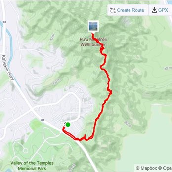
Hiked this trail with a group I found on Facebook. Parked over in shopping center parking lot and walked over to trailhead to meet up with group. The trailhead is not well marked if you don't know where you are going. I followed my AllTrails ap. The trail makes its way up a beautiful root covered trail in some areas. Overall the hike was fairly easy...rated easy to intermediate. 2.3 miles round trip, 600 elevation change. There was a short section of trail where you hiked up holding on to ropes going up and descending. The highlight of this hike is the most amazing views from the top of the Pillbox. I would do this once again for that view.


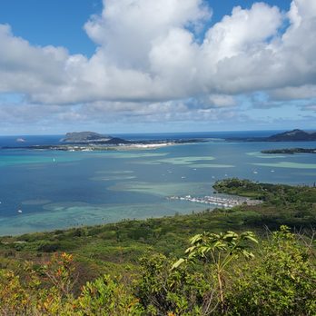
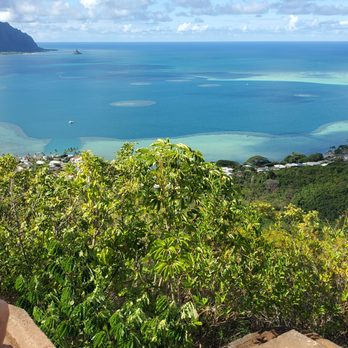
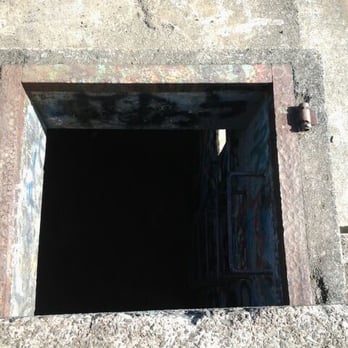
the views and serenity at the end of the trail are 5 stars without a doubt... just a perfect place to sit there and soak in all the beauty (with only one other person on the trail it was silent and serene at the viewpoint). Also, there is an old military pillbox at the end of the trail which was neat to descend into. However the trail leading to the viewpoint is itself very blah...a 2 to 3 star rating in my book because it is uninteresting, and one has to deal with a steep stretch of slippery mud (and there hadn't been much rain at all the week we were there). It's worth doing the trail for the views at the end, but don't expect anything worthwhile on the trail until you reach the viewpoint. LEAVE A SECOND PAIR OF SHOES IN YOUR TRUNK TO CHANGE INTO AFTER THE HIKE (we never fell, but our shoes were covered in mud after this short hike.... definitely not something you want to wear when you get back to your car). Also, you might consider visiting the nearby Valley of the Temples if doing this hike since you'll be so close to it.


This trail is not one of the difficult ones the hardest part is pretty much at the beginning and almost to the pillboxes with a slightly lesser of a incline. What is great is it is pretty much covered so you aren't in the Sun the whole way. Best not to go when muddy as it is quite slippery in the beginning. I actually enjoyed this hike quite a bit and the views from the Pillboxes are awesome! I parked near the Koolau shopping center on the street which has quite a bit of parking so its not too bad, you then need to hike a bit on the highway to get to the spot which is right after the guardrails. It's a great short hike.


What a great hike! So close to my home! Park at the shopping center. Crops the street and stay on the left side along the guard rail. You will see see the entrance as it a pretty clearly used trail. We went today and it was a little midday, I reccomend bringing a bag for your muddy shoes and some slippers for afterwards. The hike itself is semi challenging as you do find yourself going up hill quite a bit! But the views at the end are well worth it. Will definitely do this hike again! I really liked it! Just be prepared for a little mud and use some bug spray


Beautiful hike, slightly challenging with inclines and a rewarding view of the ocean in the end. We street parked alongside the townhomes and passed over the guard rail into the forest. It was a sunny day which is perfect. The first incline has ropes to guide you up but didn't use it since it wasn't muddy or rainy. The ropes seemed thin and looked like it been through a lot despite not really seeing much people around. More into the hike there's another much thicker rope to climb that's in a pretty steep area so definitely use that rope. Took several breaks because those inclines were tough at least for me since i'm not really an active person. The view at the end is so rewarding and beautiful to see especially since it wasn't raining. Would come back again in the future.


This was a moderate hike especially when it rained the day before. The trailhead starts along the Kahekili hwy right across from the Mcdonalds. You will need to cross over the guardrail and there will be a opening, an incline: muddy and very slippery. Take your time. Parts of the hike were covered with trees which was nice. It was very humid, my arms, back, and forehead were dripping in sweat. The views at the top outline Kaneohe Bay, very beautiful. The pillbox has a lower ledge which is a great time spot to take pictures. Parking is either the street or Ko'olau shopping center. We ended up parking further along the Hui lwa st. Please be respectful towards the residents who live in the neighborhood and pick up trash. There is a trash bag at the trailhead.


Hiked on 3/28/21 and the weather was perfect. This is definitely one of my favorite hikes on the windward side. DO NOT hike if the weather has been super rainy within a few days, there are some slightly steep parts in this hike and the trail gets super muddy. We always park at Koolau Shopping center right across of Valley of the temples. The shopping center has a McDonald's that you can't miss. After parking, from the intersection with the McDonald's you will stay on the side of the road (Kahekili hwy) across the Valley of the Temples. You'll cross the street and walk along a guardrail (walking against traffic). After the guardrail you'll see an opening that looks like a trailhead opening. This hike is a good one for all ages as long as the weather is nice. Some parts are definitely a leg burner, but worth it for the beautiful at the top from Kaneohe Bay to Chinaman's hat.


Second hike of the day and pregnant! Phew! Almost 90% was steep incline hills. Some hills had ropes that you could hang on too. I didn't use it going up the hills but coming down it was a must! Honestly wouldn't have found the trail unless I was with my friends. You are walking along side the highway across from Valley of the temples cemetery and then you cut left into the trail. Unless you have a hiking backpack for toddlers/infants, it's not a hike I would take kids 5 and under on... even with carrying a child on your back it is pretty dangerous if it was raining the night before as the hills can get really slippery. The trail seems to look like an old dirt bike trail. Towards the top there are traces of military installations and a bunker at the end with such a rewarding view! The view of Crouching lion, Chinaman's hat, Kaneohe Bay, Sandbar, and He'eia State Park was so worth it. We went on a perfect day! Most of the hike we were hidden from the sub which was good but it got pretty hot.


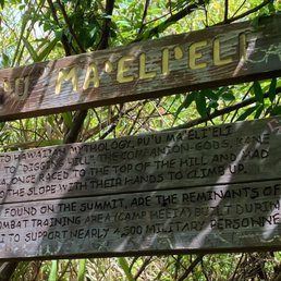
Glad I final did this today. It was my last pillbox hike on the island to do. Today was ideal because it was very dry. The red clay like soil was cracked and dry, but you can totally see where the trails was washed out and signs of struggles uphill. There's ropes right at the start of the trail. I heard when wet this trail is moderate to hard, when dry it's easy to moderate. About two thirds of the trail is completely runnable with lots of soft pine needles on the ground. Some hills are a bit uneven or too many roots. There's a few alternate routes I didn't really explore including one straight down hill at the end. The area was a former heeia combat training ground, so multiple routes makes sense. After you see the wife trail take a right is when the trail get a bit more moderate. Probably hard if wet. There's a few washed out hills and then an area were you have to climb over and under twisted short trees. When you see a little long knotted rope up a rocking incline you're approaching the end with the pictured sign. There you find the first pill box shroud in trees. No real views. The second double pillbox 100 ft down the trail offers 180° panoramic views from kualoa ranch to the mokes, and the turquoise waters of the windward side. Great short hike!


Nice little hike! It is across the street from the valley of the temples and across from McDs at Ko'olau shopping center. I usually park on the road or the shopping center. The hike is short and pretty easy. It has some steep parts and it is covered with trees all the way up. It is a good hike to get the blood flowing and get some exercise. The view is amazing when you get to the top! It shows the sandbar in Kaneohe bay. On sunny days the water is so blue! It can get muddy when it has been raining (which is more often than not in Kaneohe). Be sure to bring water, sunscreen, maybe a small snack, sunglasses, etc. A really nice hike overall!

This property is PRIVATE and there is NO TRESPASSING. Over use has caused soil erosion and mudslides during heavy rains. Crowds have become a HUGE NUCIANCE to the neighborhood and surrounding homes. This is a small community and all of the extra vehicles take up valuable parking for the hard working families who live here. Signs have been posted (again) and DLNR has been requested to patrol. Below is the official State of Hawaii LEGAL TRAIL GUIDE: https://hawaiitrails.hawaii.gov/trails/#/


Short hike with a good view of the East Side! Parking: There is no destinated parking area for this hike, so parking is outside of the shopping center complex. Just park around McDonald's and across from the Valley of the Temple. Hike: The hike took me about 1-2 hours round trip. Majority of the hike, you are under the shade with a steady incline and muddy areas. I was lucky that I did not any mud on me. This really depends on the weather for the past week. For a short person (5 ft. flat), the branches are very low. I would have to duck under severe branches along the hike making it difficult to see if I was on the right path. You know when at the top when you a sign and motivation box with a view of Kaneohe Bay, Sandbar, and Chinaman's hat. Overall: For a moderate hike, I like this hike. It could use some trimming/yard to make the path more clear, but other than that, it was the perfect length to hike it, you have shade all the time, and a spectacular view.


17 days ago
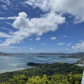
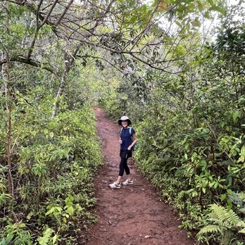
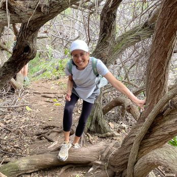
It's been a few years since I've been on this hike... It was a total of about 2.6 miles up and down because we took a side path to come down. So rather than winding back-and-forth, we came straight down and ended up near the tennis courts of the townhouses below. Park on Hui Iwa and meet at the McDonalds at the corner of Kahekili and Hui Iwa. Then walk along the highway opposite Temple Valley until you see a path going up -that's the start of the unmarked trail. Overall shady, short but with enough climbing to get in some cardio. You'll be rewarded with gorgeous Ko'olau Mountain Views and ALL of Kaneohe Bay! Excellent short hike with bay view rewards! read more




3 years ago
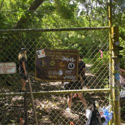
Easy-ish to moderate hike, depending obviously on your fitness level and hiking acumen. No waterfall at the end, but you're rewarded with a spectacular vista of the Kaneohe Bay area. To get to the trailhead, park on the street preferably or in the shopping area across the street (where the McDonald's is). You can chance it there, but you should be good. Very popular hike, so go early to avoid crowds. So from the shopping center or wherever, follow the guard rail alongside the highway. The beginning of it is at the corner of the road going up to the shopping center. I'd suggest not walking on the right side of the guard rail as it puts you perilously close to oncoming traffic. So hop the guard rail on the left side and follow the really narrow dirt path that leads to the end of the guard rail. To the left, you'll see a sign that says "private property - no trespassing." Ignore that, obviously, and head up the path behind it. It's an in then back the way you came from hike; not sure if it's a loop, but it's about 2 or so miles round trip. The first 1/8th is steep and muddy, with slick, clay ground. Nice people have left ropes on the side so you can use that to get up. The rest of the way is shaded, with rooted paths, lots of local fauna and lots of bugs, too. The last part right before the pillboxes is a very steep incline. Again, there's rope there to help you up if you're not a ninja like I am. First bunker is kinda cool. You can climb down the rusty but stable ladder and get a nice view from the inside. The second one is where you want to be. It's where all the Instagramers are at taking selfies. If you're lucky enough to be there alone, you'll have a nice, meditative moment where you can see the bay. Good hike that's not too hard at all. read more


A Challenging Adventure with Spectacular Views! I recently had the opportunity to hike the Pu'umaelieli trail, and it was an exhilarating experience that left me in awe of the natural beauty that unfolded along the way. The trail kicks off immediately with a steep incline, which can be quite demanding. However, once you conquer this initial hurdle, the path transforms into a pleasant stroll with lots of vegetation that provided lots of shade, accompanied by refreshing breezes. At this point, I almost doubted the trail's moderate rating for this trail until the last part before the bunkers. Here, you'll encounter a sharp incline that can be a bit brutal. Take your time, catch your breath, and rest if needed. It certainly provides an excellent leg workout. The reward for your efforts comes when you reach the top bunker. From this vantage point, you'll be treated to a mesmerizing view of Kaneohe Bay, you will be able to see the military base and sandbar. I brought my binoculars and saw a fighter jet soaring just a few hundred feet from the water then landing on the base. In my opinion, this is by far the best view you can experience on the east side. read more


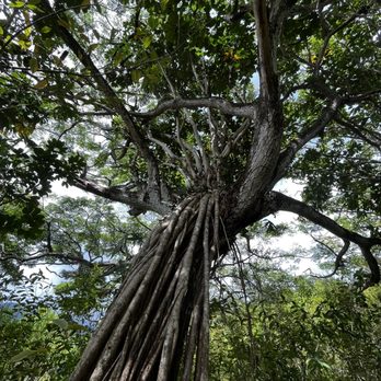
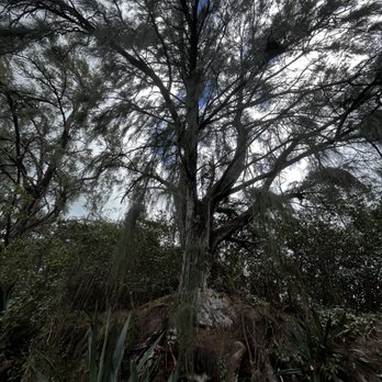


1 year ago
One of the best ohana hikes on island. Be ready for some mud as it can be slick (just in the beginning therfore bring the correct attire (trail/hiking shoes to make it easier). Other than the tough beginning it a beautiful walk/run through the hills of Ahuimanu/He'eia! It also does gets some maintenance here and there but the Cali grasses grow fast so be prepared... overall a splendid trail that that all can enjoy! read more


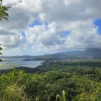


Hiked this trail with a group I found on Facebook. Parked over in shopping center parking lot and walked over to trailhead to meet up with group. The trailhead is not well marked if you don't know where you are going. I followed my AllTrails ap. The trail makes its way up a beautiful root covered trail in some areas. Overall the hike was fairly easy...rated easy to intermediate. 2.3 miles round trip, 600 elevation change. There was a short section of trail where you hiked up holding on to ropes going up and descending. The highlight of this hike is the most amazing views from the top of the Pillbox. I would do this once again for that view. read more
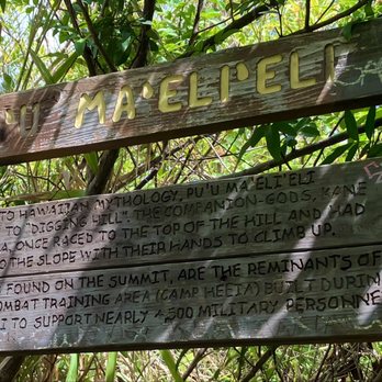


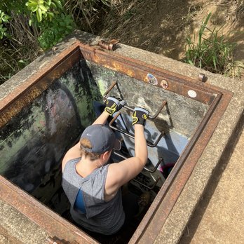


the views and serenity at the end of the trail are 5 stars without a doubt... just a perfect place to sit there and soak in all the beauty (with only one other person on the trail it was silent and serene at the viewpoint). Also, there is an old military pillbox at the end of the trail which was neat to descend into. However the trail leading to the viewpoint is itself very blah...a 2 to 3 star rating in my book because it is uninteresting, and one has to deal with a steep stretch of slippery mud (and there hadn't been much rain at all the week we were there). It's worth doing the trail for the views at the end, but don't expect anything worthwhile on the trail until you reach the viewpoint. LEAVE A SECOND PAIR OF SHOES IN YOUR TRUNK TO CHANGE INTO AFTER THE HIKE (we never fell, but our shoes were covered in mud after this short hike.... definitely not something you want to wear when you get back to your car). Also, you might consider visiting the nearby Valley of the Temples if doing this hike since you'll be so close to it. read more





6 years ago
This trail is not one of the difficult ones the hardest part is pretty much at the beginning and almost to the pillboxes with a slightly lesser of a incline. What is great is it is pretty much covered so you aren't in the Sun the whole way. Best not to go when muddy as it is quite slippery in the beginning. I actually enjoyed this hike quite a bit and the views from the Pillboxes are awesome! I parked near the Koolau shopping center on the street which has quite a bit of parking so its not too bad, you then need to hike a bit on the highway to get to the spot which is right after the guardrails. It's a great short hike. read more


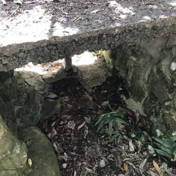



What a great hike! So close to my home! Park at the shopping center. Crops the street and stay on the left side along the guard rail. You will see see the entrance as it a pretty clearly used trail. We went today and it was a little midday, I reccomend bringing a bag for your muddy shoes and some slippers for afterwards. The hike itself is semi challenging as you do find yourself going up hill quite a bit! But the views at the end are well worth it. Will definitely do this hike again! I really liked it! Just be prepared for a little mud and use some bug spray read more


4 years ago
Beautiful hike, slightly challenging with inclines and a rewarding view of the ocean in the end. We street parked alongside the townhomes and passed over the guard rail into the forest. It was a sunny day which is perfect. The first incline has ropes to guide you up but didn't use it since it wasn't muddy or rainy. The ropes seemed thin and looked like it been through a lot despite not really seeing much people around. More into the hike there's another much thicker rope to climb that's in a pretty steep area so definitely use that rope. Took several breaks because those inclines were tough at least for me since i'm not really an active person. The view at the end is so rewarding and beautiful to see especially since it wasn't raining. Would come back again in the future. read more


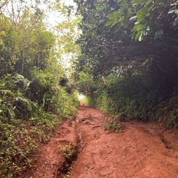


This was a moderate hike especially when it rained the day before. The trailhead starts along the Kahekili hwy right across from the Mcdonalds. You will need to cross over the guardrail and there will be a opening, an incline: muddy and very slippery. Take your time. Parts of the hike were covered with trees which was nice. It was very humid, my arms, back, and forehead were dripping in sweat. The views at the top outline Kaneohe Bay, very beautiful. The pillbox has a lower ledge which is a great time spot to take pictures. Parking is either the street or Ko'olau shopping center. We ended up parking further along the Hui lwa st. Please be respectful towards the residents who live in the neighborhood and pick up trash. There is a trash bag at the trailhead. read more



2 years ago

5 years ago
Hiked on 3/28/21 and the weather was perfect. This is definitely one of my favorite hikes on the windward side. DO NOT hike if the weather has been super rainy within a few days, there are some slightly steep parts in this hike and the trail gets super muddy. We always park at Koolau Shopping center right across of Valley of the temples. The shopping center has a McDonald's that you can't miss. After parking, from the intersection with the McDonald's you will stay on the side of the road (Kahekili hwy) across the Valley of the Temples. You'll cross the street and walk along a guardrail (walking against traffic). After the guardrail you'll see an opening that looks like a trailhead opening. This hike is a good one for all ages as long as the weather is nice. Some parts are definitely a leg burner, but worth it for the beautiful at the top from Kaneohe Bay to Chinaman's hat. read more


Second hike of the day and pregnant! Phew! Almost 90% was steep incline hills. Some hills had ropes that you could hang on too. I didn't use it going up the hills but coming down it was a must! Honestly wouldn't have found the trail unless I was with my friends. You are walking along side the highway across from Valley of the temples cemetery and then you cut left into the trail. Unless you have a hiking backpack for toddlers/infants, it's not a hike I would take kids 5 and under on... even with carrying a child on your back it is pretty dangerous if it was raining the night before as the hills can get really slippery. The trail seems to look like an old dirt bike trail. Towards the top there are traces of military installations and a bunker at the end with such a rewarding view! The view of Crouching lion, Chinaman's hat, Kaneohe Bay, Sandbar, and He'eia State Park was so worth it. We went on a perfect day! Most of the hike we were hidden from the sub which was good but it got pretty hot. read more


Glad I final did this today. It was my last pillbox hike on the island to do. Today was ideal because it was very dry. The red clay like soil was cracked and dry, but you can totally see where the trails was washed out and signs of struggles uphill. There's ropes right at the start of the trail. I heard when wet this trail is moderate to hard, when dry it's easy to moderate. About two thirds of the trail is completely runnable with lots of soft pine needles on the ground. Some hills are a bit uneven or too many roots. There's a few alternate routes I didn't really explore including one straight down hill at the end. The area was a former heeia combat training ground, so multiple routes makes sense. After you see the wife trail take a right is when the trail get a bit more moderate. Probably hard if wet. There's a few washed out hills and then an area were you have to climb over and under twisted short trees. When you see a little long knotted rope up a rocking incline you're approaching the end with the pictured sign. There you find the first pill box shroud in trees. No real views. The second double pillbox 100 ft down the trail offers 180° panoramic views from kualoa ranch to the mokes, and the turquoise waters of the windward side. Great short hike! read more


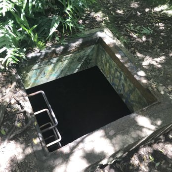


Nice little hike! It is across the street from the valley of the temples and across from McDs at Ko'olau shopping center. I usually park on the road or the shopping center. The hike is short and pretty easy. It has some steep parts and it is covered with trees all the way up. It is a good hike to get the blood flowing and get some exercise. The view is amazing when you get to the top! It shows the sandbar in Kaneohe bay. On sunny days the water is so blue! It can get muddy when it has been raining (which is more often than not in Kaneohe). Be sure to bring water, sunscreen, maybe a small snack, sunglasses, etc. A really nice hike overall! read more


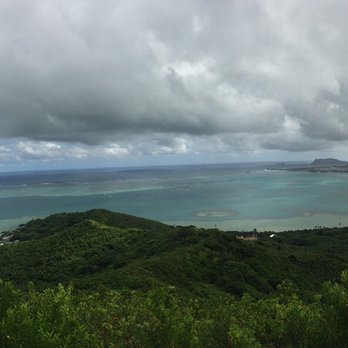


4 years ago
This property is PRIVATE and there is NO TRESPASSING. Over use has caused soil erosion and mudslides during heavy rains. Crowds have become a HUGE NUCIANCE to the neighborhood and surrounding homes. This is a small community and all of the extra vehicles take up valuable parking for the hard working families who live here. Signs have been posted (again) and DLNR has been requested to patrol. Below is the official State of Hawaii LEGAL TRAIL GUIDE: https://hawaiitrails.hawaii.gov/trails/#/ read more


7 years ago
Short hike with a good view of the East Side! Parking: There is no destinated parking area for this hike, so parking is outside of the shopping center complex. Just park around McDonald's and across from the Valley of the Temple. Hike: The hike took me about 1-2 hours round trip. Majority of the hike, you are under the shade with a steady incline and muddy areas. I was lucky that I did not any mud on me. This really depends on the weather for the past week. For a short person (5 ft. flat), the branches are very low. I would have to duck under severe branches along the hike making it difficult to see if I was on the right path. You know when at the top when you a sign and motivation box with a view of Kaneohe Bay, Sandbar, and Chinaman's hat. Overall: For a moderate hike, I like this hike. It could use some trimming/yard to make the path more clear, but other than that, it was the perfect length to hike it, you have shade all the time, and a spectacular view. read more


Why have I not heard of this hike sooner? It's just like Laniaki Pillbox, but with SHADE! We parked on the street next to McDonalds at the Koolau Shopping Center. From there, when facing the Valley of the Temples we went left and followed closely to the side guard rails towards the incoming cars. It's easy to find the starting point for this trail, just look for this trail marker http://www.yelp.com/biz_photos/puu-maelieli-digging-hill-kaneohe?select=b-uYleDU_NyatT5dCwesHQ At the end of the hike, you will reach a bunker with a beautiful view of Kaneohe Bay. It took us less than two hours to get back to our cars. We were fortunate enough to come when it really wasn't that muddy. I recommend not to do this hike if it did rain recently, because it would be more challenging. I noticed other hikes brought their dogs on this trail too. Overall I really enjoyed this hike, it was challenging because it was uphill and we did have to take a couple breaks just to catch our breaths, lol. But honestly wasn't terribly hard. read more


Loved everything about this hike...hills, flats, dirt, mud, clean trails, roots, ropes, guava trees,and a beautiful view at the end Short hike 2 miles total round trip took us 45 min in and quicker to come down. Be sure to spend lots of time at the end and enjoy the panoramic view Recommended for the family. Wear shoes with traction. Use mosquito repellent bring snacks for the little ones and water is a must. Be safe and have fun! HAPPY TRAILS!! read more


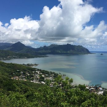


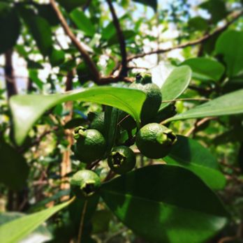


Directions: Finding this hike for the first time can be tricky, but no worries, it is doable! After reading many reviews, I was able to locate the hike. So I'll try to explain as simple and easy to read as possible. While you're on Kahekili road going towards the Byodo-in Temple or Valley of the Temples, this will be on your left. While Mcdonalds is on your right. Turn right onto Hui Iwa street. Some people park at Mcdys, but there's street parking. Just don't block or park in the townhomes. Once you find parking, walk on Hui Iwa street facing the Valley of Temples. Mcdys will be on the right and you walk to your left facing traffic. There is space to walk on the other side of the dirt path. At the END of the guard rail there is an open trail, this is where it starts. The Hike: This will be super muddy and challenging if it ever rains before or during your hike. Literally when you start, it is a long hill that seems to keep inclining to no end. Lol. Well, that's how i felt. I'm totally out of shape now a days. There is a rope for support, but wear good shoes. It took us about an hour to get to the top and another 20-30 mins to jog it down. There are some narrow paths that will show parts of the windward side, but at the end it is even more amazing. You'll see another rope and a sign with the name of the sign, when you do you are near the end! There are two bunkers and the ladder is still strong, and "safe" to use. I've seen kids, baby wearing families come through. We even brought our two dogs. :) Just please be midnful of others and trash. read more


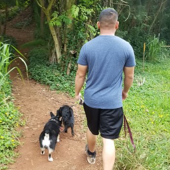


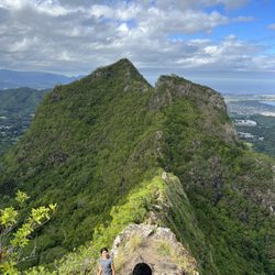
Pu'u Ma'eli'eli Digging Hill is a short novice trail with a fantastic panoramic view of Kaneohe bay all the way out to Chinaman's Hat. We began from McDonalds off Kahekili Highway opposite Valley of the Temples. At the top there was a WWII bunker but there might have been someone living there so we did not go into the bunker. I did the hike in old sneakers but wear hiking shoes if you have them because the trail can be muddy. See my pictures! read more



6 years ago

7 years ago

8 years ago
This is a just the need to/might want to knows kinda review... All trails rated this a moderate hike and I'd say for most people that's pretty accurate. Today was bone dry but I can see how it'd be significantly more difficult and super slippery after a rain. Coming from Kaneohe you'll be able to spot the trailhead on the right, it's just before the red light at the valley of the temples. (As you can read in all other reviews park at Mickey D's or times shopping center). It was one of the cleaner trails I've been on recently, which is surprising because..... The trail is on private property! However there are not any no trespassing sign. Even though I feel like it should go without saying: Just don't be a dick and junk the place up. Totally worth it. Best view on the windward side I've seen so far. read more


I would say this is a moderate hike with some steeper inclines. We went on a day after it rained and it was super muddy. Bring shoes with grip or you'll be on all fours trying to make your way up the first hill. Luckily once you make it past the first muddy hill, the rest of the hike is a lot easier, with more roots and things to walk on. Located near Valley of the Temples, we parked right on the street across from the Koolau Shopping Center. To get the entrance of the hike, you need to walk along the highway and you'll come across it on your left. The hike has plenty of places to stop for photo ops. A majority of the hike is shaded which is nice and there's a couple of places where there's an opening in the bushes and you can feel that nice cool breeze. Once you get to the top, you'll get a nice view of Kaneohe all the way to the Northshore. Lucky for us, there wasn't anybody hiking that day so we had the whole top to ourselves. It took us about an hour to get the top but that was with frequent stopping to rest & take photos. The hike down was a lot quicker. read more


Love the views up at the top. Done this one twice in the past couple of months. First time was a long ass muddy loop. Didn't enjoy the loop or mud but the views at the top were great as always. Second time was a couple of weeks ago for a quick out and back direct to the pillbox. 45 minutes up and 30 minutes down for a quick workout and great views. Besides the very beginning which is steep and can be slick with mud, this is a very easy hike. Super easy to follow too! read more


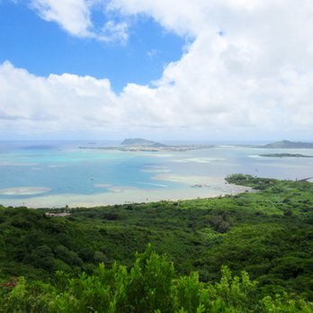


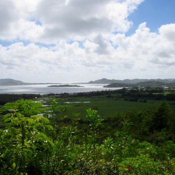


Enjoyable hike. Parked by McDonald's/Times and walked along the Kahekili highway guardrail to the trail, which you can pretty clearly see veering off to the left after the townhouses. It took our group about 50 minutes to get to the top, with a few short rests. Kudos to my amazing 73 year old mother in law who toughed it out all the way! Beautiful view at the top even on a hazy day. There's shade almost the entire way, which was nice. There are several steep sections, some have ropes to help you along. It rained yesterday so there were some slippery muddy spots. It wasn't too busy, we saw maybe a half dozen other hiking groups. Be sure to take sunscreen, water, bug repellent, and shoes with good traction. read more


9 years ago
Great shaded hike! Amazing views at the top with some fun photo ops along the way. Did it with my 3 & 5 year old while my hubs carried our 1 year old on his back and the kids loved it. Kids needed help on the way up, but were able to go down independently (minus the roped area). Luckily, it wasn't wet when we went. I could see why people would have trouble if it was. There was a beehive close to the top, however, it was easy to make our way around it. Sunrise just can't be beat. Bring water and good shoes. read more

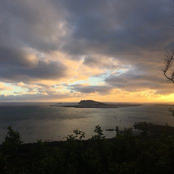



9 years ago
I love this hike! Not very frequently hiked and not "touristy" at all! Parking: I always park at Mcdonald's in the shopping center and walk there. Turn left onto Kahekili. Once the guard rail ends, the trail head is on your left. There is a private property sign and that's how you know you're in the right place. Food/Water: Bring water. Food isn't necessary. It's a short hike. Difficulty: Very easy. Length: About a mile to get to the lookout/pill box. Takes me maybe two hours to do the whole thing. Terrain: The trail is well maintained. I'm sure it could get muddy after a hard rain. You'll mostly be hiking through a forest. The View: Beautiful! You basically get a 180 degree view of Kaneohe Bay. Danger: 1/10. Very safe. Dogs/kids?: Dogs and kids can do this one. Get out there and hike! (: read more


9 years ago
I would rather be sitting at home, watching Netflix in bed, but something about a hike in Hawaii with a promise of a killer view gets me out and about. Not gonna lie, I was completely out of breath at numerous points on this hike, and it really is all uphill at the beginning, but there is a definite end point, and it is definitely worth it. We went after it hadn't rained for at least a week, which was definitely a good call - this could've been pretty perilous if muddy. There's some ropes along the way in parts that are a little more difficult too, but it's a pretty solid path, easy to follow, and not too difficult to keep your footing on. The 5 stars goes to the short distance but hardcore workout that accompanies it, the mostly shaded route, the minimal amount of people along the way, promising glimpses of the end view along the way, and the end view itself - positively gorgeous. Park on the street where the McDonald's is, walk back along the highway and you'll see the entrance before the end of the railing. It took us about an hour in and a little less back since it was mostly downhill. Definitely worthwhile, and a good choice for my second real hike here on Oahu. read more

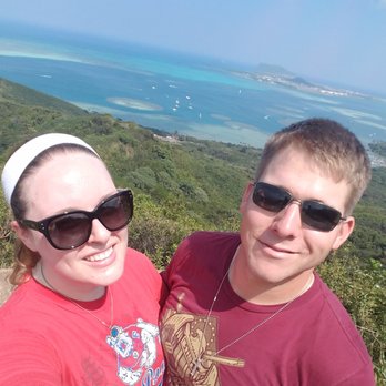

9 years ago
I loved this hike for two reasons: 1) it's not a normal tourist trail. It's work but it's worth the view at the end. 2) it was the first hike I did alone and I didn't feel scared at all. Everyone I met (which was far and few between) was so kind! Word to the wise though, listen to the other reviews and wear or bring bug spray. I didn't, I regretted it. The views are amazing, even on an overcast day. You can't beat the view from the top. I literally felt like I was on top of the whole world! The trail is well kept up. You can tell they treat it with care. Remember to pack up what you bring in! read more


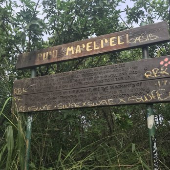


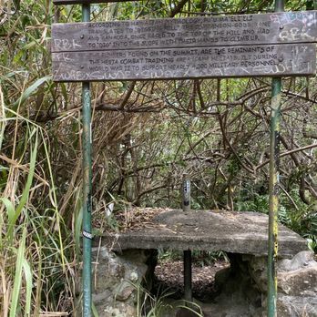
This is a great hike if you don't have a lot of time but want to feel like you got out and moved!!! Round trip time is about an hour and a half - without the time spent at the top taking pictures and just enjoying the views. First of all - you need to park in the neighborhood by Temple of the Valley McDonald's. I would not recommend parking in the shopping center parking lot. Please remember that you are a visitor and do not block driveways, watch for bus stops, and mailboxes. Please DO NOT litter. Please be respectful of people's property. To get to the trailhead you need to walk along Kamehameha Highway until you see the sign (you are walking towards Kaneohe against traffic). The initial ascent is quite steep and can be slippery (it's all hard packed dirt). For me, that is the hardest part of the trail. As you travel along, there are a few spots that you can see Kaneohe Bay from and rest. I really enjoy the different foliage and "feel" to parts of this hike. You wander through tree "tunnels", tromp through a little bit of mud, feel like you're playing hopscotch with all the roots, and walk along paths that are cool, and well maintained. When you see the big wooden "Pu'u Ma'eli'eli" sign, you are almost to the top. Take a moment to read what is written about Pu'u Ma'Eli'Eli on this sign. It is quite interesting if you're into Hawaiian culture/history. The views from the pillbox is amazing!!! You can see the whole coast from Kualoa to Kaneohe Bay. Even on voggy days the view takes your breath away. I like to find new things every time I'm at a place where I can see into the distance. This last time I was able to verify that Coconut Island was the island I saw in the distance. The tide was low, and the ocean calm, so everything was blue and shiny. For this hike I recommend you bring/wear: Hiking shoes - you will be thankful for the extra grip Water - at least a liter or two - it can get quite hot if there's no tradwinds Camera - for the amazing views Snacks - In case you want to take a longer break at the top. I hope you enjoy this hike as much as I do!! read more

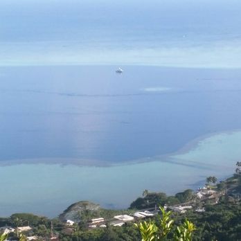
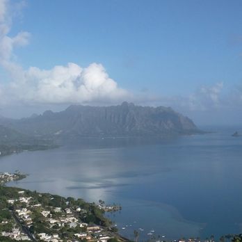


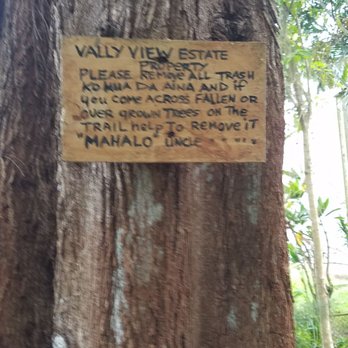
Easy Peasy! Easy street parking, easy to find trailhead, easy trail and easy to slide in the mud! Like all the other Yelpers and hikers said, park on Hui Iwa Street near Mc Donald's at the Ko'olau Shopping Center. Walk back down to Kahekili Highway, turn left so you're facing traffic and walk up the hill along side the guard rail. After approximately 200ft you'll see the trail head clearly marked with a pink ribbon. Other Yelpers reported a "No Trespassing" sign but we only saw a sign from Valley View Estate Property requesting that all rubbish be removed and help keeping trees out of the trail, signed "Uncle." The initial incline is a little steep, slippery and worse in the rain so shoes with good grip is recommended. My friends slid and fell a couple of times but simply laughed it off and trekked on. The trail is clearly marked and defined the whole way up so it's pretty impossible to get lost. Views at the pillbox as well as along the trail are amazing, but don't forget to stop and snack on the strawberry guava and swing in the trees. Trek on Yelpers! read more
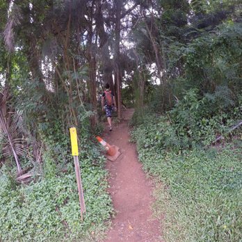
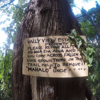


Pu'u Ma'eli'eli is a great hike right before temple valley. This hike is quite easy as i went with a group of people of all ages and physical shapes, If you can make it up daimond head hike, you can definitely make it up this hike. Pu'u Ma'eli'eli is a great hike because for the most part it is a flat hike with small inclines. About 3 hours round trip Pu'u Ma'eli'eli is not a lengthy heavy breathing hike, but the panoramic views seen from all stop points of the hike are well worth it. Throughout the hike most of the windward side of the island is clearly visible. Places such a Kaneohe, include Kaneohe MCBH, coconut island, the sandbar, and parts of Kahaluu can be seen. It is great to see Kaneohe bay and how shallow the bay actually is. I highly recommend this hike to novice hikers and even tourist, who are looking for a more non toursity viewpoint of the island. At the top of Pu'u Ma'eli'eli hike there is a lookout, and dugout. Aside from the homeless people who managed to build a love shack out of the dugout, it was quite a pleasant hike. I could even see why such a point of the hike would be an ideal place to live. With an ocean view, a canopy for cooking, and natural island breeze, this endpoint of the trail would not be a bad place to live. read more



I haven't been to Pu'u Ma'eli'eli trail in years. I grew up in the area and went on this hike many times as a teenager but I'm no spring chicken anymore. My childhood friend and I both took our two boys who are 7, 5, 4 and 1 on the hike. In case you were wondering the 1 yo was in a baby carrier. Most people I see heading to the trailhead use the entrance off of Kahekili Highway before the McDonald's shopping center. However for all those who know the area use the short cut in the neighborhood to shave off a good 20 minutes. It is a relatively simple hike. On a scale of 1 to 10, I'd give it a 3. There are some steep areas but for the most part, a hike for all ages. There are no steep drop offs. I suggest wearing shoes as some tourist I saw on the trail wore sandals...are they nuts? The end of the hike gives you a 180 degree view of Kaneohe Bay from Chinaman's Hat to the north and the Marine Base to the south. Bring water, snack and camera. There are a few abandoned bunkers from the war time which you can climb down into. It gives you a sense of what our soldiers had to be in during the war. read more


10 years ago
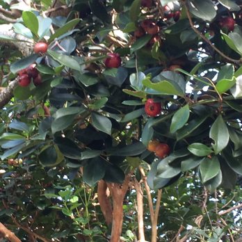
Severely underrated hike. The trail is nice and easy to find. It's slightly uphill in the beginning, but I would not rate this as hard at all, especially for the views at the end. There are a few pillboxes (bunkers) at the end of the trail to chill atop of. The path is open in some spots, but has nice shade trees on either side to give some relief from the blazing sun if you decide to go a little later in the day. Probably took us about 35 minutes, but my squad is a little on the faster side. Plus, they have wild guava fruits on the trail that you can pick right off of the tree to snack on while you're moving. It can be a little bit technical with the tree roots crossing over the path, and the constantly changing types of terrain, but not abnormal for most Oahu hikes. There were 2 mom's carrying their kids in those backpack things, if that makes you feel any better. read more



12 years ago
Currently chilling at the top. Great easy hike. Got to the top in less than an hour. Beautiful view and the amazing part is that it's all to ourselves. Not too many people hike this so it's very relaxing. You can see the the military planes fly by. To get to this hike: I followed the yelpers reviews. And it worked out perfectly. The trail is across of the valley of the temples. Park at Kaneohe mcdonalds on the side next to the condos. The take a left follow the metal rail to the end which has a path which is directly behind the condos. Just follow that trail up the mountain. Once you hit ropes you're at the top! Have fun be safe! read more

Page 1 of 3
More info about Pu'u Ma'eli'eli Digging Hill
Kaneohe, HI 96744
Directions
Hours
Indoor Amenities
Outdoor Amenities
Pu'u Ma'eli'eli Digging Hill Reviews in Other Languages
Ask the Community - Pu'u Ma'eli'eli Digging Hill
Review Highlights - Pu'u Ma'eli'eli Digging Hill
You might also consider








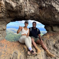


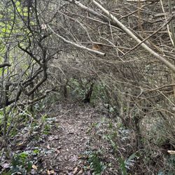


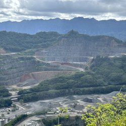



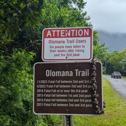












Pu'u Ma'eli'eli Digging Hill - hiking - Updated August 2026
Best of Kaneohe
People found Pu'u Ma'eli'eli Digging Hill by searching for…
Trending Searches in Kaneohe, HI
Antiques near Pu'u Ma'eli'eli Digging Hill
Barbershop For Men near Pu'u Ma'eli'eli Digging Hill
Bird Sanctuary near Pu'u Ma'eli'eli Digging Hill
Cliff Jumping near Pu'u Ma'eli'eli Digging Hill
Cruising Spots near Pu'u Ma'eli'eli Digging Hill
Dog Friendly Things To Do near Pu'u Ma'eli'eli Digging Hill
Eyebrow Threading near Pu'u Ma'eli'eli Digging Hill
Kids Haircut near Pu'u Ma'eli'eli Digging Hill
Mini Golf near Pu'u Ma'eli'eli Digging Hill
Movie Theatre near Pu'u Ma'eli'eli Digging Hill
Parks near Pu'u Ma'eli'eli Digging Hill
Pedicure near Pu'u Ma'eli'eli Digging Hill
Permanent Makeup near Pu'u Ma'eli'eli Digging Hill
Picnic Areas near Pu'u Ma'eli'eli Digging Hill
Places To Take Pictures near Pu'u Ma'eli'eli Digging Hill
Preschools near Pu'u Ma'eli'eli Digging Hill
Public Golf Courses near Pu'u Ma'eli'eli Digging Hill
Public Pools near Pu'u Ma'eli'eli Digging Hill
Rock Quarry near Pu'u Ma'eli'eli Digging Hill
Scenic Night View near Pu'u Ma'eli'eli Digging Hill
Scenic Overlook near Pu'u Ma'eli'eli Digging Hill
Shopping Malls near Pu'u Ma'eli'eli Digging Hill
Souvenir Shops near Pu'u Ma'eli'eli Digging Hill
Star Gazing near Pu'u Ma'eli'eli Digging Hill
Sunrise View near Pu'u Ma'eli'eli Digging Hill
Swimming Holes near Pu'u Ma'eli'eli Digging Hill
Trading Card Shops near Pu'u Ma'eli'eli Digging Hill
Used Furniture Stores near Pu'u Ma'eli'eli Digging Hill
Browse Articles
Browse Nearby
BEST of Kaneohe, Hawaii Coffee near Pu'u Ma'eli'eli Digging Hill
BEST of Kaneohe, Hawaii Restaurants near Pu'u Ma'eli'eli Digging Hill
BEST of Kaneohe, Hawaii Things to Do near Pu'u Ma'eli'eli Digging Hill
BEST of Kaneohe, Hawaii Breakfast near Pu'u Ma'eli'eli Digging Hill
BEST of Kaneohe, Hawaii Parks near Pu'u Ma'eli'eli Digging Hill
BEST of Kaneohe, Hawaii Walking Trails near Pu'u Ma'eli'eli Digging Hill
BEST of Kaneohe, Hawaii Campgrounds near Pu'u Ma'eli'eli Digging Hill
BEST of Kaneohe, Hawaii Sightseeing near Pu'u Ma'eli'eli Digging Hill
BEST of Kaneohe, Hawaii Excursions near Pu'u Ma'eli'eli Digging Hill
Browse Brands
Related Searches in Kaneohe, HI
Best Dog Hiking Trails Around Kaneohe, Hawaii
Best Fishing Locations and Guides in Kaneohe, Hawaii
Best Nature Trails for Hiking in Kaneohe, Hawaii
Best Places for Horseback Riding in Kaneohe, Hawaii
Best Sightseeing Experiences Available in Kaneohe, Hawaii
Best Waterfalls and Swimming Holes in Kaneohe, Hawaii
Discover Dog Friendly Trails to Explore in Kaneohe, Hawaii
Discover Easy Hiking Trails Near Kaneohe, Hawaii
Discover Kid Friendly Hiking Trails in Kaneohe, Hawaii
Discover Popular Bike Trails in Kaneohe, Hawaii
Discover Scenic Mountain Bike Trails Near Kaneohe, Hawaii
Discover Top Nature Parks to Visit in Kaneohe, Hawaii
Discover Walking Parks in Kaneohe, Hawaii Near You
Discover a Hiking Trail in Kaneohe, Hawaii
Discover the Best Night Hike Trails in Kaneohe, Hawaii
Dog-Friendly Hikes With Dogs in Kaneohe, Hawaii
Enjoy Camping Adventures Around Kaneohe, Hawaii
Enjoy Kayaking Adventures in Kaneohe, Hawaii
Enjoy Off Leash Dog Hikes in Kaneohe, Hawaii
Enjoy Tent Camping Spots Around Kaneohe, Hawaii
Enjoy a Beautiful Waterfall Hike in Kaneohe, Hawaii
Enjoy the Best Walking Path in Kaneohe, Hawaii
Enjoy the Best Walking Trails in Kaneohe, Hawaii
Explore Easy Hikes Perfect for All in Kaneohe, Hawaii
Explore Fun Activities to Do in Kaneohe, Hawaii
Explore Popular Campgrounds Near Kaneohe, Hawaii
Explore Popular State Park Destinations in Kaneohe, Hawaii
Explore Top Dog Parks in Kaneohe, Hawaii Near You
Explore the Best Beach Spots in Kaneohe, Hawaii
Family Friendly Hiking With Kids in Kaneohe, Hawaii
Find Cozy Camping Cabins in Kaneohe, Hawaii
Find Popular Ziplining Spots Around Kaneohe, Hawaii
Find Top Dog Friendly Parks to Visit in Kaneohe, Hawaii
Find Top-Rated Waterfalls in Kaneohe, Hawaii Now
Find the Best Parks for Picnics in Kaneohe, Hawaii
Hiking Trails With Waterfalls in Kaneohe, Hawaii
Off Leash Dog Hiking Trails in Kaneohe, Hawaii
Picnic Areas With BBQ Pits Available in Kaneohe, Hawaii
Popular Outdoor Activities to Try in Kaneohe, Hawaii
Popular Picnic Spots to Visit in Kaneohe, Hawaii
Popular Waterfall Hiking Trails in Kaneohe, Hawaii
Safe and Fun Parks for Kids in Kaneohe, Hawaii
Top Hiking Trails to Explore in Kaneohe, Hawaii
Top Playgrounds for Kids to Enjoy in Kaneohe, Hawaii
Top Running Trails to Explore in Kaneohe, Hawaii
Top Swimming Spots and Pools in Kaneohe, Hawaii
Top Things to Do With Kids in Kaneohe, Hawaii
Top-Rated Camping Sites in Kaneohe, Hawaii


