Cancel

    Open app

    Search

    Round Mountain Park

    4.7 (3 reviews)

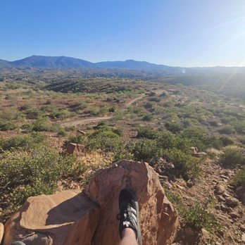
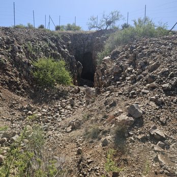
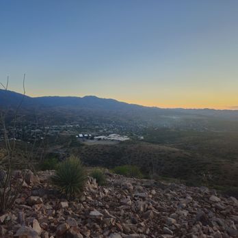
    Round Mountain Park Photos

    You might also consider

    Recommended Reviews - Round Mountain Park

    Your trust is our priority, so businesses can't pay to alter or remove their reviews. Learn more about reviews.
    Yelp app icon
    Browse more easily on the app
    Review Feed Illustration

    15 days ago

    Helpful 0
    Thanks 0
    Love this 0
    Oh no 0

    1 year ago

    Helpful 0
    Thanks 0
    Love this 0
    Oh no 0

    11 years ago

    Helpful 2
    Thanks 0
    Love this 2
    Oh no 0

    Verify this business for free

    Get access to customer & competitor insights.

    Verify this business

    Cibecue Creek Trail

    Cibecue Creek Trail

    4.8(15 reviews)
    52.8 km

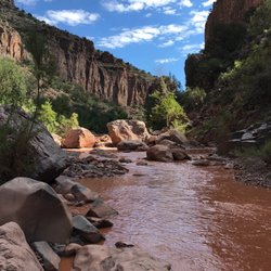
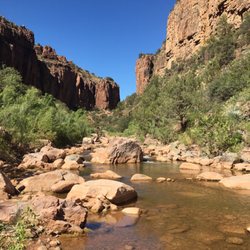
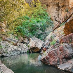
    There are 2 extremes to this hike. You can choose to explore the lower canyon to a beautiful…read morewaterfall at the end surrounded by cliffs and call it a day for a total of 3 miles out and back OR you can hire a guide and canyoneer the upper canyon and spend around 5-7 hours while rappelling, climbing, and wading through endless pools and more waterfalls for a total of over 5 miles. On this adventure, my hiking group decided to take the easy route and enjoy the lower canyon. It kind of reminded me of West Fork hike in Sedona, because you cross the creek bed repeatedly, and you cannot help but stop and stare in awe of how beautiful the surroundings are. The hike is peaceful and you feel kid-like once more since you are forced to climb over small boulders, get knee deep or sometimes even waist deep in water, and brush past tree branches of various foliage. The life is teeming with so many different plant species present and with the Salt River connecting nearby, you just know the place is great for fishing as well. Permits are $15 per person for day hikes. Cibecue is on sacred land so remember to enjoy the hike in all its glory but be respectful and pack out everything you bring in.

    One of my favorite hikes in AZ! How can you beat stunning canyon views, creek crossings, and a…read morebeautiful waterfall at the end!? Not to mention it's in the middle of nowhere away from all civilization--a great day trip getaway to relieve yourself after a stressful workweek! A few things to note before trekking out here: -You're going to want to be driving a 4x4 or high clearance vehicle as the road from the 60 turnoff is nothing but dirt and rocks. I've seen a Prius do it but it looked painful and damaging lol. -Permits are now $30 per person and you pay with cash into a box so come prepared. I'm not a huge fan of the price hike *no pun intended* but I can see why the reservation did it reduces the crowd. -Bring sturdy water shoes or prepare to get your hiking shoes wet/muddy. I have some pretty flimsy Walmart water shoes so I opted for the latter. There are multiple creek crossings and it's not like Seven Falls or Oak Creek--there are not enough stones to hop across and you will need to walk in the water.By the end of the day, my hiking shoes were completely soaked with muddy water. They will need some deep cleaning. -Piggy-backing off the point above, if you go following a monsoon storm, expect the creek and falls to be saturated with thick mud. Grand Falls style. -PLEASE pack in what you pack out. Do not litter or leave anything behind in this beautiful place.

    Photos
    Cibecue Creek Trail
    Cibecue Creek Trail
    Cibecue Creek Trail

    See all

    Hieroglyphic Trail Hoa

    Hieroglyphic Trail Hoa

    4.6(65 reviews)
    60.9 km

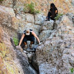
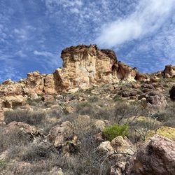
    If you're looking for a great hike in the Superstition Mountains, Hieroglyphic Trail is absolutely…read moreworth checking out. The scenery is incredible and the petroglyphs at the end make the hike feel especially rewarding. A few things to know before you go: the parking lot is pretty small and fills up fast, so getting there early is definitely recommended. Otherwise, you may end up waiting for someone to leave. I also wouldn't risk parking in a no-parking zone because I've heard they tow pretty regularly. The trail description says it's "a 1.5 mile trail that climbs a gentle slope covered with many cacti then enters the lower end of a boulder-filled canyon, ending at a rocky section where pools persist for much of the year," and that's mostly accurate. There are some sections before the canyon where you'll need to scramble over larger rocks, but overall it's manageable for most hikers. Once you reach the canyon and the petroglyph area, the terrain becomes steeper with much larger boulders. There's also a small streambed with several pools of water, which was a nice surprise. The petroglyphs themselves are amazing and can be found on both sides of the canyon. You can get fairly close to several of them, which makes the experience even better. Bring plenty of water because most of the trail is fully exposed to the sun during the day. Once you reach the petroglyphs it's a great spot to sit, rest, and recharge There is shade inside the canyon, although when we arrived most of the shady spots were already occupied by other hikers. Overall, this is a fantastic beginner-to-intermediate trail with spectacular views, unique scenery, and a rewarding destination at the end. Definitely one of my favorite hikes in the area.

    Such a beautiful hike ! Absolutely bring water. Saw some lizards along the way and beautiful cacti…read more The trail is well taken care of. As always remember to pack out what you pack in.

    Photos
    Hieroglyphic Trail Hoa
    Hieroglyphic Trail Hoa - The valley view from the top.

    The valley view from the top.

    Hieroglyphic Trail Hoa

    See all

    Picketpost Trail - East Saddlelridge  Trail (Road)  to Picket Post

    Picketpost Trail

    5.0(14 reviews)
    37.6 km

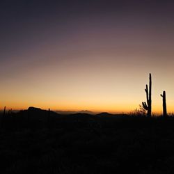
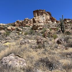
    The Picketpost Trailhead gives you access to the Arizona Trail, which traverses the state from…read moreMexico to Utah. We did not hike the Picketpost Trail up the mountain, but instead did an hour out and back along the Arizona Trail. While the scenery at Lost Dutchman State Park east of Phoenix is beautiful, driving the additional 30 minutes east to this trailhead is well worth the extra time. It's less crowded and I found the backdrop of Picketpost Mountain spectacular. If you are new to the Sonoran Desert, you will find the landscape fascinating; there is much more green than you would expect, at least in the winter. Of course, the saguaros are the highlight, and the saguaro sentinels abound up and down the ridges on this stretch of the Arizona Trail. I loved it. Access to the trailhead is on the south side of US60 about five miles west of Superior. There's a sign for the trailhead on the highway.

    Perfect spot for a challenging hike. From Phoenix area, it is about a 45 minute drive which is…read morenothing at all. You take the 60 all the way until you are about 5 minutes from Superior. You park and the trail is right there. Restrooms to use right where you park which I recommend to use because it is a bit of a longer hike. You start off easy with a little incline, but mostly flat trails. Take in the view of the mountain that you are going to eventually climb up. I thought that was one of the coolest parts seeing the mountain that you are going to struggle climbing up. After about 15-20 minutes you will start the trip up. Let me tell you, a very challenging hike if you are not in the best shape or don't hike often. The tough part was staying on the trail. For the most part, the trail is marked well with arrows to keep you on track, but there were a couple times where we must've taken the wrong turn and had to retrace our steps. Just bud careful and watch your steps as there are some very steep parts. It took us about an hour 30 minutes to get to the top. The views were incredible. Usually you get to the top and look back to see the view, but this was a full 360 degree view. Just an outstanding hike if you want to challenge yourself. I love the accomplishment of doing something new and challenging and not too far away from home.

    Photos
    Picketpost Trail - Infamous mailbox

    Infamous mailbox

    Picketpost Trail
    Picketpost Trail

    See all

    Wave Cave

    Wave Cave

    4.4(56 reviews)
    61.5 km

    worth it for sure only negative if there is one is the fact…read morethat it's out on the north east side of town and a solid drive from the west side of town, which has nothing to do with the actual hike the cave is pretty cool

    Very popular Trail due to social media. It's within the Tonto National Wilderness area and so…read moreguidelines should be followed for the wilderness. The parking lot that had been used became so overcrowded that the forest service closed it March 2026. A large parking lot is located not too far from the Peralta Trailhead. This is the Lost Goldmine East Trailhead. A permit is not required to park or to hike this area. If you need a bathroom you need to follow the road to the end to the Peralta Trailhead. The trail follows along at the beginning of the hike on the Lost Goldmine Trail. Less than 1/2 mile you'll see a fence opening to the right. This is the beginning of the Carney Springs trail and will lead up to the Wave Cave. The Wave Cave section veers off to the left and the main trail will continue up to the Superstition Ridgeline. If you miss the fence opening you will continue hiking approximately 4 miles to the next parking lot, which is for the Lost Goldmine Trail and is the same parking lot for the Hieroglyphic Trail. The wave cave is a beautiful place for picture taking and it can get very crowded on weekends. So plan your trip to go early, making sure you have good hiking shoes, hat, and plenty of water.

    Photos
    Wave Cave - Snack

    Snack

    Wave Cave - Saguaro

    Saguaro

    Wave Cave

    See all

    Round Mountain Park - hiking - Updated May 2026

    Loading...
    Loading...
    Loading...