Santa Rosa Open Space Photos


You might also consider


More like Santa Rosa Open Space
Recommended Reviews - Santa Rosa Open Space
Start your review...


Reviews With Photos


This is a safe, short, and relatively easy hike with some great views of the Bay! Try to go at least once in fall when the trees are changing colors into beautiful shades of red and yellow. The best part of the hike is that it's nestled in the Los Gatos neighborhood so you see a ton of friendly people walking their dogs, catching up, and just being neighborly. The trail ends out onto a road with some beautiful houses that are almost as fun to look at as the trail itself. I recommend taking a hike here with friends (even the ones that don't normally like hiking should be able to handle it!) and then grabbing a coffee or eating brunch in downtown Los Gatos afterwards.

A nice hidden uphill trail for a good workout and view of the Valley from above. Parking at Belgatos Park is plentiful and free (looks like an ordinary children's park with playground and picnic tables) but if you walk up the steps there's a path that leads up the hill for a great view. It's a short one (about half a mile and 300 feet of elevation gain) but those looking for a more intensive work out can walk up and down multiple times.


There is a nice spot to hike. Beginner is good to go too. We have only 1 hour that day...but we will go back to see more cool stuff...neture is always amazing
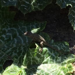

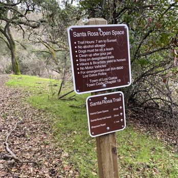
Santa Rosa Open Space is a great place for short hikes. I found the best way to access the Open Space is to park at Bel Gatos Park, in Los Gatos. It's a wonderful starting point because it has a dedicated parking area and allows you to get to Santa Rosa's Ridge Trail. It is a .6 mile out and back with a thigh burning hill in the beginning. The other great out and back trail you can do is the Santa Rosa Trail. It's .7 miles one way so it can make a pretty nice 1.4 mile hike as an out and back. Santa Rosa boarders Heintz Open Space so if you want a really great long hike, try connecting Santa Rosa Trail to Valley View to Vista Trail. It's a lot of rolling hill that will burn your quads for a 3.4 mile out and back hike. On the upside, when you walk back to the car, it's all down hill. You will occasionally see pups are on the trail and that is permitted as long as they are on leashes. So far, I have only met the nicest dogs on the trails. read more



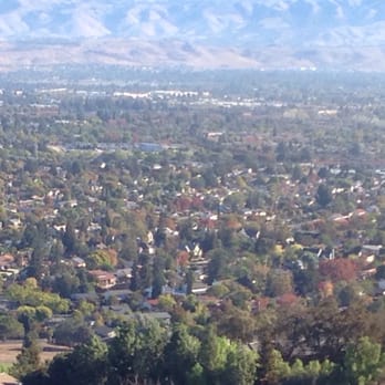
This is a safe, short, and relatively easy hike with some great views of the Bay! Try to go at least once in fall when the trees are changing colors into beautiful shades of red and yellow. The best part of the hike is that it's nestled in the Los Gatos neighborhood so you see a ton of friendly people walking their dogs, catching up, and just being neighborly. The trail ends out onto a road with some beautiful houses that are almost as fun to look at as the trail itself. I recommend taking a hike here with friends (even the ones that don't normally like hiking should be able to handle it!) and then grabbing a coffee or eating brunch in downtown Los Gatos afterwards. read more



4 years ago
A nice hidden uphill trail for a good workout and view of the Valley from above. Parking at Belgatos Park is plentiful and free (looks like an ordinary children's park with playground and picnic tables) but if you walk up the steps there's a path that leads up the hill for a great view. It's a short one (about half a mile and 300 feet of elevation gain) but those looking for a more intensive work out can walk up and down multiple times. read more


7 years ago
There is a nice spot to hike. Beginner is good to go too. We have only 1 hour that day...but we will go back to see more cool stuff...neture is always amazing read more

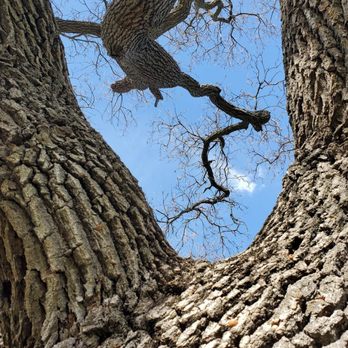


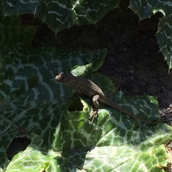
The Santa Rosa Open Space is very large. It features multiple hiking routes that create a loop at the top between the Valley View trail and the Open Sky trail. The trail starts from the bottom, and it is quite a work out to climb to the top, where the Heinz open space is. What I love about this particular open space is that it is filled with shade and good resting spots in between hiking. This place does have lots of lizards living here, keeping the insects at bay. I also love the view. The Valley View trail is especially breathtaking due to the view it offers downward into the valley. The overall trail is also extremely clean. I would highly recommend this open space for a good morning hike on a weekend! read more

19 years ago

More info about Santa Rosa Open Space
Santa Rosa Open Space Reviews in Other Languages
Ask the Community - Santa Rosa Open Space
You might also consider







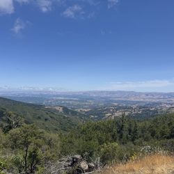


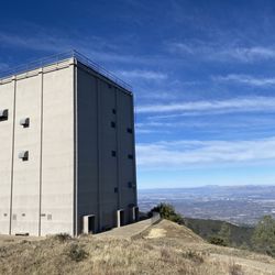
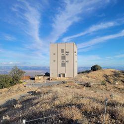
Santa Rosa Open Space - hiking - Updated September 2026
Best of Los Gatos
People found Santa Rosa Open Space by searching for…
Great View Points in Los Gatos, CA
Hiking Trails in Los Gatos, CA
Walking Trails in Los Gatos, CA
Dog Friendly Hiking Trails in Los Gatos, CA
Beautiful Views in Los Gatos, CA
Dog Friendly Places in Los Gatos, CA
Waterfall Hike in Los Gatos, CA
Stroller Friendly Hikes in Los Gatos, CA
Swimming Lakes in Los Gatos, CA
Trending Searches in Los Gatos, CA
Apple Orchards near Santa Rosa Open Space
Apple Picking near Santa Rosa Open Space
Archery near Santa Rosa Open Space
Barbershop near Santa Rosa Open Space
Baseball Fields near Santa Rosa Open Space
Blow Dry Bar near Santa Rosa Open Space
Caves near Santa Rosa Open Space
Cliff Jumping near Santa Rosa Open Space
Consignment Shops near Santa Rosa Open Space
Corn Maze near Santa Rosa Open Space
Dog Friendly Things To Do near Santa Rosa Open Space
Dog Parks near Santa Rosa Open Space
Dog Swimming near Santa Rosa Open Space
Eyebrow Threading near Santa Rosa Open Space
Eyelash Extensions near Santa Rosa Open Space
Hiking near Santa Rosa Open Space
Kids Birthday Party near Santa Rosa Open Space
Makeup Artists near Santa Rosa Open Space
Mens Suits near Santa Rosa Open Space
Off Road Trails near Santa Rosa Open Space
Parks near Santa Rosa Open Space
Photo Spots near Santa Rosa Open Space
Picnic Areas near Santa Rosa Open Space
Places To Take Pictures near Santa Rosa Open Space
Playgrounds near Santa Rosa Open Space
Private Schools near Santa Rosa Open Space
Public Running Track near Santa Rosa Open Space
Public Shower near Santa Rosa Open Space
Public Tennis Courts near Santa Rosa Open Space
River Swimming near Santa Rosa Open Space
Rock Quarry near Santa Rosa Open Space
Scenic Night View near Santa Rosa Open Space
Scenic Overlook near Santa Rosa Open Space
Sunrise View near Santa Rosa Open Space
Browse Nearby
BEST of Los Gatos, California Restaurants near Santa Rosa Open Space
BEST of Los Gatos, California Coffee near Santa Rosa Open Space
BEST of Los Gatos, California Things to Do near Santa Rosa Open Space
BEST of Los Gatos, California Walking Trails near Santa Rosa Open Space
BEST of Los Gatos, California Campgrounds near Santa Rosa Open Space
BEST of Los Gatos, California Parks near Santa Rosa Open Space
BEST of Los Gatos, California Breakfast near Santa Rosa Open Space
BEST of Los Gatos, California Ski Resorts near Santa Rosa Open Space
BEST of Los Gatos, California Motel near Santa Rosa Open Space
Browse Brands
Related Searches in Los Gatos, CA
Affordable Kayak Rental Services in Los Gatos, California
Best Dog Hiking Trails Around Los Gatos, California
Best Fishing Locations and Guides in Los Gatos, California
Best Nature Trails for Hiking in Los Gatos, California
Best Off Leash Dog Parks in Los Gatos, California
Best Parks for Parties and Events in Los Gatos, California
Best Places for Horseback Riding in Los Gatos, California
Best Sightseeing Experiences Available in Los Gatos, California
Best Water Parks for Kids in Los Gatos, California
Check Out Great Playgrounds in Los Gatos, California
Check Out Off Road Trails in Los Gatos, California
Discover Baseball Fields Around Los Gatos, California
Discover Dog Friendly Trails to Explore in Los Gatos, California
Discover Easy Hiking Trails Near Los Gatos, California
Discover Fun Toddler Parks in Los Gatos, California for Your Little One
Discover Kid Friendly Hiking Trails in Los Gatos, California
Discover Popular Bike Trails in Los Gatos, California
Discover Popular Photo Spots in Los Gatos, California
Discover Soccer Fields in Los Gatos, California Near You
Discover Top Nature Parks to Visit in Los Gatos, California
Discover Top State Parks to Visit in Los Gatos, California
Discover Walking Parks in Los Gatos, California Near You
Discover a Hiking Trail in Los Gatos, California
Discover the Best Beaches in Los Gatos, California
Discover the Best Kids Park Spots in Los Gatos, California
Discover the Best Night Hike Trails in Los Gatos, California
Dog-Friendly Hikes With Dogs in Los Gatos, California
Enjoy Camping Adventures Around Los Gatos, California
Enjoy Kayaking Adventures in Los Gatos, California
Enjoy Off Leash Dog Hikes in Los Gatos, California
Enjoy Scenic Places to Walk in Los Gatos, California
Enjoy Tent Camping Spots Around Los Gatos, California
Enjoy a Beautiful Waterfall Hike in Los Gatos, California
Enjoy the Best Picnic Spots and Ideas in Los Gatos, California
Enjoy the Best Walking Path in Los Gatos, California
Enjoy the Best Walking Trails in Los Gatos, California
Explore Beautiful Parks and Green Spaces in Los Gatos, California
Explore Easy Hikes Perfect for All in Los Gatos, California
Explore Free Picnic Areas Around Los Gatos, California
Explore Fun Activities to Do in Los Gatos, California
Explore Parks With Pull Up Bars in Los Gatos, California
Explore Picnic Parks Near Los Gatos, California
Explore Popular Campgrounds Near Los Gatos, California
Explore Popular Dog Walking Trails in Los Gatos, California
Explore Popular Kids Parks Throughout Los Gatos, California
Explore Popular Picnic Areas Around Los Gatos, California
Explore Popular RV Parks Around Los Gatos, California
Explore Scenic Lakes to Visit in Los Gatos, California


