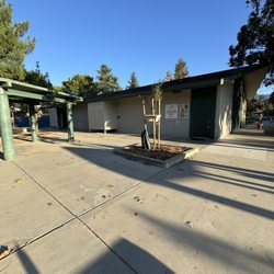
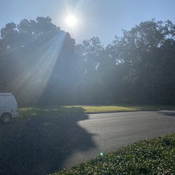
Novitiate Park Photos


You might also consider


More like Novitiate Park
Recommended Reviews - Novitiate Park
Start your review...


Reviews With Photos
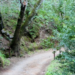

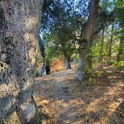
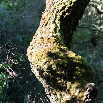
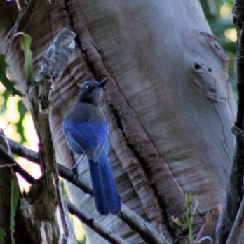
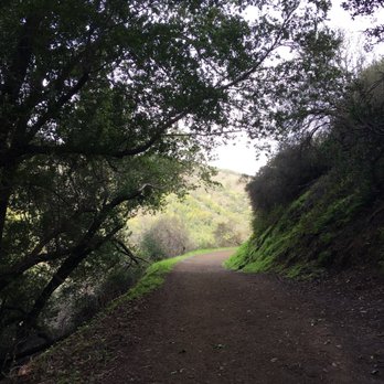
Novitiate Park (NP) is located at what once was the Novitiate Fathers' 8-acre vineyard. There are no remaining vestiges of the vineyard, as the land has been restored to a more "natural" state. NP is a no-frills kinda park that's primary purpose is to serve as a portal to access other parks (i.e., St. Joseph's Hill, Sierra Azul, & Lexington Reservoir). Here's a quick guide: Parking- There's no official parking lot to NP, but street parking is available on Jones Rd.; you then access NP at the dead-end. This is an old, narrow street so things can get a bit harry when searching for a spot. Also, please remember you're parking in a residential neighborhood so be respectful. Trails: Flume Trail (FT)- The FT runs along the westerly edge of the park; if you follow it south it'll eventually merge with the Jones Trail, but if you follow it north it'll meet up with the Los Gatos Creek Trail where you can go to Vasona Lake (North) or Lexington Reservoir (South). Jones Trail (JT)- The JT is the primary trail in NP, and navigates up the easterly edge of the park. JT will take you to Sierra Azul and St. Joseph's Hill--just follow the signage. Usage- Hiking, Mountain Biking, Horseback Riding and Dogs (on a leash) are all allowed at NP. Restrooms- No restrooms at NP or anywhere else for that matter. So, go before you come, or *ahem* make do... Trail Conditions- The trails in NP were actually all in pretty terrific shape, but as you head towards St Joseph's Hill they could get a wee bit rough, but overall very not bad. Difficulty- If you're going up to St Joseph's be prepared for an 800' ascent up some moderately steep, to really steep trails. With that being said, my 4-year-old did it, so no whining... Scenery- Beautiful views of the hills and forests that surround the area. The trails are surrounded by wild flowers, and there was a lot of birds, insects and other critters to enjoy. You can even see Lexington, LG Creek Trail, and Highway 17 as you go up. NP is not much on its own, but it serves its purpose well as it provides another access point to get out and enjoy nature. Happy hikes!


Gorgeous! My friends and I went during some lights rain and didn't regret it at all. It was still super gorgeous. I guess it was considered a moderately difficult hike but for me it seemed fine because it was pretty short. 10/10 read more




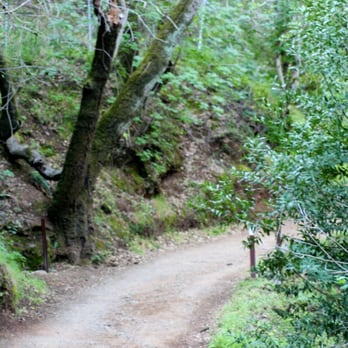
Novitiate Park (NP) is located at what once was the Novitiate Fathers' 8-acre vineyard. There are no remaining vestiges of the vineyard, as the land has been restored to a more "natural" state. NP is a no-frills kinda park that's primary purpose is to serve as a portal to access other parks (i.e., St. Joseph's Hill, Sierra Azul, & Lexington Reservoir). Here's a quick guide: Parking- There's no official parking lot to NP, but street parking is available on Jones Rd.; you then access NP at the dead-end. This is an old, narrow street so things can get a bit harry when searching for a spot. Also, please remember you're parking in a residential neighborhood so be respectful. Trails: Flume Trail (FT)- The FT runs along the westerly edge of the park; if you follow it south it'll eventually merge with the Jones Trail, but if you follow it north it'll meet up with the Los Gatos Creek Trail where you can go to Vasona Lake (North) or Lexington Reservoir (South). Jones Trail (JT)- The JT is the primary trail in NP, and navigates up the easterly edge of the park. JT will take you to Sierra Azul and St. Joseph's Hill--just follow the signage. Usage- Hiking, Mountain Biking, Horseback Riding and Dogs (on a leash) are all allowed at NP. Restrooms- No restrooms at NP or anywhere else for that matter. So, go before you come, or *ahem* make do... Trail Conditions- The trails in NP were actually all in pretty terrific shape, but as you head towards St Joseph's Hill they could get a wee bit rough, but overall very not bad. Difficulty- If you're going up to St Joseph's be prepared for an 800' ascent up some moderately steep, to really steep trails. With that being said, my 4-year-old did it, so no whining... Scenery- Beautiful views of the hills and forests that surround the area. The trails are surrounded by wild flowers, and there was a lot of birds, insects and other critters to enjoy. You can even see Lexington, LG Creek Trail, and Highway 17 as you go up. NP is not much on its own, but it serves its purpose well as it provides another access point to get out and enjoy nature. Happy hikes! read more





9 years ago
Beautiful park with hiking, mountain bike, and horse trails. The trails are easily accessible. The flume trail and jones trail are great for starting your day. Took about 40 minutes walking (round trip). Easy trails. Early in the morning the vegetation smelled great. I saw plenty of locals enjoying their daily hike. read more



More info about Novitiate Park
Jones Rd
Los Gatos, CA 95030
Directions
(408) 354-6834
Call Now
Hours
Outdoor Amenities