Skyline Drive Trails Photos


You might also consider


More like Skyline Drive Trails
Recommended Reviews - Skyline Drive Trails
Start your review...


Reviews With Photos


Great hikes and views between corona and the Orange County area. Lots of bike trails and hiking trails like tin mine, hagador and skyline trails. You can hike for miles and miles.


We hiked to the Doppler Ball and Pleasant Peak via the Skinsuit and Skyline trail. It is a challenging trail if you do not hike regularly. My challenge is I don't do well with loose gravel and there are sections where there are descents with loose gravel and I did take a stumble. Bring poles and good friends with you on this hike. Take it slowly and all should be fine. I definitely walked away with some lessons learned and I'm very determined to do better with loose gravel trails in the future. Parking is via street. Please come try the different trails and create your own experience.


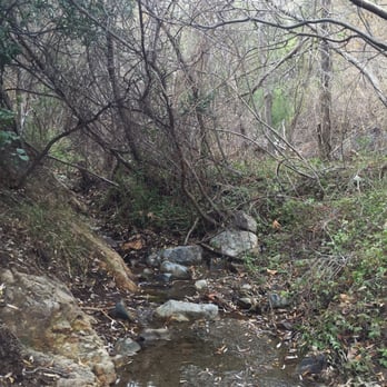
There are several trails to take ranging from easy to hard. There's running water, small creeks, lots of trees. I like to go off the path to the easy trail where there's a lot of little creeks, water. Highly recommend!


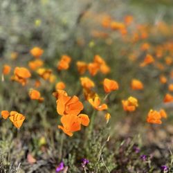
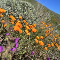
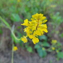
This is two hikes in one because the view down is different than the view going up. There are still wildflowers so put on you boots and get hiking. Some of the flowers are taller than you and fantastically fragrant. If you don't believe me, go there now before everything is brown. I've added some wildflower pictures and wish you could smell some of them. If you come on the weekend the parking is atrocious, so come early! You walk less than a mile on pavement before you hit the dirt road that will take you up. It's 6 miles to the Doppler. This is such a pretty peaceful hike. I hope you love it as much as I do.


There are too many reasons that would contribute to the difficulty of this trail, so let me tell you all about it. First of all, parking is easy to find, there are two entrances (the popular at the top fills up), we parked at the far one which is on Chase Dr. (see map), this is where you have to walk an extra 5 minutes to get to the Skyline trail sign. Once you see it, keeping walking forward and you will see a bunch of houses. KEEP WALKING LOL and then eventually you will see the gate to the Skyline Trail, this is where the trail starts :) 1. The trail has absolutely no shades the entire way, and its about 7 miles so in the summer with a blazing sun, you can imagine the heat :P 2. I like that its a slow and steady climb the entire way, gradual rise, nothing too steep, its challenging but doable. 3. I would recommend to wear hiking shoes because there are tons of small rocks/dirt, regular shoes might work, but I would imagine to be uncomfortable. (If you are only going to do it for like an hour then yes) 4. Besides the main trail, there are a lot of small detour which leads away the main trail, some of them look real difficult :O (I'm too scare to go) So for a person that hikes regularly, I would say this trail is easy but I imagine it could be difficult for some people. Definitely plan it out if you are coming during a hot summer, its going to be 3/4 hours under the hot sun. I love the view along the way, its amazing. If you haven't been on this trail yet, I highly recommend it, pick a day when the weather is nice (not too hot, not too cold) and do it at your own paste, have a good time :) Oh, btw before you get to the trail, you will pass by a bunch of houses, so please be respectful :)
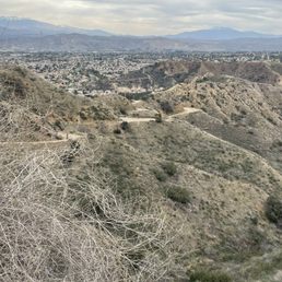

Went twice and haven't made it to the top yet, but I will. Its so relaxing to just walk, and the views are really nice as you get to different spots of the trail. The only thing I don't like are all the poop along the way.. I wish people would be more considerate and pick up after their pets, because its a nice trail but this will ruin it.


Great trail it's very wide. Have to park on Foothill Parkway. Cannot park in neighborhoods near trailhead it's permit parking only. I did 7 miles but didn't go all the way to the tip where the Doppler is. Lots of mountain bikers but the trail is wide so there is room for all. No shade so go Walt started around 845am probably 6:30am would be a better start time.


What a perfect day for a nature walk at Skyline. We've been here before but today was different with the recent rain. There was a creek of water which is normally dried up. Warm in the sun. Cool in the shade made it a perfect balance for hiking. It was not too crowded. I highly recommend.


Back.open again!!! Went this morning with my son and daughter and had a good hike. We were able to park near the trail entrance when we arrived shortly after 9:00 AM. We went up to the Tin Mine Trail and enjoyed the great views of the new growth in the hills and the thick wildflowers (lots of yellow mustard). We even saw a good sized Red Diamondback Rattlesnake, to boot. Bring water as it heats up quickly on the trail. The best part about Skyline Drive is how close it is to Corona neighborhoods, so it's a quick way to get into a natural setting. the bad part is that it draws a lot of hikers so parking can be tough (and keep any valuables out of sight in your car so as not to draw unwanted attention of theives).


I love hiking these trails! You will find beautiful little cubby hole spots along a stream if you go far enough. It's so awesome...


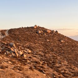
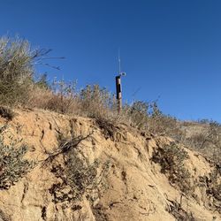
What a great hike! The trailhead is within walking distance of my home which is really convenient. I'm partial to the hike up to Doppler radar which can been for miles around. The trail branches off and connects to many other trails within the Cleveland National Forest which offers a lot of variety. Due to the number of connecting trails I am able to hike up from and meet a friend of mine who starts his hike from Black Star Canyon on the OC side of the forrest which is pretty cool. There are a number of artifacts to see along the way (old mining equipment, stone cabins and radio towers) which help you appreciate the long history of the area. There is a commanding view from this location which offers opportunities for breathtaking panoramic pictures. I can see my office in Irvine and my home standing underneath which is an unusual perspective when considering how difficult it can be driving from Corona to Irvine. It's a steep climb up and I would recommend taking plenty of water and the use of tracking poles. The trail is suitable for use year round although during the summer months you want to get an early start. It's not usual to see flashlights from early morning hikers or mountain bikers in predawn hours. If you enjoy sunsets you're for a treat. Head up in the afternoon of a partly cloudy day and you'll be treated to a view that you won't soon forget.


8 years ago

8 years ago

It's a nice trail. Not too steep but not stroller friendly. It first starts off with concrete and slowly transfer to an actual trail once you pass the homes. We went on a Sunday around 1:30pm and there wasn't s lot of people on the trail. We went up an hour and a half then came back. We took our 3 year old son but definitely need a hiking backpack carrier. read more


11 years ago
Awesome incline to start the day. Stop at any point and enjoy the view. Little hazy and smoggy today, but still gorgeous! See you on the trails!! read more


11 years ago
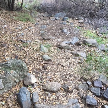
I love the area! Has a gorgeous view plus there are so many trails for you to choose from! Definitely coming back! read more




11 years ago
Great trail! Best hiking trail I have hiked so far out of 4 in the area! You can hike the main trial or find more difficult trails which we did of course and the view was amazing! Going back again soon! read more


9 years ago

8 years ago

12 years ago

8 years ago

9 years ago

8 years ago

11 years ago

9 years ago

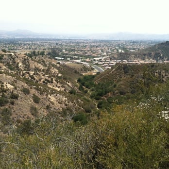
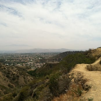
Picture this... tall, lush green mountains, exotic birds flying about, wild flowers, butterfly's...if this sounds amazing then you should check out skyline drive trail. Its probably the best hiking you'll get in the I.E. There are a few different trails you can take which is nice because it doesn't limit you in terms of exploring. There are also many "non advertised" paths you can take as well, it's quite a large area to take in. If your looking for a work out in terms of cardio and taking in some views I suggest the skyline drive trail. It's all uphill and some of the trails can get pretty steep and narrow, but all the more fun if your prepared for them. The views up there are great too. If your looking for some shade, and taking in some nature and scenery then the tin mine trail is your best bet. It's very quiet and there ate a lot of trees and shrubs to keep you cool. During the weekdays parking isn't too bad, but it can be difficult on weekends to find space along foothill parkway. From foothill to the trail head is about 0.5 miles. This place doesn't disappoint! P.s try not to smell too pretty though, there are MANY flys and other flying creatures here, but as one poster said that just comes with the territory. Also if your into creepy things, there's a crashed car near the top of skyline drive, super weirded me out but it can be interesting to check out, as it's hard to miss. read more




13 years ago
9 years ago
7 years ago

9 years ago

9 years ago

10 years ago

9 years ago

13 years ago

9 years ago
12 years ago
Best trail running I've done! I used go go to MT Rubidoux and this is wayyyy better! I wish there was a better map so I could understand how to get to all the trails though. Also the mountain lion threat scares me but still awesome view and great trails! read more


8 years ago
7 years ago
8 years ago

10 years ago

11 years ago
8 years ago

11 years ago

11 years ago
8 years ago

10 years ago

11 years ago

11 years ago

11 years ago
11 years ago

10 years ago
More info about Skyline Drive Trails
Skyline Dr
Corona, CA 92882
Directions
Hours
Indoor Amenities
Outdoor Amenities
Skyline Drive Trails Reviews in Other Languages
Ask the Community - Skyline Drive Trails
How long does it take to get to the top?
Depends upon your physical condition and what you are carrying. You do need a hiking stick, hat, and adequate liquids. If you depart from the Forest Servjce gate at Skyline Drive Trail and remain on the dirt road all the way up to the Doppler Radar…
Is this ok for strollers?
We totally did this hike today with a stroller. The main hike is an old paved road and while it hasn't been maintained, it's relatively smooth. We got about 1.5 hours up the hill before we decided to turn around but totally could have made it to…
How long is the skyline loop trail? Where is the rope course?
Not sure yet, we're slowly going by mileage.
Is there any reception out there?typically how long does 11miles take walking with a group?
No reception. Everyone walks at a different pace. Three hours 6 miles up and 6 miles down.
Is it open at night?
Yes, make sure you have a head lamp since there's no lighting at all.
How is this Hike for a first timer? It would be just me and my dog so I'm just to start with an easier hike versus harder. Thanks in advance!
Great for first timers, when my daughter was 5 she was able to complete the hike. If you're looking for a workout then try running it, and dogs are welcome. Remember to keep an eye out for rattlesnakes.
How do I find the trailhead to the rock wall/rope course? I've done it once but couldn't find it again, I know I have to go over the metal railing...
Keep walking down the regular entrance trail, making sure to go straight and pass the metal entrance gate. About a mile or so in, walk left going down onto the mountain. Be careful ! VERY RISKY but still fun !
Review Highlights - Skyline Drive Trails
You might also consider


















Why does Yelp recommend reviews?
16 reviews that are not currently recommended
The reviews below are not factored into the business's overall star rating.

8 years ago

8 years ago
6 years ago
9 years ago

8 years ago
3 months ago
8 years ago
9 years ago

10 years ago
8 years ago
8 years ago

10 years ago

11 years ago

8 years ago

9 years ago

14 years ago
Skyline Drive Trails - hiking - Updated September 2026
Best of Corona
People found Skyline Drive Trails by searching for…
Trending Searches in Corona, CA
Apple Orchards near Skyline Drive Trails
Apple Picking near Skyline Drive Trails
Barbershop near Skyline Drive Trails
Bike Shop near Skyline Drive Trails
Blowout near Skyline Drive Trails
Casinos near Skyline Drive Trails
Cliff Jumping near Skyline Drive Trails
Cruising Spots near Skyline Drive Trails
Dog Friendly Things To Do near Skyline Drive Trails
Estheticians near Skyline Drive Trails
Eyelash Extensions near Skyline Drive Trails
Furniture Stores near Skyline Drive Trails
Hiking Trails With Waterfalls near Skyline Drive Trails
Kids Birthday Party near Skyline Drive Trails
Lakes & Ponds near Skyline Drive Trails
Makeup Artists near Skyline Drive Trails
Mattresses near Skyline Drive Trails
Off Road Trails near Skyline Drive Trails
Parks near Skyline Drive Trails
Picnic Areas near Skyline Drive Trails
Places To Take Pictures near Skyline Drive Trails
Private Schools near Skyline Drive Trails
Public Shower near Skyline Drive Trails
Rock Quarry near Skyline Drive Trails
Scenic Night View near Skyline Drive Trails
Scenic Overlook near Skyline Drive Trails
Sugaring near Skyline Drive Trails
Sunrise View near Skyline Drive Trails
Browse Articles
Browse Nearby
BEST of Corona, California Coffee near Skyline Drive Trails
BEST of Corona, California Restaurants near Skyline Drive Trails
BEST of Corona, California Things to Do near Skyline Drive Trails
BEST of Corona, California Walking Trails near Skyline Drive Trails
BEST of Corona, California Parks near Skyline Drive Trails
BEST of Corona, California Breakfast near Skyline Drive Trails
BEST of Corona, California Campgrounds near Skyline Drive Trails
Browse Brands
Related Searches in Corona, CA
Affordable Kayak Rental Services in Corona, California
Best Dog Hiking Trails Around Corona, California
Best Fishing Locations and Guides in Corona, California
Best Nature Trails for Hiking in Corona, California
Best Places for Horseback Riding in Corona, California
Check Out Off Road Trails in Corona, California
Discover Dog Friendly Trails to Explore in Corona, California
Discover Easy Hiking Trails Near Corona, California
Discover Kid Friendly Hiking Trails in Corona, California
Discover Popular Bike Trails in Corona, California
Discover Scenic Mountain Bike Trails Near Corona, California
Discover Walking Parks in Corona, California Near You
Discover a Hiking Trail in Corona, California
Discover the Best Night Hike Trails in Corona, California
Dog-Friendly Hikes With Dogs in Corona, California
Enjoy Camping Adventures Around Corona, California
Enjoy Kayaking Adventures in Corona, California
Enjoy Off Leash Dog Hikes in Corona, California
Enjoy Scenic Places to Walk in Corona, California
Enjoy Tent Camping Spots Around Corona, California
Enjoy a Beautiful Waterfall Hike in Corona, California
Enjoy the Best Walking Path in Corona, California
Enjoy the Best Walking Trails in Corona, California
Explore Beautiful Parks and Green Spaces in Corona, California
Explore Easy Hikes Perfect for All in Corona, California
Explore Fun Activities to Do in Corona, California
Explore Popular Campgrounds Near Corona, California
Explore Popular Dog Walking Trails in Corona, California
Explore Top Dog Parks in Corona, California Near You
Explore the Best Beach Spots in Corona, California
Family Friendly Hiking With Kids in Corona, California
Find Parks and Recreation Activities in Corona, California
Find Top Dog Friendly Parks to Visit in Corona, California
Find Top-Rated Waterfalls in Corona, California Now
Find the Best Parks for Picnics in Corona, California
Hiking Trails With Waterfalls in Corona, California
Off Leash Dog Hiking Trails in Corona, California
Popular Outdoor Activities to Try in Corona, California
Popular Picnic Spots to Visit in Corona, California
Popular Waterfall Hiking Trails in Corona, California
Safe River Swimming Areas in Corona, California
Safe and Fun Parks for Kids in Corona, California
Top Hiking Trails to Explore in Corona, California
Top Playgrounds for Kids to Enjoy in Corona, California
Top Running Trails to Explore in Corona, California
Top Swimming Lakes to Enjoy in Corona, California
Top Swimming Spots and Pools in Corona, California
Top-Rated Camping Sites in Corona, California


