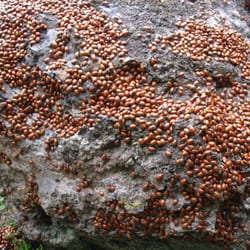
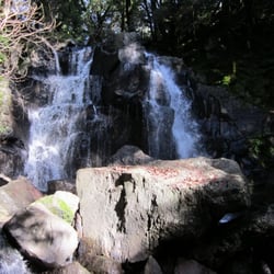
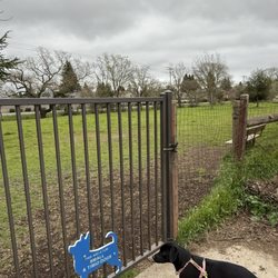
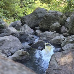
Smittle Creek Trail Photos


You might also consider
More like Smittle Creek Trail
Recommended Reviews - Smittle Creek Trail
Start your review...

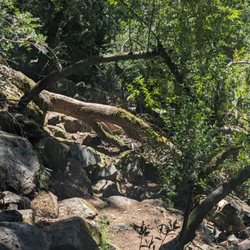
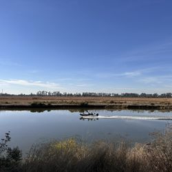
We had planned to come up to Berryessa for a day of hiking, but much to our chagrin, the trail we wanted to go on (Stebbins Cold Canyon) is closed until next month due to fire damage. Whatevs, let's make the most out of it. I looked up trails in the area and found this place. To reach the southern trailhead, we entered Oak Shores Park, turned left and followed signs to the northern-most parking lot at Coyote Knolls. The trailhead was by the bulletin board which has a map of the trail. We were one of the only cars in the lot, but the water in the lake is still pretty low, even with all of the rain this past winter. This trail was listed as a 2.6 mile hike (5.2 out and back) and I would classify it as easy to moderate. Just a path along (what should be) the lake. Lots of oak trees, wildflowers and groves. But the water is really low, which is kind of a bummer. Plus, when I go hiking, I like to go see a waterfall or the ocean...not just grass and trees. I guess it would have been different if the lake did not look like a bathtub mid-drain, but oh well. Also, although they say there is a spot to picnic on the trail, all we saw were some very splintery-looking old picnic tables that we didn't let the kids get on. We ate our snacks standing up in what I imagine was at one point the lake bed. We ended up getting to about 2.5 miles in and decided to turn back to conserve energy for the little ones. At the end of the trail was just another parking lot from what we were told by the other party we saw out there yesterday. All in all, I don't think we will be making the drive out here to do this trail again. If you are in the area it might be something to work in, but I don't know about making a special trip. read more


More info about Smittle Creek Trail
5524 Berryessa Knoxville Rd
Napa, CA 94558
Directions
Hours
Outdoor Amenities
You might also consider


Smittle Creek Trail - hiking - Updated July 2026
Best of Napa
People found Smittle Creek Trail by searching for…
Hiking Trails With Waterfalls in Napa, California
Things to Do in Napa, California
Easy Hikes in Napa, California
Hiking Trails Kid Friendly in Napa, California
Picnic Areas in Napa, California
Off Road Trails in Napa, California
Waterfalls and Swimming Holes in Napa, California
Waterfalls in Napa, California
Attractions in Napa, California
Canyoneering in Napa, California
Lakes & Ponds in Napa, California
Camping Sites in Napa, California
Walking Trails in Napa, California
Dog Friendly Lakes and Parks in Napa, California
Dog Hiking Trails in Napa, California
Boat Launch in Napa, California
Stroller Friendly Hikes in Napa, California
Places to Swim in Napa, California
Picnic Spots in Napa, California
Trending Searches in Napa, CA
4th Of July Fireworks near Smittle Creek Trail
Black Owned Nail Salons near Smittle Creek Trail
Boat Rental near Smittle Creek Trail
Cliff Jumping near Smittle Creek Trail
Day Trips near Smittle Creek Trail
Fireworks near Smittle Creek Trail
Jet Ski Rental near Smittle Creek Trail
Kayak Rental near Smittle Creek Trail
Lakes & Ponds near Smittle Creek Trail
Off Road Trails near Smittle Creek Trail
Outdoor Activities near Smittle Creek Trail
Parks For Picnics near Smittle Creek Trail
Places To Walk Around near Smittle Creek Trail
Public Pools near Smittle Creek Trail
Public Shower near Smittle Creek Trail
River Swimming near Smittle Creek Trail
Rock Quarry near Smittle Creek Trail
Scenic Night View near Smittle Creek Trail
Scenic Overlook near Smittle Creek Trail
Secluded Spots near Smittle Creek Trail
Soccer Store near Smittle Creek Trail
Splash Pad near Smittle Creek Trail
Strawberry Picking near Smittle Creek Trail
Sunrise View near Smittle Creek Trail
Swimming Holes near Smittle Creek Trail
Swimming Lakes near Smittle Creek Trail
Watch Sunset near Smittle Creek Trail
Browse Articles
Browse Nearby
BEST of Napa, California Restaurants near Smittle Creek Trail
BEST of Napa, California Coffee near Smittle Creek Trail
BEST of Napa, California Parks near Smittle Creek Trail
BEST of Napa, California Lunch near Smittle Creek Trail
BEST of Napa, California Wineries near Smittle Creek Trail
BEST of Napa, California Campgrounds near Smittle Creek Trail
Browse Brands
Related Searches in Napa, CA
Affordable Kayak Rental Services in Napa, California
Best Fishing Locations and Guides in Napa, California
Best Nature Trails for Hiking in Napa, California
Best Places for Horseback Riding in Napa, California
Check Out Off Road Trails in Napa, California
Discover Dog Friendly Trails to Explore in Napa, California
Discover Kid Friendly Hiking Trails in Napa, California
Discover Scenic Bike Paths in Napa, California
Discover Scenic Mountain Bike Trails Near Napa, California
Discover Scenic Waterfall Spots in Napa, California
Discover Top Nature Parks to Visit in Napa, California
Discover a Hiking Trail in Napa, California
Discover the Best Night Hike Trails in Napa, California
Dog-Friendly Hikes With Dogs in Napa, California
Enjoy Camping Adventures Around Napa, California
Enjoy Exciting Mountain Biking Adventures in Napa, California
Enjoy Kayaking Adventures in Napa, California
Enjoy Tent Camping Spots Around Napa, California
Enjoy a Beautiful Waterfall Hike in Napa, California
Enjoy the Best Picnic Spots and Ideas in Napa, California
Enjoy the Best Walking Path in Napa, California
Enjoy the Best Walking Trails in Napa, California
Exciting Cliff Jumping Spots in Napa, California
Experience Thrilling White Water Rafting in Napa, California
Explore Beautiful Parks and Green Spaces in Napa, California
Explore Easy Hikes Perfect for All in Napa, California
Explore Fun Activities to Do in Napa, California
Explore Popular Campgrounds Near Napa, California
Explore the Best Beach Spots in Napa, California
Explore the Best Swimming Holes Around Napa, California
Explore the Best Trail Options in Napa, California
Family Friendly Hiking With Kids in Napa, California
Find Beautiful Views in Napa, California
Find Popular Ziplining Spots Around Napa, California
Find the Best Parks for Picnics in Napa, California
Great Places to Walk in Napa, California
Hiking Trails With Waterfalls in Napa, California
Off Leash Dog Hiking Trails in Napa, California
Plan a Scenic Drive Route Near Napa, California
Popular Outdoor Activities to Try in Napa, California
Popular Picnic Spots to Visit in Napa, California
Safe River Swimming Areas in Napa, California
Safe and Fun Parks for Kids in Napa, California
Top Climbing Spots and Gyms in Napa, California
Top Paddleboarding Activities in Napa, California
Top Running Trails to Explore in Napa, California
Top Swimming Lakes to Enjoy in Napa, California
Top Swimming Spots and Pools in Napa, California
People who viewed Smittle Creek Trail also viewed
Alamo Creek Bike Trail
6 reviews
Stebbins Cold Canyon Loop Trail
88 reviews
Andrews Park Loop Trail
2 reviews
Putah Creek Wildlife Area
1 review
Linda Falls Preserve Hiking
13 reviews
Old Rocky Hiking Trail
4 reviews
Putah Creek Riparian Reserve
11 reviews
Capay Open Space Park
3 reviews
Moore Creek Park
17 reviews
Table Rock
15 reviews