Snake River Canyon Rim Trails Photos



More like Snake River Canyon Rim Trails
Recommended Reviews - Snake River Canyon Rim Trails
Start your review...



4 months ago

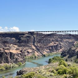
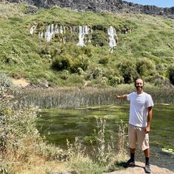
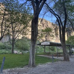
If you're a nature enthusiast with a side of daredevil nostalgia, Snake River Canyon Rim Trails is the perfect blend of breathtaking views and a trip down memory lane. The trails offer a stunning panorama that's nothing short of awe-inspiring. The Snake River Canyon, with its majestic cliffs and winding waters, provides a backdrop that's almost too beautiful to be true. It's like nature's own masterpiece, and the trails allow you to soak it all in at your own pace. What makes this place truly unique is its hidden gem status. It's almost like the canyon is hiding in plain sight, waiting for you to discover its magic. Once you do, you'll wonder how it remained under the radar for so long. Now, for the icing on the cake - the Evel Knievel jump site and statue. For those of us old enough to remember when Evil Knievel was the sport-rock star of the 70s, this spot is a pilgrimage. Standing by the statue, you can almost feel the adrenaline of those iconic jumps. It's a nostalgic trip that adds a whole new dimension to the hiking experience. The ramp site is now on private property so we couldn't get close but you can still see the mound jutting towards the canyon! So, lace up those walking shoes, embrace the breathtaking views, and take a stroll down memory lane. read more

2 years ago

Wow, easy beautiful hike. A great friend moved to Twin Falls recently and I had to visit. On a Friday afternoon she recommended this fantastic hike. We parked at a paved small lot off Pole Line and Eastland Drive N. The trail head is well marked. The approximately 3 mile path from here to the Shoshone Falls Park is 12 feet wide and paved. Hikers, joggers, bicyclists and dogs on leash are all welcomed. From the parking lot the elevation doesn't change much for the first 2 miles. The last mile declines into the Shoshone Falls Park. So remember you'll have to hike uphill a while to return to your car. The trail winds through a housing development and a few pastures. Edging the south rim of the Snake River about 500 feet down. Step off the trail and enjoy the occasional bench to take in the magnificent rock colors and formations. Slowly the falls will start to appear and you'll hear the low rumble of the water crashing to the pool below. There a couple of observation platforms just off trail. They are easy to find and get to. At the end of the trail we descended into the park. Here we spent time reading the history kiosks and getting close up shots of the falls. We took our time and savored all the sites for almost three hours. Also along the trail we walked past the Evel Kinevel launch site from 1974. That brought back memories. The views will vary on the time of year and the water flow. We enjoyed a partly cloudy day with some gusty winds. It was still fabulous. I will do this trail every time I visit. No restrooms along the trail. There are some at the falls in the park, along with a small refreshment stand. read more


4 years ago
More info about Snake River Canyon Rim Trails





















Snake River Canyon Rim Trails - hiking - Updated September 2026
Best of Twin Falls
People found Snake River Canyon Rim Trails by searching for…
Places to Take Pictures in Twin Falls, ID
Things to Do in Twin Falls, ID
Swimming Lakes in Twin Falls, ID
Natural Hot Springs in Twin Falls, ID
Beautiful Views in Twin Falls, ID
Hiking Trails in Twin Falls, ID
Visitor Centers in Twin Falls, ID
Walking Trails in Twin Falls, ID
Picnic Areas in Twin Falls, ID
Tent Camping in Twin Falls, ID
Tourist Attractions in Twin Falls, ID
Secret Spots in Twin Falls, ID
Playgrounds for Kids in Twin Falls, ID
Off Road Trails in Twin Falls, ID
Trending Searches in Twin Falls, ID
Barbershop near Snake River Canyon Rim Trails
Beautiful Views near Snake River Canyon Rim Trails
Bike Shop near Snake River Canyon Rim Trails
Casinos near Snake River Canyon Rim Trails
Casinos With Slot Machines near Snake River Canyon Rim Trails
Cliff Jumping near Snake River Canyon Rim Trails
Consignment Shops near Snake River Canyon Rim Trails
Dress Shops near Snake River Canyon Rim Trails
Estheticians near Snake River Canyon Rim Trails
Eyebrow Threading near Snake River Canyon Rim Trails
Eyelash Extensions near Snake River Canyon Rim Trails
Makeup Artists near Snake River Canyon Rim Trails
Mens Suits near Snake River Canyon Rim Trails
Nail Technicians near Snake River Canyon Rim Trails
Parks near Snake River Canyon Rim Trails
Picnic Areas near Snake River Canyon Rim Trails
Places To Take Pictures near Snake River Canyon Rim Trails
Public Shower near Snake River Canyon Rim Trails
Teeth Whitening near Snake River Canyon Rim Trails
Things To Do This Weekend near Snake River Canyon Rim Trails
Browse Articles
Browse Nearby
BEST of Twin Falls, Idaho Coffee near Snake River Canyon Rim Trails
BEST of Twin Falls, Idaho Things to Do near Snake River Canyon Rim Trails
BEST of Twin Falls, Idaho Restaurants near Snake River Canyon Rim Trails
BEST of Twin Falls, Idaho Walking Trails near Snake River Canyon Rim Trails
BEST of Twin Falls, Idaho Campgrounds near Snake River Canyon Rim Trails
BEST of Twin Falls, Idaho Parks near Snake River Canyon Rim Trails
BEST of Twin Falls, Idaho Breakfast near Snake River Canyon Rim Trails
BEST of Twin Falls, Idaho Caves near Snake River Canyon Rim Trails
BEST of Twin Falls, Idaho Sightseeing near Snake River Canyon Rim Trails
Browse Brands
Related Searches in Twin Falls, ID
Affordable Kayak Rental Services in Twin Falls, Idaho
Best Fishing Locations and Guides in Twin Falls, Idaho
Best Fun Things to Do in Twin Falls, Idaho
Best Places for Horseback Riding in Twin Falls, Idaho
Best Sightseeing Experiences Available in Twin Falls, Idaho
Check Out Off Road Trails in Twin Falls, Idaho
Discover Dog Friendly Trails to Explore in Twin Falls, Idaho
Discover a Hiking Trail in Twin Falls, Idaho
Discover the Best Beaches in Twin Falls, Idaho
Enjoy Camping Adventures Around Twin Falls, Idaho
Enjoy Kayaking Adventures in Twin Falls, Idaho
Enjoy Tent Camping Spots Around Twin Falls, Idaho
Experience Stunning Sunset Views in Twin Falls, Idaho
Explore Beautiful Parks and Green Spaces in Twin Falls, Idaho
Explore Free Things to Do Around Twin Falls, Idaho
Explore Fun Activities to Do in Twin Falls, Idaho
Explore Popular Campgrounds Near Twin Falls, Idaho
Explore Popular RV Parks Around Twin Falls, Idaho
Explore Popular Scenic Views Near Twin Falls, Idaho
Explore Scenic Lakes to Visit in Twin Falls, Idaho
Explore the Best Swimming Holes Around Twin Falls, Idaho
Family Friendly Hiking With Kids in Twin Falls, Idaho
Find Beautiful Views in Twin Falls, Idaho
Find Cozy Camping Cabins in Twin Falls, Idaho
Find Exciting Tours to Take in Twin Falls, Idaho
Find Fun Things to Do With Kids in Twin Falls, Idaho
Find Top-Rated Waterfalls in Twin Falls, Idaho Now
Find the Best Playgrounds to Visit in Twin Falls, Idaho
Must-See Tourist Attractions Around Twin Falls, Idaho
Perfect Spots to Watch Sunset in Twin Falls, Idaho
Popular Fishing Spots to Explore in Twin Falls, Idaho
Popular Kids Activities in Twin Falls, Idaho
Popular Outdoor Activities to Try in Twin Falls, Idaho
Popular Things to Do in Twin Falls, Idaho
Popular Things to See in Twin Falls, Idaho
Relax at Natural Hot Springs Near Twin Falls, Idaho
Safe River Swimming Areas in Twin Falls, Idaho
Safe and Fun Parks for Kids in Twin Falls, Idaho
Top Dog Friendly Things to Do in Twin Falls, Idaho
Top Hiking Trails to Explore in Twin Falls, Idaho
Top Paddleboarding Activities in Twin Falls, Idaho
Top Playgrounds for Kids to Enjoy in Twin Falls, Idaho
Top RV Campgrounds to Visit in Twin Falls, Idaho
Top Swimming Lakes to Enjoy in Twin Falls, Idaho
Top Swimming Spots and Pools in Twin Falls, Idaho
Top Things to Do With Kids in Twin Falls, Idaho





