St. Mary's Falls Photos


More like St. Mary's Falls
Recommended Reviews - St. Mary's Falls
Start your review...


Reviews With Photos


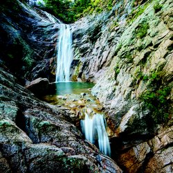
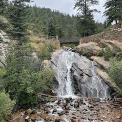
This is a real enjoyable hike. The first 1.6 miles are real easy, no elevation gain and just one very long traverse. This traverse does not offer much shade protection, so be prepared for the sun. Get there early to avoid the heat. The remaining 1.2-1.6 miles are of considerable elevation gain - Not as difficult as a 14er, but difficult nevertheless. This path is well marked and shaded, so it is much less hot then at the beginning. The last switchback is killer on the legs, but worth it when you reach the fall. The advantage to this hike is that it is incredibly dog friendly; however, not so family friendly. Everyone going up had a dog with them and each dog was having a good time. This trail runs along a stream, so there is plenty of opportunities for the dogs to drink some water and relax. Also, when you reach the top, there is a pool of water towards the middle of the falls that the dogs are able to swim in. Many dogs were also off leash enjoying running through the stream and playing with other dogs. On the day that we hiked, it was greater then 90 degrees and very dry. There was not much water in the falls, but it was still nice to see. The fall does run year-round, however, on dry days, there is much less water then you would expect. It was still an enjoyable visit though, especially considering how much calories were burned. Total...this trail is around 6 miles down and back with the most difficult stretch (constant elevation gain) towards the last 1.6 miles. The last 0.2 miles are really tough. FYI: the pictures are not too great, but the hike is still a fun time and a must do.
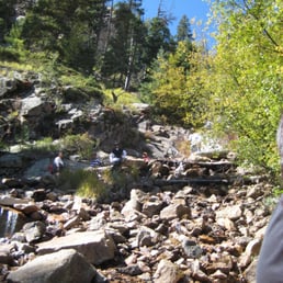

We were supposed to go on a hike even kids could manage but missed the turn and ended up at St Mary's about 1.5 hours later. On the way up there were definitely times I thought I would roll down the hill and end up in a cast. But the trick is definitely not to look down and to bring a walking stick. The view is incomparable. I even saw elderly people, people with babies, and children make it up to the top, so even if it looks intimidating the first time, just do it. Tips: bring a walking stick, snacks, water, sunglasses


4 years ago
We loved our hike to st marys falls. St Marys is a moderate hike around 6.5 miles and 1394 feet of elevation gain. The main road to the falls parking lot is closed and you have to take gold camp road over. This is around 3 miles of dirt. Its narrow with some pot holes and also 2 tunnels you will need to go through. A lot of the road is very narrow and really only wide enough for just one car. So be prepared for a little bit of a hairy ride. it will be the 2nd parking lot on your right. There is a fairly large parking lot, however it fills up quickly especially on a weekend. If you want to do this you will want to arrive sooner rather than later. Dogs are allowed but are supposed to be on a leash. The parking lot for saint marys is the same as for some other trails over there, seven bridges and silver cascades being 2 of them. You will have to walk around 1 1/4 miles up a dirt road until you get to the trailhead. The trail follows a creek most of the trail. It is rocky and at times a little slick with the loose rock. It is beautiful, surrounded by forest. It was very magical and lovely. it felt so nice to be out in the woods. Mountain bikes and motorcycles are also allowed to use this trail. We did not see any motorcycles but there were a few mountain bikers. And they dont necessarily signal so well beware. There is a trash can at the trail head. Be sure to PACK out what you pack in! My friend and i were picking up garbage that people had left along the trail :( There is no reason to leave your garbage. Please take it with you. read more


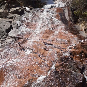


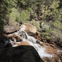
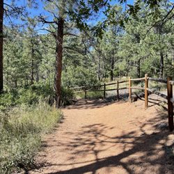
Inadvertently found this trail while looking for a different place to hike with the pup, who is young and just learning how to be a good off leash hiking dog. I'm not 100% certain, but I think that you are allowed to take your dogs off leash on this trail. I certainly never saw any signs stating otherwise and out of maybe 10 dogs we saw, half were on leash and a half off. It was a beautiful hike however we were not prepared and did not have water or maybe a hiking stick for me, at least. The beginning part of the trail is a wide open fire lane, but once you get back there it's a trail with a gradual uphill climb the entire way that turns even steeper towards the end. I was definitely asking "how much longer" for the last half-hour and really regretting that I didn't have water with me as my sensitive back started to ache. On our way down as we passed other hikers, they were asking the same question about "how much longer". The gradual uphill climb the entire way can be a little much if you're not prepared for it and the journey back down to the car is much quicker since it's basically downhill the whole way. Took half the time to get down than it did to get up. The waterfall and stream were beautiful and soothing. Walking with shady tree cover much of the way and a stream next to us was a plus for the pup to get his first experience of playing in a stream. The pup definitely enjoyed himself most of all. We took this hike in early June and on our way back we got hit with a rainstorm that dropped the temperature about 20° and we were freezing and poured on by the time we got back to the car, so be prepared when coming here in the summertime! read more


Love this trail. It's very scenic and follows a creek for a pretty good stretch. To reach the trail you have to walk on Gold camp road for quite a while...which I guess is pretty hot in the summer as it's not shaded, but once you hit the trail it provides quite a bit of shading and the stream sounds are nice. WARNING: trail may be very icy in the winter and spring months. Snowmelt causes icing so yack-tracks are advised. Also, the waterfall may be completely frozen when you get up there...just FYI. read more

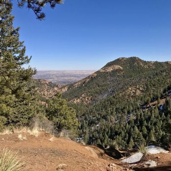


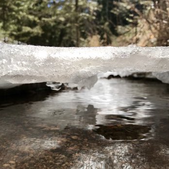


This is a real enjoyable hike. The first 1.6 miles are real easy, no elevation gain and just one very long traverse. This traverse does not offer much shade protection, so be prepared for the sun. Get there early to avoid the heat. The remaining 1.2-1.6 miles are of considerable elevation gain - Not as difficult as a 14er, but difficult nevertheless. This path is well marked and shaded, so it is much less hot then at the beginning. The last switchback is killer on the legs, but worth it when you reach the fall. The advantage to this hike is that it is incredibly dog friendly; however, not so family friendly. Everyone going up had a dog with them and each dog was having a good time. This trail runs along a stream, so there is plenty of opportunities for the dogs to drink some water and relax. Also, when you reach the top, there is a pool of water towards the middle of the falls that the dogs are able to swim in. Many dogs were also off leash enjoying running through the stream and playing with other dogs. On the day that we hiked, it was greater then 90 degrees and very dry. There was not much water in the falls, but it was still nice to see. The fall does run year-round, however, on dry days, there is much less water then you would expect. It was still an enjoyable visit though, especially considering how much calories were burned. Total...this trail is around 6 miles down and back with the most difficult stretch (constant elevation gain) towards the last 1.6 miles. The last 0.2 miles are really tough. FYI: the pictures are not too great, but the hike is still a fun time and a must do. read more


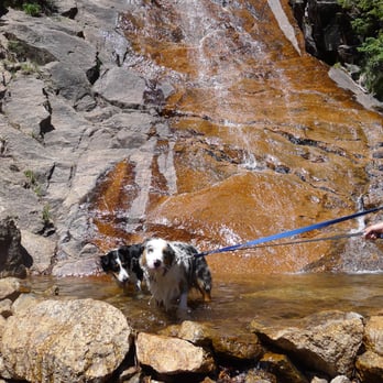

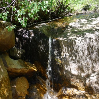

We were supposed to go on a hike even kids could manage but missed the turn and ended up at St Mary's about 1.5 hours later. On the way up there were definitely times I thought I would roll down the hill and end up in a cast. But the trick is definitely not to look down and to bring a walking stick. The view is incomparable. I even saw elderly people, people with babies, and children make it up to the top, so even if it looks intimidating the first time, just do it. Tips: bring a walking stick, snacks, water, sunglasses read more
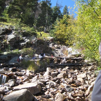


8 years ago

9 years ago

10 years ago
Good hike, with nice falls at the end making the 3 mile hike to the top so worth it. The trail is clearly marked and easy to follow. The first part is prettu fart and the ascent midway through the hike is not that bad. Saw lots of dogs and some kids on trail but thankfully it wasn't that busy late Saturday morning. The hike is easy to find once you figure out how to make it to the trailhead. read more


15 years ago
More info about St. Mary's Falls
Colorado Springs, CO 80901
Directions
Hours
Indoor Amenities
Outdoor Amenities
Ask the Community - St. Mary's Falls
Review Highlights - St. Mary's Falls

























Why does Yelp recommend reviews?
1 review that is not currently recommended
The reviews below are not factored into the business's overall star rating.

11 years ago
St. Mary's Falls - hiking - Updated August 2026
Best of Colorado Springs
People found St. Mary's Falls by searching for…
Hiking Trails With Waterfalls in Colorado Springs, CO
Scenic View in Colorado Springs, CO
Swimming Lakes in Colorado Springs, CO
Dog Swimming in Colorado Springs, CO
Campgrounds in Colorado Springs, CO
Things to Do in Colorado Springs, CO
Places to Take Pictures in Colorado Springs, CO
Fun Things to Do at Night With Kids in Colorado Springs, CO
Night View in Colorado Springs, CO
Night Hike in Colorado Springs, CO
Waterfalls in Colorado Springs, CO
Off Road Trails in Colorado Springs, CO
Walking Trails in Colorado Springs, CO
Dog Friendly Hiking Trails in Colorado Springs, CO
Scenic Overlook in Colorado Springs, CO
Dog Friendly Things to Do in Colorado Springs, CO
Parks for Kids in Colorado Springs, CO
Off Leash Dog Hiking Trails in Colorado Springs, CO
Fun Things to Do With Teens in Colorado Springs, CO
Swimming Holes in Colorado Springs, CO
Swimming in Colorado Springs, CO
Trending Searches in Colorado Springs, CO
Bird Sanctuary near St. Mary's Falls
Cliff Jumping near St. Mary's Falls
Cruising Spots near St. Mary's Falls
Day Trips near St. Mary's Falls
Dog Friendly Things To Do near St. Mary's Falls
Flower Fields near St. Mary's Falls
Indoor Mini Golf near St. Mary's Falls
Kids Activities Indoor near St. Mary's Falls
Kids Haircut near St. Mary's Falls
Movie Theatre near St. Mary's Falls
Outdoor Activities near St. Mary's Falls
Picnic Areas near St. Mary's Falls
Rainy Day Activities near St. Mary's Falls
Rock Quarry near St. Mary's Falls
Scenic Night View near St. Mary's Falls
Shopping Malls near St. Mary's Falls
Sports Card Shops near St. Mary's Falls
Sunrise View near St. Mary's Falls
Swimming Holes near St. Mary's Falls
Things To Do On A Rainy Day near St. Mary's Falls
Trading Card Shops near St. Mary's Falls
Uniforms near St. Mary's Falls
Used Book Stores near St. Mary's Falls
Browse Articles
Browse Nearby
Browse Brands
Related Searches in Colorado Springs, CO
Best Dog Hiking Trails Around Colorado Springs, Colorado
Best Fishing Locations and Guides in Colorado Springs, Colorado
Best Places for Horseback Riding in Colorado Springs, Colorado
Best Sightseeing Experiences Available in Colorado Springs, Colorado
Check Out Off Road Trails in Colorado Springs, Colorado
Discover Dog Friendly Trails to Explore in Colorado Springs, Colorado
Discover Fun Toddler Parks in Colorado Springs, Colorado for Your Little One
Discover Kid Friendly Hiking Trails in Colorado Springs, Colorado
Discover Popular Bike Trails in Colorado Springs, Colorado
Discover Scenic Mountain Bike Trails Near Colorado Springs, Colorado
Discover a Hiking Trail in Colorado Springs, Colorado
Discover the Best Night Hike Trails in Colorado Springs, Colorado
Dog-Friendly Hikes With Dogs in Colorado Springs, Colorado
Enjoy Camping Adventures Around Colorado Springs, Colorado
Enjoy Exciting Mountain Biking Adventures in Colorado Springs, Colorado
Enjoy Kayaking Adventures in Colorado Springs, Colorado
Enjoy Off Leash Dog Hikes in Colorado Springs, Colorado
Enjoy Tent Camping Spots Around Colorado Springs, Colorado
Enjoy the Best Walking Trails in Colorado Springs, Colorado
Explore Beautiful Parks and Green Spaces in Colorado Springs, Colorado
Explore Easy Hikes Perfect for All in Colorado Springs, Colorado
Explore Fun Activities to Do in Colorado Springs, Colorado
Explore Popular Campgrounds Near Colorado Springs, Colorado
Explore Top Dog Parks in Colorado Springs, Colorado Near You
Explore the Best Beach Spots in Colorado Springs, Colorado
Explore the Best Swimming Holes Around Colorado Springs, Colorado
Explore the Scenic River in Colorado Springs, Colorado
Family Friendly Hiking With Kids in Colorado Springs, Colorado
Find Cozy Camping Cabins in Colorado Springs, Colorado
Find Parks and Recreation Activities in Colorado Springs, Colorado
Find Popular Ziplining Spots Around Colorado Springs, Colorado
Find Top-Rated Waterfalls in Colorado Springs, Colorado Now
Find the Best Parks for Picnics in Colorado Springs, Colorado
Find the Best Playgrounds to Visit in Colorado Springs, Colorado
Hiking Trails With Waterfalls in Colorado Springs, Colorado
Off Leash Dog Hiking Trails in Colorado Springs, Colorado
Plan a Scenic Drive Route Near Colorado Springs, Colorado
Popular Outdoor Activities to Try in Colorado Springs, Colorado
Safe River Swimming Areas in Colorado Springs, Colorado
Safe and Fun Parks for Kids in Colorado Springs, Colorado
Top Hiking Trails to Explore in Colorado Springs, Colorado
Top Playgrounds for Kids to Enjoy in Colorado Springs, Colorado
Top Running Trails to Explore in Colorado Springs, Colorado
Top Swimming Lakes to Enjoy in Colorado Springs, Colorado
Top Swimming Spots and Pools in Colorado Springs, Colorado
Top Things to Do With Kids in Colorado Springs, Colorado
Top-Rated Camping Sites in Colorado Springs, Colorado
Walk Dog Friendly Hiking Trails in Colorado Springs, Colorado


