Table Rock Photos



More like Table Rock
Recommended Reviews - Table Rock
Start your review...


Reviews With Photos


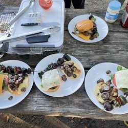
During our stay in Napa, we wanted a little more activity than just eating and drinking all day. So, we packed a cooler with wine, cheese, and sausages and went hiking - to then eat and drink. :-) The weather was warm/hot and the trail was a little challenging for a beginner. There were some steep spots, which made it fun. The views were incredible, with multiple spots along the way spectacular enough to make you catch your breath. We stopped about halfway to Table Rock and lunched near the big boulders - what seemed to be the highest altitude and best view to that point. From where we sat we overlooked vineyards on one side and forest valley on the other. There are no facilities on this trail (compared to Big Basin, with full restrooms at most of the campgrounds), and the trail gets a little narrow (just a little) after you pass the first big opening. There is a small parking lot right near the trial head - it is very easy to miss, so keep your eyes peeled. The drive up to Table Rock was also very enjoyable - half the fun of the hike was zipping along the winding mountain roads. We didn't make it all the way to Table Rock (ran out of time), but we really enjoyed ourselves, the fresh air, and the beautiful landscapes.


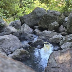
Wow. What a fantastic hike. But damn, it is a REAL hike! I do not recommend this hike for anyone who may have a knee injury, balance problems, young children, or someone who is not in good shape. The hike starts off quite mildly as it weaves through trees and is fairly shaded with a wide open trail. Then within ten minutes the terrain changed and you are having to either climb over granite and smoothed stone of a dried up river bed, or hiking down a very steep incline and having to be very careful not to fall. Spectacular breathtaking views. Definitely give yourself an hour and a half each way with a couple stops in between. Bring water with you (I recommend at least two bottle pp), and a snack. My assumption after reading these reviews is that it would be moderately challenging, but this hike is definitely not for the faint of heart! I exercise 4-5 times a week and my boyfriend does as well and we are very young and healthy...this hike kicked our butts, but it was totally worth it to see the beautiful views along the way. Also a great hike for dogs!


1 year ago
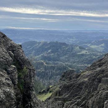
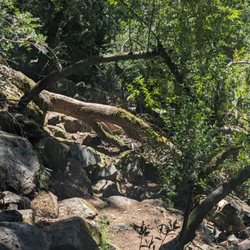
Table Rock trail is located within Robert Louis Stevenson State Park. The road to get to the trailhead is directly north of Calistoga on Highway 29-about 20 minutes from the downtown. There are no facilities and parking can be hard to come by, as there are just two small lots. You're competing with other hikers who might be climbing up Mt St Helena. Mileage wise, the trail signs indicate 4.2 miles round trip. So, while the distance is short, the trail itself is moderate to challenging. There are sections both going in and out with an incline. While the inclines and declines aren't terribly steep, it's the loose rocks, downed trees and washed out trail sections that make it more challenging. I do wish I brought hiking poles to navigate the downhills and found myself tripping a few times, The scenery is quite unique with interesting rock formations along the way. The end of this trail, at Table Rock itself is spectacular, especially in winter when the valley below is green. The area did suffer from fires back in 2017 so there are a lot of burned trees and scrubby landscape. Interesting hike and worth checking out at least once. If you're up for more of a challenge, the trail continues to the Palisades trail and eventually connects down to the Oat Hill Mine trail in Calistoga. Good workout, scenic and not too crowded. Bring water and layers. It's exposed for much of the uphills and I was sweating but then cold and windy at the top. Minus 1 star for the challenging parking situation and washed out (but passable) sections. read more




4 years ago
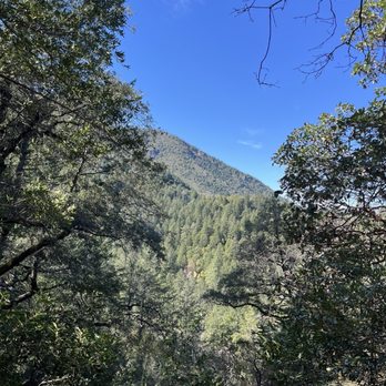
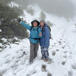
Fun little trail with a lot of scenic views, trees, and (currently) greenery. We went today, which happened to be cold, windy, cloudy, and even hailed a bit, and there were a few downed trees you needed to hop over. I loved the hike. Only saw 4 other people, a couple on their way out and a couple on their way in (when we were on our way out). It was quiet and peaceful. The parking lot adjacent to it was nearly full. There was another trail entrance across the road from this one that seemed more popular. read more


9 years ago
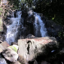
The drive to/from here is so beautiful! We got to the trailhead around noon on a Saturday and there were still a few parking spots left. My bf & I stopped about halfway in to have lunch on the giant boulders and WOW, what an amazing view! The labyrinth area was pretty cool too. The next mile though after the rock mazes wasn't as easy as the first. When you reach the top of Table Rock, you essentially get the same views as you did with that first stop on the giant boulders. So if you want to take it easy, stop by the first boulders, check out the labyrinth below, and then turn around. But if you are willing and able, definitely hike the whole thing! Just be careful at the top - it is super windy up there! This is one of the cleanest trails I've seen in terms of trash and dog poop (great job people!). There's lots of shade and it wasn't too busy when I went on a Saturday afternoon. It took us about 2 1/2 hours to complete (with lunch and picture breaks included) so it wasn't too bad. I do agree with other Yelpers about it being very rocky and not suitable for young children or for those with injuries. read more


14 years ago
During our stay in Napa, we wanted a little more activity than just eating and drinking all day. So, we packed a cooler with wine, cheese, and sausages and went hiking - to then eat and drink. :-) The weather was warm/hot and the trail was a little challenging for a beginner. There were some steep spots, which made it fun. The views were incredible, with multiple spots along the way spectacular enough to make you catch your breath. We stopped about halfway to Table Rock and lunched near the big boulders - what seemed to be the highest altitude and best view to that point. From where we sat we overlooked vineyards on one side and forest valley on the other. There are no facilities on this trail (compared to Big Basin, with full restrooms at most of the campgrounds), and the trail gets a little narrow (just a little) after you pass the first big opening. There is a small parking lot right near the trial head - it is very easy to miss, so keep your eyes peeled. The drive up to Table Rock was also very enjoyable - half the fun of the hike was zipping along the winding mountain roads. We didn't make it all the way to Table Rock (ran out of time), but we really enjoyed ourselves, the fresh air, and the beautiful landscapes. read more



6 years ago

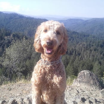
Wow. What a fantastic hike. But damn, it is a REAL hike! I do not recommend this hike for anyone who may have a knee injury, balance problems, young children, or someone who is not in good shape. The hike starts off quite mildly as it weaves through trees and is fairly shaded with a wide open trail. Then within ten minutes the terrain changed and you are having to either climb over granite and smoothed stone of a dried up river bed, or hiking down a very steep incline and having to be very careful not to fall. Spectacular breathtaking views. Definitely give yourself an hour and a half each way with a couple stops in between. Bring water with you (I recommend at least two bottle pp), and a snack. My assumption after reading these reviews is that it would be moderately challenging, but this hike is definitely not for the faint of heart! I exercise 4-5 times a week and my boyfriend does as well and we are very young and healthy...this hike kicked our butts, but it was totally worth it to see the beautiful views along the way. Also a great hike for dogs! read more



18 years ago

7 years ago

9 years ago
7 years ago
Yeah, we loved this hike, but I definitely recommend hiking poles because of the loose rocks and the steep terrain. read more


16 years ago

15 years ago
14 years ago
13 years ago
11 years ago
More info about Table Rock
3801 Saint Helena Hwy
Robert Louis Stevenson State Park
Calistoga, CA 94515
Directions
Hours
Indoor Amenities
Outdoor Amenities
Ask the Community - Table Rock
Review Highlights - Table Rock















Why does Yelp recommend reviews?


Table Rock - hiking - Updated August 2026
Best of Calistoga
People found Table Rock by searching for…
Hiking Trails in Calistoga, CA
Dog Friendly Hiking Trails in Calistoga, CA
Walking Trails in Calistoga, CA
Off Road Trails in Calistoga, CA
Scenic Overlook in Calistoga, CA
Parks for Kids in Calistoga, CA
Lookout Points in Calistoga, CA
Running Trails in Calistoga, CA
Waterfall Hike in Calistoga, CA
Romantic Views in Calistoga, CA
Trending Searches in Calistoga, CA
Barbershop For Men near Table Rock
Consignment Shops near Table Rock
Cruising Spots near Table Rock
Dog Friendly Things To Do near Table Rock
Elementary Schools near Table Rock
Eyebrow Threading near Table Rock
Lookout Points near Table Rock
Outdoor Activities near Table Rock
Public Golf Courses near Table Rock
Scenic Night View near Table Rock
Scenic Overlook near Table Rock
Swimming Holes near Table Rock
Trading Card Shops near Table Rock
Browse Articles
Browse Nearby
Browse Brands
Related Searches in Calistoga, CA
Affordable Kayak Rental Services in Calistoga, California
Best Dog Hiking Trails Around Calistoga, California
Best Fishing Locations and Guides in Calistoga, California
Best Places for Horseback Riding in Calistoga, California
Best Sightseeing Experiences Available in Calistoga, California
Discover Dog Friendly Trails to Explore in Calistoga, California
Discover Kid Friendly Hiking Trails in Calistoga, California
Discover Popular Bike Trails in Calistoga, California
Discover a Hiking Trail in Calistoga, California
Discover the Best Night Hike Trails in Calistoga, California
Dog-Friendly Hikes With Dogs in Calistoga, California
Enjoy Camping Adventures Around Calistoga, California
Enjoy Kayaking Adventures in Calistoga, California
Enjoy Off Leash Dog Hikes in Calistoga, California
Enjoy Scenic Places to Walk in Calistoga, California
Enjoy Tent Camping Spots Around Calistoga, California
Enjoy a Beautiful Waterfall Hike in Calistoga, California
Enjoy the Best Picnic Spots and Ideas in Calistoga, California
Enjoy the Best Walking Path in Calistoga, California
Enjoy the Best Walking Trails in Calistoga, California
Explore Beautiful Parks and Green Spaces in Calistoga, California
Explore Easy Hikes Perfect for All in Calistoga, California
Explore Fun Activities to Do in Calistoga, California
Explore Popular Campgrounds Near Calistoga, California
Explore Popular Dog Walking Trails in Calistoga, California
Explore Popular Scenic Views Near Calistoga, California
Explore Top Dog Parks in Calistoga, California Near You
Explore the Best Beach Spots in Calistoga, California
Family Friendly Hiking With Kids in Calistoga, California
Find Popular Ziplining Spots Around Calistoga, California
Find Top Dog Friendly Parks to Visit in Calistoga, California
Find the Best Parks for Picnics in Calistoga, California
Find the Best Playgrounds to Visit in Calistoga, California
Hiking Trails With Waterfalls in Calistoga, California
Off Leash Dog Hiking Trails in Calistoga, California
Popular Outdoor Activities to Try in Calistoga, California
Popular Picnic Spots to Visit in Calistoga, California
Popular Waterfall Hiking Trails in Calistoga, California
Safe River Swimming Areas in Calistoga, California
Safe and Fun Parks for Kids in Calistoga, California
Top Hiking Trails to Explore in Calistoga, California
Top Playgrounds for Kids to Enjoy in Calistoga, California
Top Running Trails to Explore in Calistoga, California
Top Swimming Lakes to Enjoy in Calistoga, California
Top Swimming Spots and Pools in Calistoga, California
Top-Rated Camping Sites in Calistoga, California


