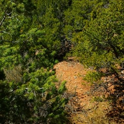
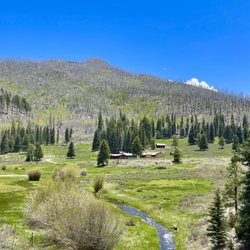
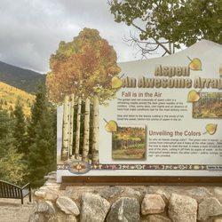
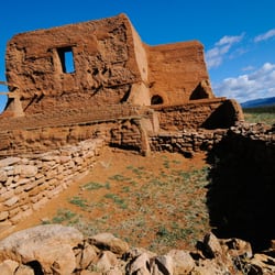
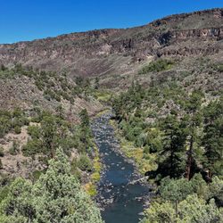
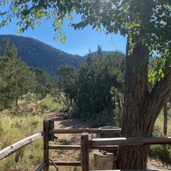
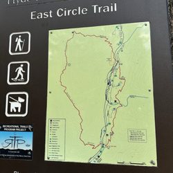
The High Five Eco Zip Tour Photos


You might also consider
More like The High Five Eco Zip Tour
Recommended Reviews - The High Five Eco Zip Tour
Start your review...

8 months ago
Making reservations was easy! We came from Los Angeles for the balloon fiesta and wanted to do something exciting! Definitely worth it! Arriving and being trained and fitted with gear was great. The whole experience was amazing. Staff were more than pleasant and more than knowledgeable. They, Joshua, Ellie & Ethan were friendly, attentive, likeable and very knowledgeable. They were a blessing to us! God bless this adventure and we encourage many more people to visit!!! read more


2 years ago
10 years ago
10 years ago
10 years ago
My husband and I went on a zip line tour on Monday 8/8/16 and it was AWESOME!! We had a great time and every aspect of the tour was top of the line! All the equipment was brand new and it was EXTREMELY comfortable to be in a sitting position while zip lining! Our tour guide Jesse was a super cool guy, very knowledgeable and knew what he was doing!! I would recommend this to almost anyone!! We had a very young girl about 7 on our tour and she had a blast! Great experience and we will definitely be back to so this again!! read more


10 years ago
More info about The High Five Eco Zip Tour
35 NM-50
Glorieta, NM 87535
Directions
Visit Website
http://www.glorietahighfive.com
Hours
Payment methods
Indoor Amenities
Outdoor Amenities
Other Amenities
From the Business
Ask the Community - The High Five Eco Zip Tour
You might also consider


Why does Yelp recommend reviews?
5 reviews that are not currently recommended
The reviews below are not factored into the business's overall star rating.
10 years ago
10 years ago
10 years ago
10 years ago
10 years ago
The High Five Eco Zip Tour - tours - Updated June 2026
Best of Glorieta
People found The High Five Eco Zip Tour by searching for…
Things to Do in Glorieta, New Mexico
Scenic View in Glorieta, New Mexico
Things to Do at Night in Glorieta, New Mexico
Fun Things to Do on Date Night in Glorieta, New Mexico
Fun Things to Do on Your Birthday in Glorieta, New Mexico
Hiking Trails With Waterfalls in Glorieta, New Mexico
Transportation in Glorieta, New Mexico
Walking Trails in Glorieta, New Mexico
Hot Air Balloons in Glorieta, New Mexico
Trolley Tour in Glorieta, New Mexico
Easy Hikes in Glorieta, New Mexico
Beautiful Views in Glorieta, New Mexico
Off Road Trails in Glorieta, New Mexico
Attractions in Glorieta, New Mexico
Hiking Groups in Glorieta, New Mexico
Hotels & Travel in Glorieta, New Mexico
Night Hike in Glorieta, New Mexico
Sunset View in Glorieta, New Mexico
Horse Carriage Ride in Glorieta, New Mexico
Canyoneering in Glorieta, New Mexico
Zip Line in Glorieta, New Mexico
Zipline Tours in Glorieta, New Mexico
Trending Searches in Glorieta, NM
Amusement Parks near The High Five Eco Zip Tour
Beaches near The High Five Eco Zip Tour
Caves near The High Five Eco Zip Tour
Dog Friendly Things To Do near The High Five Eco Zip Tour
Dog Swimming near The High Five Eco Zip Tour
Fruit Picking near The High Five Eco Zip Tour
Gem Mining near The High Five Eco Zip Tour
Kayak Rental near The High Five Eco Zip Tour
Lakes near The High Five Eco Zip Tour
Outdoor Activities near The High Five Eco Zip Tour
Pool Supplies near The High Five Eco Zip Tour
Public Pools near The High Five Eco Zip Tour
Public Shower near The High Five Eco Zip Tour
River Swimming near The High Five Eco Zip Tour
River Tubing near The High Five Eco Zip Tour
Running Trails near The High Five Eco Zip Tour
Scenic Drive near The High Five Eco Zip Tour
Splash Pad near The High Five Eco Zip Tour
Sunrise View near The High Five Eco Zip Tour
Swimming Holes near The High Five Eco Zip Tour
Swimming Lakes near The High Five Eco Zip Tour
Swimming Pools near The High Five Eco Zip Tour
Things To Do On A Rainy Day near The High Five Eco Zip Tour
Things To See near The High Five Eco Zip Tour
Tourist Attractions near The High Five Eco Zip Tour
U Pick Farms near The High Five Eco Zip Tour
Browse Articles
Browse Nearby
BEST of Glorieta, New Mexico Hotels near The High Five Eco Zip Tour
BEST of Glorieta, New Mexico Restaurants near The High Five Eco Zip Tour
BEST of Glorieta, New Mexico Shopping near The High Five Eco Zip Tour
BEST of Glorieta, New Mexico Coffee near The High Five Eco Zip Tour
BEST of Glorieta, New Mexico Hiking near The High Five Eco Zip Tour
BEST of Glorieta, New Mexico Campgrounds near The High Five Eco Zip Tour
BEST of Glorieta, New Mexico Rafting/Kayaking near The High Five Eco Zip Tour
BEST of Glorieta, New Mexico Breakfast near The High Five Eco Zip Tour
BEST of Glorieta, New Mexico Airport Shuttles near The High Five Eco Zip Tour
Browse Brands
Related Cost Guides
Related Searches in Glorieta, NM
Affordable Airport Shuttles Available in Glorieta, New Mexico
Best Fishing Locations and Guides in Glorieta, New Mexico
Best Lookout Points to Visit in Glorieta, New Mexico
Best Places for Horseback Riding in Glorieta, New Mexico
Best Sightseeing Experiences Available in Glorieta, New Mexico
Book Cheap Tours Available in Glorieta, New Mexico
Book a Trolley Tour Experience in Glorieta, New Mexico
Book a Winery Tour Experience in Glorieta, New Mexico
Book an Exciting City Tour in Glorieta, New Mexico
Challenge Yourself With an Obstacle Course in Glorieta, New Mexico
Check Out Off Road Trails in Glorieta, New Mexico
Discover Architectural Tours Available in Glorieta, New Mexico
Discover Dog Friendly Trails to Explore in Glorieta, New Mexico
Discover Exciting Adventure Options in Glorieta, New Mexico
Discover Popular Bike Trails in Glorieta, New Mexico
Discover Popular Photo Spots in Glorieta, New Mexico
Discover Scenic Mountain Bike Trails Near Glorieta, New Mexico
Discover Spooky Ghost Tour Options in Glorieta, New Mexico
Discover Stunning Skyline View Spots in Glorieta, New Mexico
Discover Top Nature Parks to Visit in Glorieta, New Mexico
Discover a Hiking Trail in Glorieta, New Mexico
Discover the Best Caves to Explore in Glorieta, New Mexico
Discover the Best Coffee Tour Experiences in Glorieta, New Mexico
Discover the Best Night Hike Trails in Glorieta, New Mexico
Dog-Friendly Hikes With Dogs in Glorieta, New Mexico
Enjoy Hiking Adventures in Glorieta, New Mexico
Enjoy Scenic Cruises in Glorieta, New Mexico
Enjoy Scenic Night View Experiences in Glorieta, New Mexico
Enjoy the Best Night View Spots in Glorieta, New Mexico
Experience Stunning Sunset Views in Glorieta, New Mexico
Experience Thrilling Snowmobiling in Glorieta, New Mexico
Experience a Unique Food Tour in Glorieta, New Mexico
Explore Bike Rentals Throughout Glorieta, New Mexico
Explore Easy Hikes Perfect for All in Glorieta, New Mexico
Explore Free Picnic Areas Around Glorieta, New Mexico
Explore Nature Spots Around Glorieta, New Mexico
Explore Popular Campgrounds Near Glorieta, New Mexico
Explore Popular Guided Tours in Glorieta, New Mexico
Explore Popular Scenic Overlook Points in Glorieta, New Mexico
Explore Popular Scenic Views Near Glorieta, New Mexico
Explore Popular View Points Around Glorieta, New Mexico
Explore Scenic Lakes to Visit in Glorieta, New Mexico
Explore Scenic Sunset Hike Trails Around Glorieta, New Mexico
Explore Summer Camps for All Ages in Glorieta, New Mexico
Explore Top Bus Tours Around Glorieta, New Mexico
Explore the Best Trail Options in Glorieta, New Mexico
Explore the Best Wine Tours in Glorieta, New Mexico
Find Beautiful Views in Glorieta, New Mexico
Find Exciting Tours to Take in Glorieta, New Mexico
Find Parks and Recreation Activities in Glorieta, New Mexico