Cancel

    Open app

    Search

    Vermilion Cliffs National Monument

    4.7 (3 reviews)

    Vermilion Cliffs National Monument Photos
    You might also consider

    More like Vermilion Cliffs National Monument

    Recommended Reviews - Vermilion Cliffs National Monument

    Your trust is our priority, so businesses can't pay to alter or remove their reviews. Learn more about reviews.
    Yelp app icon
    Browse more easily on the app
    Review Feed Illustration
    Photo of Niki S.
    1559
    567
    17293

    1 year ago

    Helpful 23
    Thanks 5
    Love this 16
    Oh no 0

    4 years ago

    Helpful 8
    Thanks 0
    Love this 8
    Oh no 0
    Photo of Kaori M.
    269
    1740
    1484

    11 years ago

    Helpful 3
    Thanks 0
    Love this 4
    Oh no 0

    You might also consider

    Verify this business for free

    People searched for Hiking 234 times last month within 15 miles of this business.

    Verify this business

    The Wave at Coyote Buttes - Not crowded but some people hog this area for hours

    The Wave at Coyote Buttes

    4.8(31 reviews)
    0.0 km

    After years of trying to apply for a permit, our group finally got picked! Highly recommend hiking…read moreat least once. I wouldn't do it again though, mainly because of how hard it was to get a permit. We visited in April and the weather was fantastic. It was actually freezing in the morning but as the sun rose, it warmed up to the point where we would sweat a little when hiking. I can't even imagine doing this in the summer but if you win the lottery then, make sure everyone brings plenty of water. To get to the trailhead, I'd recommend having a high-clearance vehicle, especially if it just recently rained. The road off of the freeway becomes unpaved and there are some ditches that can be flooded. Download an offline map of the trail and area for when you lose service. It gets spotty but you'll find reception every now and then. At the beginning, there are a couple of vault toilets. The trail itself is difficult to follow without an offline map. There's only a handful of signs pointing in a general direction. And until the Wave, we were pretty much the only people around. Considering only about 60 people are approved each day, it wasn't surprising, and honestly, kind of nice to be alone in nature. The Wave was everything we hoped for. We had clear, blue skies and that contrast with the red and orange rocks was beautiful. It looked exactly like the Windows background! There was even a pond further up with a ton of tadpoles. Besides the Wave, there's other neat waypoints to stop by but because we were tired, we didn't try for many of them. The only one we went out of our way for was the dinosaur tracks but it was anti-climatic. They just looked like larger chicken feet prints. Despite this hike being only about 6 miles round trip, it took pretty much the entire day. We stopped a lot to take pictures but also the landscape was difficult to hike. Lots of sand to walk through and lots of weird inclines to walk across, which kept our feet, knees, and legs at weird angles. There might have been easier pathways but as I said earlier, there's no clear indications of a trail. There was also a BLM worker at the Wave asking for the permit holders. If you hike without one and get caught, you'll get slapped with some steep fines. Drones are also not allowed!

    My friend won the online lottery for the permit 4 months in advance but after talking to the…read moreranger, it seems that there's a good chance you can win the daily lottery since a lot of people cancel every day. It's easier if you have less people (like two people). Anyways, the orientation the day before was useful for weather and road conditions. The hike wasn't too bad, can be a bit steep in some parts but for the most part, not too much incline. It's moderate for the novice hiker but easy for an experienced hiker. For experienced hikers, probably can get to the Wave in 1 to 1.5 hours. For the inexperienced, it might take 2.5 to 3 hours. Either way, if you're planning to spend a lot of time at the Wave (some people take 2-3 hours for their extensive Instagram photoshoots haha), definitely go there early and spend all day there. I would definitely come back if I win the lottery!

    Photos
    The Wave at Coyote Buttes
    The Wave at Coyote Buttes
    The Wave at Coyote Buttes

    See all

    Peek-a-boo & Spooky Slot Canyon - Desert Skies

    Peek-a-boo & Spooky Slot Canyon

    4.7(17 reviews)
    69.9 km

    Peek-a-boo is tight, fun and fairly easy with amazing colors and really interesting rock…read moreformations. Spooky is a lot harder. We had a guide, Gary, from Roam outdoor adventures and glad we did. His help in navigating how to get down from spots through the rocks/boulders that can be rather daunting and dangerous. Though the slots aren't really long, navigating through them is not a quick pass through. They take time. The site could use some signs to get people to start at the right side. Some start at the wrong end and there is no place in these slots for anyone to pass by you. It can get really hot in the summer so 2 liters of water is recommended along with snacks. The ruts in the road can be passed by in a regular car but you will wind up with loose bolts. The road is partially paved there and dirt the rest of the way. Very dusty. Excellent experience. No fee required but donations at the parking lot and restrooms appreciated. Please pack out what you packed in and leave no trace. Some have started writing on the walls of these areas and it's not only awful to have to see but ruins these old sights for everyone. Very disappointing.

    Let me set the record straight, slot canyons are my jam! I will go anywhere there is an opportunity…read moreto walk, shimmy, or rappel into a slot canyon. I just think they are the most interesting Mother Nature created places to explore. We came here on a July 4th holiday with some friends of my husbands. The road out here can be rough in spots and does require a 4X4 to get out here, but we made it safely to the canyon. These slot canyons are located within the Grand Staircase-Escalante National Monument in the beautiful state of Utah. This land is run by the BLM. Talk about beautiful! The canyon walls with their orange/red colored Navajo sandstone just envelopes you as you walk through this slot canyons. So many twists and turns with lots of crevices to peer or climb into. Be sure to pack plenty of water, sunscreen, good trail shoes (not Skechers HA! HA!), a hat and a small pack so you can move through the slot canyons comfortably. Both of these canyons are so worth the drive and the time. Most of all remember to Leave No Trace. Happy Adventuring!

    Photos
    Peek-a-boo & Spooky Slot Canyon - Peek-a-boo

    Peek-a-boo

    Peek-a-boo & Spooky Slot Canyon - Spooky slot canyon

    Spooky slot canyon

    Peek-a-boo & Spooky Slot Canyon - Ancient Moqui Steps in the sandstone

    See all

    Ancient Moqui Steps in the sandstone

    Cathedral Wash Trailhead

    Cathedral Wash Trailhead

    5.0(2 reviews)
    2.4 km

    Sometimes, just sometimes, you should take an unexpected adventure!…read more My wife and I were on the tail end of a 7 day trip out West. We started in Las Vegas and migrated to Page, Arizona for the final 2 days. While there we decided to visit Marble Canyon. Something to know about me: I am a MAJOR planner, mostly because I never want to get home and discover I missed something I could have seen! However, in my plans I always allow for some good old fashion spontaneous exploration. Marble Canyon was not on my schedule, but I needed to make some last minute adjustments. My wife is not as passionate a hiker as I am and quite honestly I had exhausted ALL of her hiking grace! In my defense, I couldn't help myself. Arizona, Utah and Nevada are irresistible eye candy for Nature Lovers. Some places required very little hiking for euphoric scenery while many others required some endurance. I chose a solid mixture of the two leaning heavily on the easy side. But on this, the last day of our time in Page, Miss Thangs feet had reached their limit. My husbandly compromise was a drive along Vermillion Cliffs Scenic Highway. Most views could easily be seen from the car or roadside overlook, but to my surprise she remained open to a spontaneous hike IF we stumbled upon something worthy of the effort. Well, Cathedral Wash Canyon was such a hike. [ THE EXPERIENCE ] We had no idea how long of a hike it would be or what we would see, but the portion visible from the road made the decision to explore it an easy choice. We did not complete the entire 1.5 miles one way from the trailhead to the Colorado River. We only did about half that, but what we did hike was absolutely fantastic! The beautifully layered coloring and texture enveloped us like a warm hug. The young explorer inside me felt very much like Indiana Jones while the adult man on the outside relished in seeing this gorgeous creation with his wife and amazing friend of 25 years (27 together). When you love someone, it is an indescribable feeling to visually witnessing their eyes lite up as they experience new and wondrous things. Our ENTIRE trip had many moments like that, but especially everything we experienced on the drive from Vegas to Page. I honestly don't know how anyone can question if there is a God when you walk breathtaking creation with the love of your life by your side. Just beyond the midpoint we turned back as the canyon grew deeper and more rugged. Others returning from the end of the trail confirmed as much, but a video I found online made me wish we had continued. As spectacular as the portion we hiked looked, the second half was even more majestic and grand as the canyon grew deeper and its walls taller! I wish I had seen this video prior to our visit because I wouldn't have foolishly assumed the second half of the trail was the same as the beginning: https://www.youtube.com/watch?v=UxeiFOafJy8 [ PARKING & OTHER THINGS TO DO ] Parking is ample for about a dozen cars. The trail begins on the opposite side of the road from the actual slot canyon via a large drainage opening below Lees Ferry Road. Cost to enter Lees Ferry Road is $35/car at a self service kiosk. It was a cost that almost turned me away until a couple (OUT OF NOWHERE) pulled up beside our car and paid our entrance fee. Sound unbelievable? We couldn't believe it either! Also along this 5.5 mile road is BALANCED ROCK, PARIA BEACH, SPENCER TRAIL - a 4.4 mile hike to a spectacular overlook at the end of the road, and HISTORIC NAVAJO BRIDGE and Interpretive Center at the beginning. Nearby is BADGER CREEK CANYON, an erosion canyon near the start of the Grand Canyon complex. Be warned: it requires climbing gear and repelling skills. You need some expertise to navigate that trail because it is not for the casual hiker! [ FINAL THOUGHTS ] Whether you do the entire 3 miles round trip from the trailhead to the Colorado River or just the first half where the trail is easiest and flattest, CATHEDRAL WASH SLOT CANYON is sure to please. We encounter a young family with elementary school age children coming from the harder section unharmed, so I think its safe to say the entire trail is family friendly. ENJOY! 2023 / 6
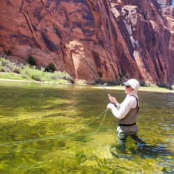
    My husband and I found this trail while driving along Lees Ferry Road in the Vermillion Cliffs…read morearea. We saw a few people hiking the canyon and decided to join the party. We didn't complete the entire trail which leads all the way to the Colorado River, but we did hike the majority of it up until it became more rugged and rough. We had done a lot of hiking during our vacation and honestly my feet were ready to fall off my body in protest. Still, the portion of the canyon we completed was an easy hike. Very picturesque with pretty rocks and interesting textures. The whole area reminded me of a layered sponge cake or Neapolitan ice cream. I actually got hungry walking the trail, lol

    Photos
    Cathedral Wash Trailhead
    Cathedral Wash Trailhead
    Cathedral Wash Trailhead

    See all

    The New Wave - Look at those curves!

    The New Wave

    4.7(3 reviews)
    17.9 km

    I entered the permit lottery for The Wave, and much like the vast majority of people who enter, I…read moredidn't win. As an alternative, I selected this trail. I think this hike was well worth it, being much shorter and much more accessible. Also known as the Beehive Loop Trail, this trail is 1.3 miles with minimal elevation gain. You see and can walk on cool-looking sandstone formations, with undulating striations that play with your eyes. The parking lot is a dirt pullout near the side of the road. There's no bathroom however right across the street is the campground with composting toilets. The trail is marked with cairns and rocks lining the path. It's hard to get lost, but there are some side off shoots that you can follow off the main path.
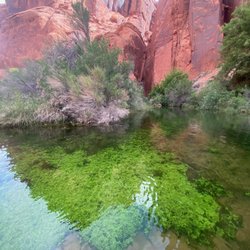
    Page is known for a couple of things. Antelope Canyon. Horseshoe Bend. And The Wave. Experiencing…read moreThe Wave isn't easy because there's a lottery system that only 16 people win daily. Another option is The New Wave. It's free and there's no lottery system in place. We stopped by on a Saturday afternoon. It's a moderate hike that takes about an hour or so depending on your pace. Make sure to bring plenty of water and the proper attire. There's some incline and some uneven footing, that's about the extent of the challenge. You'll be rewarded with nice views, including wave-like cliffs. While it's not as impressive as The Wave, The New Wave is a nice consolation prize.

    Photos
    The New Wave - Look at those curves!

    Look at those curves!

    The New Wave - Landscape

    Landscape

    The New Wave - Landscape

    See all

    Landscape

    Havasu Falls

    Havasu Falls

    4.1(185 reviews)
    113.9 km

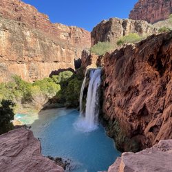
    There are places on this earth that don't feel entirely claimed by man where the air sits heavier,…read morewhere silence hums just a little too loud. Havasupai Falls is one of those places. Now listen I'm gonna tell you straight. You can hike it, sure. Strap on your pack, bake in that canyon heat, follow the mules and the dust like you're reenacting some pioneer tragedy. Or... you take the helicopter. Drop in like you've got better sense than the rest of 'em. Because when you're only staying a night, you don't waste half your trip pretending you enjoy suffering. You get there quick, boots on the ground, eyes wide open. And what waits for you... ain't normal. The water this unreal shade of blue, like someone spilled paint straight outta heaven itself cuts through red rock like it's been there since before memory had a name. The canyon walls stand tall, watching. Always watching. You can feel it. Not in a poetic way... in a you're not alone kind of way. The people there, the tribe they carry a quiet presence. Like they know something they're not in a hurry to explain. Respectful, grounded... but there's history in their eyes. Old history. Night comes different down there. The fire was crackling low. Shadows stretching just a little too far, bending where they shouldn't. That's when I saw it. Across the canyon, tucked behind a tree like it didn't quite understand hiding... something big. Hairy. Not a trick of the light. Not a deer. Not a man. It stood there. Watching. Then came the sound. Tap... tap... tap. Something hitting the tent. Not hard. Just enough to say, "I'm still here." I thought maybe rocks... maybe pinecones. But there weren't any trees above us that could explain it. And whatever it was it had aim. I told the others. Nobody laughed. Nobody slept. We sat around that fire like it was the last safe place on earth, eyes fixed into the dark, waiting for something to step forward... or worse, not step forward. Because sometimes what you don't see is worse than what you do. Finally, in a moment of pure, desperate brilliance or stupidity someone grabbed a sandwich and chucked it out there into the black. We waited. Minutes stretched. The canyon held its breath. And then... nothing. Whatever it was... it was gone. No footsteps. No sound. Just silence again, like the place had swallowed it whole. Now I ain't saying I believe in Bigfoot... ...but I'm also not saying I slept worth a damn that night. And here's the part where I switch gears for ya because after all that spooky nonsense, you gotta laugh a little. Look, I'm just gonna say it .. "I paid good money to fly into a canyon, not to get mugged by a damn woodland gorilla." You got folks hiking ten miles, riding donkeys, sweating like they owe the sun money... and I'm down there getting harassed by what I can only assume is the canyon's unofficial night manager. Five stars. Would absolutely go again. ...but next time, I'm bringing two sandwiches.

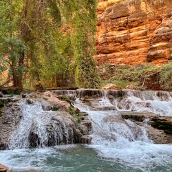
    Out in the middle of the desert in Arizona pretty much near the end portion of the Grand Canyon and…read moreabout an hour away from Route 66 is the trail to get to Havasupai. There's a lodge in the village and a campground area another 2 miles from the village, both have different dates to apply for permits online about a year in advance. There are 5 amazing water fall sites once you pass the village. 50 Foot Falls, Lower Navajo Falls, Havasu Falls, Mooney Falls, and Beavers. An additional journey heading out 6 miles past Beaver falls you can get to the Confluence where you can see the Havasu Creek water meet up with the Colorado river. For the camp sites you aren't assigned an actual location you just grab any available site that's not directly on the trail. There's a fresh water spring in the camp site where we refilled out bottles for the 4 days & 3 nights we were here. Also 2 miles back up at the village they do have a cafeteria with burgers fries, hot dogs and all that other stuff. If you're not up for the 8-10 miles hike into the village/campground with all your camping gear on your back they have options at additional cost. You can have your bags packed on miles/horses and carried into the site & they also have helicopter rides in and out of the village (first come first serve, the natives have priority to skip the line at anytime)

    Photos
    Havasu Falls
    Havasu Falls
    Havasu Falls

    See all

    Lake Powell - Sunset

    Lake Powell

    4.3(73 reviews)
    24.3 km

    Lake Powell is a reservoir created by the flooding of Glen Canyon by the Glen Canyon Dam…read more Unfortunately due to the southwestern North American megadrought that began in 2000, the water levels are lower than usual, and you can see the bathtub ring effect on the rocks. I visited Lone Rock Beach, however it's no longer alone, since the receding water levels has connected the rock stack the the beach itself. The paved road ends and turns into a quite sandy surface, so be careful and use your best judgement, especially since there is no guaranteed towing service if you get stuck in the sand. Beautiful place.

    Page, while it has become touristy, is a wonderful place to visit in Arizona. I made a weekend trip…read moreto visit all of the top attractions, including Lake Powell. There are several different ways you can check out Lake Powell. One option is to see it from afar from atop cliffs and overlooks in Glen Canyon Park. This provides scenic views of the beautiful lake. Another option is to actually see the Lake up close and personal. There are several spots where you can do that. I decided to make the short drive into Utah to see it from Lone Rock. You have to drive through some rocky/sandy terrain so me careful to follow the path (unless you're in a car with four-wheel drive). Once you get closer to the beach, you will reach a sandy area. Do not drive through it. You'll see cars and RVs parked right where the terrain changes for good reason. Unless you have the proper vehicle, you'll get stuck in the sand. I saw it happen. That will ruin your day. There are even warning signs about this. Once we parked our rental, we walked to the shoreline. I dipped my toes in the water, a bit cold but pleasant. It's a great place to just relax and take in the beauty of your surroundings. The Lake is also a popular spot to rent boats. While I didn't do this, it is a popular activity. A must-visit while in Page!

    Photos
    Lake Powell
    Lake Powell - Kayaking

    Kayaking

    Lake Powell

    See all

    Vermilion Cliffs National Monument - hiking - Updated July 2026

    Loading...
    Loading...
    Loading...