Cancel

    Open app

    Search

    White Rocks National Recreation Area

    4.0 (1 review)

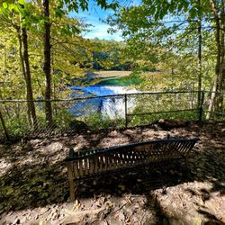
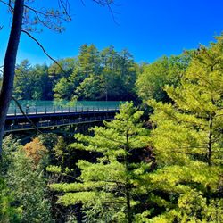
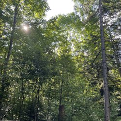
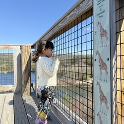
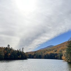
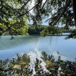
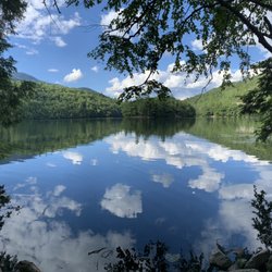
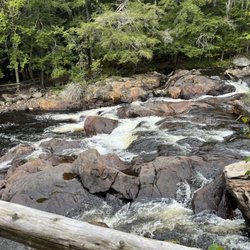
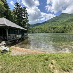
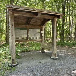
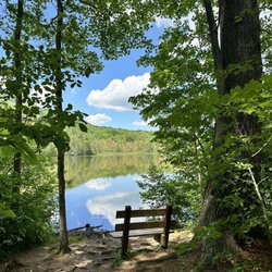
    White Rocks National Recreation Area Photos

    More like White Rocks National Recreation Area

    Recommended Reviews - White Rocks National Recreation Area

    Your trust is our priority, so businesses can't pay to alter or remove their reviews. Learn more about reviews.
    Yelp app icon
    Browse more easily on the app
    Review Feed Illustration

    18 years ago

    Helpful 4
    Thanks 0
    Love this 3
    Oh no 0

    Verify this business for free

    Get access to customer & competitor insights.

    Verify this business

    Buttermilk Falls

    Buttermilk Falls

    4.5(13 reviews)
    11.1 mi

    Wow ! What a hidden gem ! We were visiting Ludlow VT and saw this fall . Kids wanted to enjoy…read morewater and this was a perfect choice for us . The water was colddddddddddd though. Ufff . Very cold . The first dip was tough ! Later once you get use of it , it felt a bit better . Pathway was a bit crazy , in some places .it is about a 2 mile walk but we just went not too far : .. the lower and middle falls is also accessible from car parking lots outside . Parking is outside and sometimes you have to park 5-8 mins away from the falls . Not much of restrooms around . Lots of dogs in the water :) It was an amazing tint though ! Loved it . 5 stars !

    As we were staying near Ludlow, I had put this on our schedule as a "check it out whenever time…read morepermits" item. We drove back after visiting some places to the north, and were passing this around 4 p.m. so we checked it out. This was in early October and the sun was just starting to go down. Though it was pre-dusk, it would be better to visit this site in full sunlight. There are 3 separate falls (the creatively named upper, middle, and lower). You access them from the main highway via a side road that starts as paved but soon becomes (good) dirt/gravel. The total length is less than 2 miles. You first get to a wide spot / parking area from which you can access the middle and lower falls. A trail leads down a hill where you must choose which falls to visit. The middle falls is impressive. It is probably the easiest one to access. The area from which you have the best view is a bit rocky, but navigable. It makes for nice photos. The lower falls appeared accessible from a side trail that descended a bit more steeply. You can also see it from above (somewhat) without descending. It appeared smaller and less photogenic than the middle falls. We then drove another 1/4 mile up the road (to its end) to check out the upper falls. There is a sharp short descent from the road to the top of the falls. It appeared to have a fairly large pool at the bottom and a flat dirt/sand area where some people had laid out a blanket for a picnic. The light was fading more so we skipped walking down the relatively gentle slope to check it out further. If you are in the area and have time, this is a nice spot to visit. It is within 3 miles of Ludlow. I cannot comment on what the swimming is like, but I saw references to that online (during summers, I guess).

    Photos
    Buttermilk Falls
    Buttermilk Falls
    Buttermilk Falls

    See all

    Gifford State Park

    Gifford State Park

    4.6(9 reviews)
    16.7 mi

    I stayed in the cabin moose and it was absolutely terrific! Very clean and spacious. The ceiling…read morefan kept us cool even during late summer heat. The bathrooms and showers were also very clean (just remember to bring quarters because you do have to pay for showers). There's lovely restaurants and nearby day hikes. 10/10!

    Gifford Woods State Park is a great location for hikers (or any visitor to the Killington area for…read morethat matter) to bunk for a couple of nights. The park hosts 4 cabins, 22 tent/RV sites, and 21 lean-to sites located around two paved/well-maintained dirt roads on the premises. It appears to be open Memorial Day weekend to late October. It is a breeze to find, easily located just off Route 100. The Appalachian Trail runs right through the park so you may catch a glimpse of some thru-hikers on their journey between Maine and Georgia! The park is very well-maintained! The campsite was neatly raked, the fire pit cleaned out for use. I stayed at campsite #1 and it was quite spacious...a bit further removed from the road than the other campsites. The whole site was marked out with a fine gravel, plenty of room for parking and maneuvering the car. Each road loop contains modern bathrooms and coin-operated hot showers. There are areas for picnicking, volleyball, horseshoes, trash/recycling, and drinking water. Kent Pond is just across the way complete with boat launch and fishing! Booking and check-in were a breeze for this location. I called 10 days before our intended arrival and got a site no problem. On arrival, the ranger at the park office was very friendly and sold us firewood and ice straight from there. If you need any assistance during off-hours, the ranger lives in a cute house attached to the park office. They encouraged us to knock on the door at any time if we needed help. The campsite is pet-friendly and I came across quite a few well-behaved dogs during my stay. Quiet hours are from 10pm-7am. The park itself is pretty quiet all day long... I heard nothing but birds chirping, trees rustling, and a bit less-welcoming: the traffic from Route 100. This didn't bother me so much since I generally wear earplugs to sleep but something to consider if you prefer a more rustic atmosphere when camping. Tent sites are between $20-$22/night, $27-$29 for a lean-to site, and $50 for cabins. There is a 2-night minimum for reservations. Affordable, clean, convenient... I would definitely stay here again!

    Photos
    Gifford State Park
    Gifford State Park
    Gifford State Park

    See all

    Table Rock Trail

    Table Rock Trail

    5.0(2 reviews)
    33.1 mi

    Anytime of the year is perfect for the rewarding view. Maybe a little tough during snow and mud…read moreseason, but still doable. Table Rock faces the Bellows Falls are from New Hampshire, just across the Connecticut River. We're in our 60s and needed to stop a few times on the way up, but it was never too steep or treacherous, just a long steady hike. You want bring good hiking shoes with serious treads. No fees. Dogs allowed.

    Phenomenal trail!! Definitely in my top 5 fave hikes - especially for the fall colors (my visit was…read morein early October)!! And it's a killer workout too! The view from the top is breathtaking- but not for the faint of heart - I have a fear of heights and it took me a while to work up the nerve to go sit on the edge lol! AllTrails has this trail labeled as "moderate" - but it was insanely muddy and very wet when I hiked it - took me ages and totally wore me out - so in those conditions I'd call it moderate-hard. And also with the rock scrambling at the top - it can be quite difficult. Very steep and especially narrow at the top - can be dangerous if you're not careful. I did a total of 2 miles round trip - it's an out and back trail. In those 2 miles, my tracker showed an 800 foot elevation gain so it's definitely a butt burner. And along the trail there are numerous areas of rock scrambling (some are very steep) and stream crossings during the wet season - get ready to be covered in mud lol! You will definitely need decent hiking shoes - and poles would've been so helpful I think! There were quite a few other hikers around. The trails are very well marked with colorful tree badges - but in some spots between the markers, I needed my trail map bc the ground was covered in leaves and mud and it wasn't as obvious. Once you get to the top of Table Rock, the stunning view will absolutely take your breath away! It's a sweeping vista of the entire forest area with the lake and resort below to the left and the long stretch of road through the park to the right - perfect for taking in all the colorful autumn splendor!! The top is a long, very narrow and flat tableau. It seems pretty stable - but has extremely steep (and deadly!) drop offs either side and no safety rails or fencing or anything so be aware. Drones aren't allowed in the park (according to the State Park website) but someone was flying one and buzzing us closely at the top which made it very distracting and scary unfortunately. Dogs are allowed - there were many on the trail and at the top. Parking is a small dirt lot pull out on the side of the road at the trailhead - Google maps took me right to it (just put in Table Rock Trailhead). It's located in Dixville Notch State Park (you can see my review of that for more detailed info). The park doesn't have bathrooms that I could find. And I think it's free. I didn't see any fee areas and their website doesn't list it as a fee area.

    Photos
    Table Rock Trail
    Table Rock Trail - Another stream crossings along the trail

    Another stream crossings along the trail

    Table Rock Trail - Gorgeous fall colors all along the trail (early October)!

    See all

    Gorgeous fall colors all along the trail (early October)!

    White Rocks National Recreation Area - parks - Updated July 2026

    Loading...
    Loading...
    Loading...