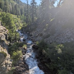
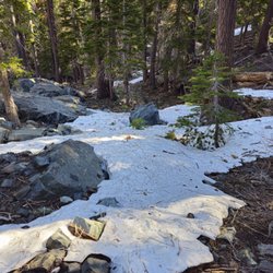
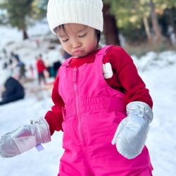
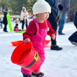
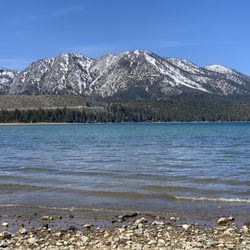
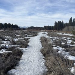
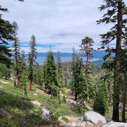
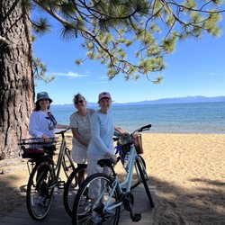
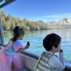
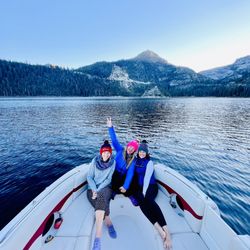
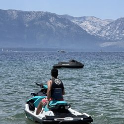
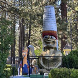
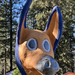
Bryan Meadows Trail Photos
You might also consider
More like Bryan Meadows Trail
Recommended Reviews - Bryan Meadows Trail


More info about Bryan Meadows Trail
Bryan Rd - 17E13
South Lake Tahoe, CA 96150
Directions
Hours
Outdoor Amenities
You might also consider


Bryan Meadows Trail - hiking - Updated July 2026
Best of South Lake Tahoe
People found Bryan Meadows Trail by searching for…
Hiking Trails in South Lake Tahoe, California
Easy Hikes in South Lake Tahoe, California
Walking Trails in South Lake Tahoe, California
Canyoneering in South Lake Tahoe, California
Running Trails in South Lake Tahoe, California
Dog Friendly Trails in South Lake Tahoe, California
Trail in South Lake Tahoe, California
Bike Paths in South Lake Tahoe, California
Hikes With Waterfalls in South Lake Tahoe, California
Off Leash Dog Hikes in South Lake Tahoe, California
Off Road Trails in South Lake Tahoe, California
National Parks in South Lake Tahoe, California
Free Campgrounds in South Lake Tahoe, California
Waterfalls in South Lake Tahoe, California
Watch Sunset in South Lake Tahoe, California
Scenic Night View in South Lake Tahoe, California
Things to Do in South Lake Tahoe, California
Stargazing in South Lake Tahoe, California
Dog Friendly Hikes in South Lake Tahoe, California
Kid Friendly Hiking Trails in South Lake Tahoe, California
Running Routes in South Lake Tahoe, California
Sunrise Hike in South Lake Tahoe, California
Trending Searches in South Lake Tahoe, CA
Boat Rental in South Lake Tahoe, CA
Cliff Jumping in South Lake Tahoe, CA
Day Trips in South Lake Tahoe, CA
Dog Friendly Trails in South Lake Tahoe, CA
Fireworks in South Lake Tahoe, CA
Jet Ski Rental in South Lake Tahoe, CA
Kayak Rental in South Lake Tahoe, CA
Lakes & Ponds in South Lake Tahoe, CA
Outdoor Activities in South Lake Tahoe, CA
Places To Swim in South Lake Tahoe, CA
Public Pools in South Lake Tahoe, CA
Public Shower in South Lake Tahoe, CA
River Swimming in South Lake Tahoe, CA
Rock Quarry in South Lake Tahoe, CA
Running Trails in South Lake Tahoe, CA
Scenic Overlook in South Lake Tahoe, CA
Secluded Spots in South Lake Tahoe, CA
Soccer Store in South Lake Tahoe, CA
Splash Pad in South Lake Tahoe, CA
Sunrise View in South Lake Tahoe, CA
Swimming Holes in South Lake Tahoe, CA
Swimming Lakes in South Lake Tahoe, CA
Swimming Pools in South Lake Tahoe, CA
U Pick Farms in South Lake Tahoe, CA
Watch Sunset in South Lake Tahoe, CA
Browse Articles
Browse Nearby
BEST of South Lake Tahoe, California Coffee near Bryan Meadows Trail
BEST of South Lake Tahoe, California Things to Do near Bryan Meadows Trail
BEST of South Lake Tahoe, California Restaurants near Bryan Meadows Trail
BEST of South Lake Tahoe, California Breakfast near Bryan Meadows Trail
BEST of South Lake Tahoe, California Walking Trails near Bryan Meadows Trail
BEST of South Lake Tahoe, California Parks near Bryan Meadows Trail
BEST of South Lake Tahoe, California Hot Springs near Bryan Meadows Trail
BEST of South Lake Tahoe, California Campgrounds near Bryan Meadows Trail
BEST of South Lake Tahoe, California Sightseeing near Bryan Meadows Trail
Browse Brands
Related Searches in South Lake Tahoe, CA
Affordable Kayak Rental Services in South Lake Tahoe, California
Best Fishing Locations and Guides in South Lake Tahoe, California
Best Places for Horseback Riding in South Lake Tahoe, California
Best Sledding Spots and Fun in South Lake Tahoe, California
Best Waterfalls and Swimming Holes in South Lake Tahoe, California
Check Out Off Road Trails in South Lake Tahoe, California
Discover Dog Friendly Trails to Explore in South Lake Tahoe, California
Discover Kid Friendly Hiking Trails in South Lake Tahoe, California
Discover Scenic Waterfall Spots in South Lake Tahoe, California
Discover a Hiking Trail in South Lake Tahoe, California
Discover the Best Night Hike Trails in South Lake Tahoe, California
Dog-Friendly Hikes With Dogs in South Lake Tahoe, California
Enjoy Camping Adventures Around South Lake Tahoe, California
Enjoy Exciting Mountain Biking Adventures in South Lake Tahoe, California
Enjoy Kayaking Adventures in South Lake Tahoe, California
Enjoy Tent Camping Spots Around South Lake Tahoe, California
Enjoy a Beautiful Waterfall Hike in South Lake Tahoe, California
Enjoy the Best Picnic Spots and Ideas in South Lake Tahoe, California
Enjoy the Best Tubing Experiences in South Lake Tahoe, California
Enjoy the Best Walking Path in South Lake Tahoe, California
Enjoy the Best Walking Trails in South Lake Tahoe, California
Experience Thrilling White Water Rafting in South Lake Tahoe, California
Explore Beautiful Parks and Green Spaces in South Lake Tahoe, California
Explore Easy Hikes Perfect for All in South Lake Tahoe, California
Explore Fun Activities to Do in South Lake Tahoe, California
Explore Nature Spots Around South Lake Tahoe, California
Explore Popular Campgrounds Near South Lake Tahoe, California
Explore the Best Beach Spots in South Lake Tahoe, California
Explore the Best Boating Spots in South Lake Tahoe, California
Explore the Best Swimming Holes Around South Lake Tahoe, California
Explore the Best Trail Options in South Lake Tahoe, California
Family Friendly Hiking With Kids in South Lake Tahoe, California
Find Beautiful Views in South Lake Tahoe, California
Find Fun Kids Activities Outdoor in South Lake Tahoe, California
Find Popular Ziplining Spots Around South Lake Tahoe, California
Find the Best Scenic View Locations in South Lake Tahoe, California
Hike the Popular Waterfall Trail in South Lake Tahoe, California
Hiking Trails With Waterfalls in South Lake Tahoe, California
Off Leash Dog Hiking Trails in South Lake Tahoe, California
Plan a Scenic Drive Route Near South Lake Tahoe, California
Popular Outdoor Activities to Try in South Lake Tahoe, California
Popular Picnic Spots to Visit in South Lake Tahoe, California
Safe River Swimming Areas in South Lake Tahoe, California
Safe and Fun Parks for Kids in South Lake Tahoe, California
Top Running Trails to Explore in South Lake Tahoe, California
Top Swimming Lakes to Enjoy in South Lake Tahoe, California
Top Swimming Spots and Pools in South Lake Tahoe, California
Top Things to Do With Kids in South Lake Tahoe, California
Walk Dog Friendly Hiking Trails in South Lake Tahoe, California
Walk the Best Paved Walking Trails in South Lake Tahoe, California